2 trails found in Tennessee
Which "conasauga creek" are you looking for?
We found 2 off-road trails in Tennessee matching your search. Pick the one you're looking for below.
Conasauga Creek Falls Trailhead
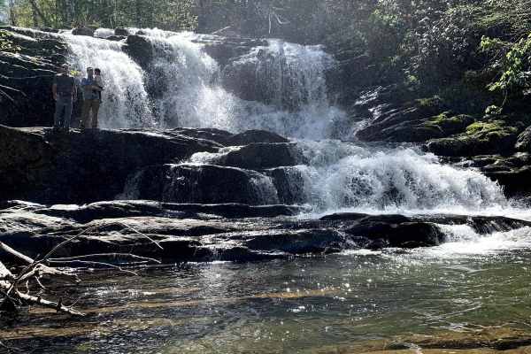
Conasauga Spur A is off of Conasauga Creek Off-road Trail. It is a nice forest service road that is a nicely maintained road to the trailhead of Conasauga Waterfall. Along the road, there are some over looks of the valley below. There is a short hike down to the falls that is well worth your time to...
Learn more about Conasauga Creek Falls Trailhead

Conasauga Creek
This trail is a forest service road that has several water crossings. After rain falls the water can become deep so be careful when crossing. Along the way, you will find a waterfall that you can hike out to. It is about a mile hike in and out round trip. When driving this road keep your eyes open n...
Learn more about Conasauga Creek