Ridge Road (North)
Total Miles
6.2
Technical Rating
Best Time
Spring, Summer, Fall
Trail Type
Full-Width Road
Accessible By
Trail Overview
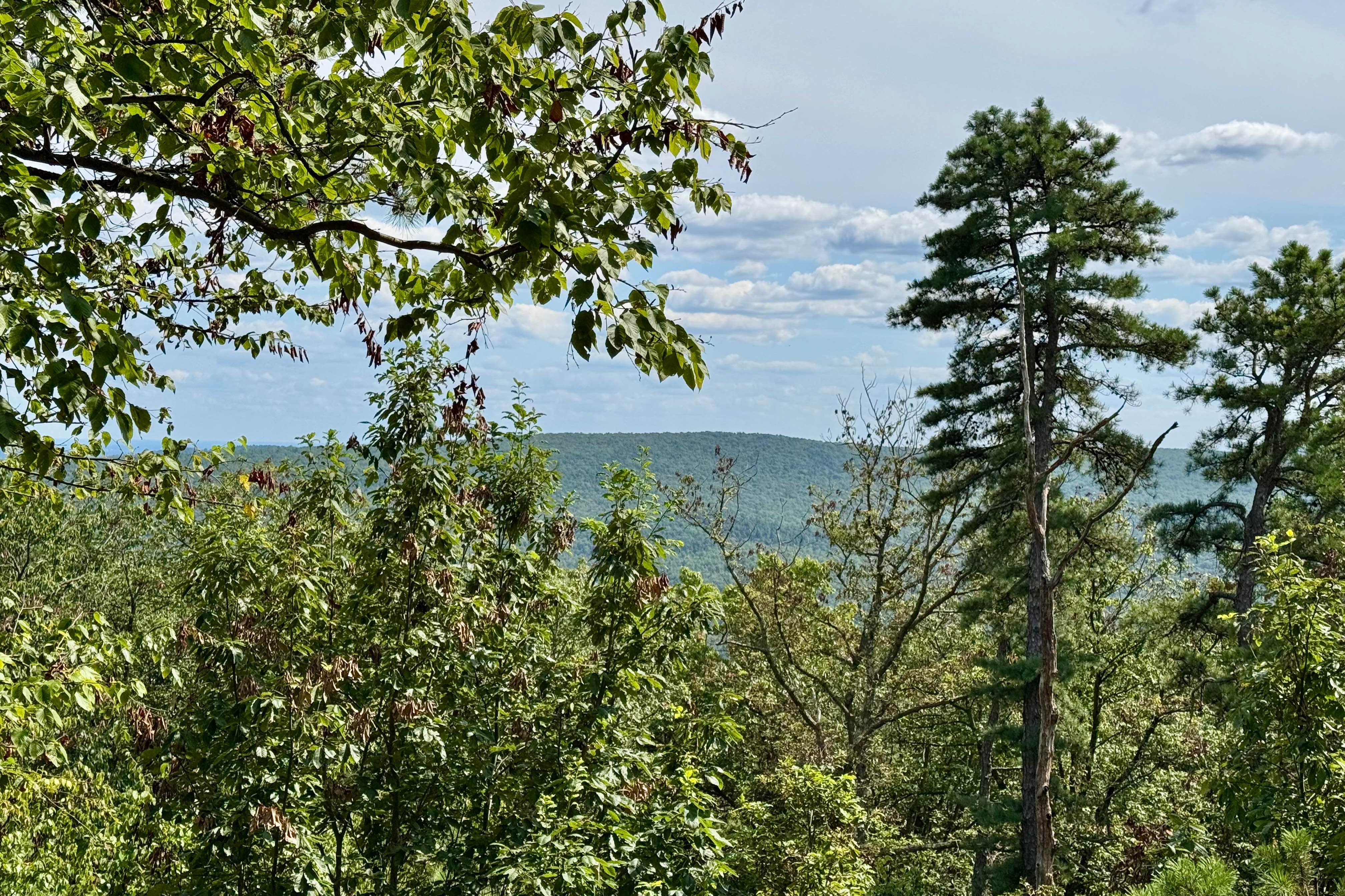
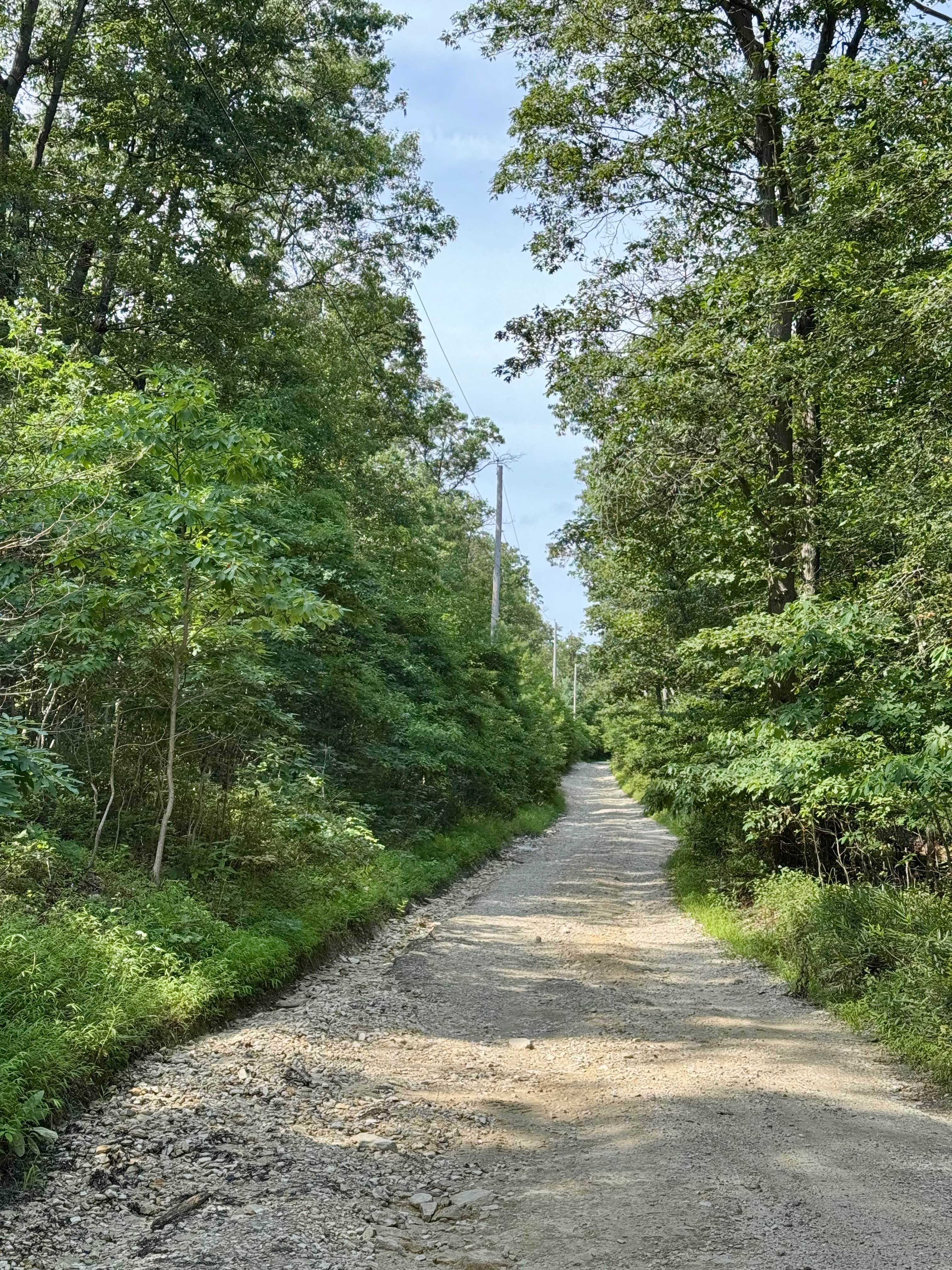
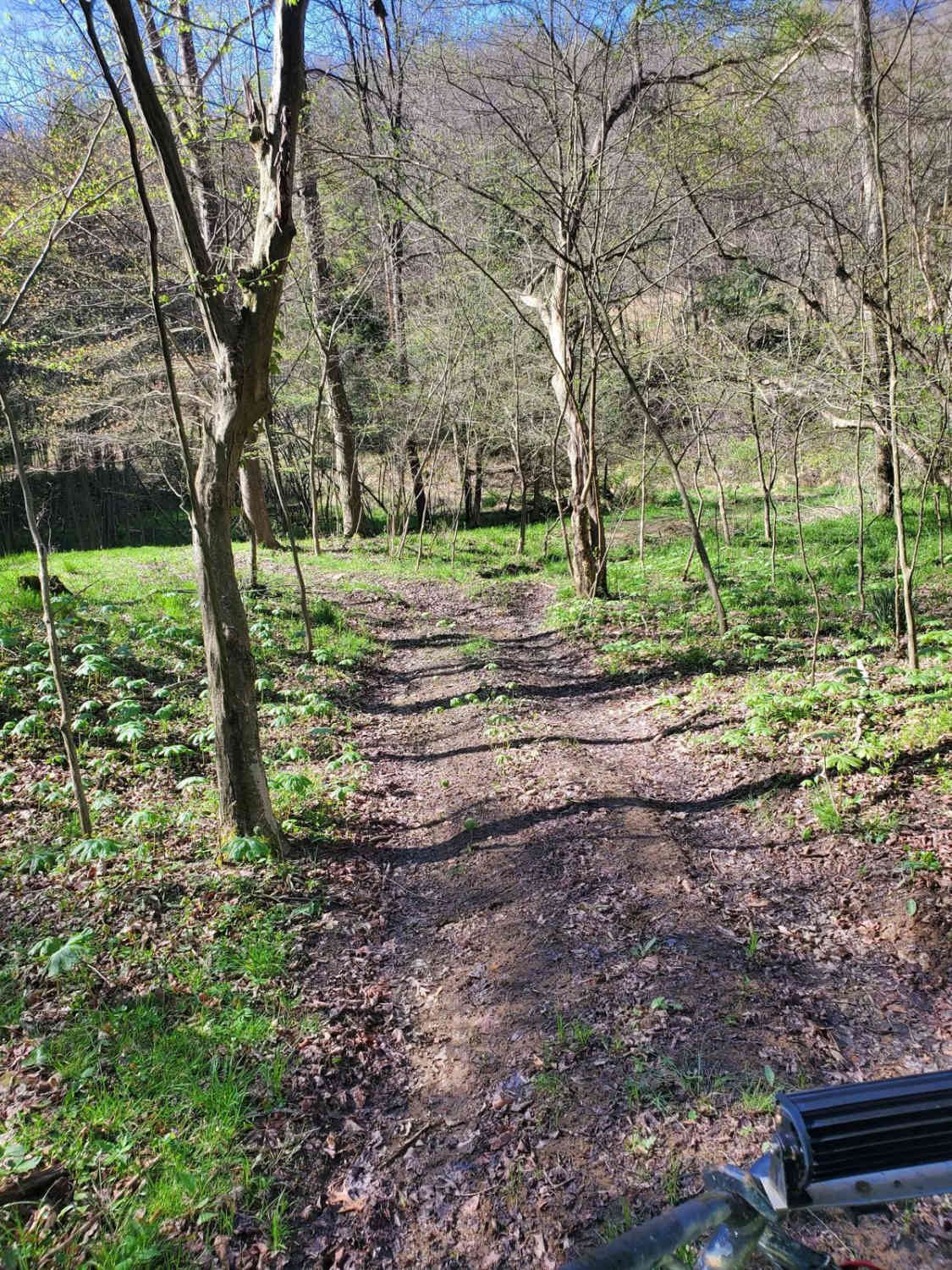
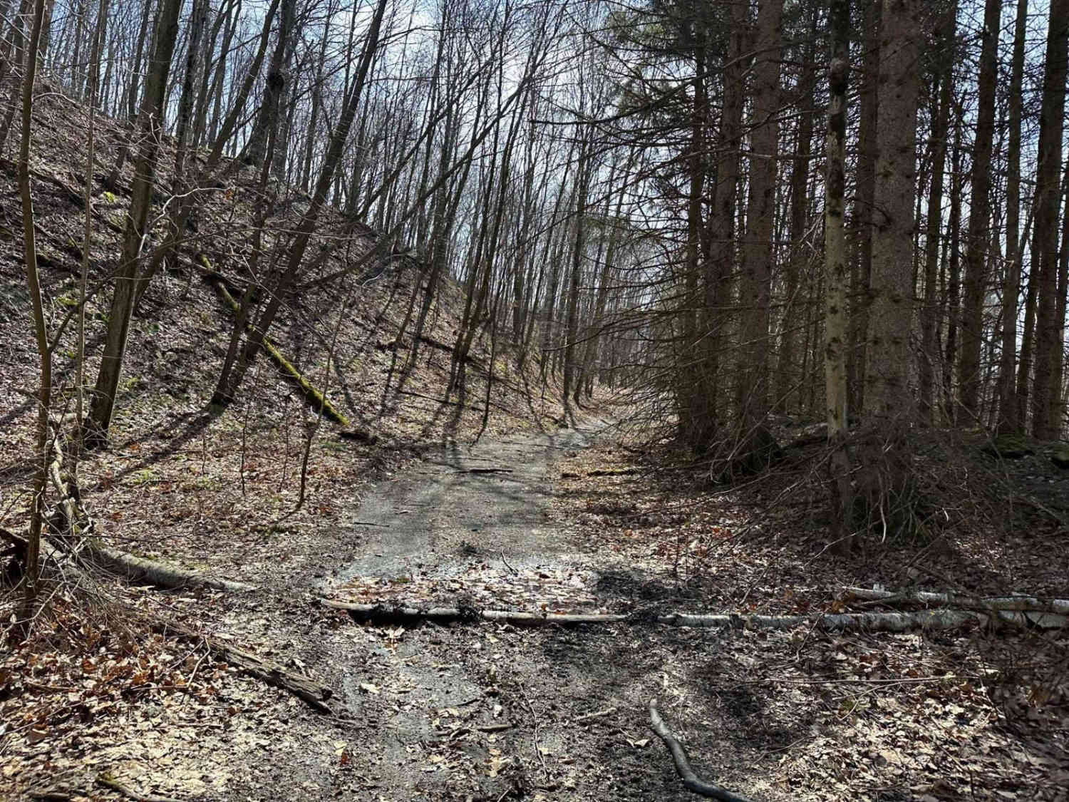
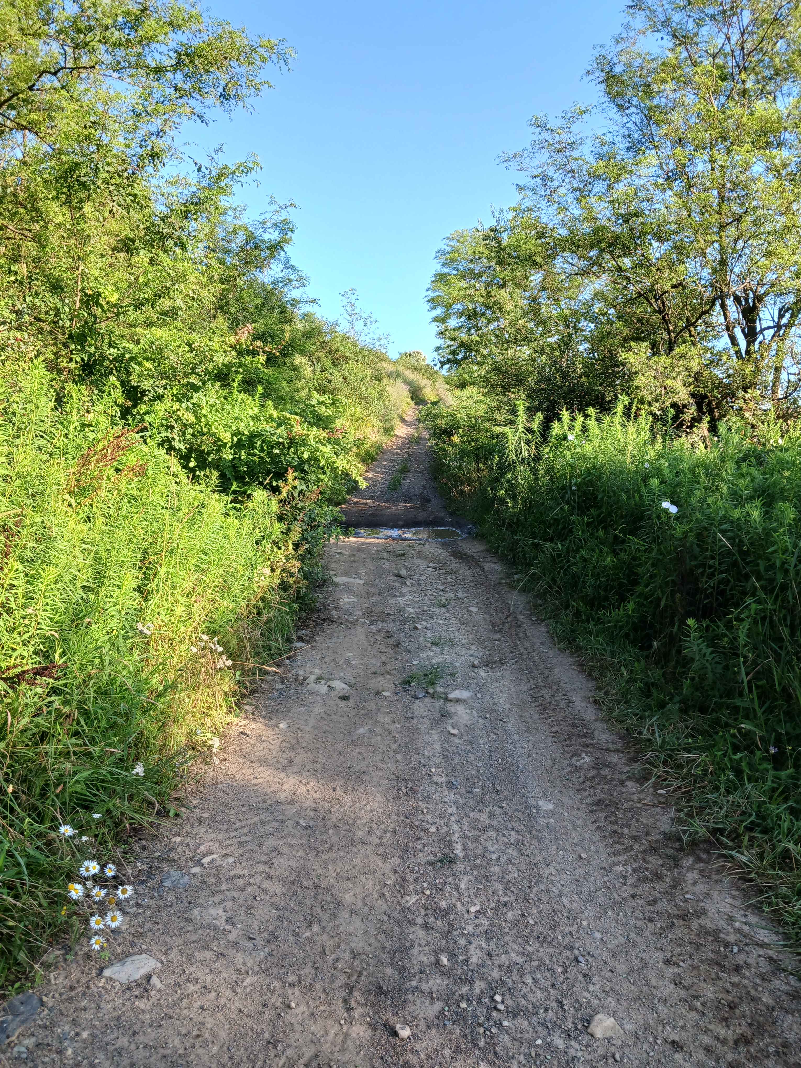
Ridge Road runs through much of Michaux State Forest. The northern end is known for its access to Hammond's Rocks and for being more challenging than most of the other forest roads here. Accessing Hammond's Rocks from the south is recommended unless you have high clearance, as north of there, the well-graded road deteriorates to a more rocky, rutted, and washed-out surface. The to and from Mount Holly Springs has been graded in the last couple of years, but is not to be trifled with in the winter if there's snow or ice on the ground. Definitely see Hammond's Rocks, however you reach it! There is a view if you climb the short path to the top. The rocks are fairly impressive themselves. Do look out for snakes basking on the rocks- look before you step. This road is on the Mid-Atlantic BDR route, so be on the lookout for adventure bike traffic.
Photos of Ridge Road (North)
Difficulty
The northern end features a steep grade and a rocky portion that will generally require high-clearance or a carefully selected line. Washouts and puddles up to 12 inches are possible after storms. The southern section up to Hammond Rocks is a more typical Pennsylvania state forest road.
History
Ridge Road served for many years as an Appalachian Trail route through this historically rich section. The path of the AT has since moved, but historic alignment is preserved in records and walking tours.
Ridge Road (North) can be accessed by the following ride types:
- High-Clearance 4x4
- SUV
Ridge Road (North) Map
Popular Trails
Trail 12V - Rock Run Recreation Area
Keating Mountain Road
The onX Offroad Difference
onX Offroad combines trail photos, descriptions, difficulty ratings, width restrictions, seasonality, and more in a user-friendly interface. Available on all devices, with offline access and full compatibility with CarPlay and Android Auto. Discover what you’re missing today!