Upper Henderson - FS 2260
Total Miles
2.7
Technical Rating
Best Time
Spring, Summer, Fall, Winter
Trail Type
Full-Width Road
Accessible By
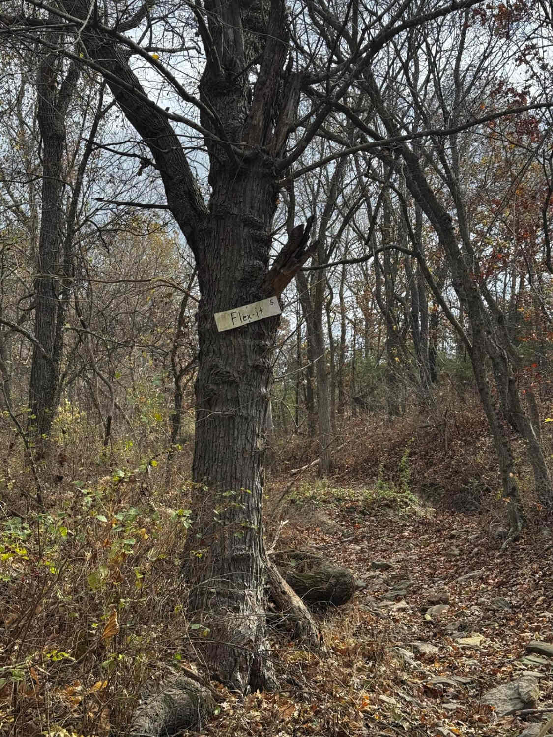
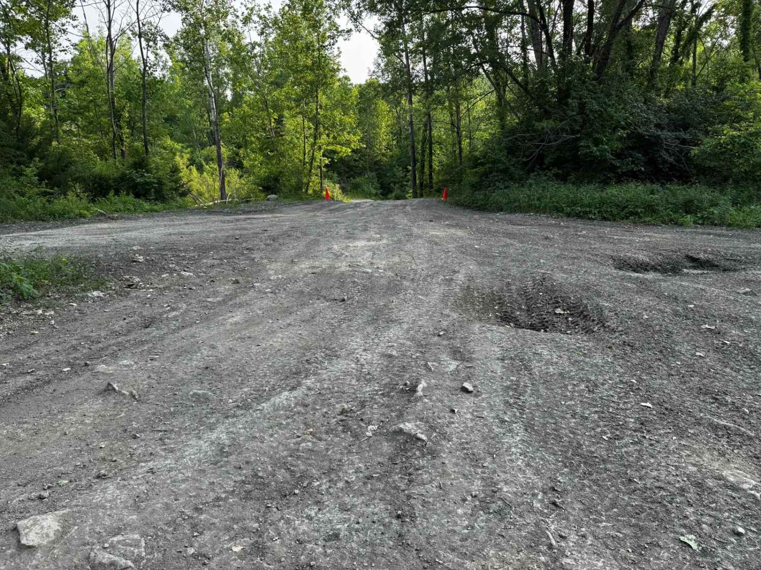
Trail Overview
Upper Henderson (FS 2260) is a natural leaning gravel and dirt terrain Forest Service Road within the Salem Unit of Mark Twain National Forest, open to all vehicles complying with Reynolds County and Missouri state laws. From the beginning where the FS 2260 spurs off the Karkaghne Scenic Drive (or Reynolds County Road 907), the base terrain is made up of coarse natural gravel and dirt mix, with the features including mild graded hills, moderae erosion ruts, plentiful natural cobbles scattered along the path, natural rock and tree roots poking out at the surface, 6 to 12 inches deep water collection spots, occasional tight trees, as the track following along the ridge top spines, through beautiful tree lines, until it meets the safe turnaround at 37.51176, -91.10234, this is where users must turn around and head back the way they entered, as this is the last spacious turnaround approximately 400 feet before the legal end of the MVUM motorized route at private property, the road does continues past this private property point as a Forest Service maintenance easement, and is not allowed for the general public. The road also connects at two points with the 50-inch and under SB 1 ATV trail near the middle section of the track. The northern SB 1 trailhead gate is at 37.53684, -91.10478, with some space to park shortly south at the power line tract along FS 2260. The southern SB 1 trailhead gate is at 37.52528, -91.10268, this southern entry has a parking spot for a small vehicle and trailer, between the SB 1 gate and FS 2260. Please do not park on or block the FS 2260 when unloading ATVs to enjoy the SB 1.
Photos of Upper Henderson - FS 2260


Difficulty
FS 2260 is given a base rating of 3/10, for having a natural coarse gravel fading to a full dirt path in several spots, over mild graded hills, moderate forms of active erosion and ruts, plentiful loose 4-10" cobbles lying in the road, small whoops, and natural rock and tree roots poking out at the surface acting as small obstacles. Note that at about 37.52956, -91.10571, the road suddenly goes from being semi-maintained to suddenly more natural; from this point further south, loose rocks and water collection holes both seem to multiply in consistency, and the trees also tighten on the edges of the path. Full-size vehicles are not advised on this more natural southern portion of the track, but are not restricted. Difficulty can increase, from heavy use and a lack of maintenance, large 12"+ fallen trees blocking the trail, in wet or rainy conditions, inclement weather, or from damage sustained from erosion.
Status Reports
Upper Henderson - FS 2260 can be accessed by the following ride types:
- High-Clearance 4x4
- SUV
- SxS (60")
- ATV (50")
- Dirt Bike
Upper Henderson - FS 2260 Map
Popular Trails

West Brown's Hollow

Arch Cave Cliff Drive - 274
The onX Offroad Difference
onX Offroad combines trail photos, descriptions, difficulty ratings, width restrictions, seasonality, and more in a user-friendly interface. Available on all devices, with offline access and full compatibility with CarPlay and Android Auto. Discover what you’re missing today!