Town Hollow - FS 2647
Total Miles
1.0
Technical Rating
Best Time
Spring, Summer, Fall, Winter
Trail Type
Full-Width Road
Accessible By
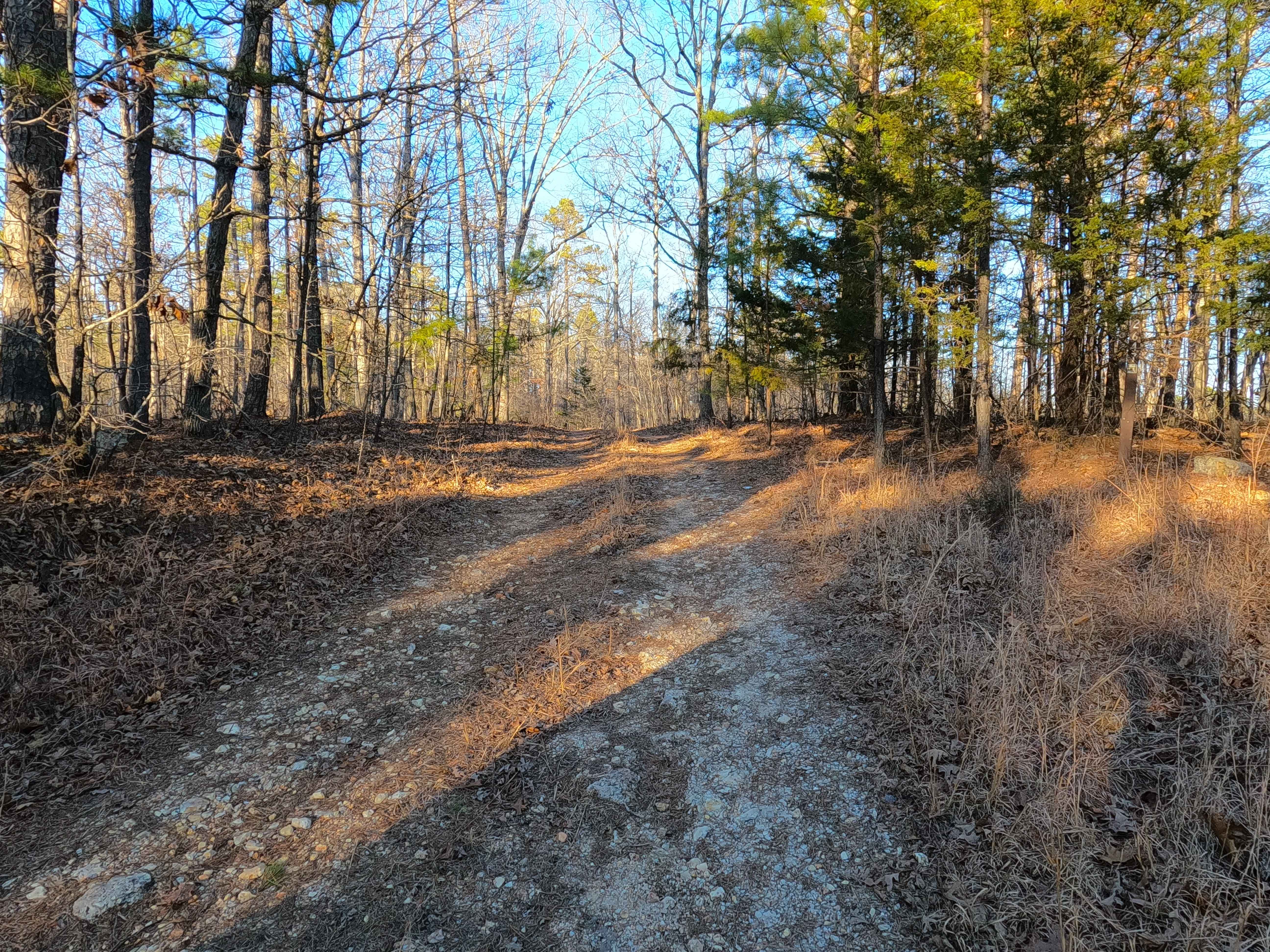
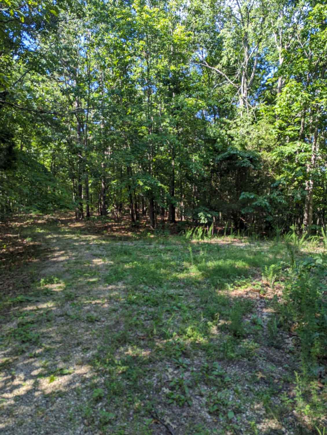
Trail Overview
Town Hollow (FS 2647) is a Forest Service road within the Salem Unit of Mark Twain National Forest, open to all vehicles complying with Reynolds County and Missouri state laws. The surface begins as coarse natural gravel before transitioning into a mixed gravel-dirt terrain. Starting where FS 2647 spurs north off the Karkaghne Scenic Drive (Reynolds County Road 907), the road initially follows a coarse gravel surface, passing a small water collection/mud hole before settling into a natural gravel-dirt path. From here, the road travels along a ridge with mild graded hills, scattered small cobbles, active erosion washes, and the occasional small fallen tree. The track reaches a hard 90-degree turn where a large opening provides a safe turnaround point for full-size vehicles (37.50921, -91.01433). Beyond this point, the road becomes more natural in character, dropping down and climbing over several ridge spines as it heads north. This section offers great views of the surrounding hills to the north, east, and west, but comes with extremely tight tree clearance and heavy pinstriping. The road ends at a turnaround at the northern terminus (37.5188, -91.0101), where two non-motorized paths branch off to the northwest and east. Per the MVUM motorized route designation, users must return the way they came. The first full-size turnaround makes an excellent staging area -- with room for a small truck and trailer -- for unloading sub-50" OHV vehicles headed into the Sutton Bluff ATV/OHV Area, particularly when accessing the system via SB 4 North, 4 South, 6, or 14 North.
Photos of Town Hollow - FS 2647

Difficulty
FS 2647 receives a base rating of 2/10. The road features a natural coarse gravel and dirt surface with mild graded hills, small whoops, loose 4-10" cobbles, natural rock at the surface, mild active erosion, ruts, and a small 6-12" deep water/mud hole near the entry. Worth noting, however, are some unsung difficulties: the road narrows significantly in several spots, making it unsuitable for full-size vehicles beyond the first 0.25 miles. Even smaller high-clearance 4x4s will encounter tight sections and can expect heavy pinstriping. Difficulty may increase due to heavy use, lack of maintenance, fallen trees (12"+) blocking the trail, or wet, rainy, or otherwise inclement conditions.
Status Reports
Town Hollow - FS 2647 can be accessed by the following ride types:
- High-Clearance 4x4
- SUV
- SxS (60")
- ATV (50")
- Dirt Bike
Town Hollow - FS 2647 Map
Popular Trails

Yellow 20

East Kelly Ridge

Stringtown Branch - FSR 2550
The onX Offroad Difference
onX Offroad combines trail photos, descriptions, difficulty ratings, width restrictions, seasonality, and more in a user-friendly interface. Available on all devices, with offline access and full compatibility with CarPlay and Android Auto. Discover what you’re missing today!