Tennyson Hollow East - FS 507
Total Miles
3.9
Technical Rating
Best Time
Spring, Summer, Fall, Winter
Trail Type
Full-Width Road
Accessible By
Trail Overview
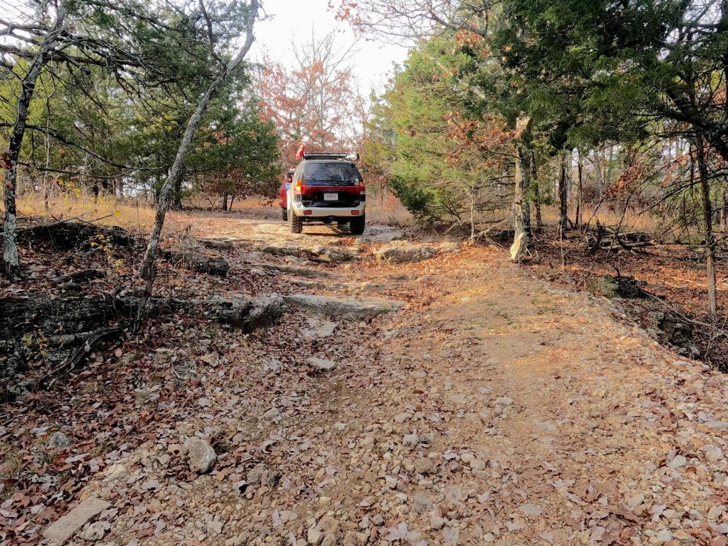
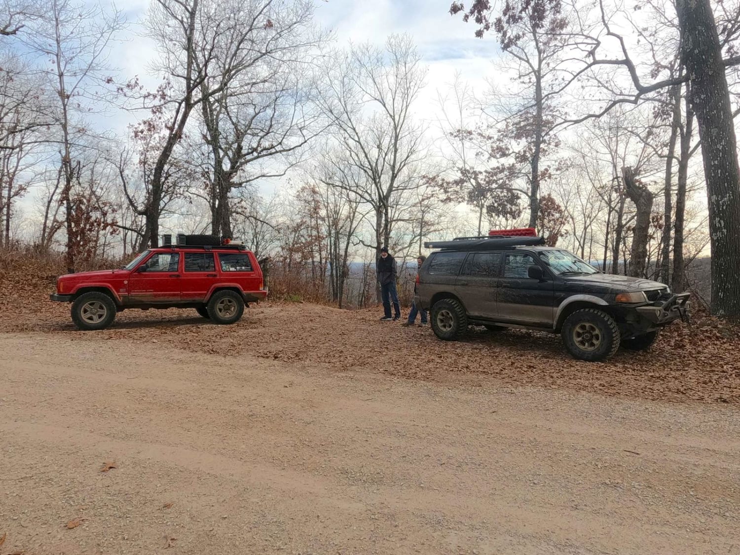
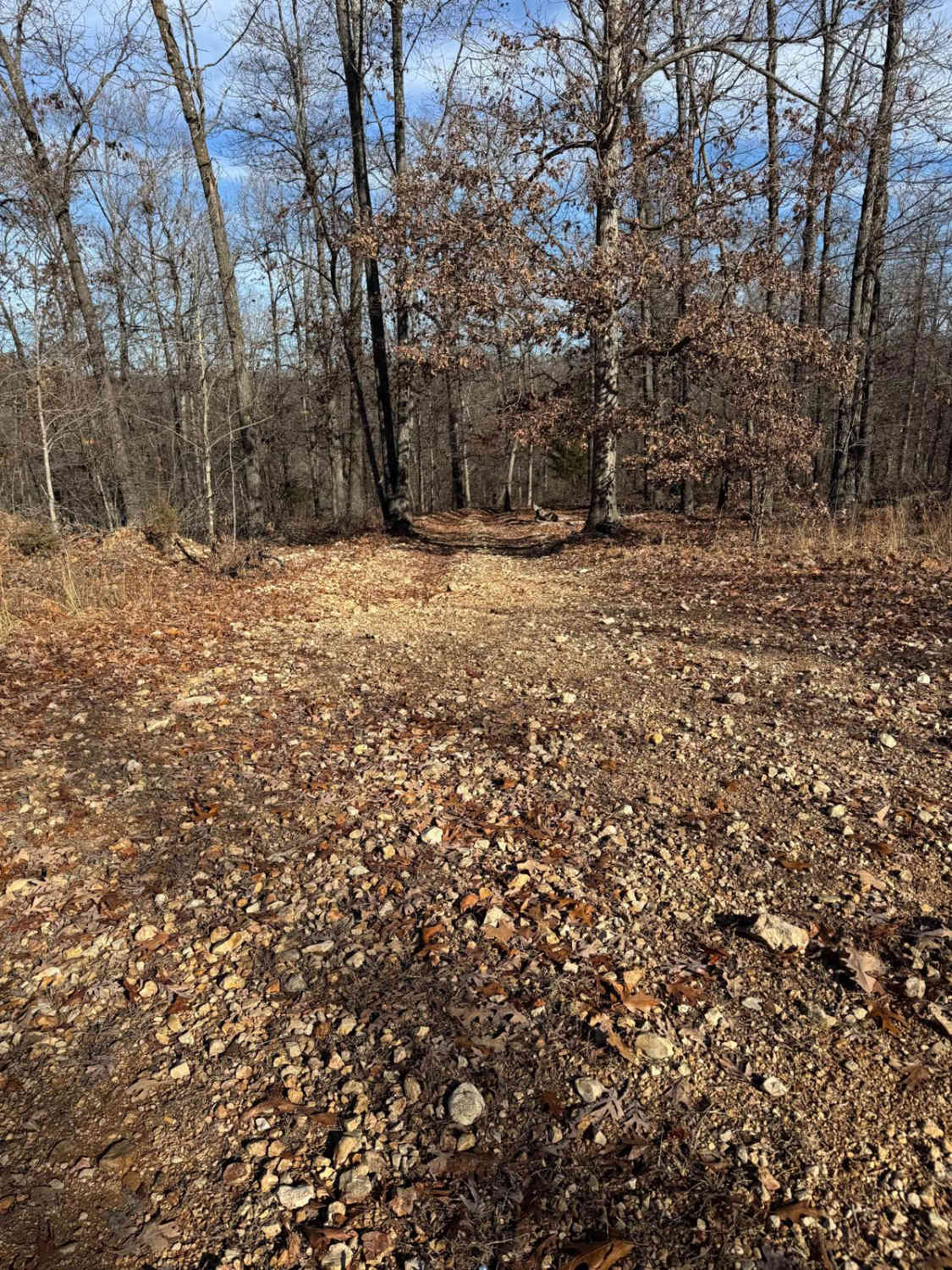
Tennyson Hollow East FS 507 is the eastern section of the 507 trail, with the Hub Tree splitting the two sections east from west. It is a natural terrain forestry road branching off the Glade Top National Scenic Byway within Mark Twain National Forest, Ava Unit. This trail features great scenery, but at its core, it is an entry-technical challenge. It allows riders to get a footing on how to traverse mild obstacles such as ledges and glade rock slabs that this area is known for while having elements of tight treelines, natural coarse cobbles/small boulders, water erosion, mild to moderate grades, and water collection holes to keep it diverse. The trail features several natural landmarks, such as several dispersed campsites, the overlooking ridgetop on the northern section of the trail looking south, east, and west, and the trailside natural fissure forming at 36.63741, -92.80569, near the FS 507B spur road. At the southern end of the trail is the Hub Tree, a large circled lot around a lone standing tree at 36.62978, -92.82483. It's a notable spot to disperse camp, take a break, potentially eat, stage vehicles, and then decide what trail is next. One of Missouri's and Mark Twain's most noteworthy and beloved trails, please respect the laws of the Glade Top area and stay on the forestry-sanctioned MVUM trails. This helps preserve the rights to use these trails.
Photos of Tennyson Hollow East - FS 507
Difficulty
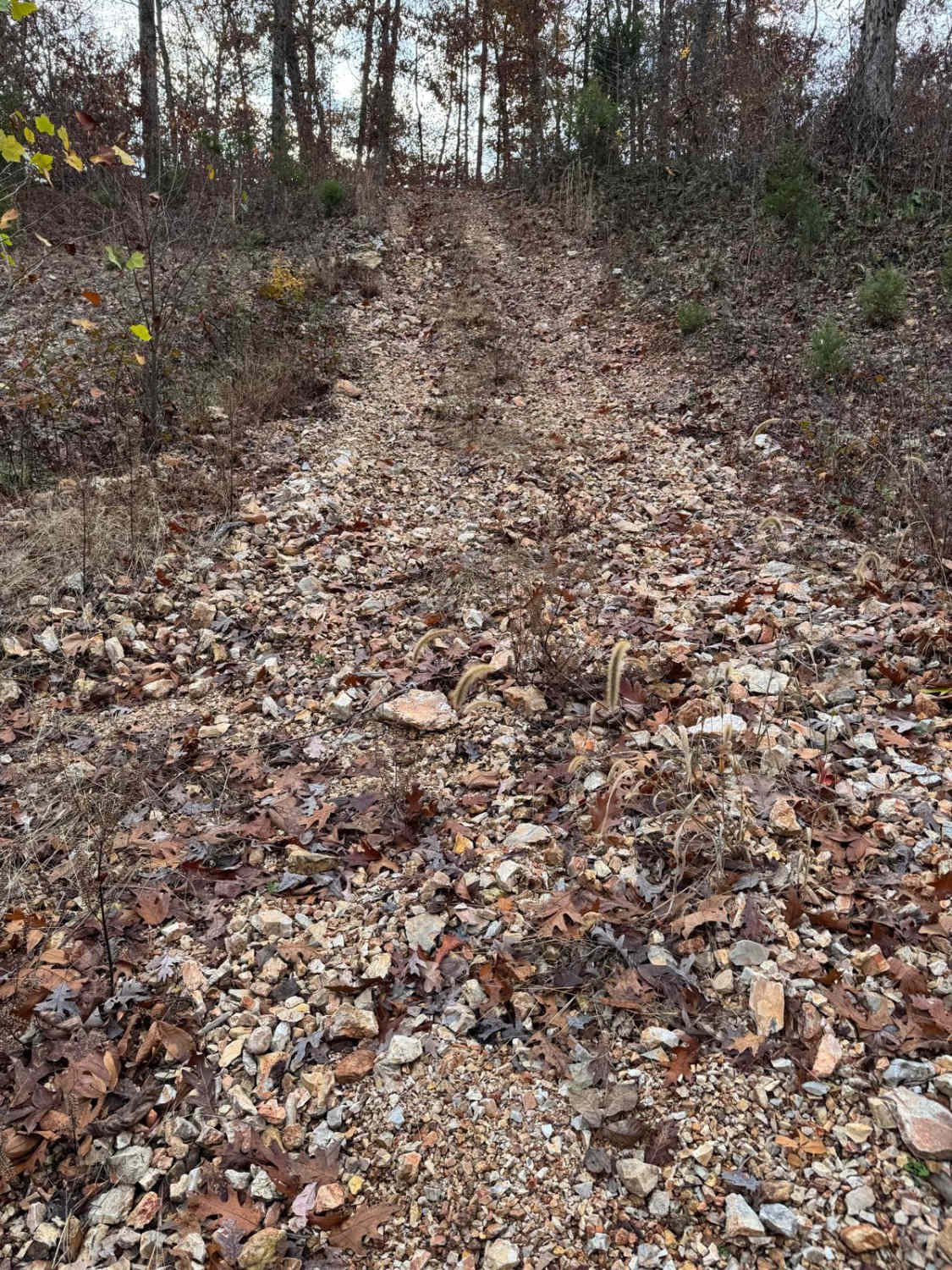
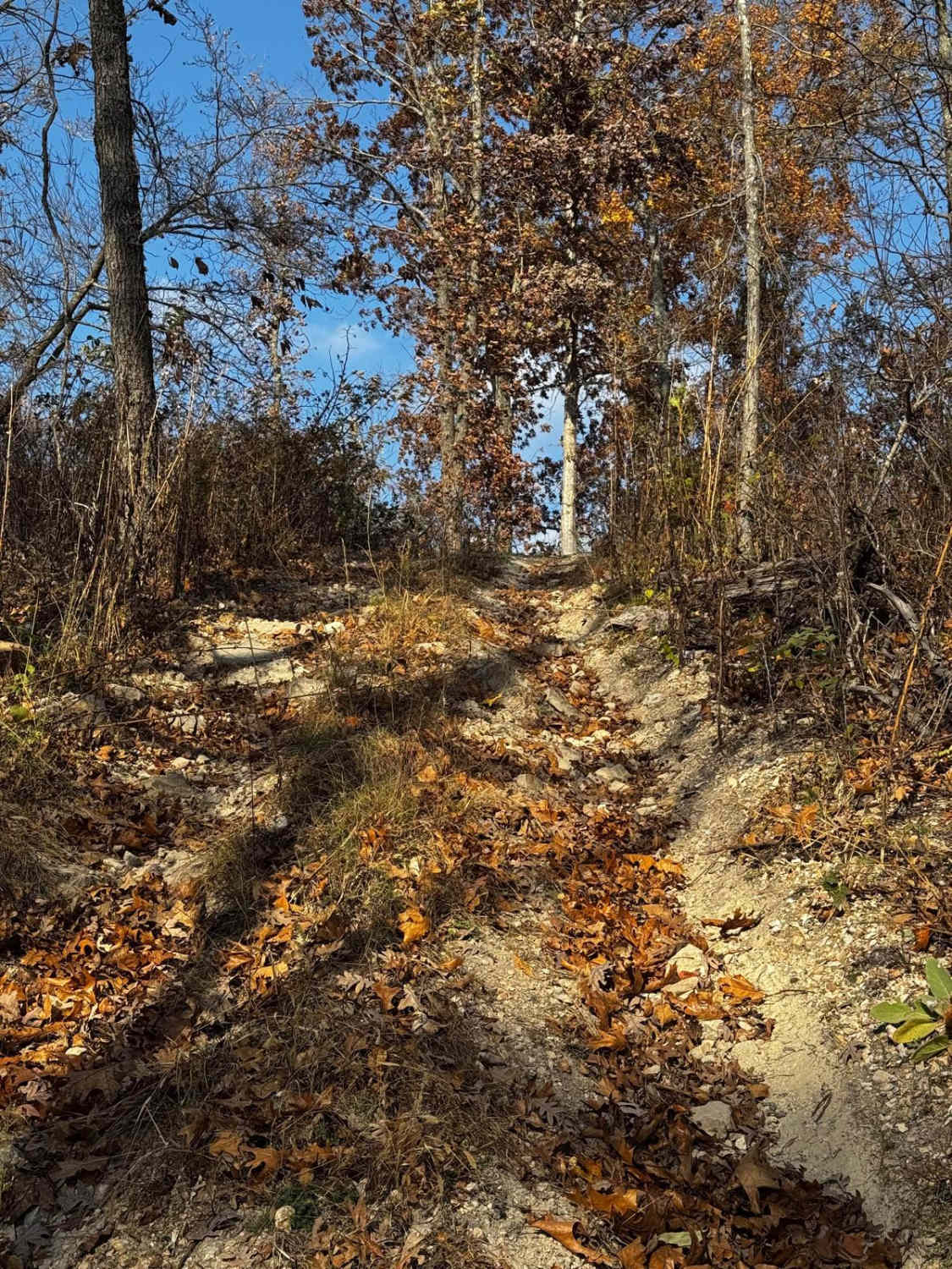
The east section of 507 is a great example of an entry-technical Glade Top side trail. At its core, it is a dirt-surfaced trail that features loose natural cobble rock (mostly 3 to 6-inch blocks, less likely 6 to 10-inch) and rare potential for small half-man boulders (10 to 16-inch range), featuring flat ridge top sections transforming to mild and moderate grades with several glade rock ledges, steps, and slabs along the way. These ledges range from 6 to 12 inches consistently, a few up to 18 inches. With a less-built vehicle, the driver will have to be picky about what line to take. At the southern end near the Hub Tree, heavy erosion and rutting exist from rainwater shed down the trail. This exposes natural loose coarse rock, including climbing off-camber dirt mounds (sloped 1 to 3-foot-tall increases over similar length), and has a moderate potential to be muddy. There are also some water collection spots throughout the trail, but they are mild to moderate (3 to 18 inches) and hard-bottomed. One such water hole features natural rock on either side of the water hole, so use some judgment on entering said spots. Several sections navigate tight treelines and require great attention to the width amongst surrounding trees, and ultimately may include hopping over downed trees. All this said, the trail is given a base rating of a medium-demanding 4/10, with the largest ledges and water holes being the primary obstacle earning this rating. Note that large sections of this trail will ride like a 2/10, with 3 and 4 obstacles along the way. The further south on the trail, the more the obstacles. The difficulty of this trail will increase in inclement weather, with a lot of leaves on the ground. Some of the Missouri rock is very sharp, there are tight sections within the trees, and the locust trees have thorns that can puncture tires.
History
The Glade Top Trail is a Civilian Conservation Corps [CCC] built road that was designated a Scenic Byway in 1989. Portions of Forest Roads 147, 149, and 150 comprise the trail. The trail follows a series of ridgetops through the central glade area of the White River Hills. The Glade Top Trail is little changed from the original road constructed by the Civilian Conservation Corps in the late 1930s. For twenty-three miles, the two-lane, all-weather gravel road follows narrow ridge tops rising approximately 500 feet above the surrounding rolling countryside and overlooks and passes through many limestone/dolomite glades interspersed with open and closed woodlands. (Sourced from the USDA website.)
Status Reports
Tennyson Hollow East - FS 507 can be accessed by the following ride types:
- High-Clearance 4x4
- SUV
Tennyson Hollow East - FS 507 Map
Popular Trails
Yellow 324

The onX Offroad Difference
onX Offroad combines trail photos, descriptions, difficulty ratings, width restrictions, seasonality, and more in a user-friendly interface. Available on all devices, with offline access and full compatibility with CarPlay and Android Auto. Discover what you’re missing today!