Sutton Bluff ATV 8 West - SB 8
Total Miles
2.7
Technical Rating
Best Time
Spring, Summer, Fall, Winter
Trail Type
50" Trail
Accessible By
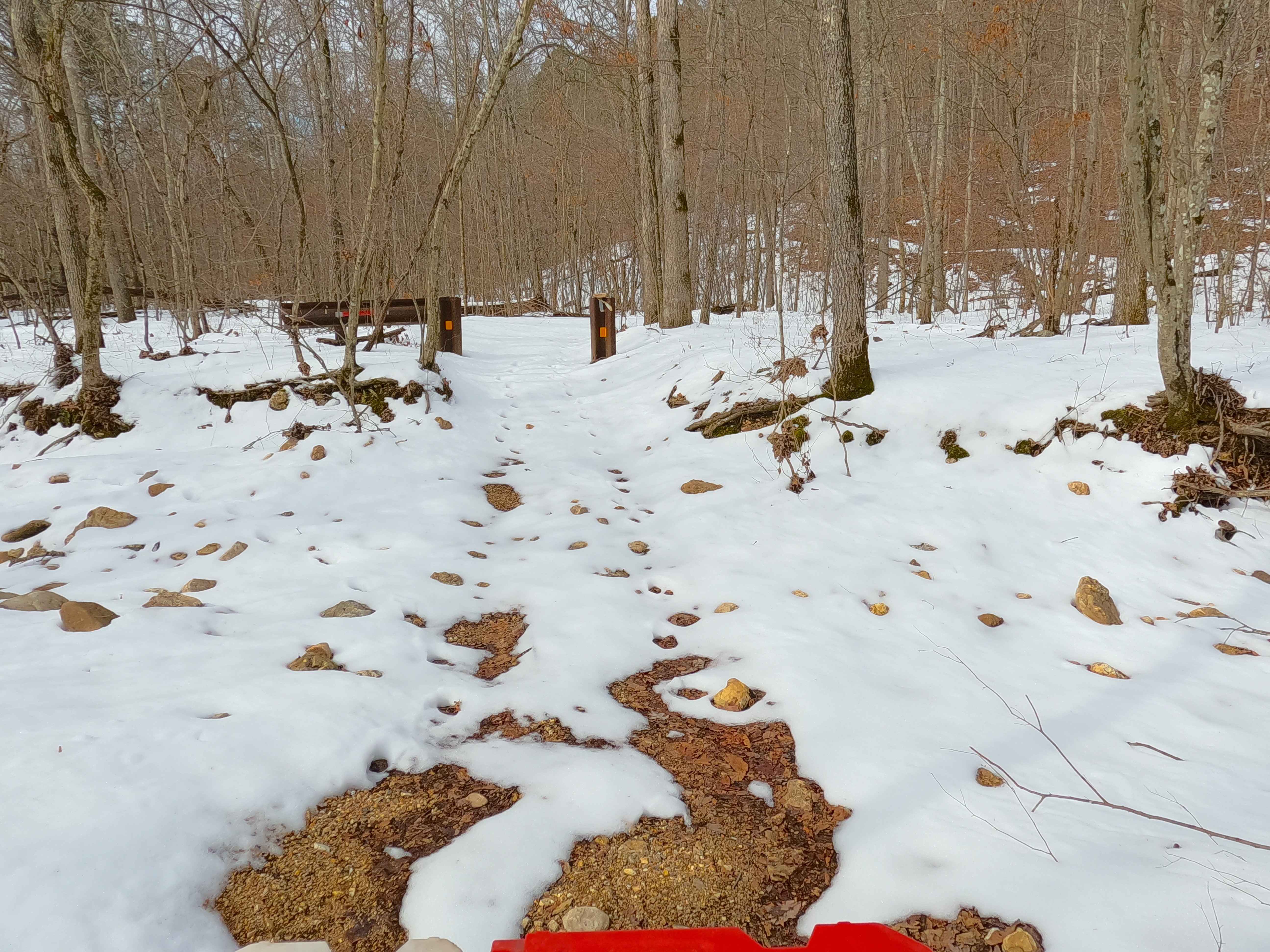
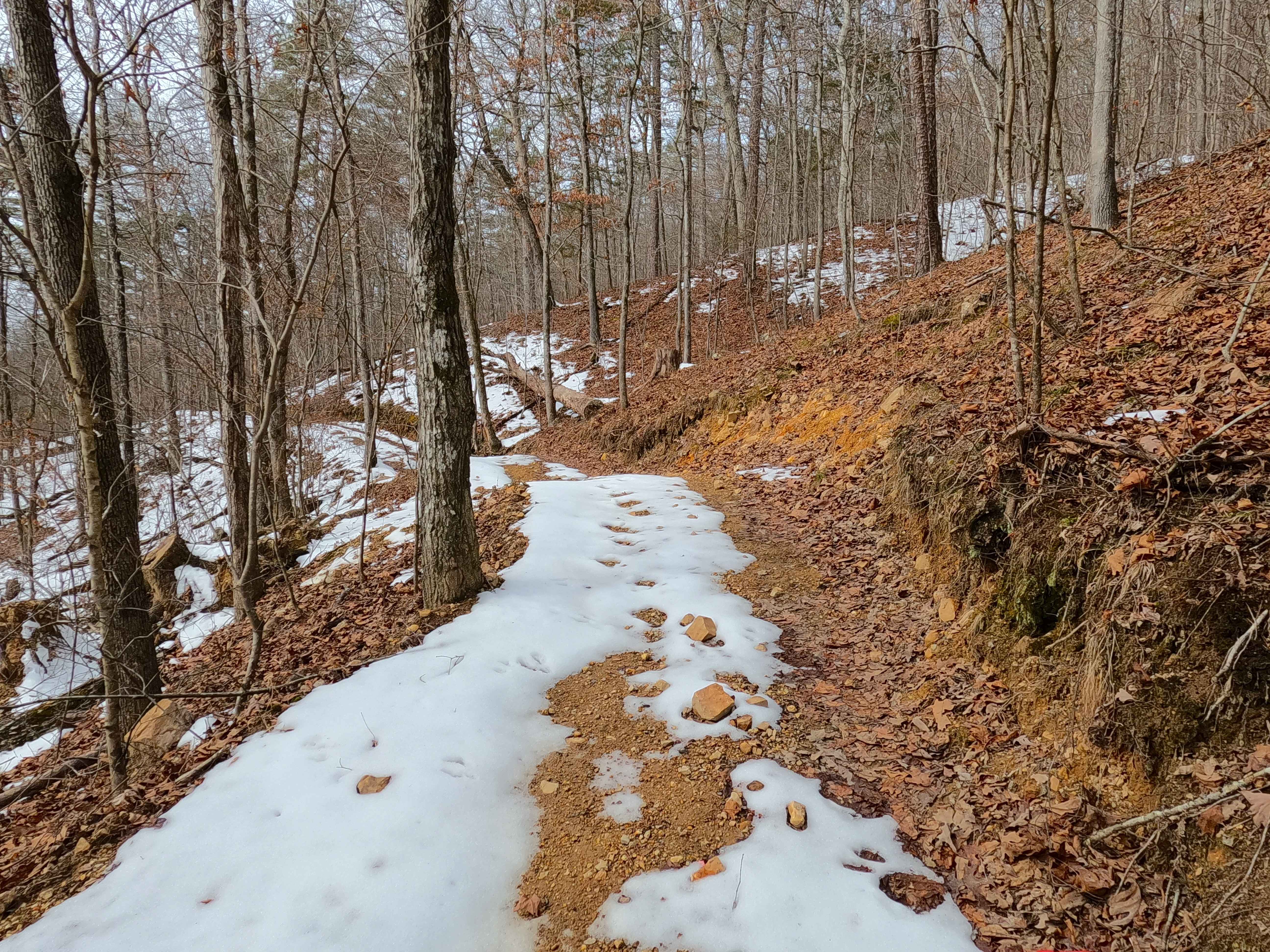
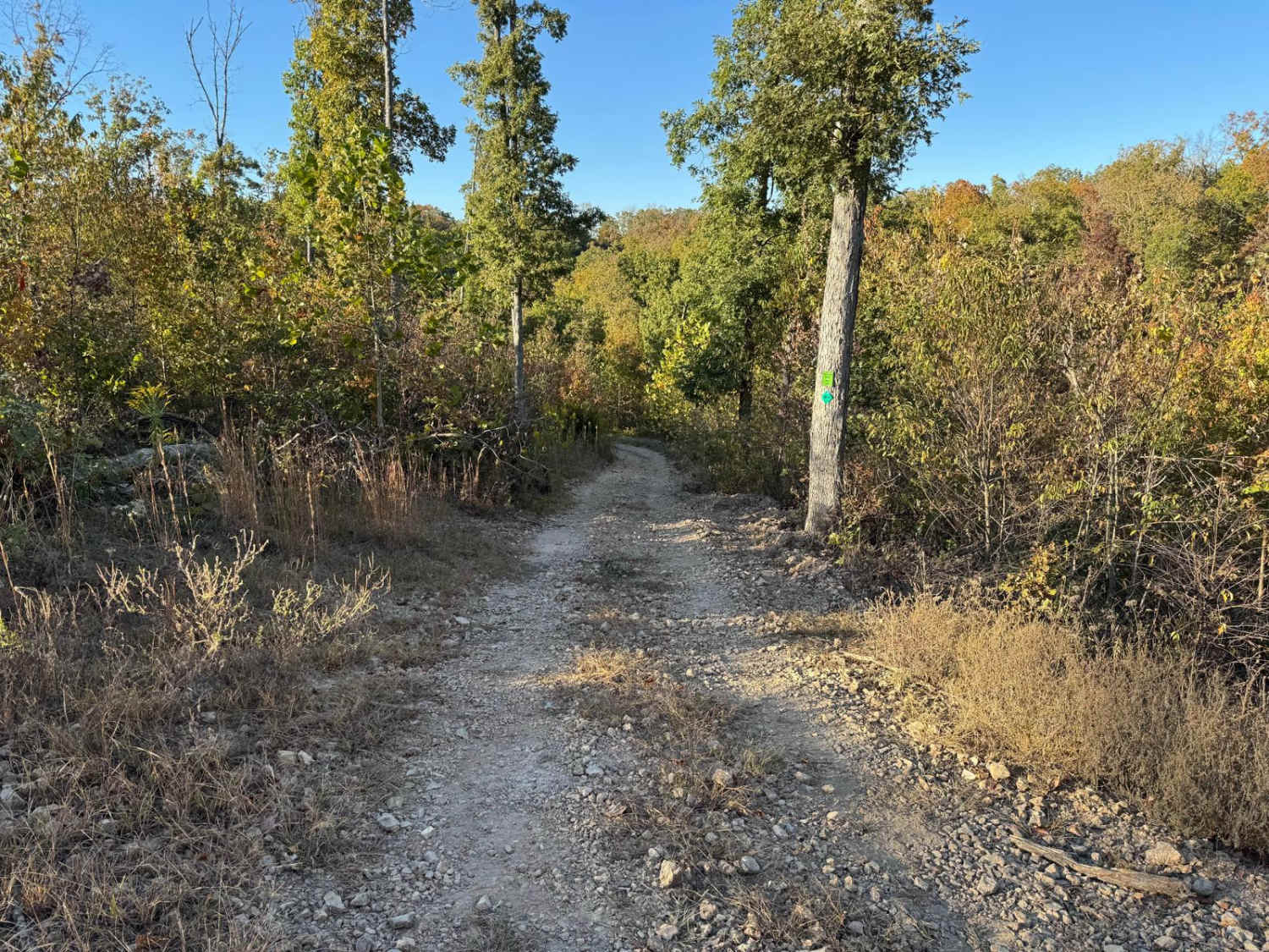
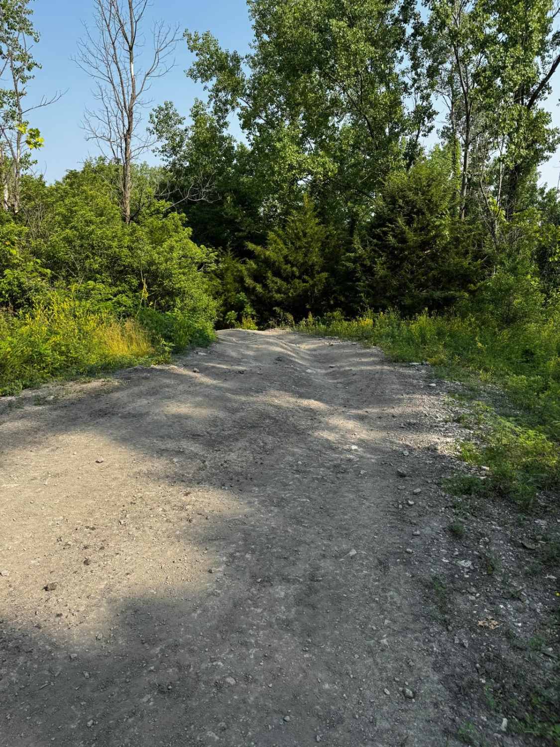
Trail Overview
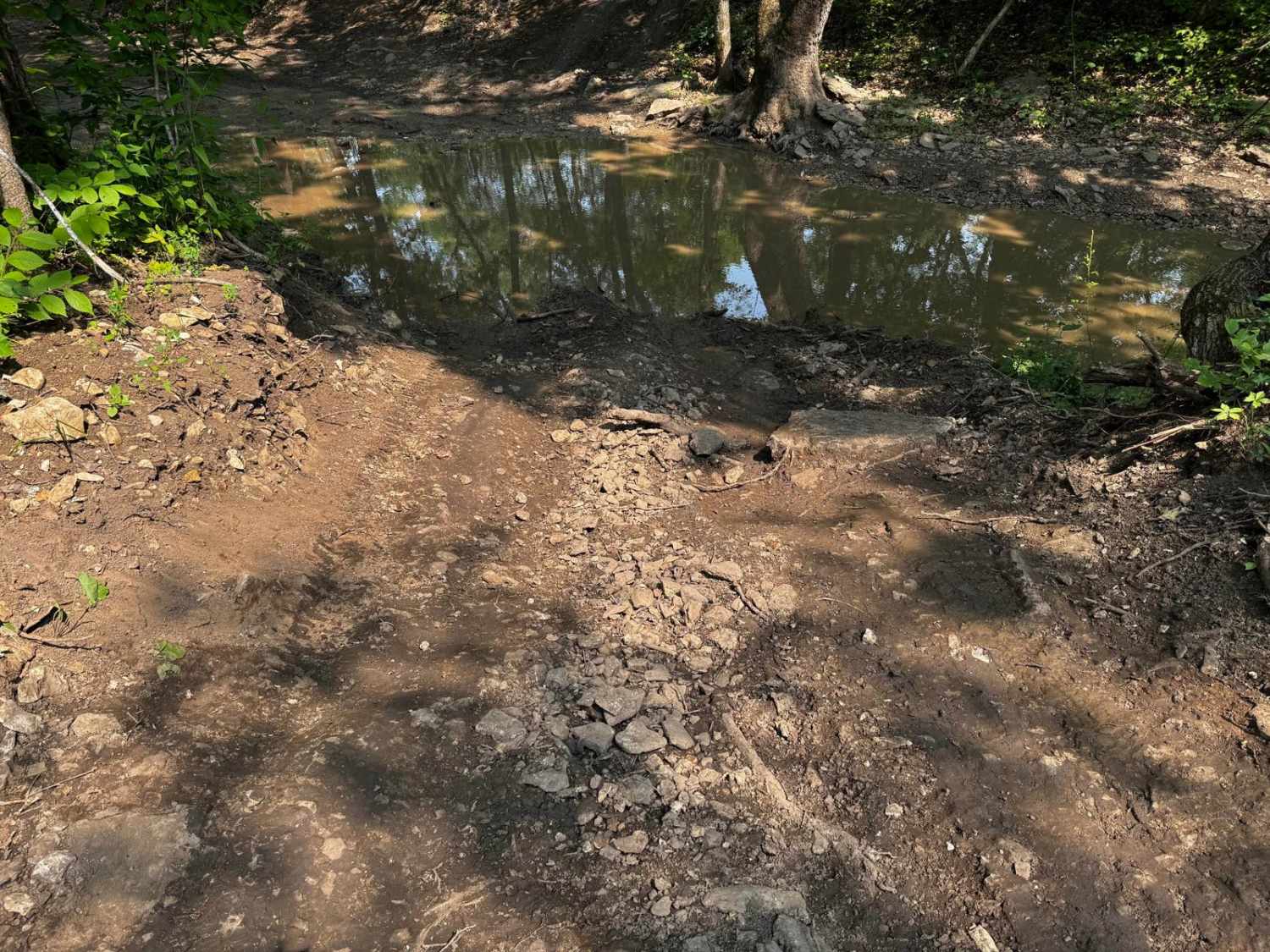
Sutton Bluff ATV 8 (West Section), also known as McLean Branch (legal/emergency ID SB 8), is a 50-inch and under restricted trail within the Sutton Bluff OHV trail system managed by the Mark Twain National Forest Salem Unit. SB 8 West is a part of the "far east section" of Sutton Bluff OHV. Oriented as a north-to-south trail in an L shape, the final, most southern stretch is oriented east-west. Starting at the Karkaghne Scenic Drive on the north end, the route shortly passes the SB 16 crossing, passes the SB 18 crossing midway into the route, and concludes to the south at a 3-way crossing with SB 8 East and SB 9 in the bottoms. Summary of the SB 8 West: it starts on the Karkaghne Scenic Drive ridges and heads south, passing SB 16, then shortly hitting a heavy switchback section. The track consistently goes downhill until it reaches a section where the track is etched into a hillside with the valley to the east. It passes SB 18 and arrives in the valley section, crossing a feeder branch of the West Fork Black River twice. The route concludes at the SB 8 East and SB 9 crossing. SB 8 West's notable core elements include one large section of switchbacks, a natural coarse-gravel-dirt path featuring whoops, loose cobbles, mini boulders, natural rock slabs, tree roots, mild water crossings, and small water-collection spots. To enjoy this trail and OHV system, obtain the required Sutton Bluff permit from Mark Twain National Forest, and if intending to use an ATV on Reynolds County Roads to commute between trails, obtain the Reynolds County ATV/UTV permit as well, in accordance with Missouri state laws.
Photos of Sutton Bluff ATV 8 West - SB 8
Difficulty
SB 8 West is given a base rating of 3/10, for having small 3-12-inch water crossings and water collection spots, steep grades throughout the majority of the track, occasional small 3-12-inch fallen trees, tree roots acting as mini 3-8-inch ledges, loose 4-10-inch cobbles laying in the trail, 10-inch to 18-inch mini boulders, and natural slabs present on edges or mostly buried within the ground as part of the path. Difficulty can increase from heavy use, lack of maintenance, large 12-inch+ fallen trees blocking the trail, wet or rainy conditions, inclement weather, or damage sustained from flash flooding. If actively flooding, consider the trail closed.
Status Reports
Sutton Bluff ATV 8 West - SB 8 can be accessed by the following ride types:
- ATV (50")
- Dirt Bike
Sutton Bluff ATV 8 West - SB 8 Map
Popular Trails
Double Trouble Two 92

County Road SE9056
The onX Offroad Difference
onX Offroad combines trail photos, descriptions, difficulty ratings, width restrictions, seasonality, and more in a user-friendly interface. Available on all devices, with offline access and full compatibility with CarPlay and Android Auto. Discover what you’re missing today!