Central Pond FSR 2144
Total Miles
2.0
Technical Rating
Best Time
Spring, Fall, Winter, Summer
Trail Type
Full-Width Road
Accessible By
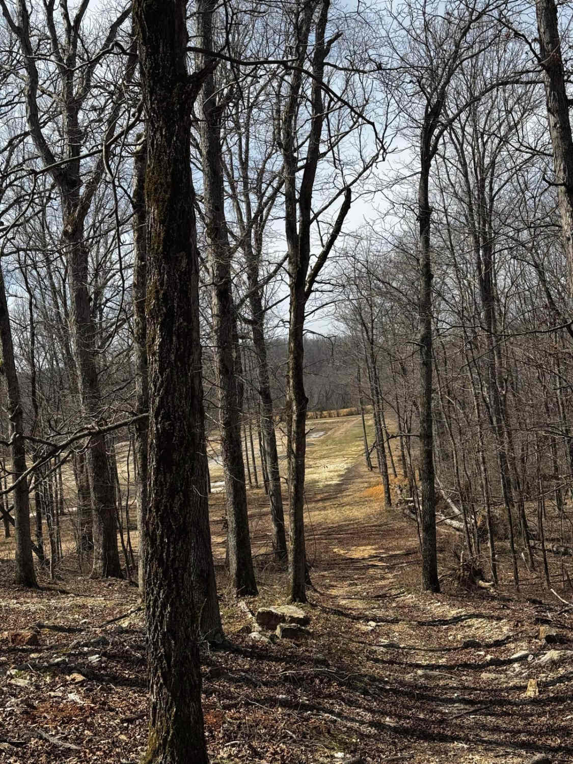
Trail Overview
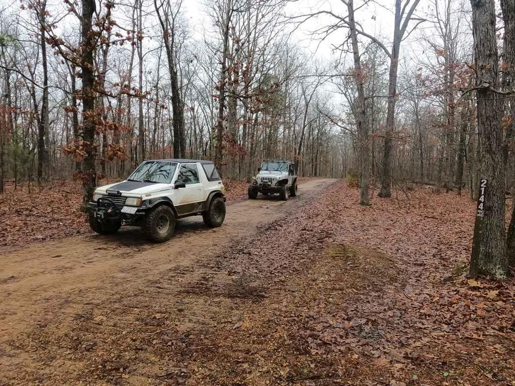
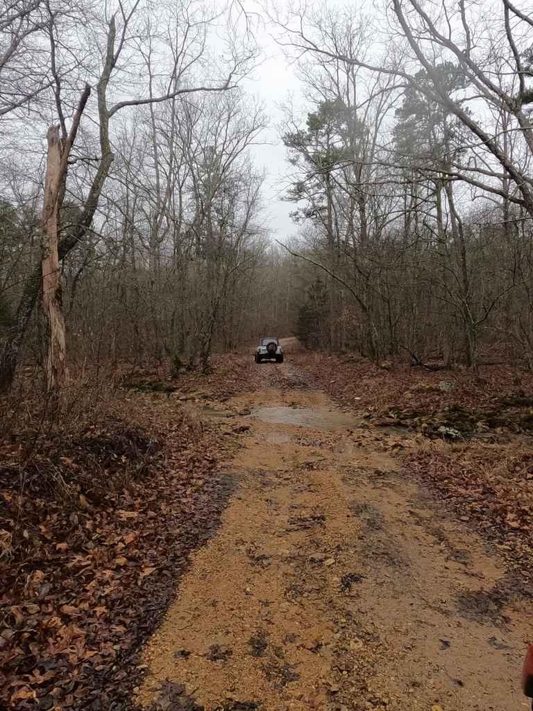
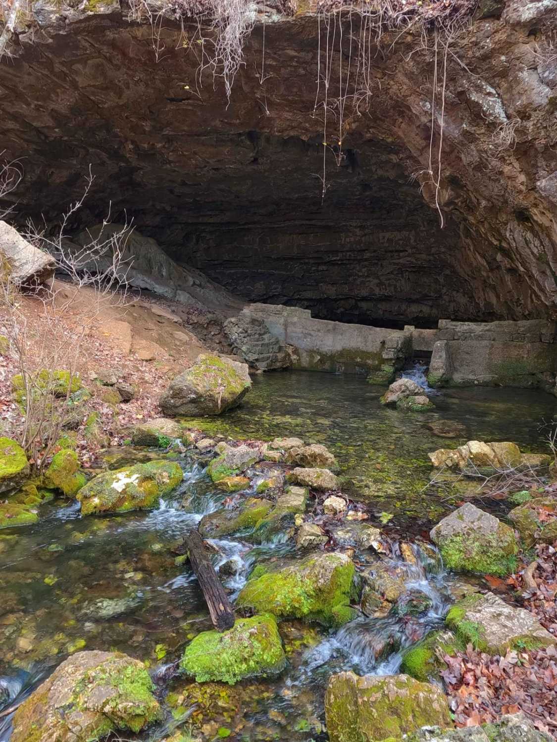
The Central Pond FSR 2144 is a mild-weight gravel forestry road that leads through the St Francis Mountains within Mark Twain National Forest. The road features gravel at its foundation, but in spots, the trail fades to dirt or mud. On the hills and grades, it has a tendency to form ruts and washes, at minimum being washboarding and mounding. There are also water collection spots roughly a foot deep, including the small feeder creek crossings at Peters Creek, this also being the lowest point in the trail. Along the route, there are also many camp-able cutouts. This is a great warmup trail to start exploring the Fredericktown sector of Mark Twain National Forest.
Photos of Central Pond FSR 2144
Difficulty
The difficulty of this road shows in the hills where rainwater carves ruts and washes into the pathway and also in the murky water collection spots in the valleys and hilltops that could feature hidden tree roots and rocks.
Central Pond FSR 2144 can be accessed by the following ride types:
- High-Clearance 4x4
- SUV
Central Pond FSR 2144 Map
Popular Trails
Pruitt Run Byway
Backside Hill Climb Access
Cave Spring - NPS 105
The onX Offroad Difference
onX Offroad combines trail photos, descriptions, difficulty ratings, width restrictions, seasonality, and more in a user-friendly interface. Available on all devices, with offline access and full compatibility with CarPlay and Android Auto. Discover what you’re missing today!