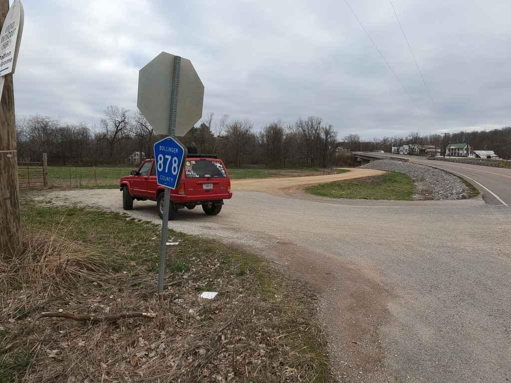
Bollinger County Road 878
Total Miles
2.5
Technical Rating
Best Time
Spring, Summer, Fall, Winter
Trail Type
Full-Width Road
Accessible By
Trail Overview
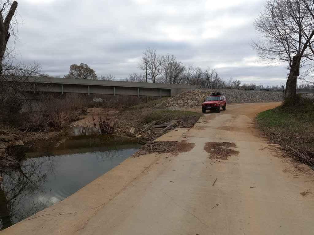
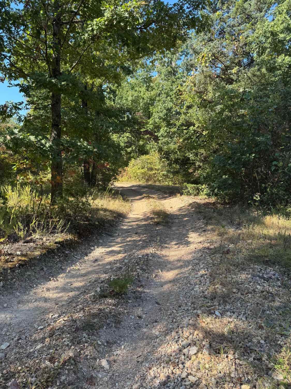
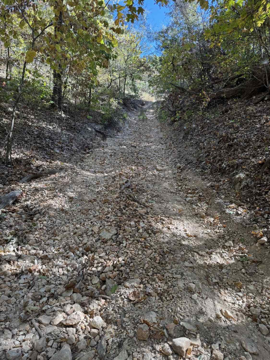
The Bollinger County Road 878 is a gravel-based road, that climbs through the hills and feeder creeks west of Patton, Missouri. The road in typical Bollinger County fashion starts out maintained on the ends and shows its character towards the middle less used section. The road features washboarding, potholes, mounding, sections the road turns to dirt, loose rock, natural rock poking out at the road surface, a low water bridge crossing, a natural creek crossing at the Baltimore Creek, and countryside views. A fun route to bypass MO-72 to come into Patton, MO. Would be a great road for a snow-covered run.
Photos of Bollinger County Road 878
Difficulty
The road features a large low-water bridge but appears to stay dry, but the natural creek crossing is evidently shaped by rain water, and heavy rains could pose slight water challenges and escalate the difficulty. The road has loose rock, mild-grade hills, and the typical mounding, potholes, and washboarding of Bollinger County. There are a few spots where natural rock sticks out of the road and requires attention to not cause potential damage.
Status Reports
Bollinger County Road 878 can be accessed by the following ride types:
- High-Clearance 4x4
- SUV
Bollinger County Road 878 Map
Popular Trails
Yellow 18

Turkey Ridge
Yellow 67

Power Line West
The onX Offroad Difference
onX Offroad combines trail photos, descriptions, difficulty ratings, width restrictions, seasonality, and more in a user-friendly interface. Available on all devices, with offline access and full compatibility with CarPlay and Android Auto. Discover what you’re missing today!