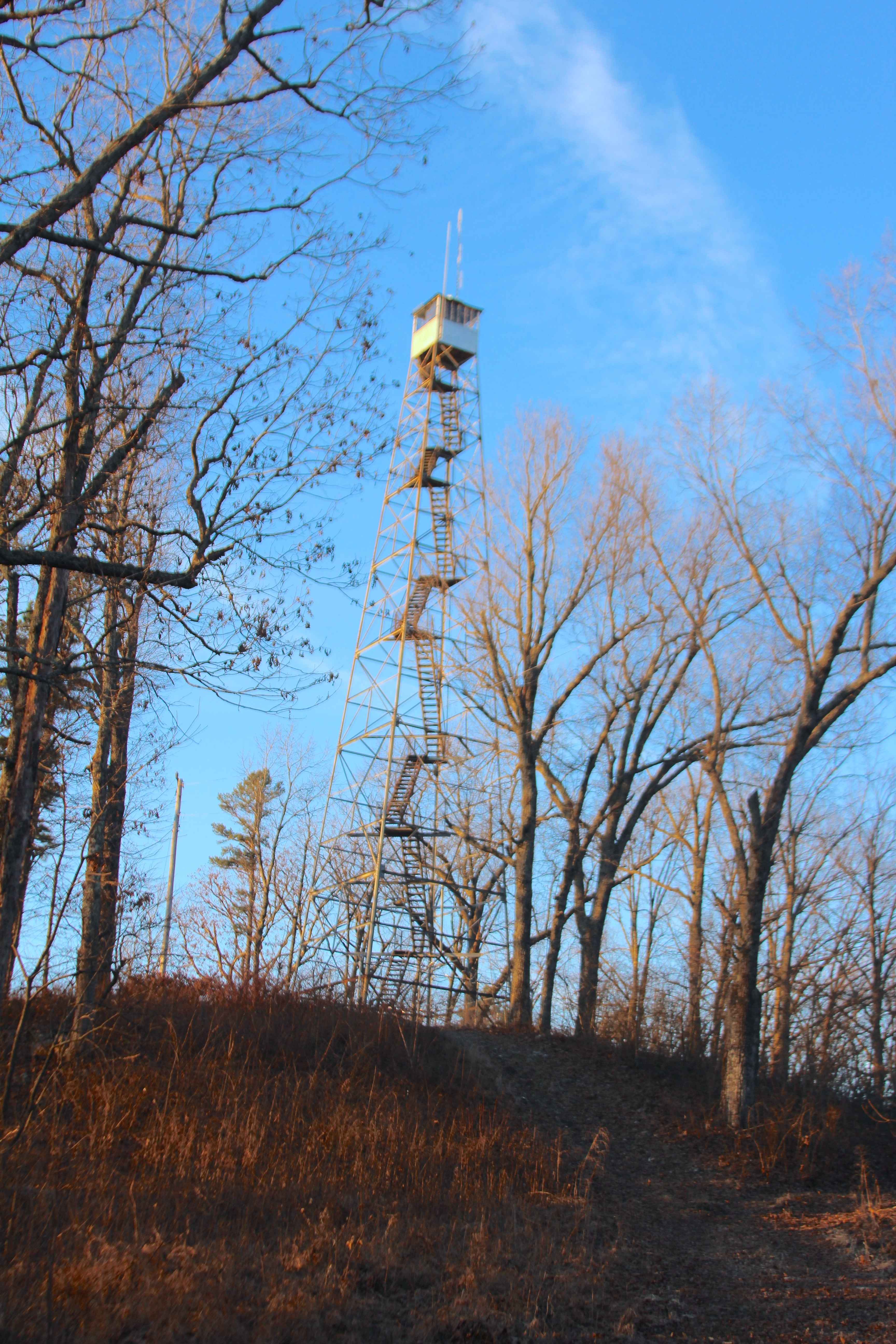
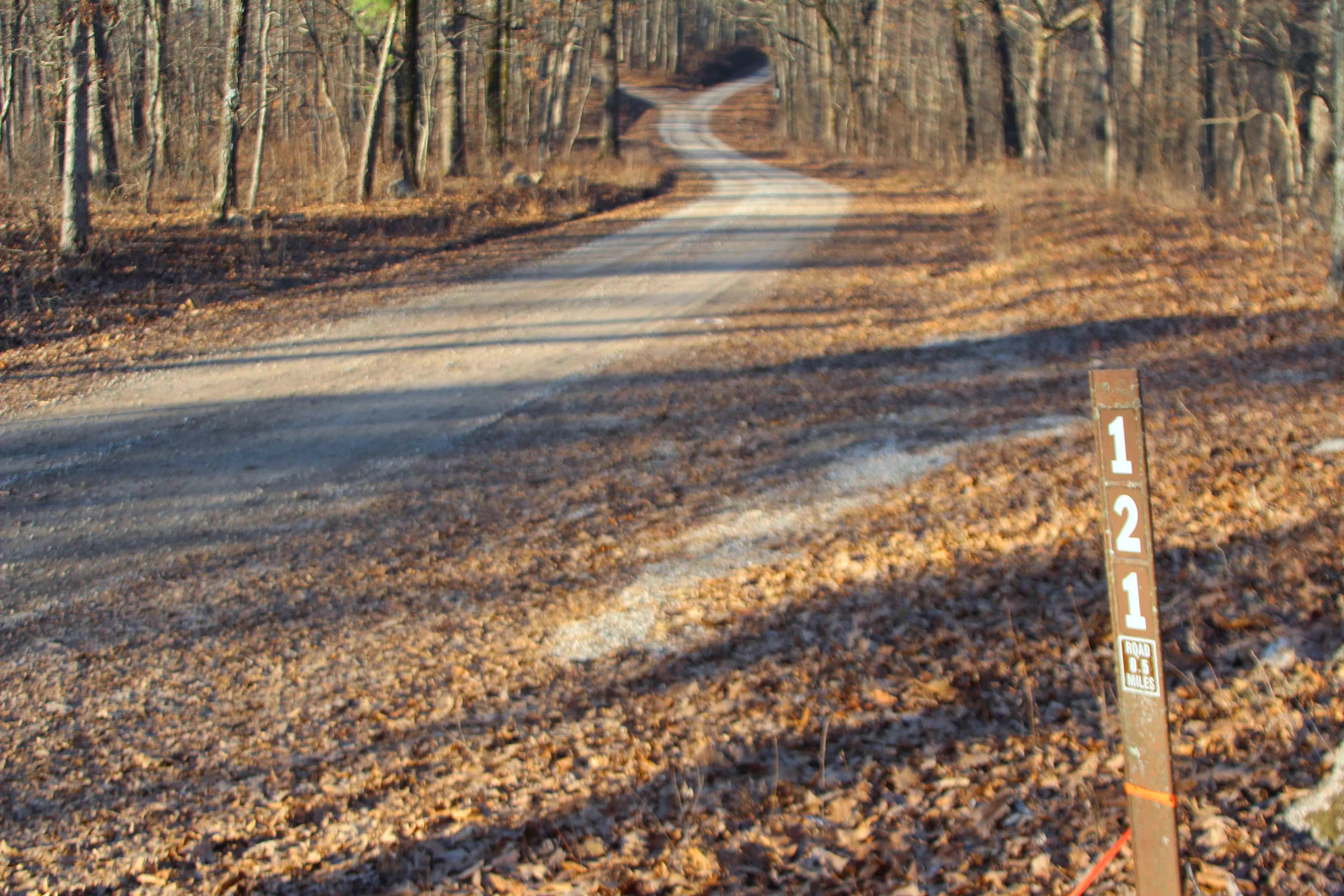
Blue Buck Tower - FS 121
Total Miles
0.5
Technical Rating
Best Time
Spring, Summer, Fall, Winter
Trail Type
Full-Width Road
Accessible By
Trail Overview
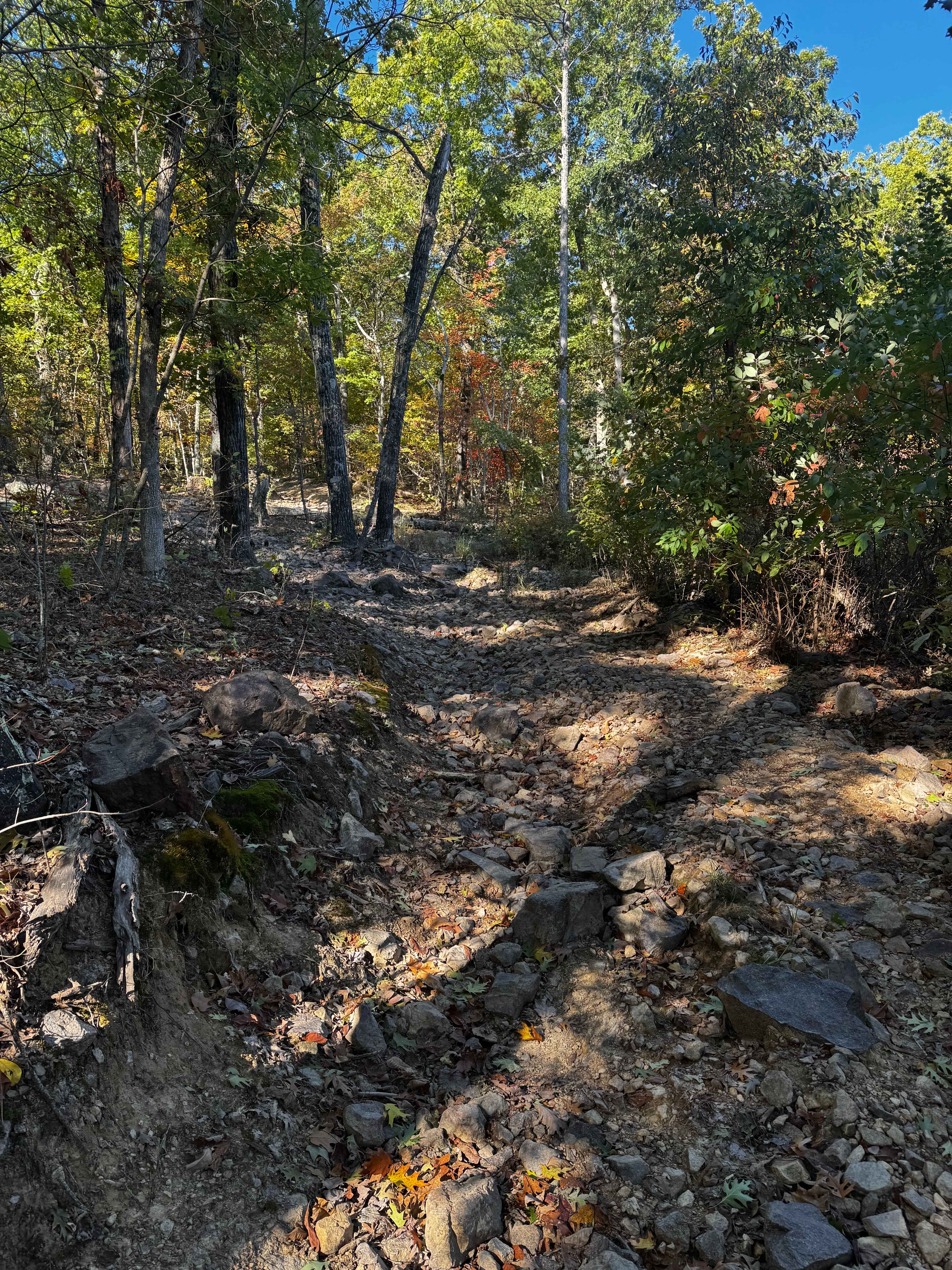
Blue Buck Tower (FS 121) is a maintained gravel Forest Service road within the Willow Springs Unit of Mark Twain National Forest. The road to Blue Buck Tower is located west of South Missouri Route 181, between Missouri Route 76 to the north and the Route 181 junction with the AP Highway to the south, making it one of the most centrally located sites in this Unit, clearly marked by the 110-foot-tall Blue Buck Fire Tower overlooking the surrounding roads, hills, and valleys. The FS 121 road is short, leaving 181 heading southwest, climbing a steady hill to the closed gate at the roads halfway point, from here users can turn vehicles around and head back the way they came, or continue on foot uphill along the road to the enjoy views of the tower from ground level, there are views down the power line tract, heading south from the tower, towards Route 181 and the hills beyond. Other than tower access, the primary purpose of the FS 121 is to connect to its two spur roads, FS 121A and FS 122, providing more recreation and exploration opportunities while visiting the Blue Buck Tower area. The roads in the Blue Buck Tower area are restricted to day-use and are not permitted for overnight or camping use.
Photos of Blue Buck Tower - FS 121
Difficulty
Blue Buck Tower is given a base rating of 1/10, being a hillside road with a steady grade over its track going uphill westward to the conclusion at the closure gate. It is safe to expect the typical gravel-road complications of potholes, washboards, mounding of the gravel, and potential mild erosion along the hill. Difficulty could increase during heavy use, wet conditions, or severe lack of maintenance.
History
Blue Buck Tower was built in 1935 by Civilian Conservation Corps (CCC) Camp Willow, Company 1739. This was one of their first larger projects in the area shortly after they arrived in 1934, alongside running telephone wires and establishing roads. It is a 110-foot-tall structure with a 7x7-foot cabinet. Via the website National Historic Lookout Register, notes and pictures of the tower's condition in 2010 suggested the cabinet needed a restoration and stairs to the top needed repairs, but when visiting and documenting the tower in 2/2026, these projects had since been completed, with the cabinet appearing restored with new flooring, and the bottom flight of stairs being re-constructed. Documented by Christopher Menz in 3/2026
Status Reports
Blue Buck Tower - FS 121 can be accessed by the following ride types:
- High-Clearance 4x4
- SUV
- SxS (60")
- ATV (50")
- Dirt Bike
Blue Buck Tower - FS 121 Map
Popular Trails

Primitive Camp Loop
Eastern Lower
The onX Offroad Difference
onX Offroad combines trail photos, descriptions, difficulty ratings, width restrictions, seasonality, and more in a user-friendly interface. Available on all devices, with offline access and full compatibility with CarPlay and Android Auto. Discover what you’re missing today!