Weiss - FS 3445
Total Miles
2.5
Technical Rating
Best Time
Spring, Summer, Fall
Trail Type
Full-Width Road
Accessible By
Trail Overview
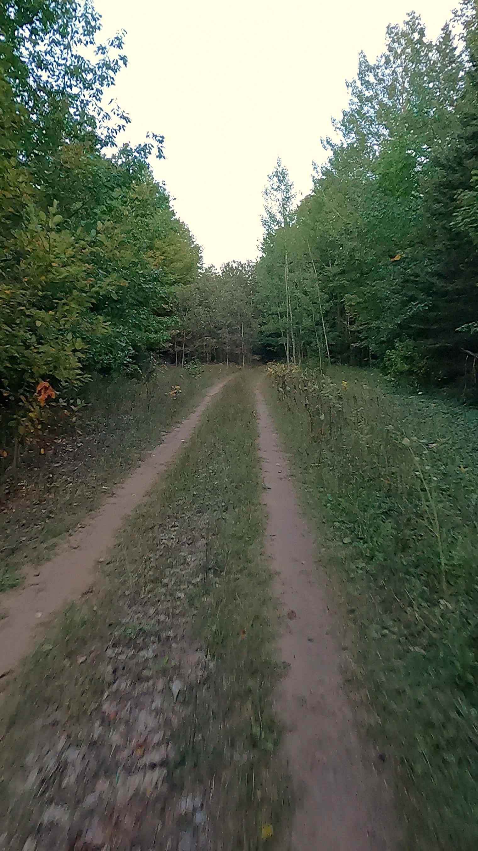
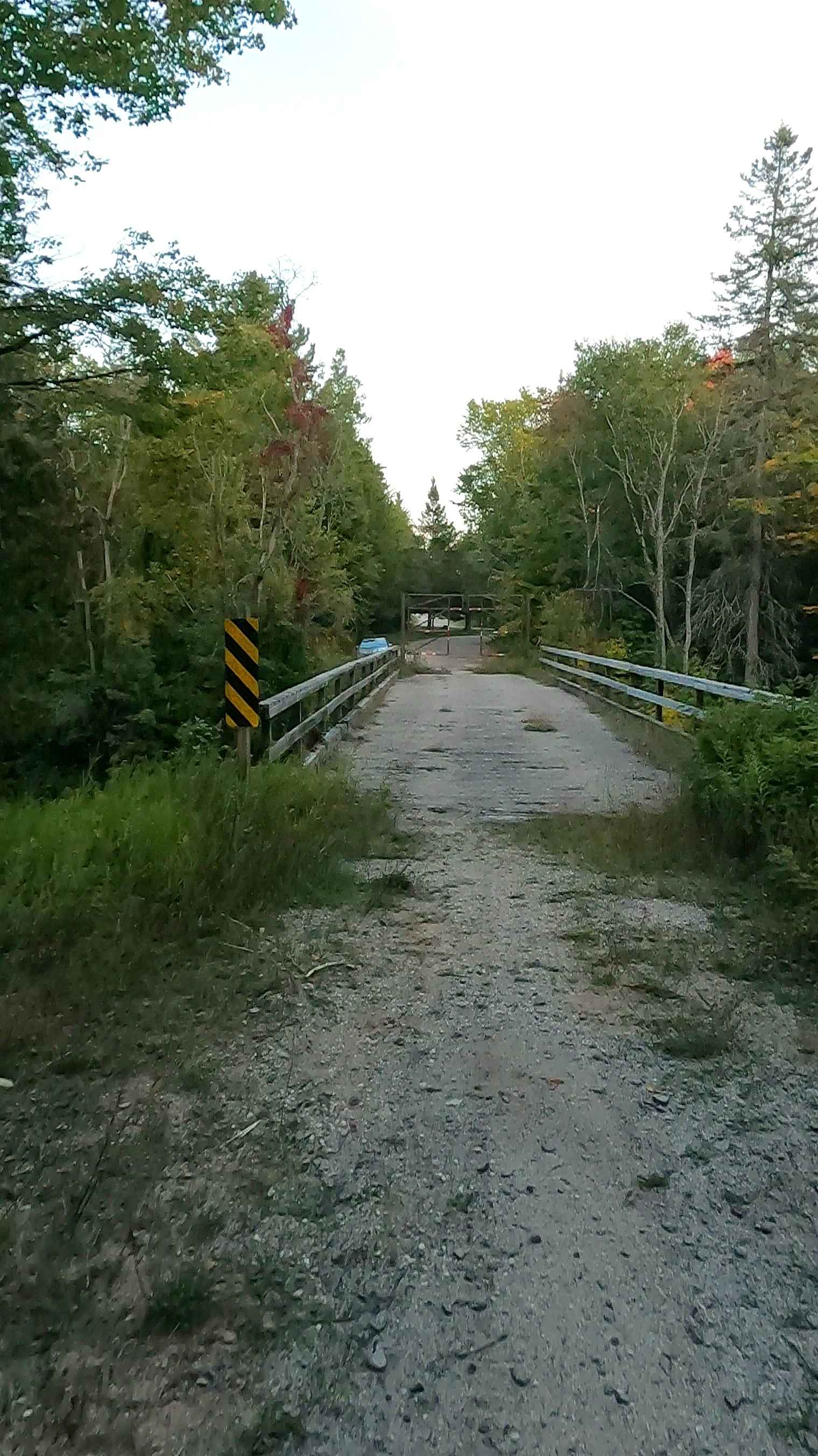
Federal Forest Service Road (FS) 3445, also known as Weiss, is a federally owned/ locally maintained, Level-2/ Level-3 forest road with a surface composition of dirt, sand, gravel, and native material. This route is currently open and in fair condition. It is a "There-and-Back" route off of H63- Mackinac Trail; it is not a DNR road (ORV use is subject to local government regulations). Seasonally, this route has a 50-inch restriction gate at the entrance of the bridge that traverses over the Carp River. Vehicle access is limited to vehicles 50 inches in width or less between April 1 and November 30. Description created on September 17, 2025.
Photos of Weiss - FS 3445
Difficulty
Dirt, sand, grass, and a rooted path, typically unmaintained after rain or snow, which may give rise to shallow water crossings and obstacles under 12 inches on the trail, including small ledges. This route is a narrow "Two-Track" that is one vehicle in width. Vehicle access is limited to vehicles 50 inches in width or less between April 1 and November 30.
History
The Carp River, flowing into St. Martin Bay near St. Ignace, Michigan, is historically significant for its 19th-century logging, fishing, and unique geology. The area features the 1920s-era Mackinac Trail-Carp River Bridge (National Register of Historic Places) and flows through flat land, providing habitats for trout, salmon, and, historically, native white suckers. Geological Significance: The river flows east-to-west along the strike of bedrock, unique in a region where rivers usually flow north-south, and it features distinct karst features, according to the National Wild and Scenic River System. Historic Bridge: The Mackinac Trail-Carp River Bridge was constructed in 1920, listed on the National Register of Historic Places in 1999, and restored in 2010 to continue servicing local traffic. Logging and Industry: In the late 19th century, the area surrounding St. Ignace was a hub for lumbering and fishing. The river was a key part of this ecosystem, supporting regional industry as St. Ignace grew into a major shipping point. Early History: The Carp River area was home to significant prehistoric Native American sites, and early settlers often named it for the large, native sucker fish found there. Ecological Surveys: In the 1950s, the Michigan Department of Natural Resources conducted extensive studies on the Carp River watershed, confirming it as a habitat for brook, brown, and rainbow trout.
Status Reports
Weiss - FS 3445 can be accessed by the following ride types:
- High-Clearance 4x4
- SUV
- SxS (60")
- ATV (50")
- Dirt Bike
Weiss - FS 3445 Map
Popular Trails


Heart Creek Trail
Porterfield Lake

Pine Row Connector Trail
The onX Offroad Difference
onX Offroad combines trail photos, descriptions, difficulty ratings, width restrictions, seasonality, and more in a user-friendly interface. Available on all devices, with offline access and full compatibility with CarPlay and Android Auto. Discover what you’re missing today!