Moonlight Creek
Total Miles
2.2
Technical Rating
Best Time
Spring, Summer, Fall, Winter
Trail Type
Full-Width Road
Accessible By
Trail Overview
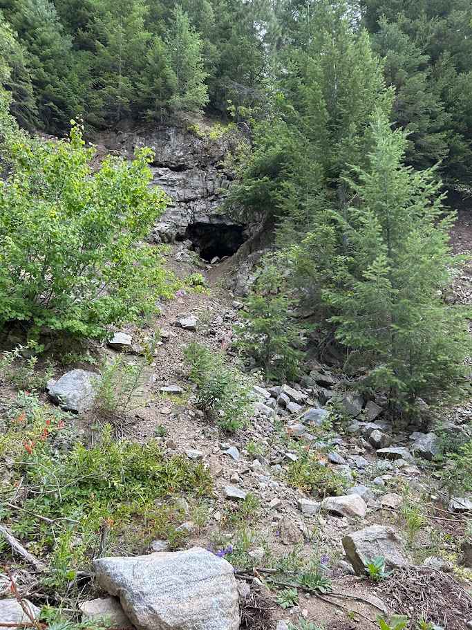
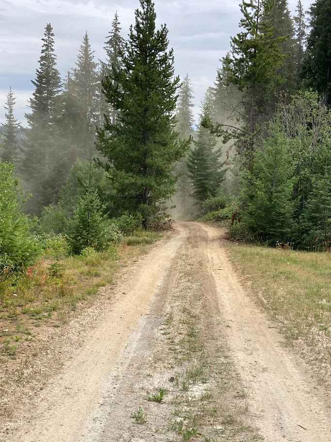
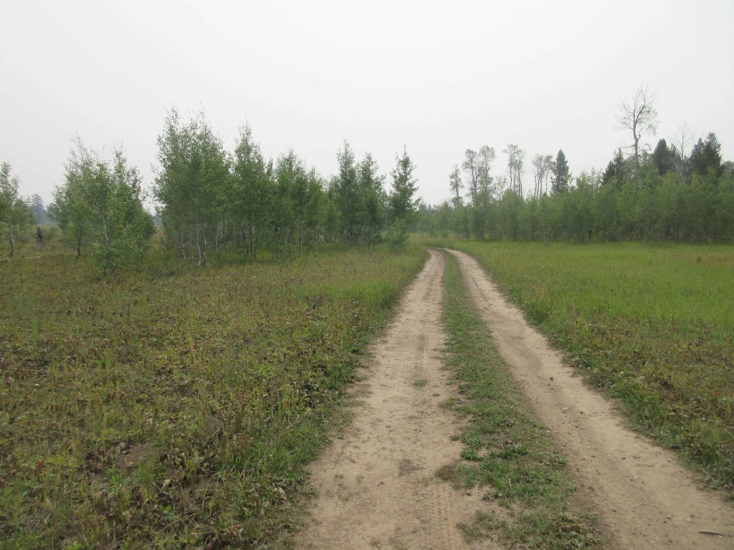
Moonlight Creek Road (NF 119) is a mellow-to-moderate backcountry drive that climbs a narrow forested valley with frequent creek crossings and views into tight granite draws. The surface is mostly packed dirt and decomposed granite with stretches of embedded rock, occasional baby-head rubble, and short rutted climbs; expect potholes, brushy pinstripes, and a couple of tight pull-outs where passing requires cooperation. Highlights include weathered mining relics scattered along the corridor; adit portals (tunnels) cut into the hillside, ore chute footings, and abandoned equipment slowly being reclaimed by the forest. Please admire the historic features from a distance and avoid entering any tunnels. Wildlife is common (elk, mule deer, and busy beaver ponds), and the creek provides shady picnic spots and cool-air reprieves on hot afternoons. Best suited for high-clearance 4x4s; air down for comfort, carry recovery basics, and be prepared for spring runoff to deepen crossings and for early snow to linger in the timbered bends.
Photos of Moonlight Creek
Difficulty
Easy trail with conditions that vary with the season.
History
Moonlight Creek Road (NF 119) has its roots in Idaho's late 19th and early 20th-century mining boom. Prospectors and small mining companies established the corridor to access gold, silver, and copper deposits in the surrounding hills. The road originally served as a wagon and pack route, connecting mining claims along Moonlight Creek to main supply routes in the region. Miners constructed tunnels, ore chutes, and small stamp mills along the creek, remnants of which are still visible today. Over time, as mineral production declined, the route fell into disuse and was gradually maintained by the Forest Service for timber access and recreational use. Today, it preserves both the natural beauty of the Moonlight Creek valley and tangible glimpses into Idaho's mining heritage.
Status Reports
Moonlight Creek can be accessed by the following ride types:
- High-Clearance 4x4
- SUV
- SxS (60")
- ATV (50")
- Dirt Bike
Moonlight Creek Map
Popular Trails
Garner Canyon

Spruce Summer Cabins Loop

Crestline trail - Bell Marsh Creek

Canfield Mountain- Trail 1
The onX Offroad Difference
onX Offroad combines trail photos, descriptions, difficulty ratings, width restrictions, seasonality, and more in a user-friendly interface. Available on all devices, with offline access and full compatibility with CarPlay and Android Auto. Discover what you’re missing today!