Deer Creek
Total Miles
5.4
Technical Rating
Best Time
Fall, Summer, Spring
Trail Type
Single Track
Accessible By
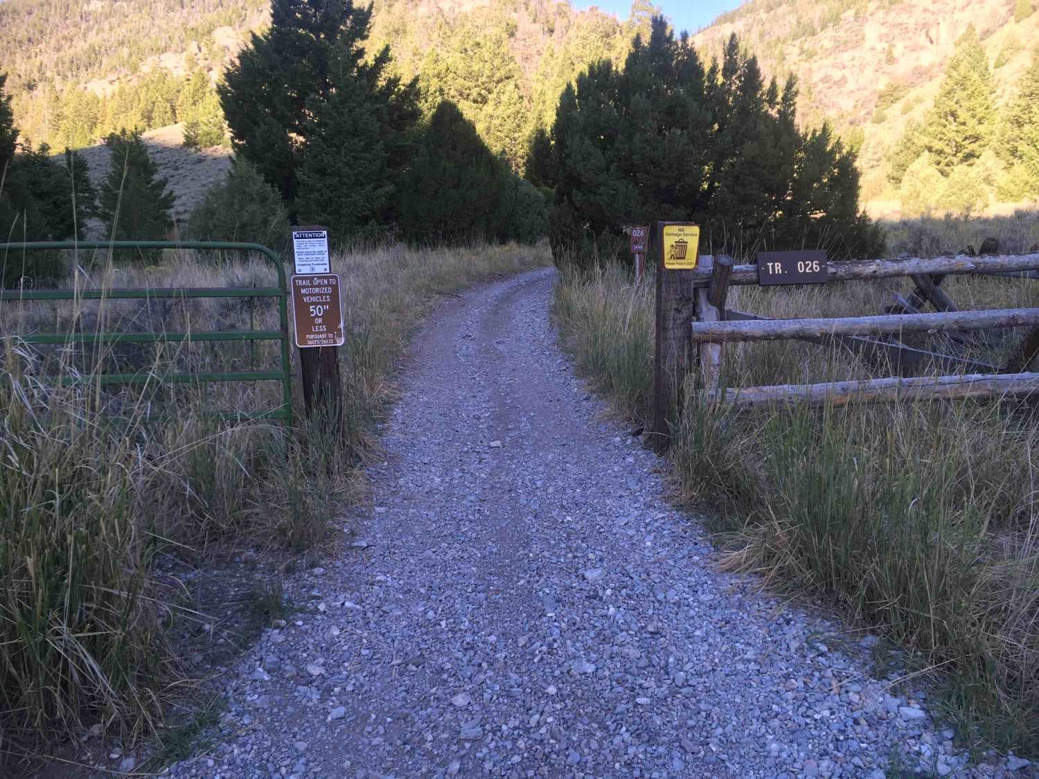
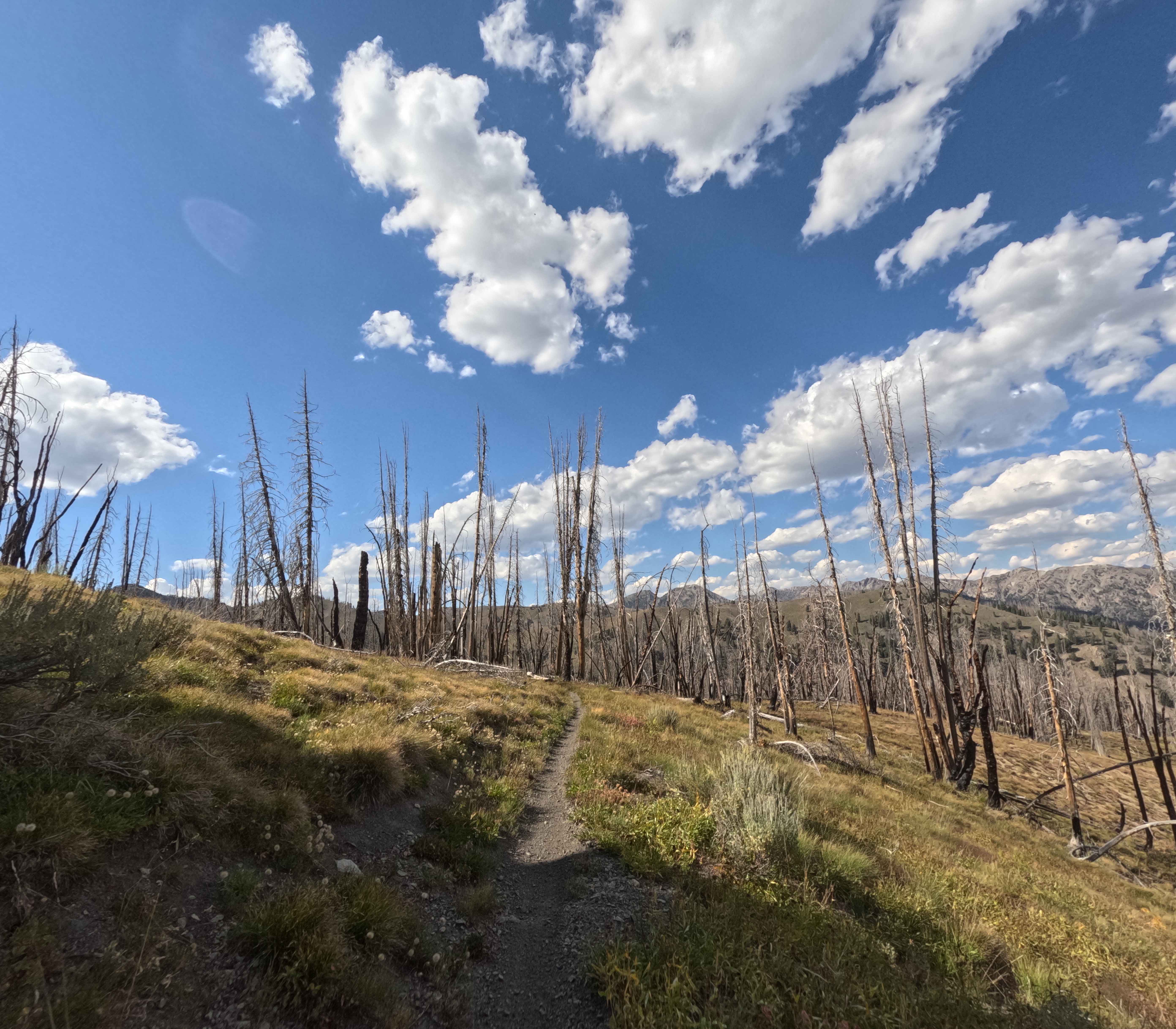
Trail Overview
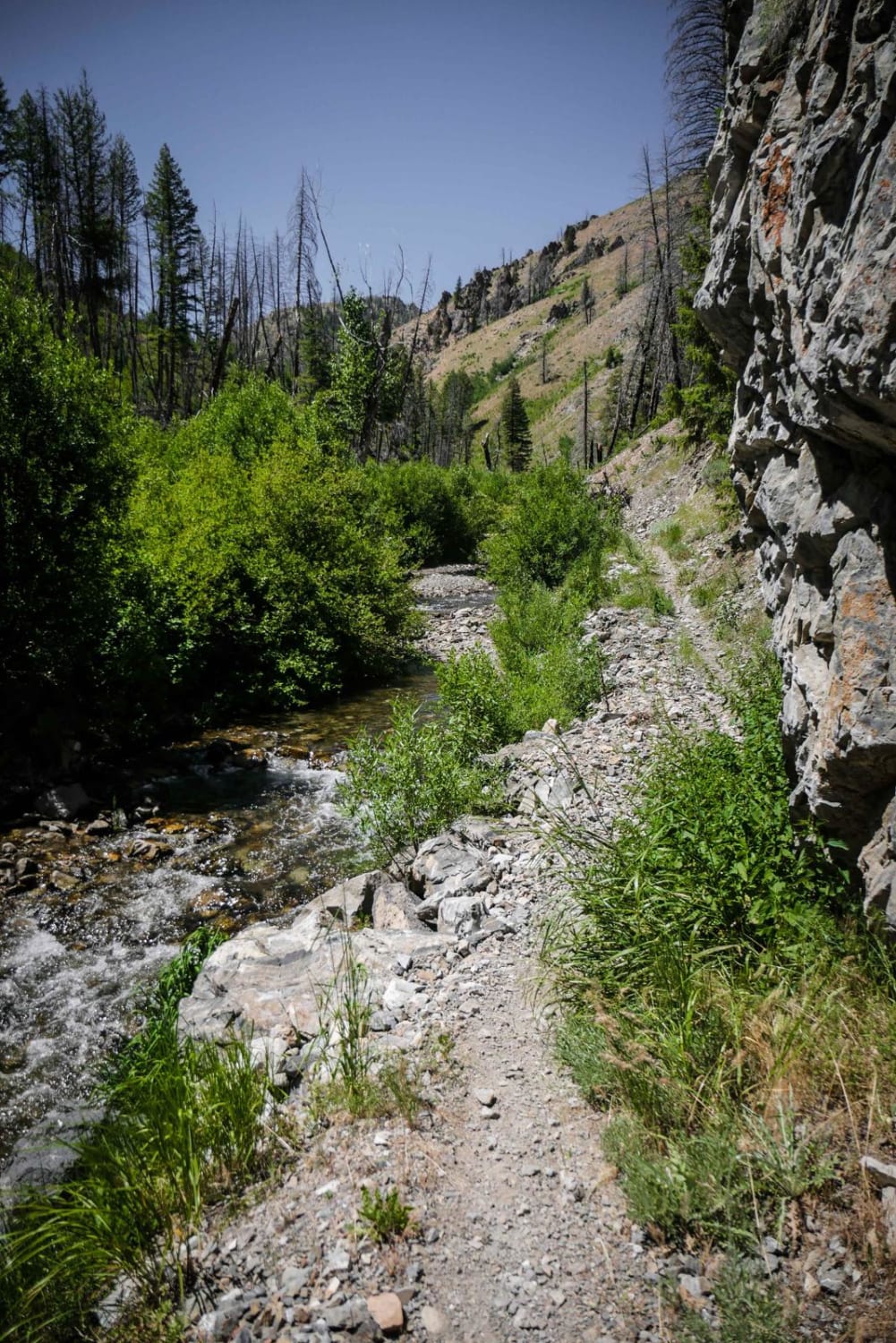
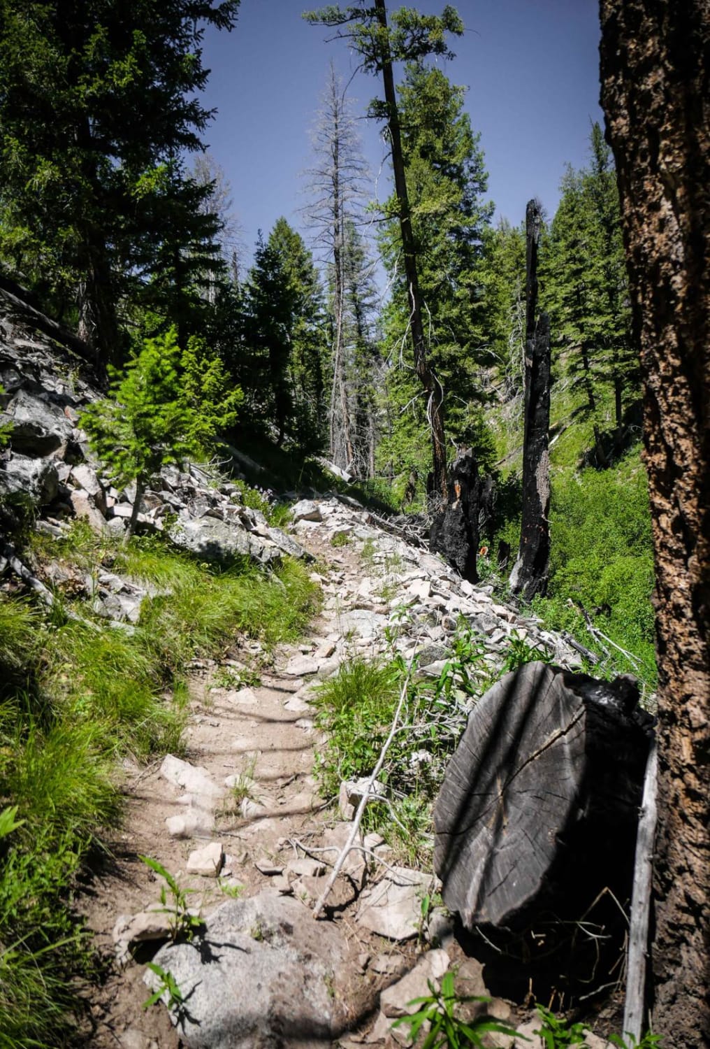
Deer Creek is a more challenging intermediate single track that is very rocky all throughout the trail. It starts elevated above a creek on a narrow trail covered in scree at the bottom of an exposed hillside. It goes through some really tall grass by the creek and it's hot and muggy and hard to see the trail. There are embedded boulders all throughout the trail, some loose rock, and several more scree sections. There's an intermediate rock ledge obstacles where you have to get over some of the bigger boulders. Most of the trail is pretty narrow with exposure above the creek. It has several stream crossings through the creek that are mostly easy, but some that are more difficult. One of the crossings has a difficult entrance that was a drop-off right next to a bunch of branches, and you have to take only one line otherwise it will suck you into a deep pool of water. Halfway through the trail, there is a huge pile of avalanche debris that is only partially cut. There's a pathway through it, but it's very technical because of many slick little branches on the ground and the packed snow drifting underneath the debris.
Photos of Deer Creek
Difficulty
This trail is challenging trail due to so many rocks including boulders and scree, and avalanche debris half way through the trail that is only partially cut.
Status Reports
Deer Creek can be accessed by the following ride types:
- Dirt Bike
Deer Creek Map
Popular Trails
Red Rock Pass Island Park
North Fork River Road
Pass Creek Lake Trail
Castle Rock - FS 7140
The onX Offroad Difference
onX Offroad combines trail photos, descriptions, difficulty ratings, width restrictions, seasonality, and more in a user-friendly interface. Available on all devices, with offline access and full compatibility with CarPlay and Android Auto. Discover what you’re missing today!