Barney Creek
Total Miles
3.0
Technical Rating
Best Time
Spring, Summer, Fall
Trail Type
Single Track
Accessible By
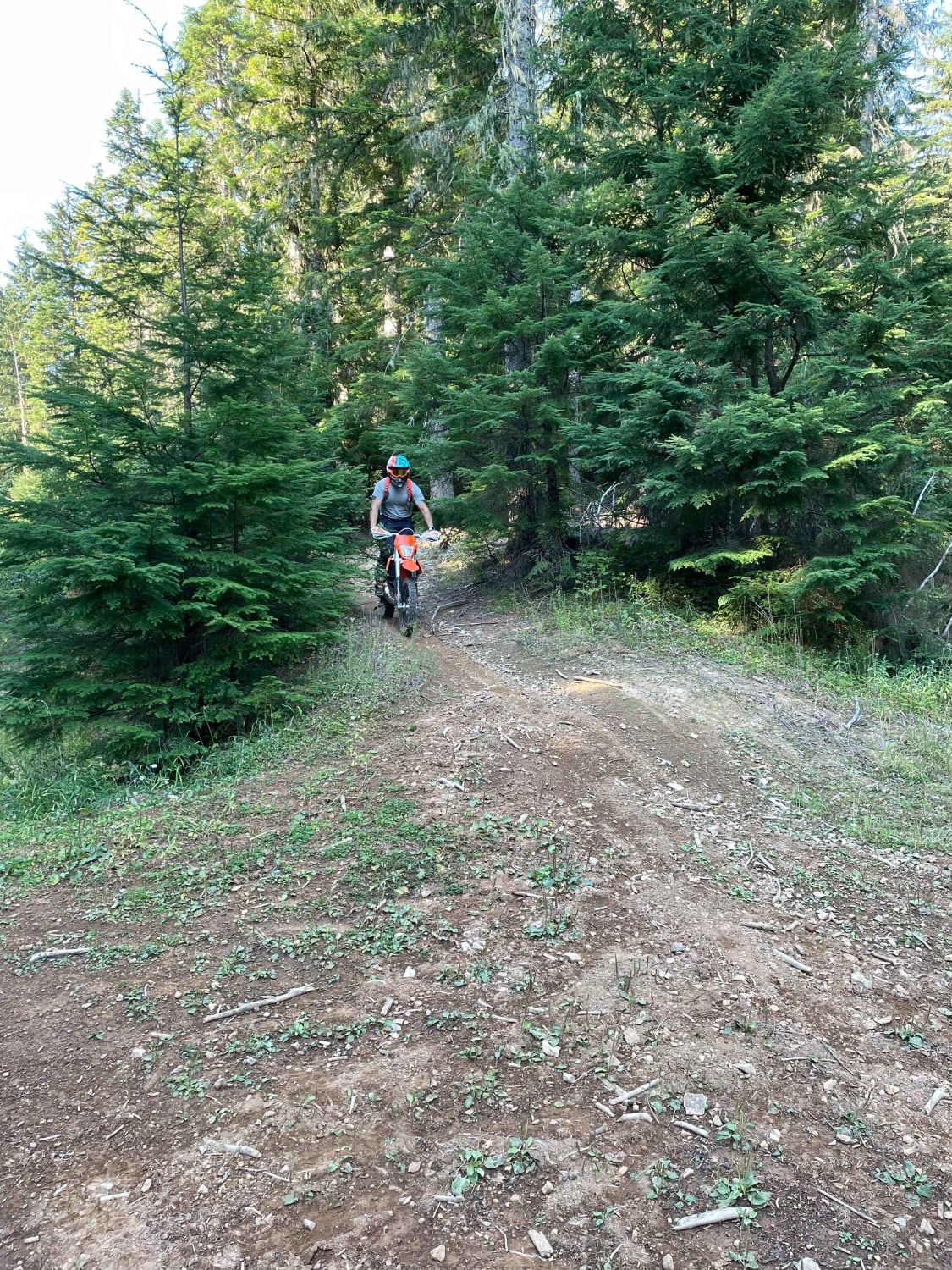
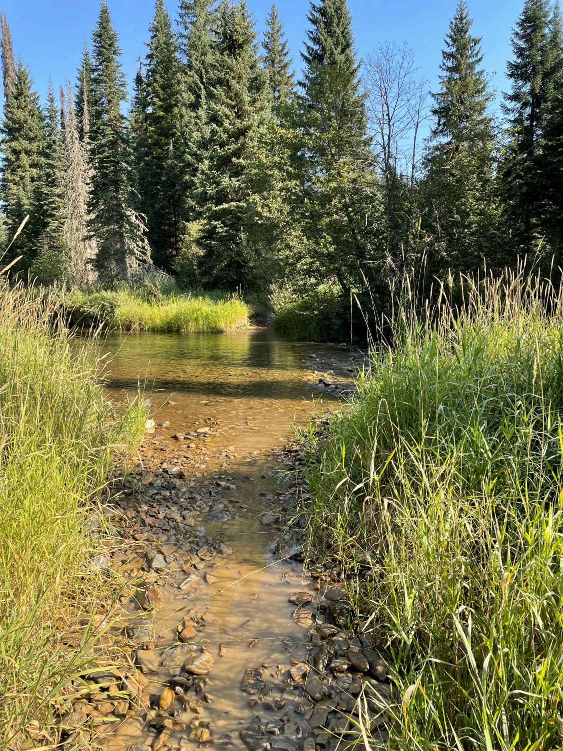
Trail Overview
Fun single track. Follows a creek bed and is in full shade so the trail is generally wet and cooler year-round. Watch for slick spots. From the Little North Fork River Road, the trail begins by crossing the Little North Fork of the Coeur d'Alene River. The river crossing is generally 12-18" deep. There are smaller creek crossings and wet areas throughout the trail but this is the only significant water crossing. The trail is very flowy. Occasional cattle may be seen in the area during the summer months. Heading from the river it ends on Forest Service road 1532. Follow this road to the west and you can end up at the old Horse Haven airstrip and then loop the roads back to your starting point, or turn around and ride back the way you came.
Photos of Barney Creek
Difficulty
One river crossing that can be slick. Slick roots and river bed areas.
Status Reports
Barney Creek can be accessed by the following ride types:
- Dirt Bike
Barney Creek Map
Popular Trails
North Rim - Jerome

Challis Creek Lakes
FR 09 - Mann Creek
The onX Offroad Difference
onX Offroad combines trail photos, descriptions, difficulty ratings, width restrictions, seasonality, and more in a user-friendly interface. Available on all devices, with offline access and full compatibility with CarPlay and Android Auto. Discover what you’re missing today!