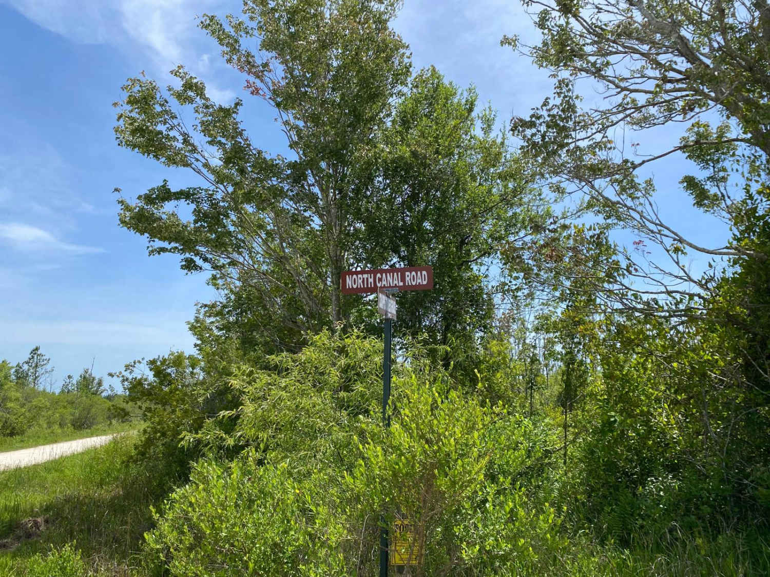
North Canal Road
Total Miles
4.0
Technical Rating
Best Time
Spring, Summer, Fall, Winter
Trail Type
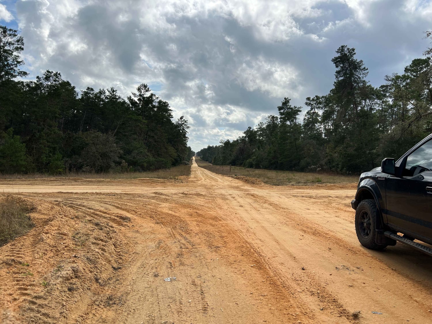
Full-Width Road
Accessible By
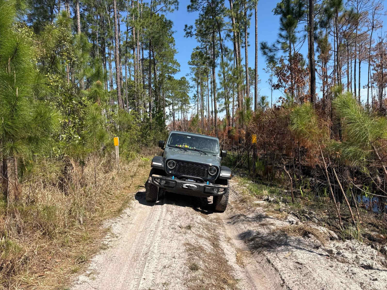
Trail Overview
This trail is one of many in the vast network of trails located within the Mallory Swamp Wildlife Management Area (WMA). Public access is open year-round from 1 1/2 hours before sunrise until 1 1/2 hours after sunset on all trails that are not signed as closed/restricted or private property. ATVs, SxS, or unlicensed or unregistered motorcycles are permitted following the close of Spring Turkey season until the beginning of the Fall black powder hunting season. The use of airboats and tracked vehicles is prohibited. Class 1 electric bicycles may be operated according to rules for traditional, non-motorized bicycles. All other electric bicycles may be operated only on named or numbered roads open to motorized vehicles. The trail is one of the many trails depicted on the area ATV Access and WMA maps that has signage in place. It is composed of loose dirt and rock. The trail varies in width. Areas that narrow have little to no shoulders before dropping off ledges (straight drops) into deep swamp water. The trail starts somewhat graded and minimally compacted, but conditions deteriorate quickly after starting down the trail. The trail quickly becomes riddled with potholes, wheel ruts, deep mud holes, and some holes holding 12 inches or more water even in periods of drought. Vehicles with High Clearance and 4WD are highly recommended. During the wet season or following rain events, expect the trail conditions to become sticky and soft, with many deep-water crossings. The trail comes to a dead end at the western limits of WMA. Backtracking is required. Pull-offs for passing, where available, are mainly limited to soft shoulder areas abutting drop-offs into the adjacent swamp. Otherwise, passing in narrow sections is a bit sketchy due to straight ledges leading into a deep swamp. Areas along the trail where other vehicles have attempted to use the shoulders are marked with very deep ruts where vehicles have sunk into the yielding material.
Photos of North Canal Road

Difficulty
Uneven, rutted dirt and mud trail that has the potential of deep water and mud greater than 18 inches. Shoulders are soft with the potential to stick vehicles trying to use them. The road is not maintained following storm or rain events. Ledges that drop vertically straight down (two feet or more) into the adjacent swamp.
Status Reports
North Canal Road can be accessed by the following ride types:
- High-Clearance 4x4
- SUV
- SxS (60")
- ATV (50")
- Dirt Bike
North Canal Road Map
Popular Trails

Crooked River Road
Sandy Pipeline Run

Franklin Trail - FS 165
East River Road - ONF 74
The onX Offroad Difference
onX Offroad combines trail photos, descriptions, difficulty ratings, width restrictions, seasonality, and more in a user-friendly interface. Available on all devices, with offline access and full compatibility with CarPlay and Android Auto. Discover what you’re missing today!