FR 250-B
Total Miles
2.4
Technical Rating
Best Time
Spring, Summer, Fall, Winter
Trail Type
Full-Width Road
Accessible By
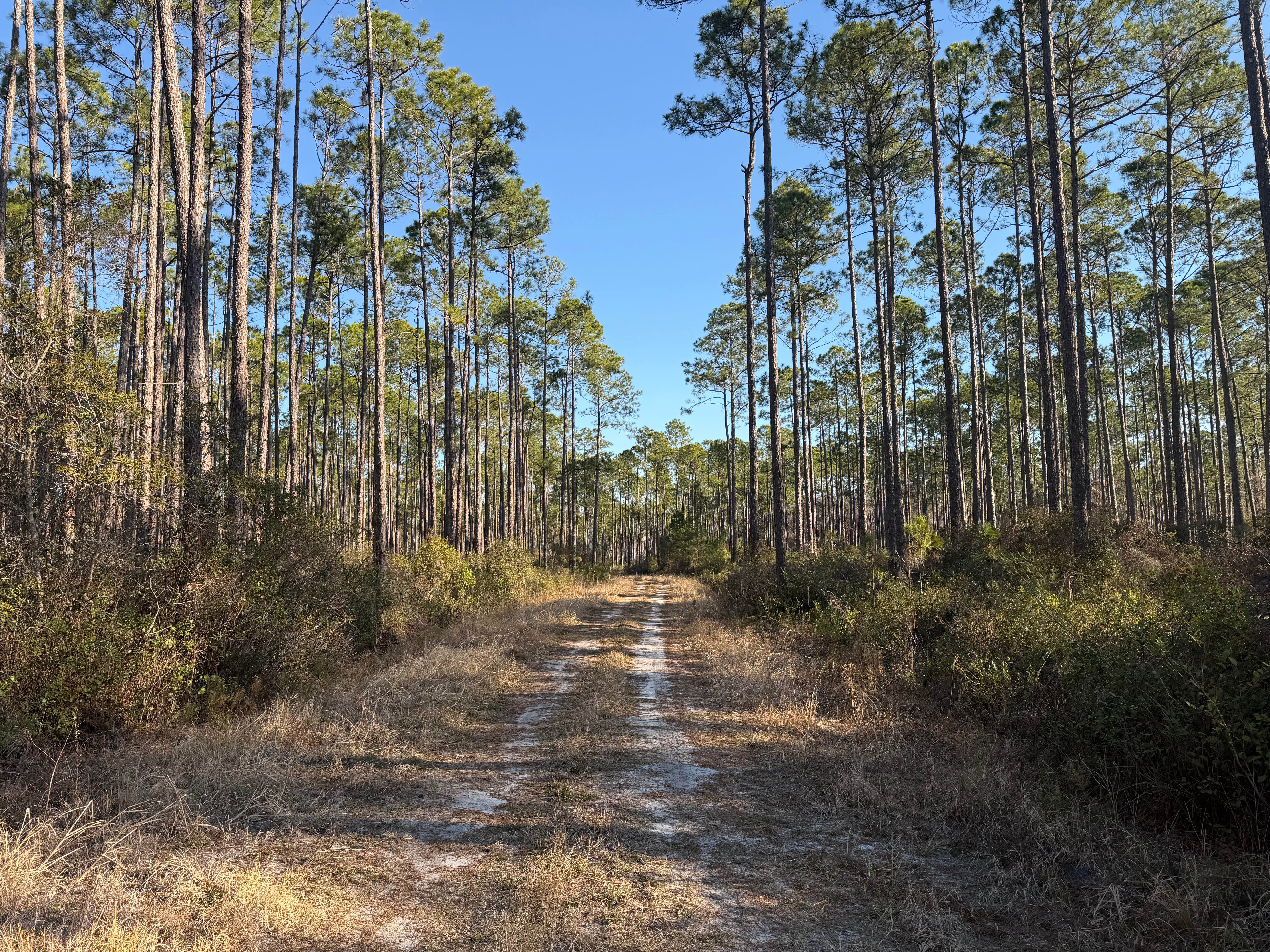
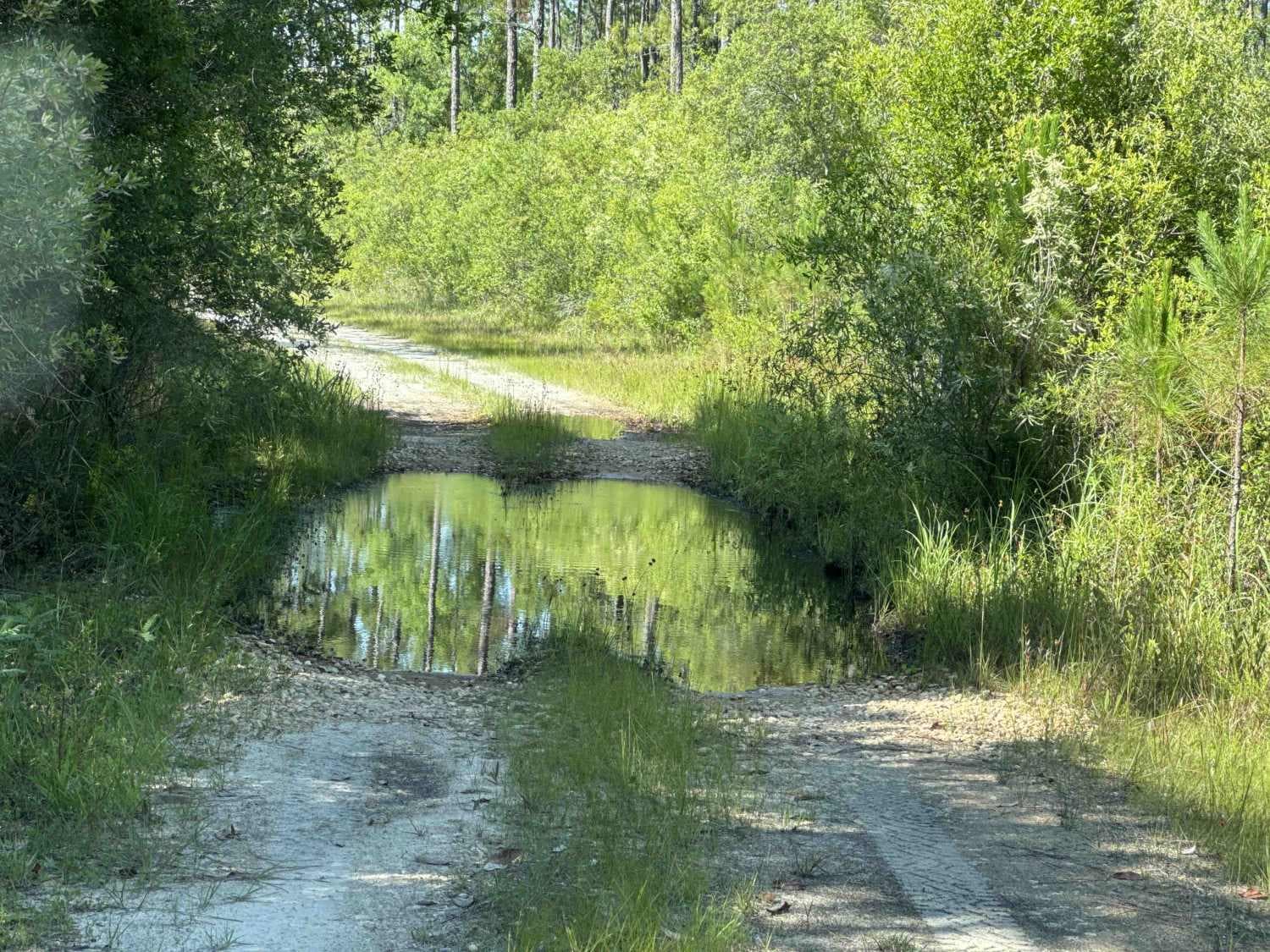
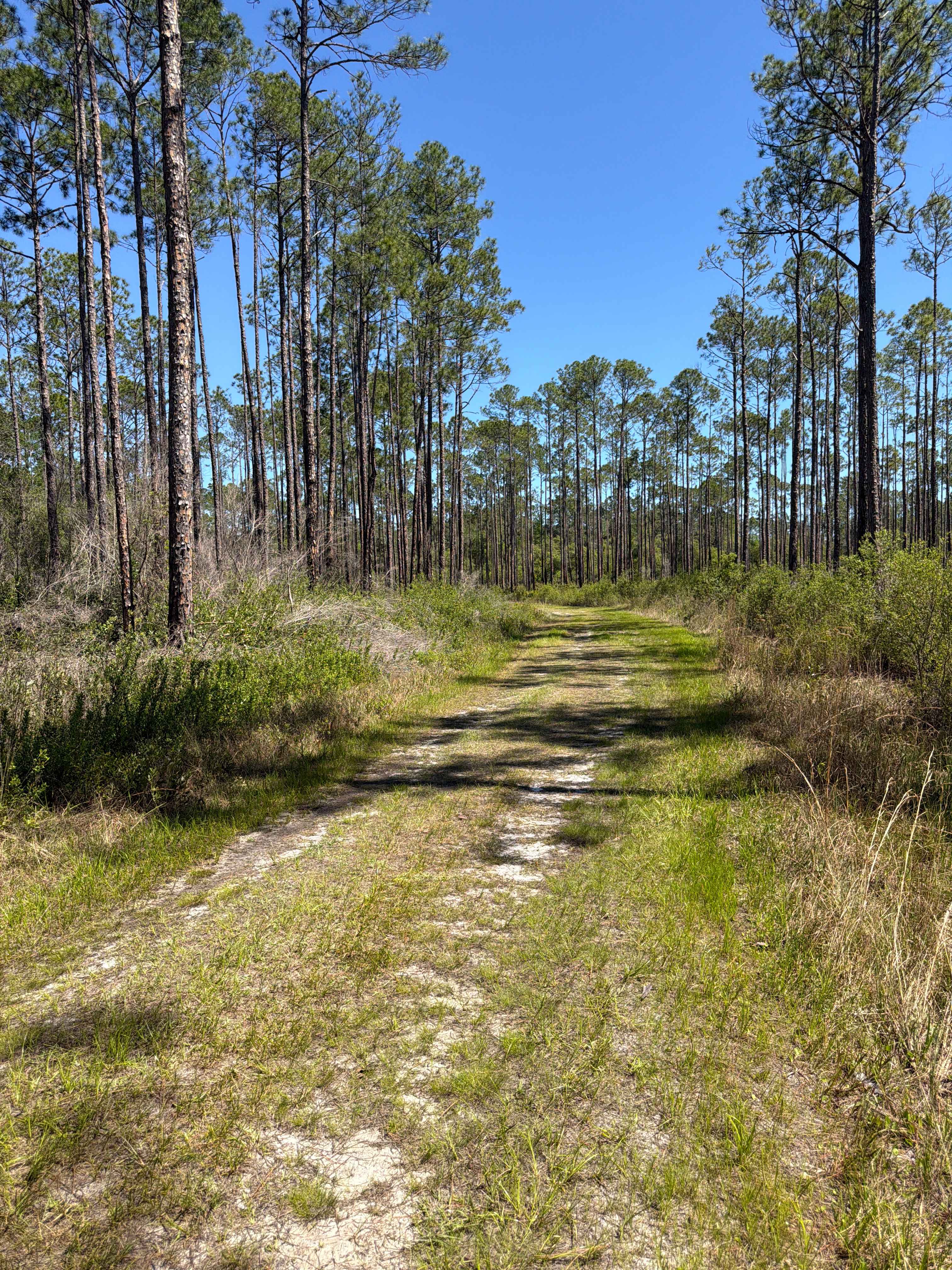
Trail Overview
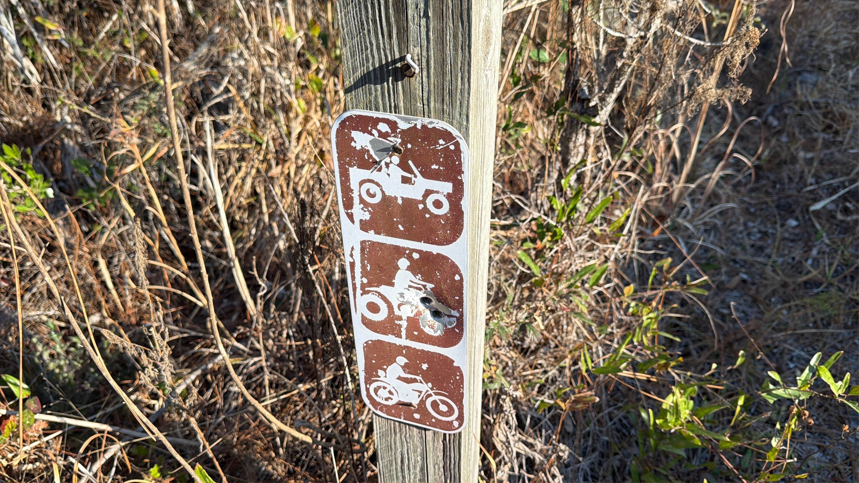
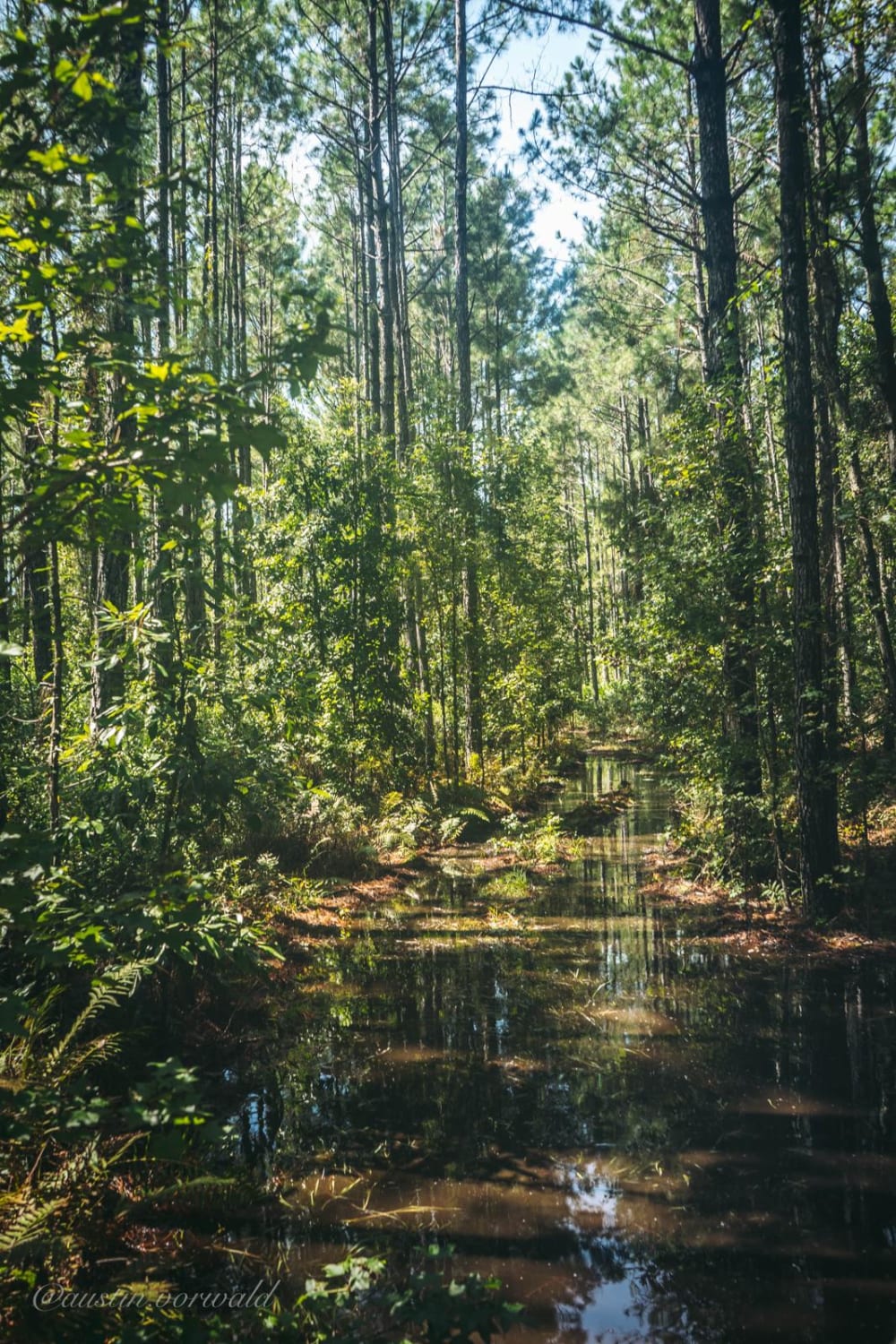
This trail runs through the Osceola National Forest (NF) and Wildlife Management Area (WMA). The trail is open to public access year-round unless otherwise posted. The trail is open to registered highway legal motor vehicles, all-terrain vehicles, recreational off-highway vehicles (side-by-sides), and unlicensed or unregistered motorcycles. Vehicle access is only permitted on named and numbered trails. County and State roads/right of ways may prohibit or limit access to only highway legal vehicles. Additionally, some of the NF and WMA main internal trails may have limited or restricted vehicle access based on vehicle type. The USDA Forest Service has published a free online "Motor Vehicle Use Map (MVUM), Osceola National Forest" that reflects and identifies these trails on the map key. This is an excellent secondary resource to have when exploring trails that have yet to be reviewed and rated by trail guides. There are no off-road vehicle (ORV) permits required, making Osceola NF the only NF in the state that does not require an ORV permit. Access to trails are year round, unless otherwise posted. The trailhead is located on County Road 250 (CR 250). There is no staging area on CR 250. This loop trail starts off at the western trailhead as an unimproved, single vehicle-wide dirt trail. At the onset, the trail has plenty of grass and dirt shoulder pull-off areas to allow passing. Starting off at the western trailhead, the trail does not appear to pose many challenges initially and appears to be safe for most low-clearance vehicles. These conditions change rapidly after crossing the first intersecting spur trail. The remainder of the trail is one that has tight trees, overgrown vegetation, deep wheel ruts, mudholes, whoops, segments of off-camber trail, and heavy cabin rolls. The Department of Forestry (DNF) cautions on their website and published maps that the designation of a road or trail should not be interpreted as the trail is passable, actively maintained, or safe for travel. Seasonal weather may rapidly change the trail conditions. Following rains or storms, water crossings 12 inches or more are possible. Also, following rains or storms, areas of washes or fallen debris up to 18 inches or more are likely. Trail conditions can deteriorate rapidly and may limit access to only high-clearance 4WD. Following storms or rain events, trails may become impassable. Maintenance of trails is limited due to limited available resources. Following storms or seasonal weather events, the trails may go unmaintained.
Photos of FR 250-B
Difficulty
Unimproved, uneven, rutted, dirt trail with potential for loose debris (e.g. rock, tree branches, washes, etc.). Seasonal water crossings 18 inches deep or more, areas of loose sand, potential for mudholes or obstacles up to 24 inches. The trail is mainly a single vehicle-wide trail with areas to pass. Following storms or seasonal weather events, the trails may go unmaintained.
Status Reports
FR 250-B can be accessed by the following ride types:
- High-Clearance 4x4
- SUV
- SxS (60")
- ATV (50")
- Dirt Bike
FR 250-B Map
Popular Trails
North South Spur Road - Four Creeks State Forest
Deep Creek Loop
Indian Creek - FS 176
The onX Offroad Difference
onX Offroad combines trail photos, descriptions, difficulty ratings, width restrictions, seasonality, and more in a user-friendly interface. Available on all devices, with offline access and full compatibility with CarPlay and Android Auto. Discover what you’re missing today!