East Mainline
Total Miles
10.1
Technical Rating
Best Time
Spring, Summer, Fall, Winter
Trail Type
Full-Width Road
Accessible By
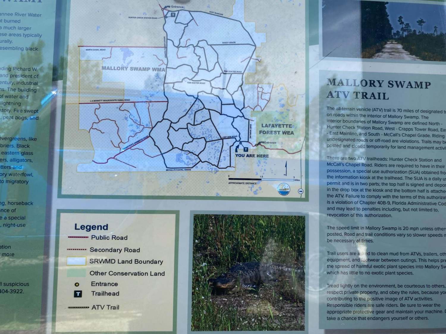
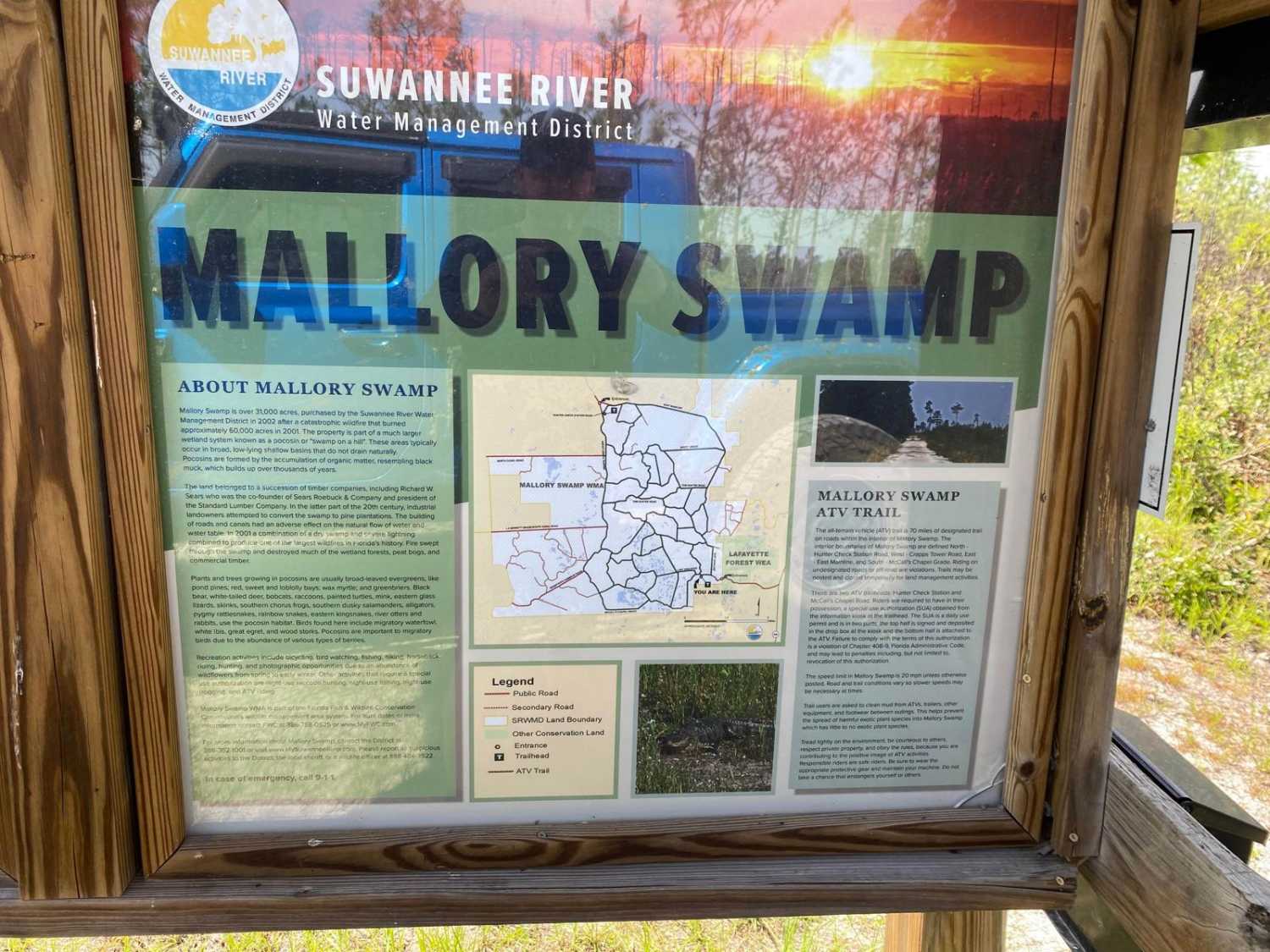
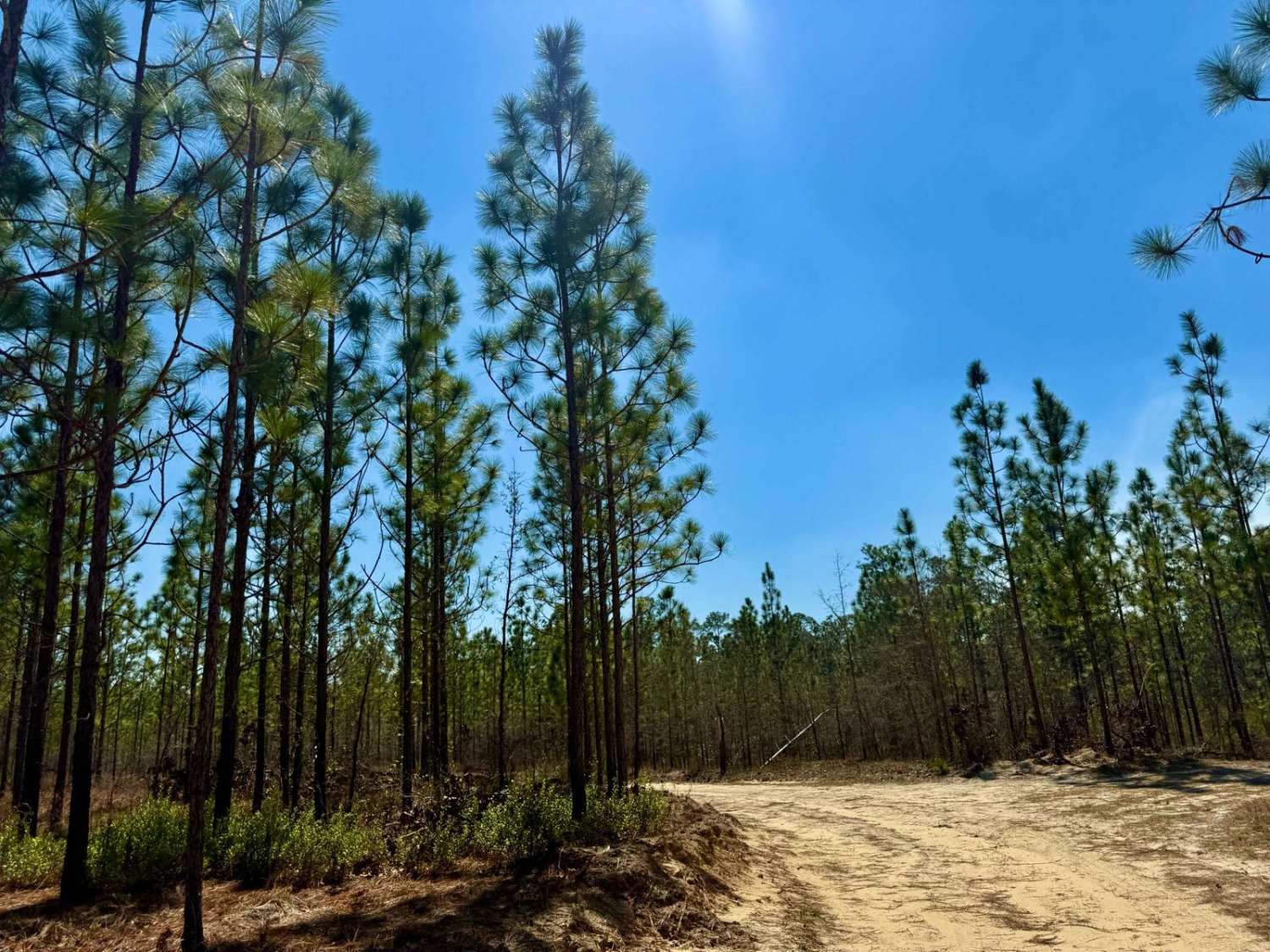
Trail Overview
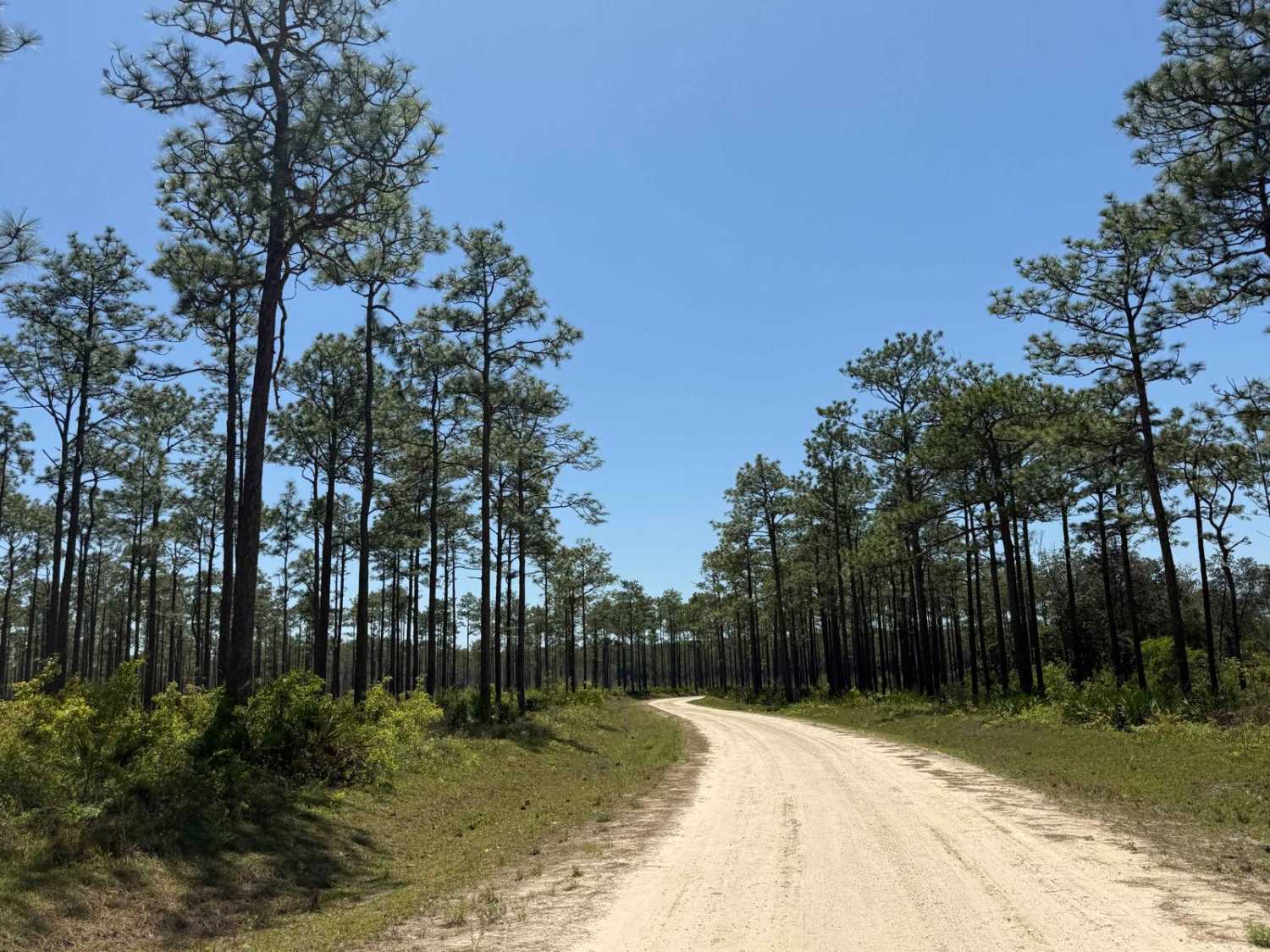
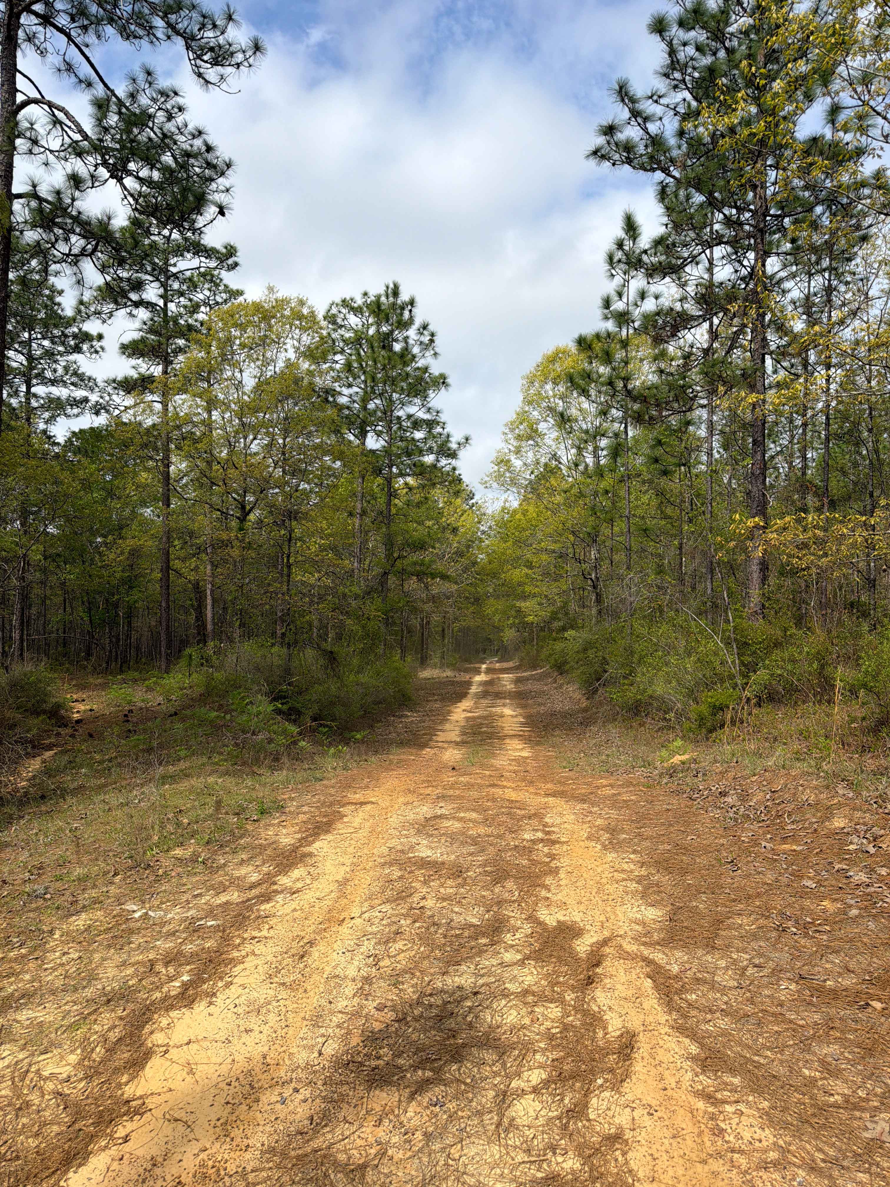
This trail is one of many in the vast network of trails located within the Mallory Swamp Wildlife Management Area (WMA). Public access is open year-round from 1 1/2 hours before sunrise until 1 1/2 hours after sunset on all trails that are not signed as closed/restricted or private property. ATVs, SxS, or unlicensed or unregistered motorcycles are permitted following the close of Spring Turkey season until the beginning of the Fall black powder hunting season. The use of airboats and tracked vehicles is prohibited. Class 1 electric bicycles may be operated according to rules for traditional, non-motorized bicycles. All other electric bicycles may be operated only on named or numbered roads open to motorized vehicles. The trail is one of the few that is signed, named, and depicted on the area's ATV Access and WMA maps. It is composed of compacted gravel and dirt, being mostly wide enough for two vehicles. There are plenty of potholes and some minor wheel ruts, but in general, the trail is passable without 4WD or high clearance. During the wet season or following rain events, expect some shallow standing water in the many potholes. There are some narrow portions; in those areas, pull-offs for passing are mainly limited to soft shoulder areas abutting drop-offs into the adjacent swamp. The shoulders are soft and muddy. There are plenty of deep ruts where vehicles have pulled off and sunk deep into the soil. The trail is very scenic. Wildlife is abundant along the trail, and on numerous occasions, deer or turkeys crossed the trail.
Photos of East Mainline
Difficulty
One of the main bordering roads to the area. The trail is a compacted gravel and dirt road with some potholes and minor ruts. The trail is safe for most 2WD and 4WD vehicles. The road is typically two vehicles wide.
Status Reports
East Mainline can be accessed by the following ride types:
- High-Clearance 4x4
- SUV
- SxS (60")
- ATV (50")
- Dirt Bike
East Mainline Map
Popular Trails
Wrights Landing - FS 101
Jeff Capp Road - C133

Road 19 - Three Lakes WMA
The onX Offroad Difference
onX Offroad combines trail photos, descriptions, difficulty ratings, width restrictions, seasonality, and more in a user-friendly interface. Available on all devices, with offline access and full compatibility with CarPlay and Android Auto. Discover what you’re missing today!