Sunset Rocks
Total Miles
2.9
Technical Rating
Best Time
Fall, Spring
Trail Type
Single Track
Accessible By
Trail Overview
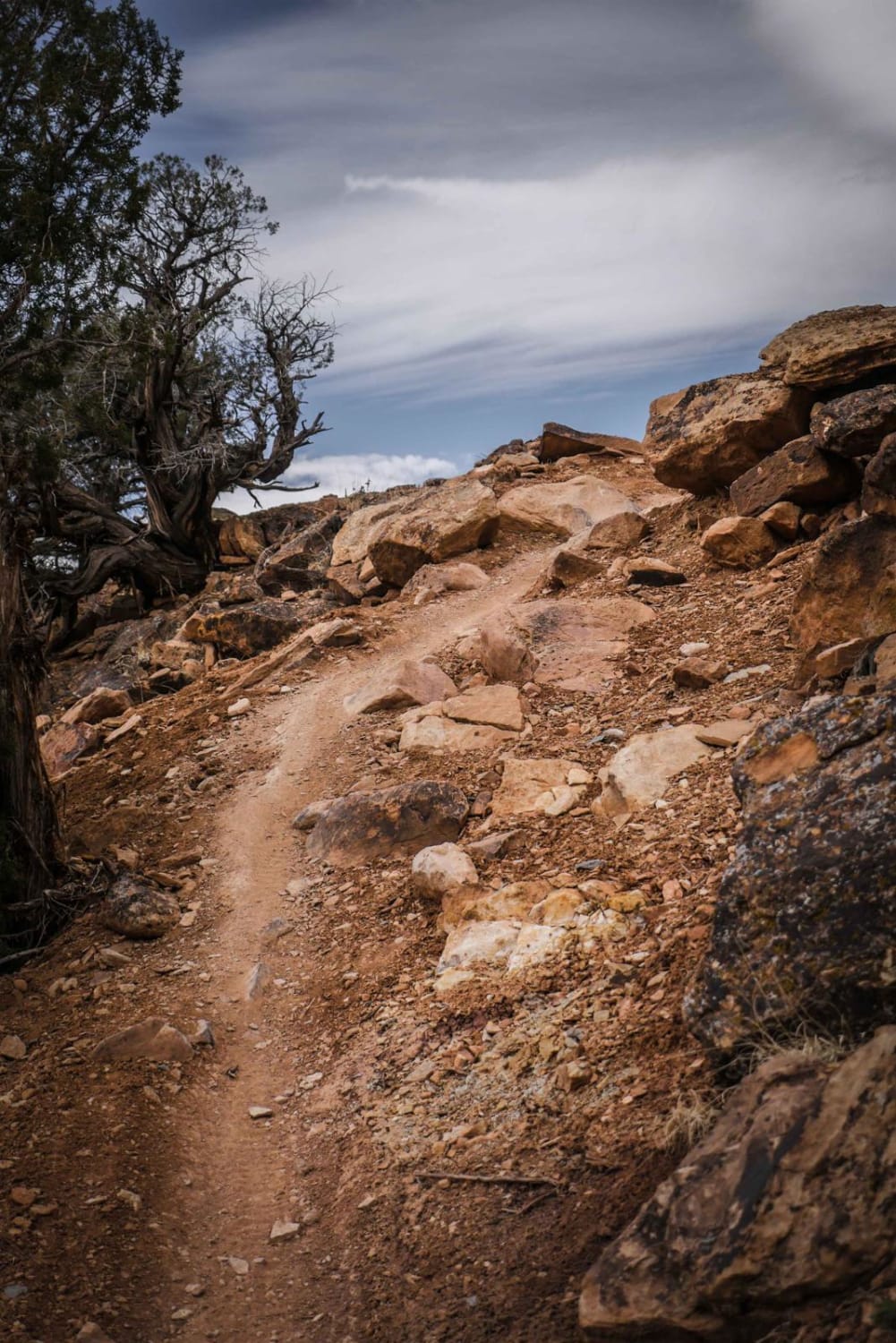
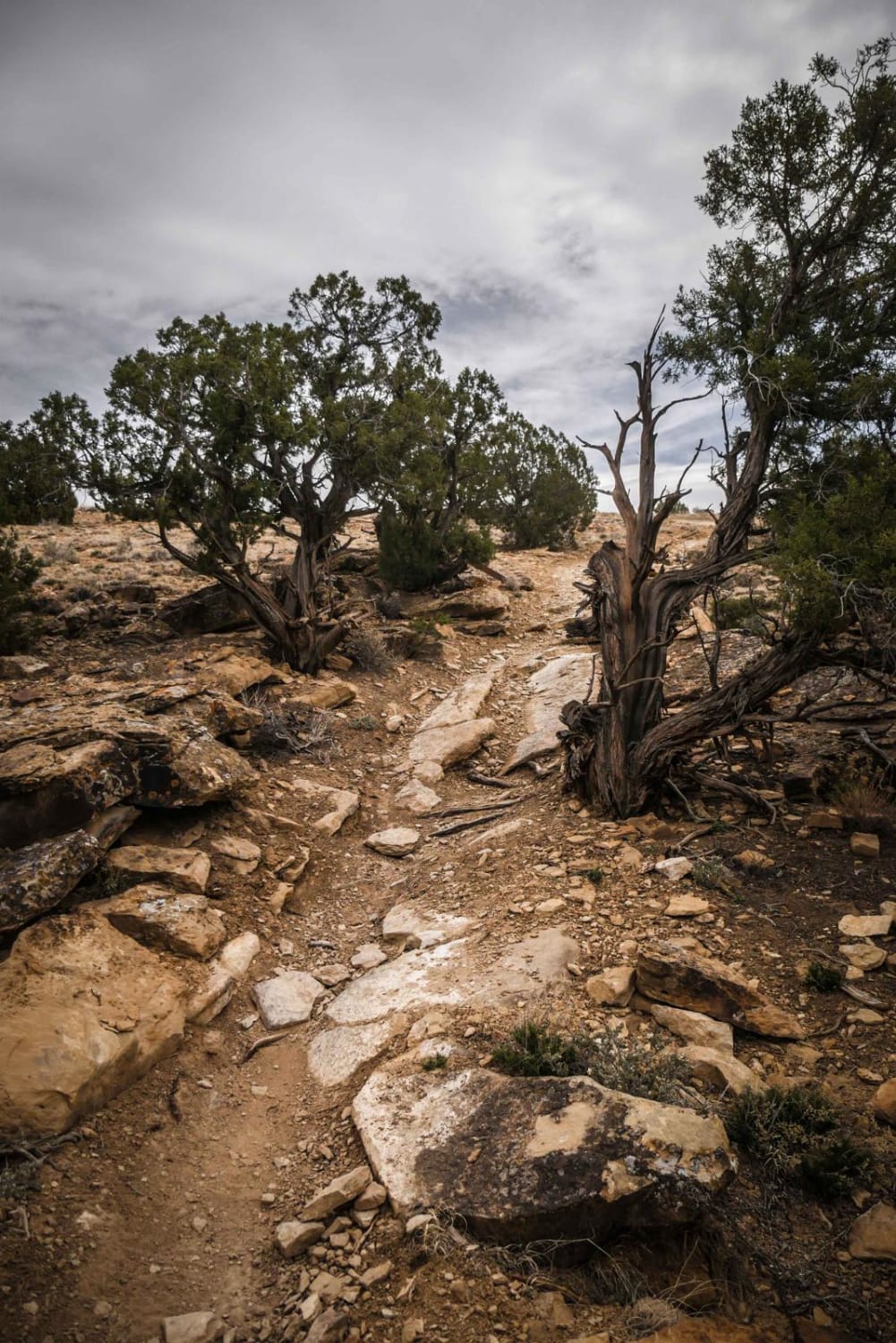
Sunset Rocks is a tight twisty single track through rocky desert terrain on the side of a mesa with pinyon pine and red rock. The trail starts at the intersection of Eagle Valley and Sidewinder and ends at an entrance to Moonlight Mesa in the adobe hills. It curves tightly through the pinyon trees, dips in and out of ravines, and climbs up hills with loose rock. There are a few moderate rock ledges to get over, and large rocks in the trail that are pinch points. For example, there are small rock ledges at the crest of a hill climb that are like small stair steps. These obstacles are pretty frequent throughout the trail, on both the up hills and down hills, so the trail would be a similar difficulty if riding in either direction. The trail goes through a very scenic landscape, as you go over red dirt sections and overlook the Peach Valley while riding on the mesa high above it. This is definitely a fun trail and can be made into a challenging loop from the staging area on Chukar Road by also riding Eagle Valley, Mystery Ditch, Black Ridge (most difficult), and Spikes back down to where you started.
Photos of Sunset Rocks
Difficulty
This trail is an intermediate difficulty because there are small rocks and ledges constantly throughout the trail, but there isn't an overly difficult obstacle that would be considered a crux.
Status Reports
Sunset Rocks can be accessed by the following ride types:
- Dirt Bike
Sunset Rocks Map
Popular Trails

Middle Mountain
Tincup Pass, St. Elmo
674 Flatrock ATV Trail

Sand Road - BLM 5980
The onX Offroad Difference
onX Offroad combines trail photos, descriptions, difficulty ratings, width restrictions, seasonality, and more in a user-friendly interface. Available on all devices, with offline access and full compatibility with CarPlay and Android Auto. Discover what you’re missing today!