25 and 27 1/4 Connector
Total Miles
2.1
Technical Rating
Best Time
Spring, Summer, Fall
Trail Type
Full-Width Road
Accessible By
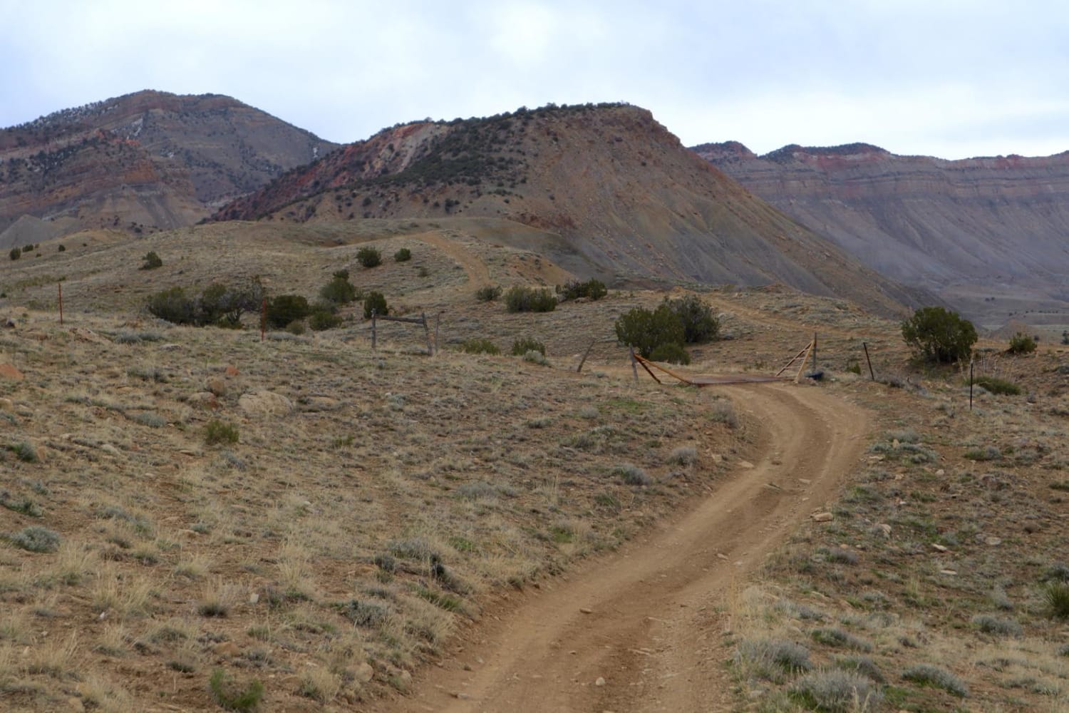
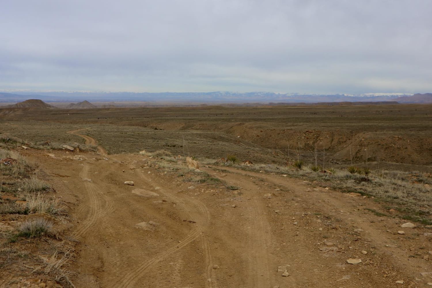
Trail Overview
This is a good option for connecting Mesa County Roads 25 and 27 1/4 as opposed to backtracking entirely to town. There are other routes in the vicinity to explore, though most either dead end or simply disappear in the cliffs. This is route is mostly easy, flat dirt road, with only a few instances of larger rocks, ruts and washes. There is one slightly knife edge moment where wheel placement should not be ignored. Monitoring weather prior to use recommended. Pack out what you pack in. Be mindful of free-ranging livestock.
Photos of 25 and 27 1/4 Connector
Difficulty
This is mostly a flat dirt road, with a few instances of large rocks and ruts. One knife edge area where wheel placement should be considered.
Status Reports
25 and 27 1/4 Connector can be accessed by the following ride types:
- High-Clearance 4x4
- SUV
- SxS (60")
- ATV (50")
- Dirt Bike
25 and 27 1/4 Connector Map
Popular Trails

Burnt Mountain Road - FR651

Yansing Gulch
Sheep Mountain
The onX Offroad Difference
onX Offroad combines trail photos, descriptions, difficulty ratings, width restrictions, seasonality, and more in a user-friendly interface. Available on all devices, with offline access and full compatibility with CarPlay and Android Auto. Discover what you’re missing today!