Stockade Flat Road
Total Miles
2.2
Technical Rating
Best Time
Summer, Fall, Spring
Trail Type
Full-Width Road
Accessible By
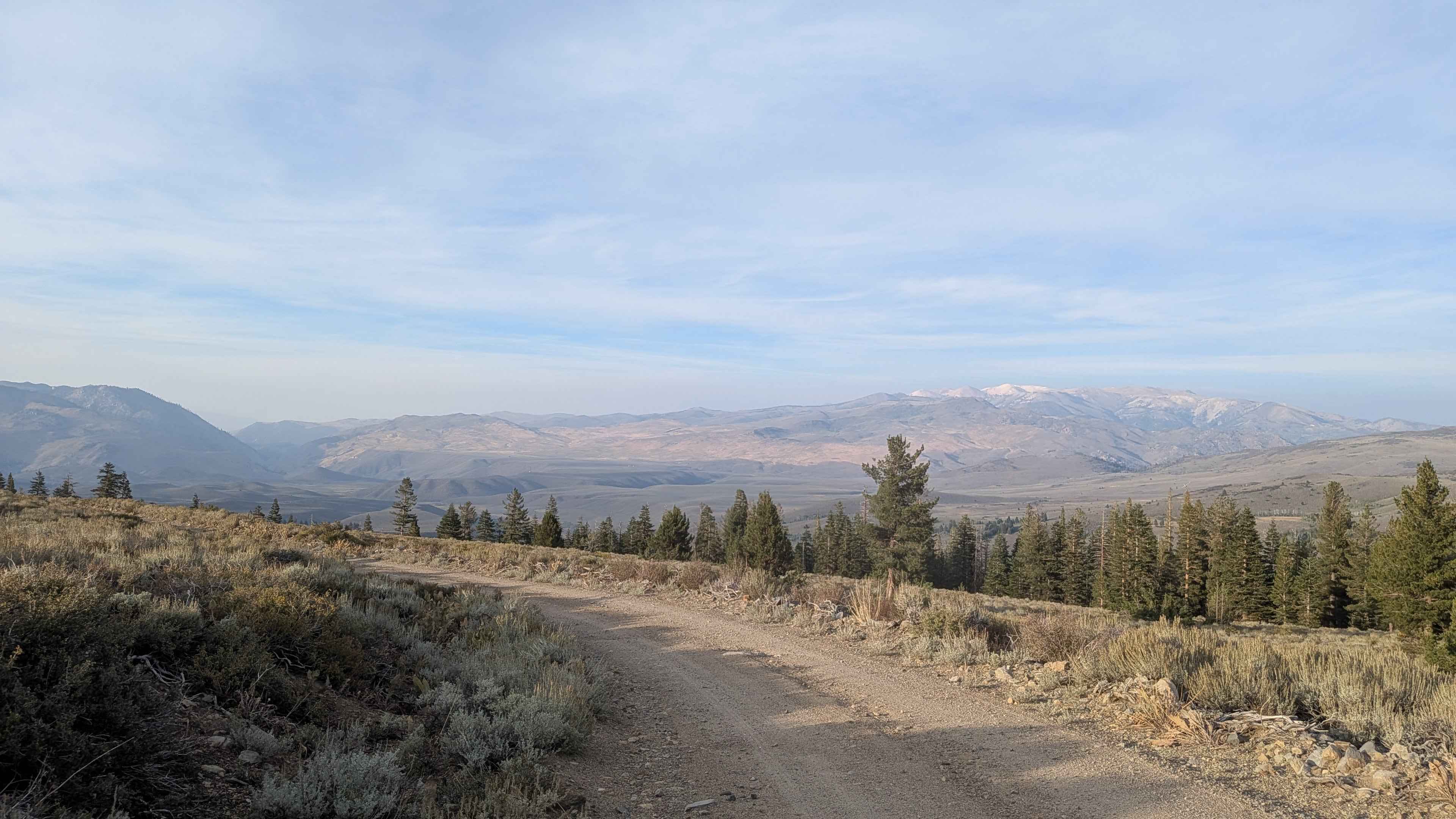
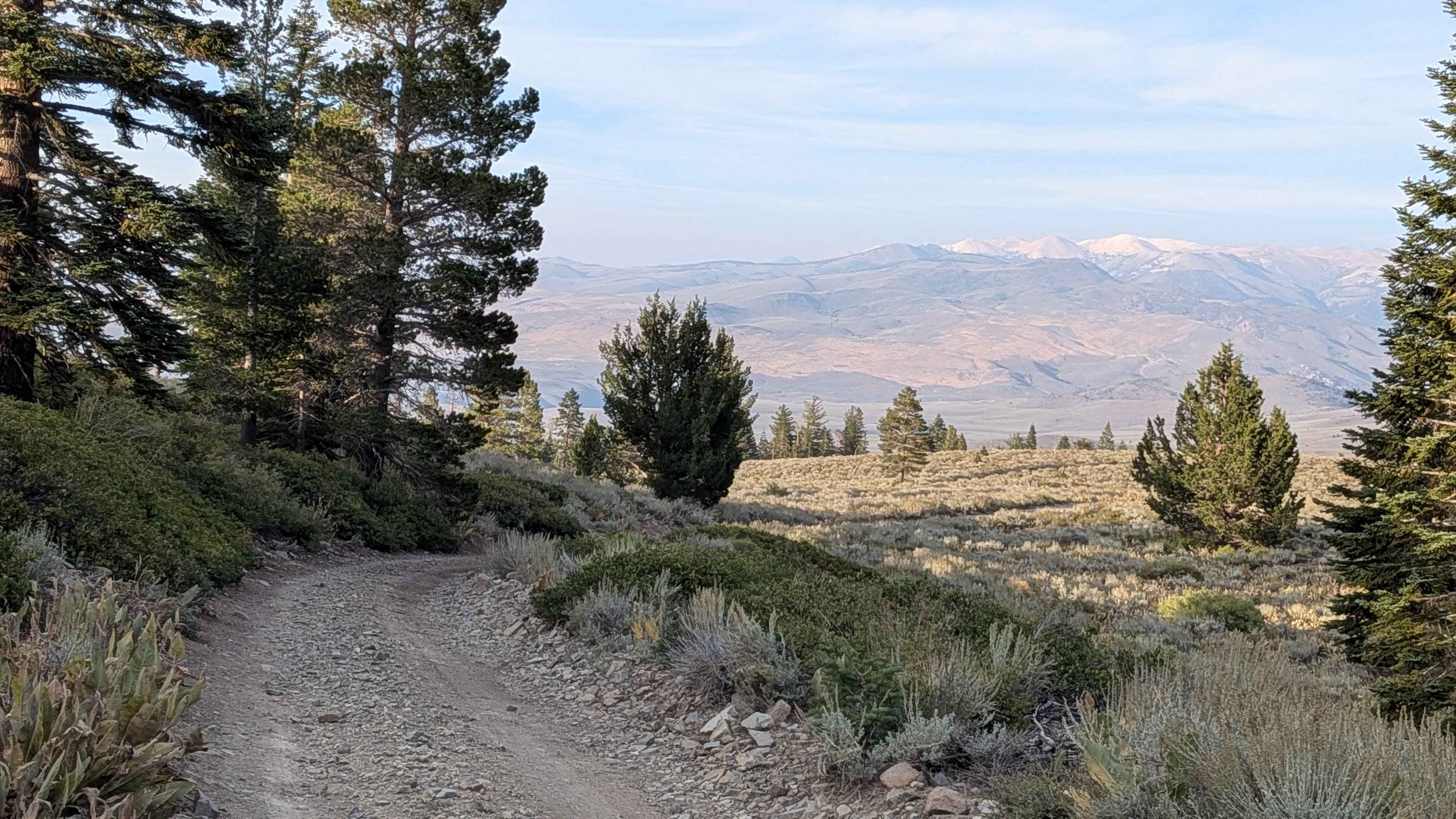
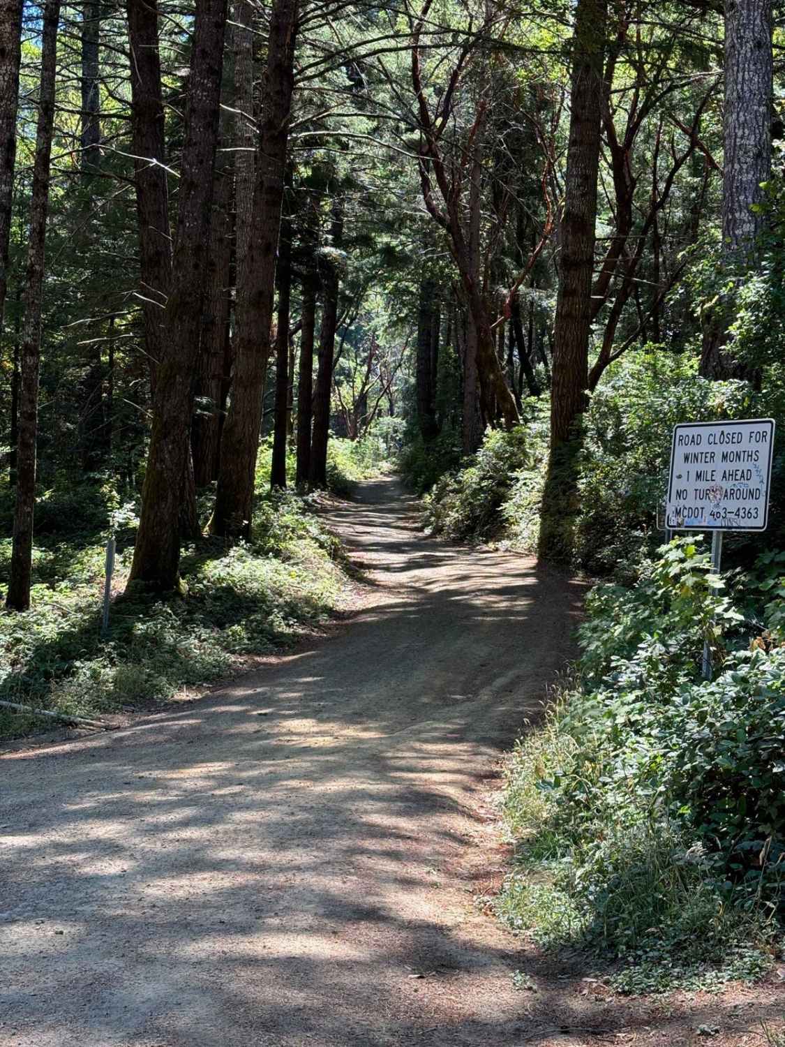
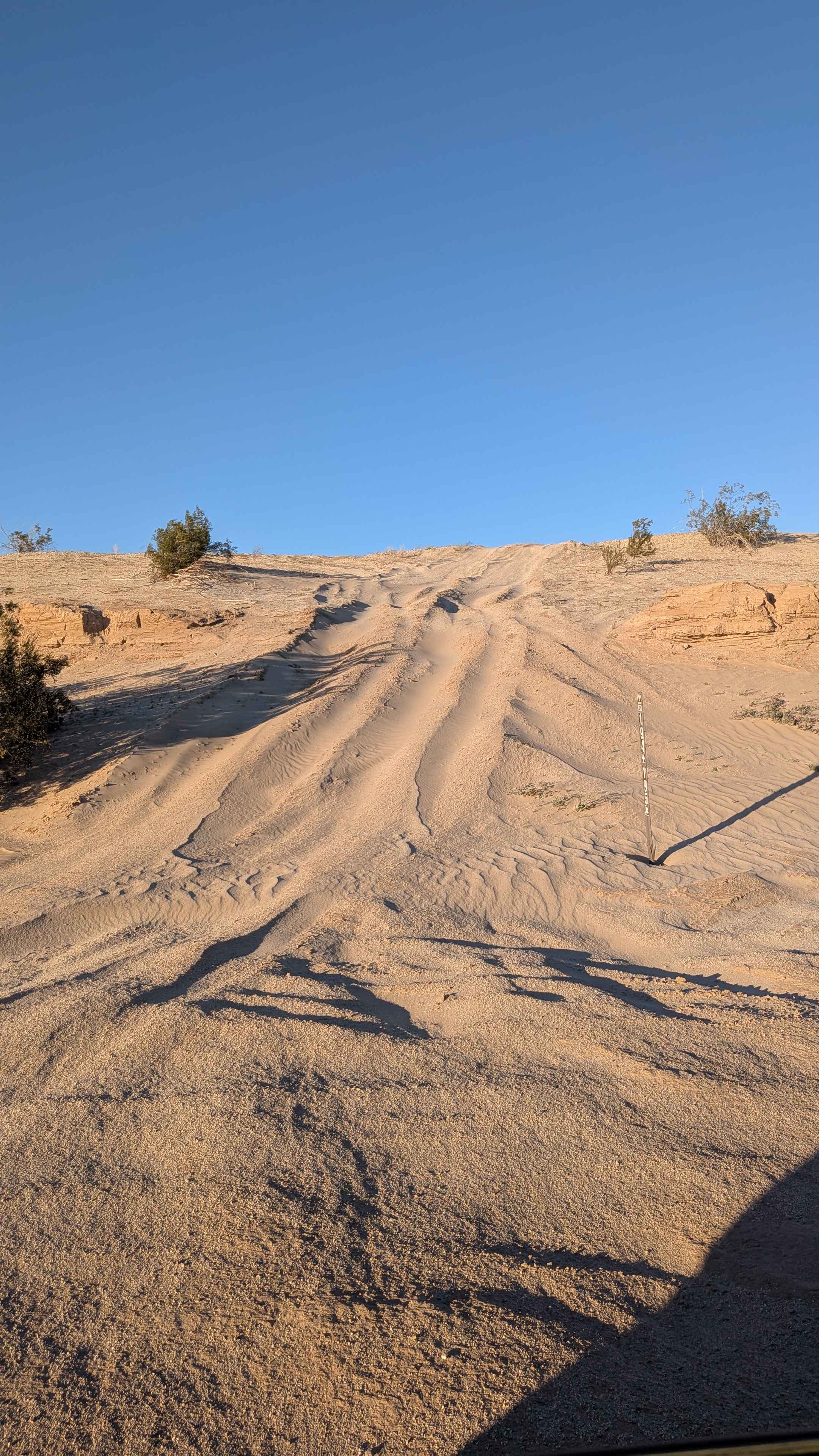
Trail Overview
The trail begins at Little Walker Road and climbs over 700 feet in just over 2 miles, providing a steady but manageable ascent through beautiful mountain terrain. The trail starts as a relatively wide route, accommodating 1 to 1.5 vehicles in width, with a sand and gravel surface that makes for comfortable driving. Lined with pine trees throughout its length, the trail offers a pleasant forest driving experience with natural shade and scenic beauty. The route remains relatively smooth for the first portion, making it accessible to a wide range of vehicles and skill levels. At approximately 1.2 miles, the trail features a spectacular shelf road section that provides stunning views of the surrounding mountain peaks, offering an excellent photo opportunity and rest stop. Around mile 1.5, the character of the trail changes as it becomes narrower, reducing to a single vehicle width with increased embedded rocks that create a rougher driving surface. This section requires more careful navigation and attention to vehicle placement. The trail culminates at approximately 8,500 feet elevation at the base of the Hoover Wilderness, where it terminates at a large parking area. Various spur trails branch off from the main route, providing opportunities for exploration and potential dispersed camping sites for those looking to extend their adventure.
Photos of Stockade Flat Road
Difficulty
This trail receives a difficulty rating of 1, indicating it is suitable for most vehicles and drivers, including beginners. The relatively smooth surface, manageable grades, and wide initial width make it accessible to stock vehicles with adequate ground clearance. While the trail does become narrower and rougher in the final section, the overall difficulty remains low and suitable for those new to off-road driving.
Status Reports
Stockade Flat Road can be accessed by the following ride types:
- High-Clearance 4x4
- SUV
- SxS (60")
- ATV (50")
- Dirt Bike
Stockade Flat Road Map
Popular Trails
North Fork Palm Wash
Claypit Cutoff - FS 3S07
Usal Road (Northern Portion)
The onX Offroad Difference
onX Offroad combines trail photos, descriptions, difficulty ratings, width restrictions, seasonality, and more in a user-friendly interface. Available on all devices, with offline access and full compatibility with CarPlay and Android Auto. Discover what you’re missing today!