Savahia Peak Mines
Total Miles
19.3
Technical Rating
Best Time
Spring, Fall, Winter
Trail Type
Full-Width Road
Accessible By
Trail Overview
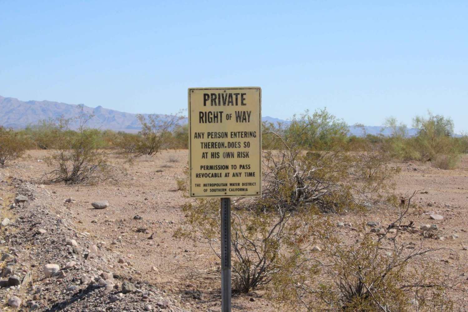
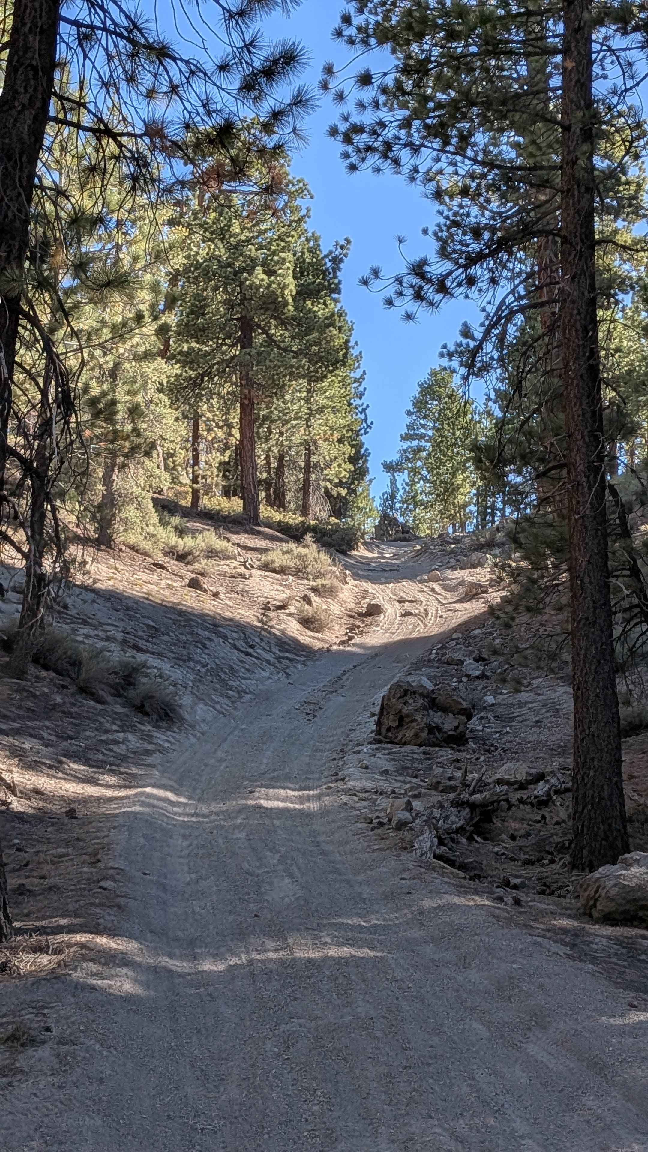
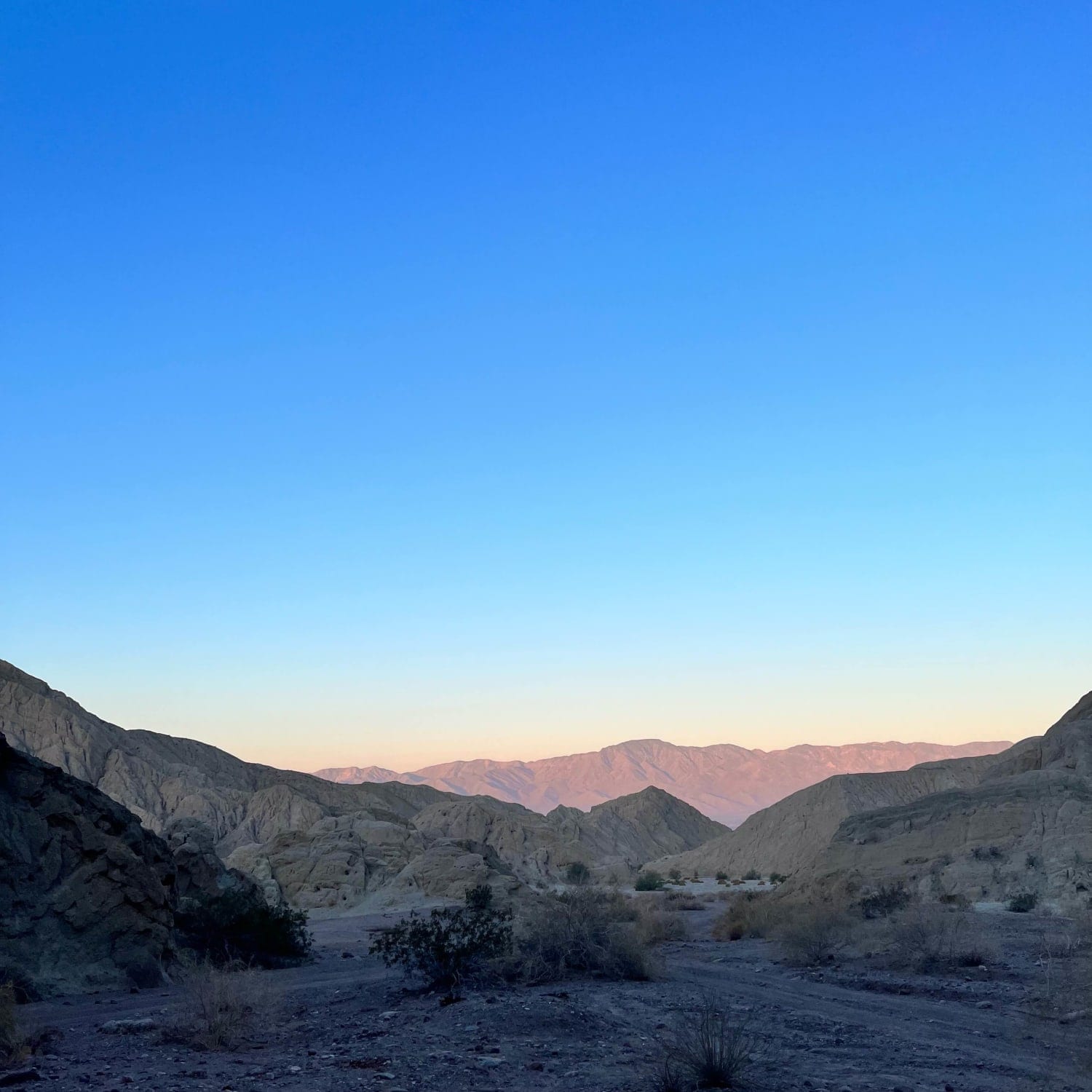
This trail cuts through an old mining area and passes down a narrow and challenging wash area near Savahia Peak. It primarily consists of two-track paths on dirt or packed sand surfaces with loose small to medium-sized rocks found often on and alongside the route. In the middle section of the trail, the wash canyon turns become tight and narrow, which will make it difficult for a full-sized vehicle to pass through without expecting body panel scratches or dents. There is also a short rocky stretch in the Wash Canyon that cannot be bypassed and will require high clearance to navigate successfully. The trail can be run in either direction, but there is a gas station and convenience store close by the west end in Vidal Junction. This initial section on the west end runs along the Colorado Aquaduct for about 1 mile. Be aware that the route alongside the Aquaduct is posted as a private right of way and access can be revoked. Please drive safely and responsibly through this area and do not cross over the fences protecting the waterway. Note that a large portion of this trail travels through a wash, so caution should be taken to watch weather conditions so as to prevent from being caught in a flash flood.
Photos of Savahia Peak Mines

Difficulty
The trail varies from packed dirt roads to sandy washes with loose rocks and boulders to short stretches of large rock gardens. There are also sections with foot-high whoops which can test a vehicle's suspension. The wash canyon will become narrow at points with vegetation and rocky walls restricting the passage of wide vehicles. Rainy weather will also make this trail much more challenging and slick.
Status Reports
Savahia Peak Mines can be accessed by the following ride types:
- High-Clearance 4x4
- SUV
- SxS (60")
- ATV (50")
- Dirt Bike
Savahia Peak Mines Map
Popular Trails
Glass Spur A FS 2S23A
Painted Canyon Road

North Fork Arroyo Salado
The onX Offroad Difference
onX Offroad combines trail photos, descriptions, difficulty ratings, width restrictions, seasonality, and more in a user-friendly interface. Available on all devices, with offline access and full compatibility with CarPlay and Android Auto. Discover what you’re missing today!