2 trails found in California
Which "pinyon mountain road" are you looking for?
We found 2 off-road trails in California matching your search. Pick the one you're looking for below.
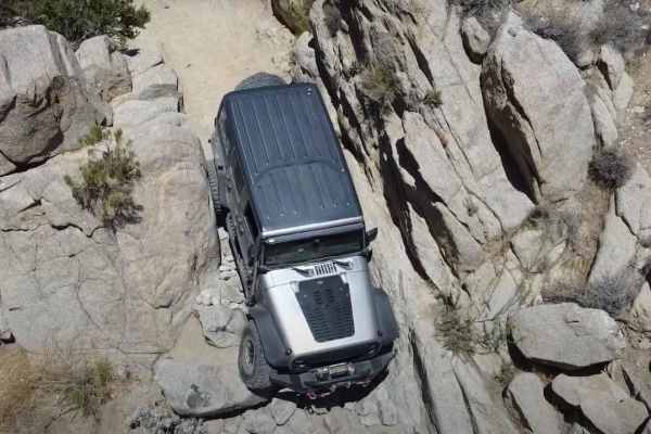
Pinyon Mountain Road
Pinyon Mountain Road is an 8.8-mile one-way point-to-point trail rated 5 of 10 within the California Anza-Borrego Desert State Park (ABDSP). Trails within the ABDSP are restricted to street-legal vehicles. With its three major off-roading challenges--The Squeeze, Pinyon Drop-off (aka Heart Attack Hi...
Learn more about Pinyon Mountain Road
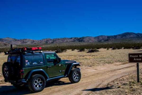
North Pinyon Mountain Road
This trail traverses a scenic desert landscape. It is an out-and-back trail with designated areas for dispersed camping. A spur trail offers a scenic and level campsite equipped with a fire ring. Ground fires are strictly prohibited in Anza-Borrego Desert State Park to safeguard the desert soil. Cam...
Learn more about North Pinyon Mountain Road