Cameron Canyon
Total Miles
1.5
Technical Rating
Best Time
Summer, Fall
Trail Type
Full-Width Road
Accessible By
Trail Overview
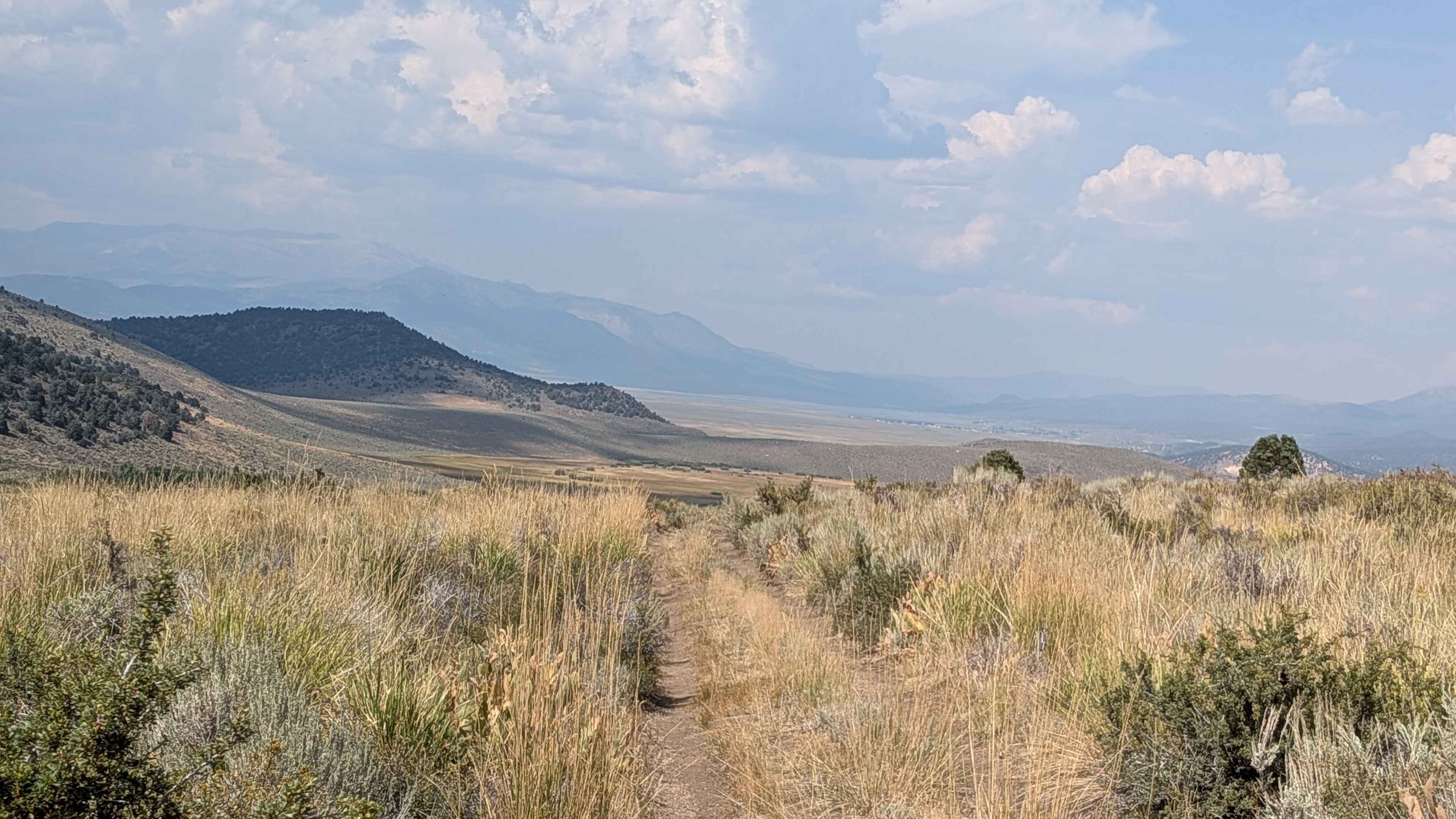
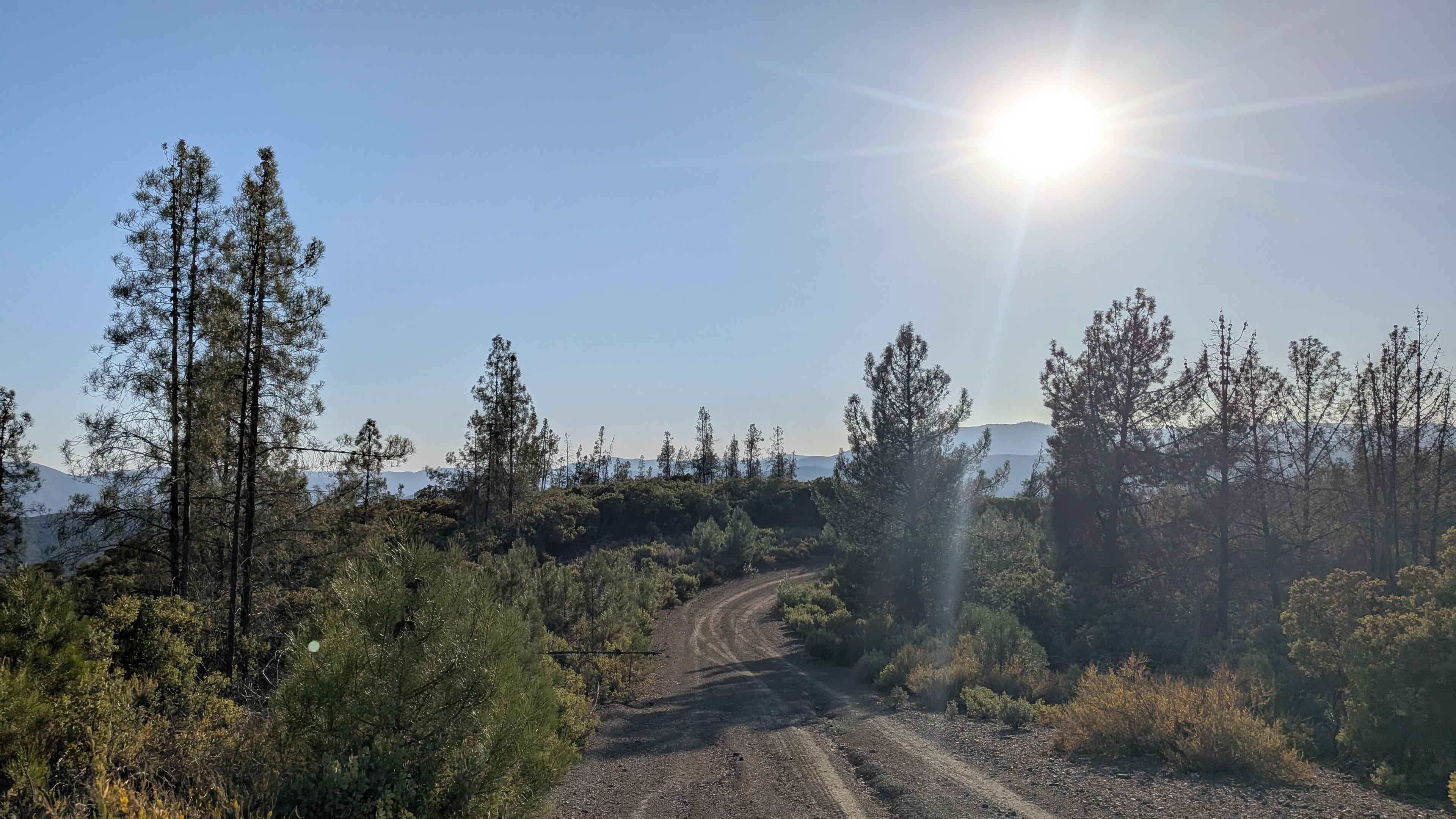
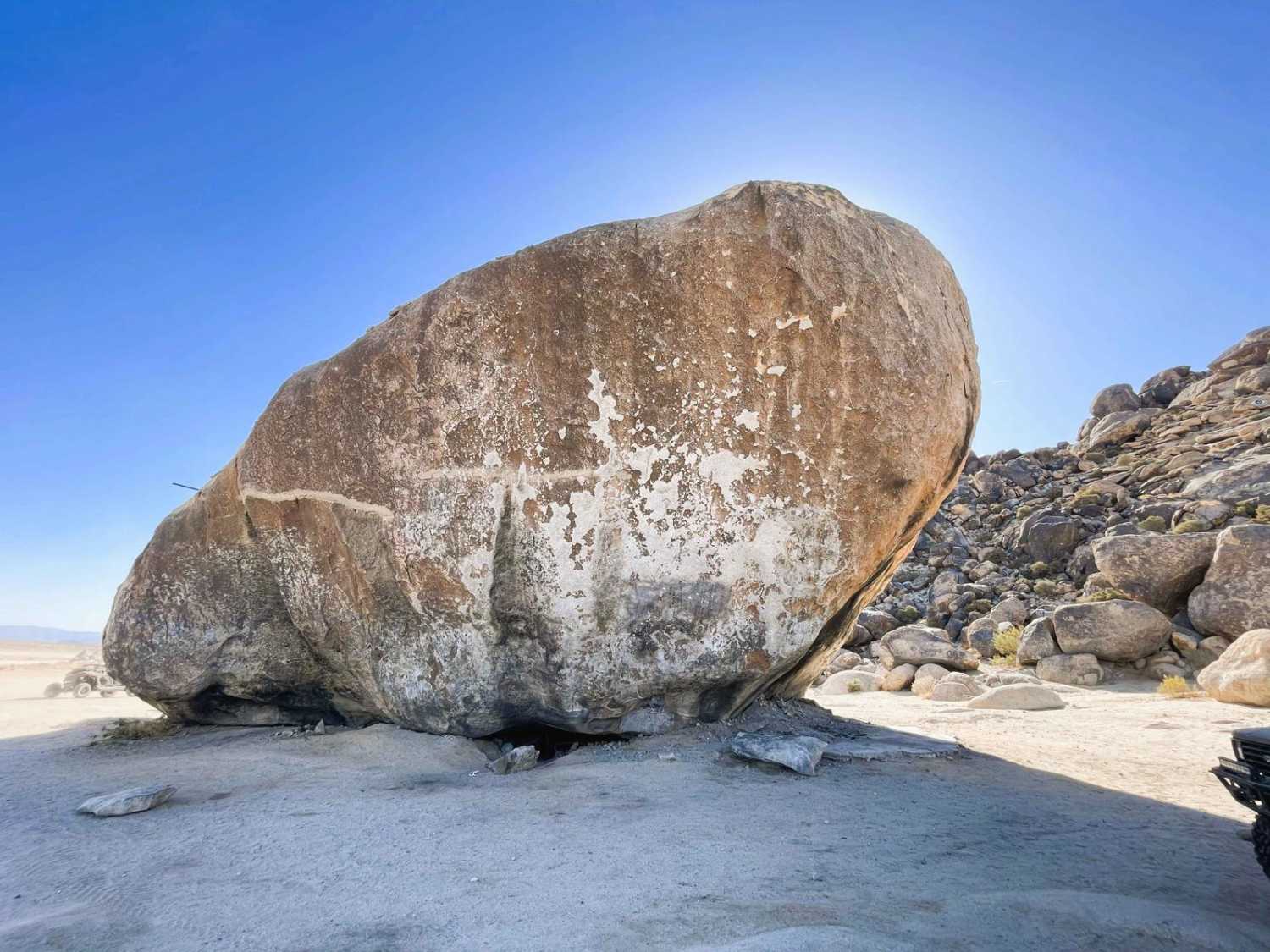
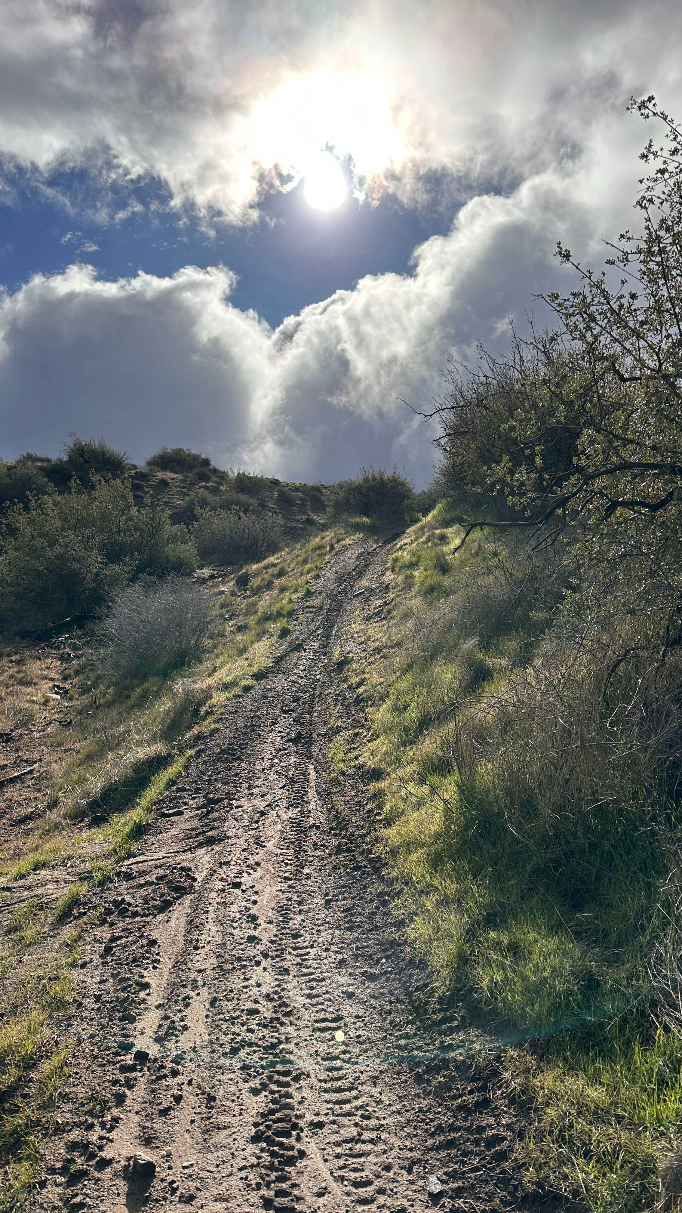
This route is a dirt and sand trail with lots of rocks embedded along the path. The trail climbs over 700 feet in just more than 1.5 miles and is just over one vehicle wide throughout most of the journey. It's lined with heavy brush and heavy grass, offering beautiful views of the surrounding hills, Eastern Sierras, and Hoover Wilderness. Around a mile in, it enters a sparse aspen forest where the trail becomes more narrow and you have to navigate over a couple of logs. There are a few low-hanging branches that tall vehicles could hit. Near the end, there's a small river crossing with a large boulder on one side that's under 18 inches. A couple of downed trees mark the end of the trail, and while the trail appears to continue, it's marked as a closed road on forest service maps. The drive down offers beautiful views of the Bridgeport Valley.
Photos of Cameron Canyon
Difficulty
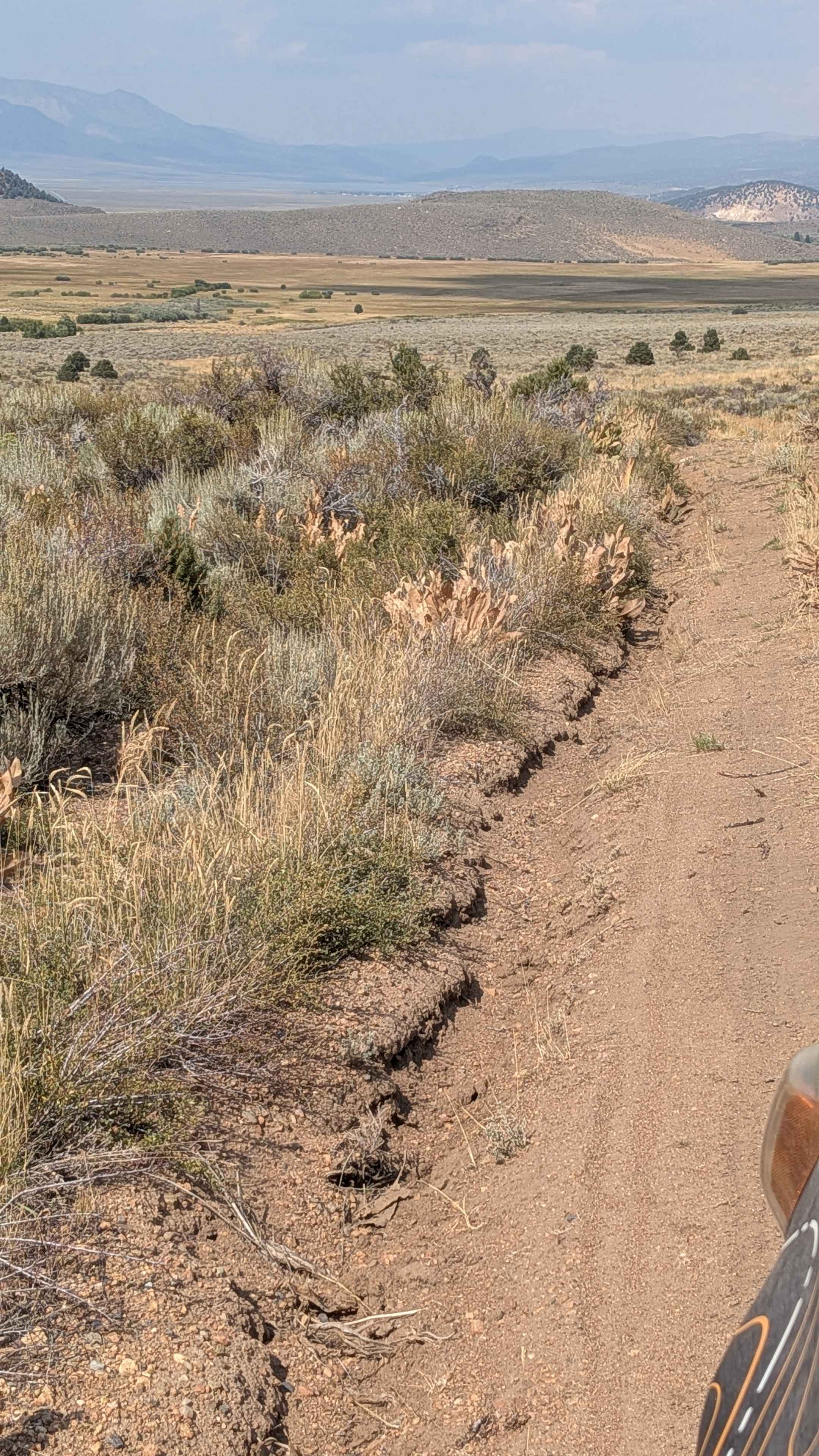
This trail earns a moderate-easy difficulty rating with several challenging features. Less than a tenth of a mile down, there's already a bypass created due to very deep ruts and holes from water runoff. The route features various off-camber sections and deep rutted sections to maneuver around, with some of these long rut sections over 2 feet deep, requiring wise wheel placement choices. The small river crossing near the end adds an additional challenge to navigate carefully.
History
Cameron Canyon near Twin Lakes and Bridgeport is primarily known for its role in the 19th-century mining era, particularly as a route used by emigrants and prospectors seeking gold in the Bodie and Dunderberg Peak areas. While the canyon itself doesn't have a standalone recorded history, it served as a geographical feature along the paths of early explorers and miners who traversed the Eastern Sierra, including the region near the historic Dogtown and Monoville mining settlements.
Status Reports
Cameron Canyon can be accessed by the following ride types:
- High-Clearance 4x4
- SUV
- SxS (60")
- ATV (50")
- Dirt Bike
Cameron Canyon Map
Popular Trails
Ponderosa Way North - FS 3S02
Dynamite Canyon Whipple Mountains
Ruts & Roots
The onX Offroad Difference
onX Offroad combines trail photos, descriptions, difficulty ratings, width restrictions, seasonality, and more in a user-friendly interface. Available on all devices, with offline access and full compatibility with CarPlay and Android Auto. Discover what you’re missing today!