Salt River Canyon
Total Miles
40.4
Technical Rating
Best Time
Summer, Fall
Trail Type
Full-Width Road
Accessible By
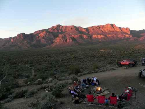
Trail Overview
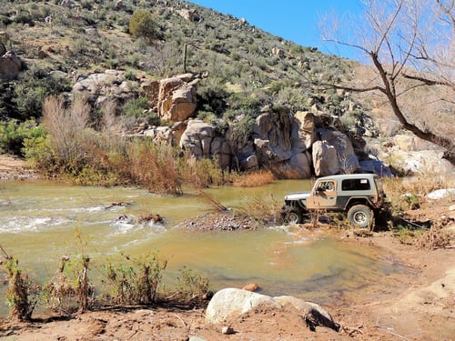
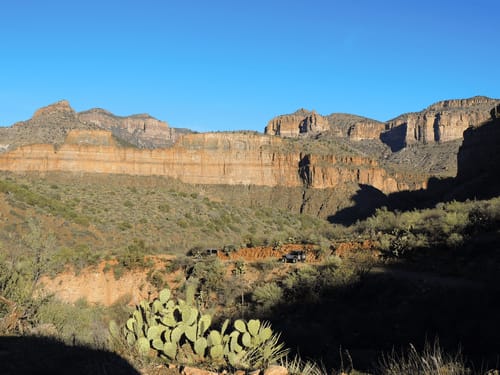
A very scenic and (usually) easy trip from US 60 north of Globe down Salt River Canyon and through a very beautiful remote country to Cherry Creek and Young Road. Most of this trail is on the Fort Apache Indian Reservation, home to the White Mountain Apache Tribe. A permit is required for all recreational activities such as taking this trip. The permit could be purchased online when we did the trip in 2017, but that does not seem to be available as of Dec 2018. We do not know how to obtain a permit, or even if it is still available to the public. The Salt River begins in eastern Arizona where the Black and White rivers meet. The entire watershed, which comes out of the White Mountains, is 13,000 square miles, fed by snowmelt, rain, and mountain streams. The river itself is about 200 miles long. Just below the Black-White confluence are salt banks, which raise the salinity of the water, said Ileen Snoddy, coordinator of heritage for Salt River Project. This trail can be driven in either direction but we ran it east to west. Perhaps a bit more scenic in this direction because the Sierra Ancha Mountains are frequently visible in the distance. The road follows close to the river for a few miles then climbs into the higher country north of the river. There is a side spur to an overlook 2 - 3 miles west of Rock Canyon waterfall. It is worth the short diversion. There are several water crossings on this trip. Most are no problem in normal weather with little rain. Canyon Creek is the largest drainage and can be impassible after heavy rain. We have only done this trip one time so do not know what it is like in normal weather, but we certainly know what it is like a week after a major and widespread rainfall. We looked the creek over pretty hard, thought about it during lunch then decided we could cross it if we paid attention and did it right. The idea was to have the first Jeep attached to a winch line so he could be winched backward if he got in trouble.The trail reached high ground and split into an east and a west leg near Medicine Ranch. Road signs and markers seem to indicate that the west leg is the main route, but we believe the east leg is more scenic. The east leg stays on ridges with nice views, while the west leg spends a lot of time in valleys with much less to see. Medicine Creek flows across both legs and also erodes both legs. We found the east leg crossing somewhat easier, but that might be because of the recent rain. The trail reaches the Salt River at Gleason Flat. The only thing of interest seems to be some abandoned equipment.The only areas with any difficulty are the water crossings.
Photos of Salt River Canyon
Difficulty
The only areas with any difficulty are the water crossings.
Status Reports
Salt River Canyon can be accessed by the following ride types:
- High-Clearance 4x4
- SUV
- SxS (60")
- ATV (50")
- Dirt Bike
Salt River Canyon Map
Popular Trails
Superstition Backroads

Historic Pinal Cemetery Trail
The onX Offroad Difference
onX Offroad combines trail photos, descriptions, difficulty ratings, width restrictions, seasonality, and more in a user-friendly interface. Available on all devices, with offline access and full compatibility with CarPlay and Android Auto. Discover what you’re missing today!