County Hwy 103-Twin Point
Total Miles
51.8
Technical Rating
Best Time
Spring, Summer, Fall
Trail Type
High-Clearance 4x4 Trail
Accessible By
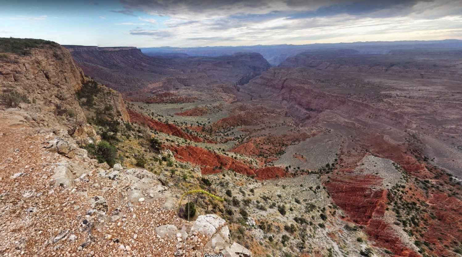
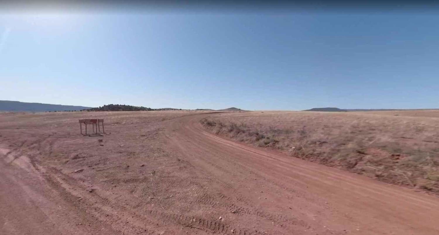
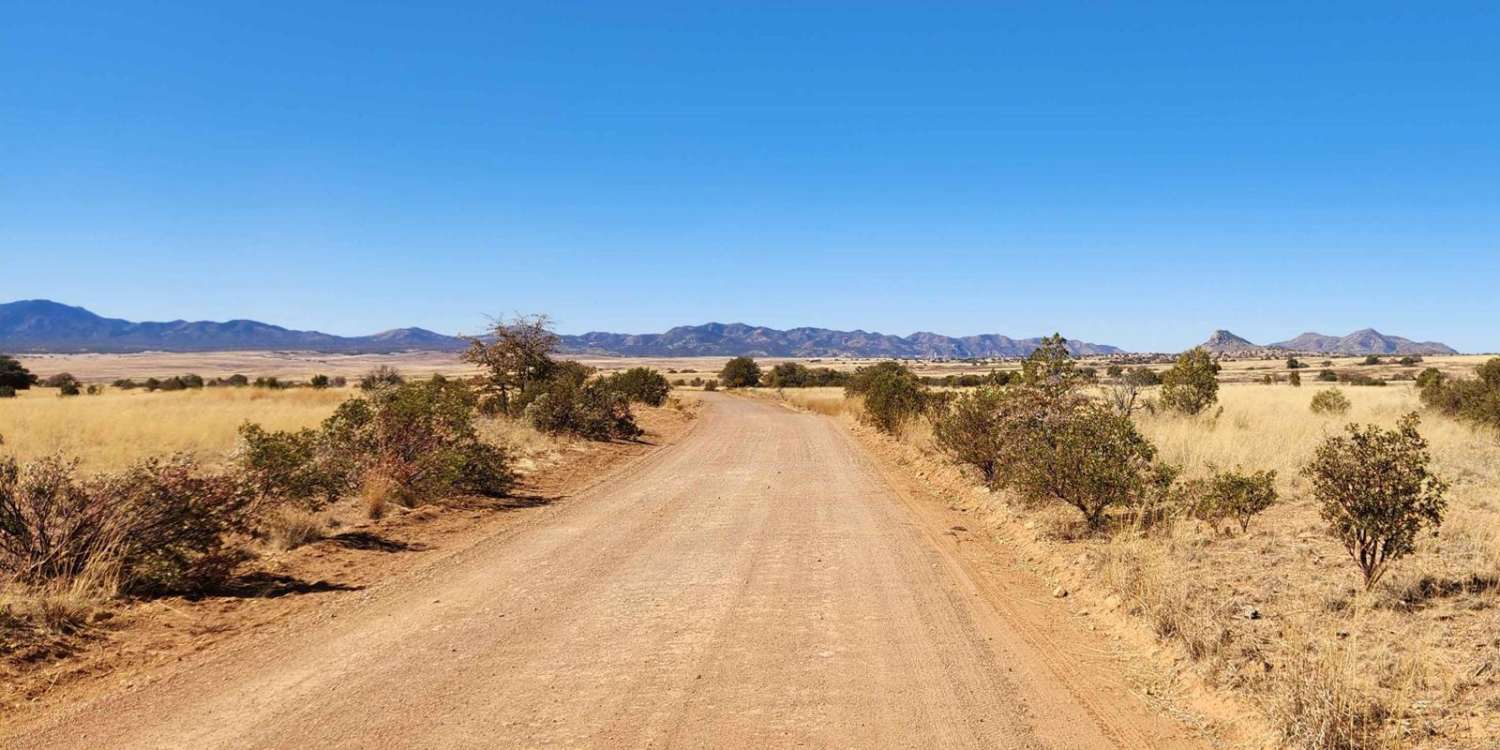
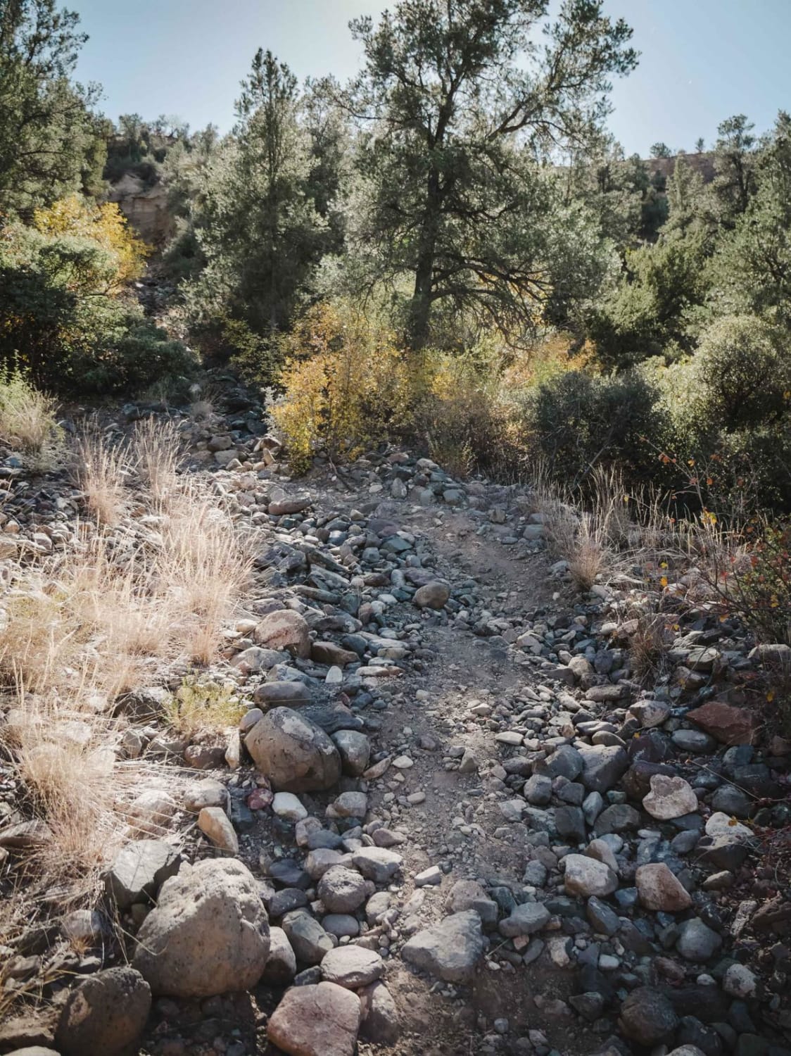
Trail Overview
Mohave County Highway 103 is a dirt road that is rated 3 of 10 however, in bad weather can easily become a 6 or 7 rated or even impassable. The road extends from Mount Turmbull School House Road (Co HWY 5) and ends on the north rim of the Grand Canyon at Twin Point within the Grand Canyon-Parashant National Monument (pronounced PAIR-uh-shont). Twin Point is a seldom-visited viewpoint overlooking the north rim of the Grand Canyon. The drive to get there takes you through part of the Arizona Strip and the Grand Canyon-Parashant National Monument. Making the trek to Twin Point from St. George, Utah is roughly a 180-mile round trip. Twin Point provides several stunning views of the Grand Canyon. While it can be done in a day from St. George but many consider camping overnight in order to either see the sunset or sunrise over the canyon. There are several campsites along the Grand Canyon rim. On the way to Twin Point, you'll see cattle and cowboy line shacks and drive through a ponderosa pine forest. Per the National Parks Service high clearance 4x4 trucks or SUVs are needed. Passenger cars, crossovers, minivans, and RVs will not make it to Twin Point. The road is too rough and has very sharp turns. As one of the last truly wild places in the American Southwest, Parashant offers zero cell service and road conditions that range from "rough" to "extremely rough." A visitor can easily go days without seeing another soul, making the monument one of the worst places in Arizona to experience a breakdown. There are no services within the Parashant, be prepared and bring adequate supplies. It's a challenge to reach and travel through this remote monument. Before attempting to visit the Grand Canyon-Parashant National Monument, get a map at the Interagency Information Center, 345 E. Riverside Drive in St. George, Utah. From St. George, take River Road south to the Arizona/Utah border.
Photos of County Hwy 103-Twin Point
Difficulty
Trail consisting of loose rocks, dirt, and sand with some slick rock surfaces, mud holes possible, no steps higher than 12". 4WD is required, and aggressive tires are a plus.
History
The Grand Canyon-Parashant National Monument is a very isolated and undeveloped place managed jointly by the National Park Service (NPS) and the Bureau of Land Management (BLM). There are no paved roads in the monument or visitor services. Much of the monument remains unexplored, with only 5% of the protected land having been surveyed. You can see thousands of archaeological sites, petroglyphs and artifacts, documenting the cultures and ways of life of the Anasazi and Southern Paiute. The monument stands at a significant intersection of three distinct ecoregions: the Basin and Range Province, the Mohave Desert, and the Colorado Plateau converge within its boundaries to create a varied and interesting landscape. Grand Canyon-Parashant National Monument has been designated as the Parashant International Night Sky Province for its pristine and breathtaking night skies. That means it is one of the best places in the world to see the stars and planets.
Status Reports
County Hwy 103-Twin Point can be accessed by the following ride types:
- High-Clearance 4x4
- SxS (60")
- ATV (50")
- Dirt Bike
County Hwy 103-Twin Point Map
Popular Trails
Patagonia Loop

Pigeon Canyon Road-BLM1002
Camp Verde Trail #545 (South)

Rockridge to Wash - P1346
The onX Offroad Difference
onX Offroad combines trail photos, descriptions, difficulty ratings, width restrictions, seasonality, and more in a user-friendly interface. Available on all devices, with offline access and full compatibility with CarPlay and Android Auto. Discover what you’re missing today!