Ceboruco Volcano Trail
Total Kilometers
12.6
Technical Rating
Best Time
Spring, Summer, Fall, Winter
Trail Type
Full-Width Road
Accessible By
Trail Overview
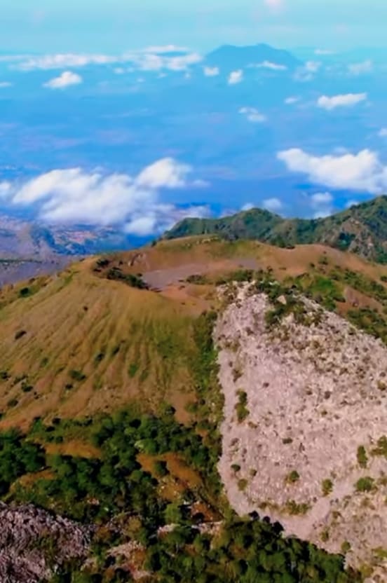
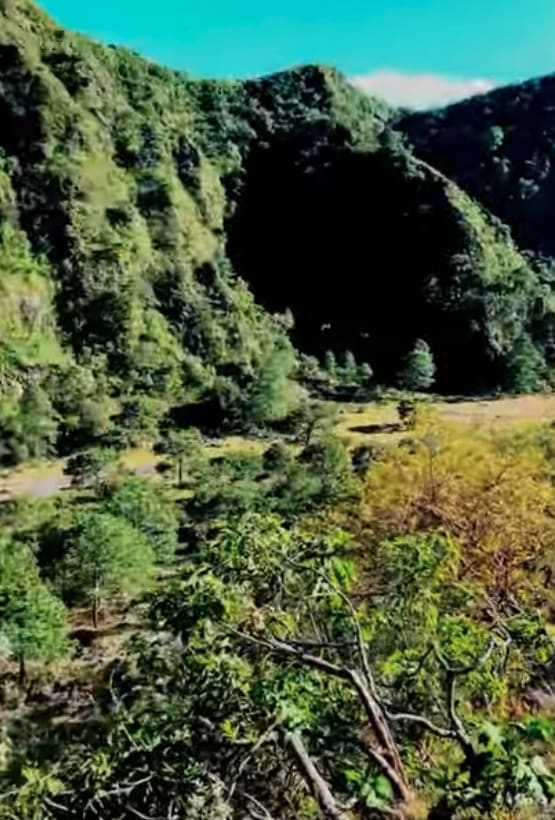
Once you leave the pavement, the off-road trail transforms into a mixture of grass, dirt, and occasional cemented two tracks added in select areas to mitigate erosion. Though relatively easy to navigate, the trail is somewhat narrow, with minimal opportunities to pass other vehicles. As such, it is recommended that you commence your ascent in the morning and descend during the afternoon or evening. The majority of the trail is encircled by a dense tree cover that creates a tunnel-like feeling in some sections until you eventually reach the apex of the volcano. Once you've made it to the top, you have the option of driving over the rim and into the first dome of the volcano. From there, the path continues upwards along a wider dirt road to the summit of the second dome. At this point, you'll be rewarded with the sight of the ruins of a hotel, and you can also find the trailhead for a scenic hike up and into the second dome.
Photos of Ceboruco Volcano Trail
Difficulty
This is a very easy route. A big rig would likely not have clearance but a full size truck or high clearance vehicle would have no issue. The main issue is the lack of places to pass and it is a two way route. Recommended travel up in the am and down in the pm to avoid this issue especially on weekends or holidays.
History
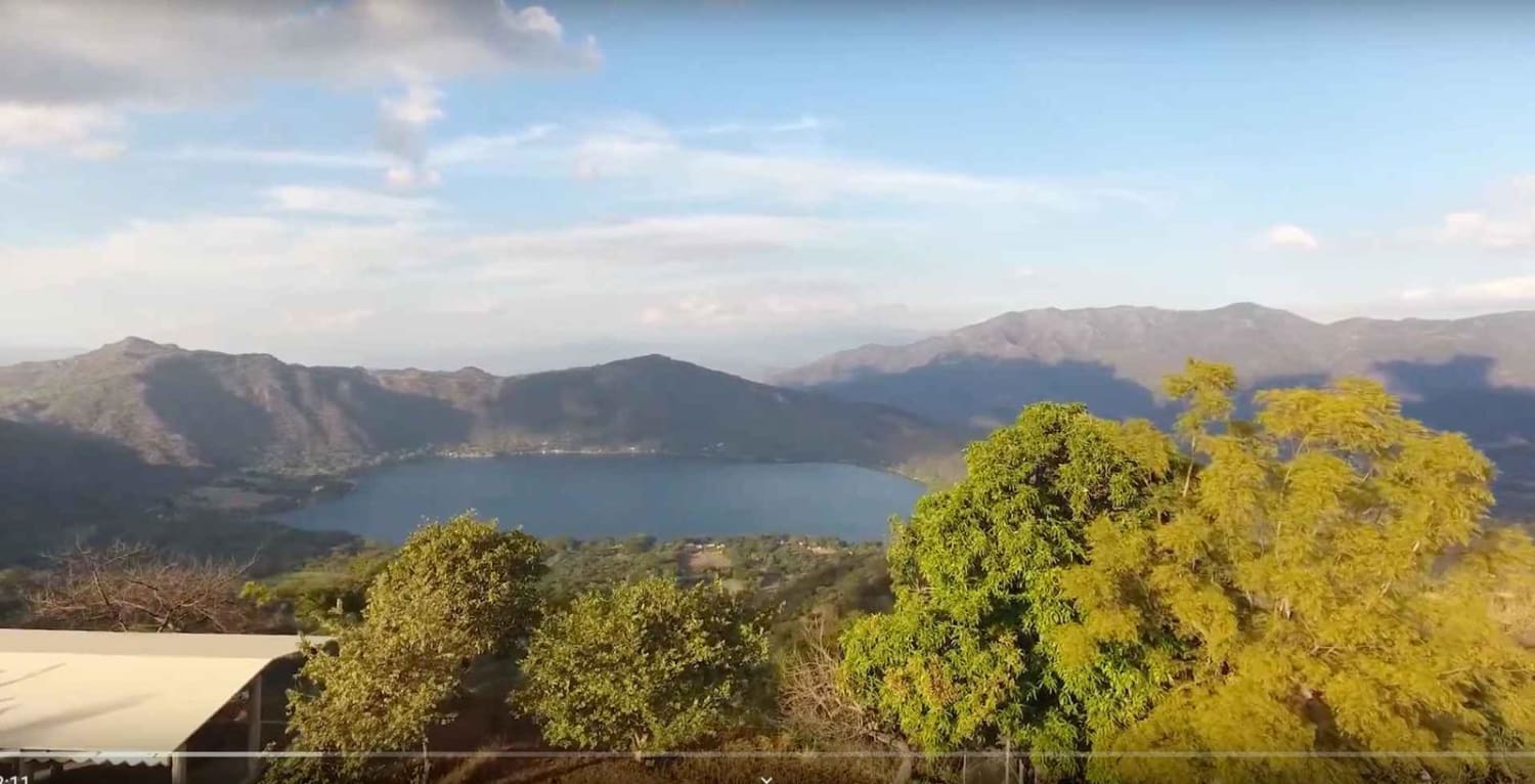
One of the last major eruptions took out the town of Jala which was relocated. You can see what's left of that eruption today when passing from Tepic to Jala on the toll road. Both sides of the highway will turn from green landscapes to a lunar-like terrain of dark oddly shaped rocks. Here is some history and detail about Ceboruco: Located in Nayarit, Mexico, northwest of the Trans-Mexican Volcanic Belt, Ceboruco is a dacitic stratovolcano that experienced its largest eruption, the Jala Plinian eruption, around 930 AD +-200, with a VEI 6 rating and releasing 11 cubic kilometers (2.6 cu mi) of tephra. The most recent well-documented eruption occurred from 1870 to 1875, with fumarole activity persisting into the 20th century. The mountain has a large caldera resulting from the Jala eruption, and a smaller crater nested inside it that formed when the Dos Equis lava dome collapsed during the Coapales eruption in around 1100 AD. Both craters contain several explosive volcanic features, such as scoria deposits, lava domes, and pyroclastic domes. Cooled lava flows around the volcano provide a record of recent eruptions. Prior to the Jala eruption, there was one significant lava flow known as the Destiladero flow. Following the Jala eruption, the volcano was highly active for 500 years, with six major lava flows recorded before the arrival of the Spanish in 1521: the Copales, El Cajon, Coapan I, Coapan II, El Norte, and Ceboruco flows. Although the volcano remained active until the next major eruption in 1870, volcanism was mainly confined to the calderas.
Status Reports
Ceboruco Volcano Trail can be accessed by the following ride types:
- High-Clearance 4x4
- SUV
- SxS (60")
- ATV (50")
- Dirt Bike
Ceboruco Volcano Trail Map
Popular Trails
Ceboruco Volcano Trail
Laguna Santa Maria De Oro Volcano Lake Loop
The onX Offroad Difference
onX Offroad combines trail photos, descriptions, difficulty ratings, width restrictions, seasonality, and more in a user-friendly interface. Available on all devices, with offline access and full compatibility with CarPlay and Android Auto. Discover what you’re missing today!