La Rumorosa Trail
Total Kilometers
39.1
Technical Rating
Best Time
Spring, Fall
Trail Type
Full-Width Road
Accessible By
Trail Overview
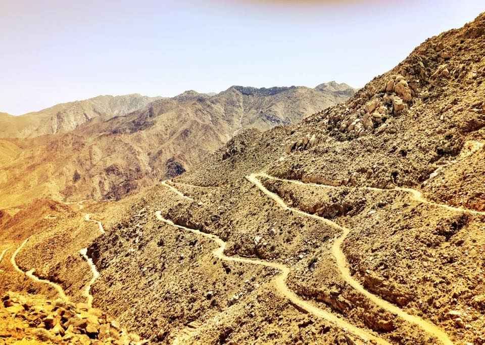
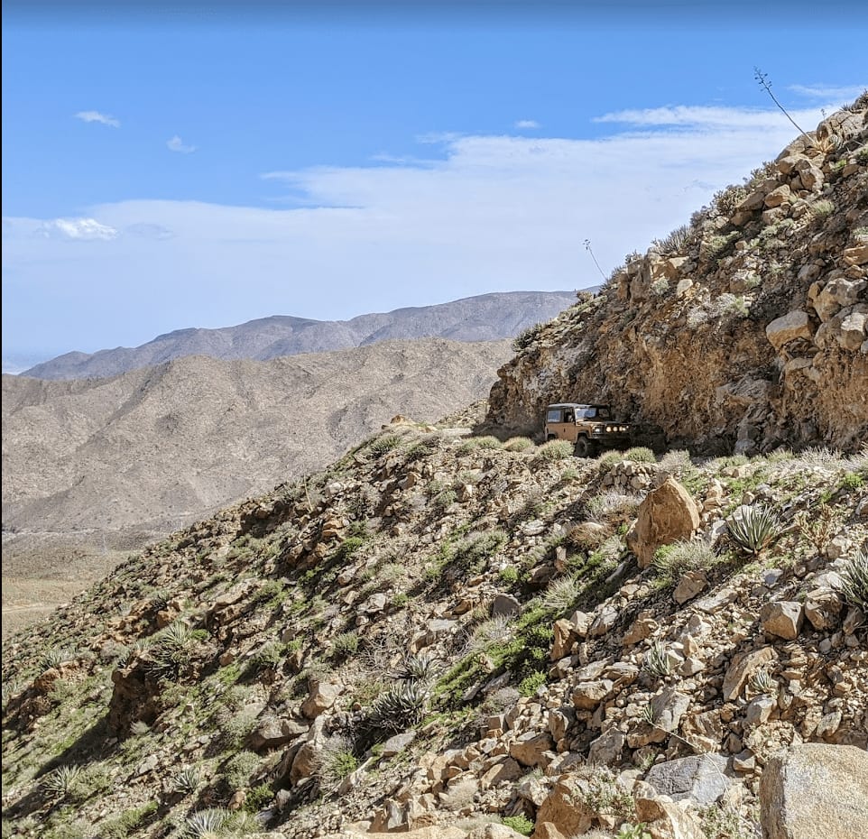
Historic road through the Sierra Juarez that connects the town of La Rumorosa down to the desert below. The 25-mile route contains a dozen tight switchbacks (a couple requiring three-point turns), a couple of tight spots for full-size rigs, and lots of exposure. It pays off with spectacular views and occasional sightings of bighorn sheep and/or California Condors. This is a tight, one-lane road and is popular with local hikers, mountain bikers, and UTV users traveling in both directions. The bottom of the road ends in a rocky wash where yearly storms can change the route conditions. Be prepared to stack rocks to negotiate boulder fields. On the Eastern end, the track changes to sandy whoops and then connects to tracks through the Laguna Salada, the Guadalupe Canyon Hot Springs route, and points further South.
Photos of La Rumorosa Trail
Difficulty
The trail ranges between a 4 - 6 when dry.
Status Reports
La Rumorosa Trail can be accessed by the following ride types:
- High-Clearance 4x4
- SUV
- SxS (60")
- ATV (50")
- Dirt Bike
La Rumorosa Trail Map
Popular Trails

Road to San Carlos Hot Springs

Camino del Canon

El Hongo Prison Loop

Around Cerro el Moreno
The onX Offroad Difference
onX Offroad combines trail photos, descriptions, difficulty ratings, width restrictions, seasonality, and more in a user-friendly interface. Available on all devices, with offline access and full compatibility with CarPlay and Android Auto. Discover what you’re missing today!