Aquaduct Service Road Grapevine - BLM LA1
Total Miles
5.2
Technical Rating
Best Time
Fall, Summer, Spring
Trail Type
Full-Width Road
Accessible By
Trail Overview
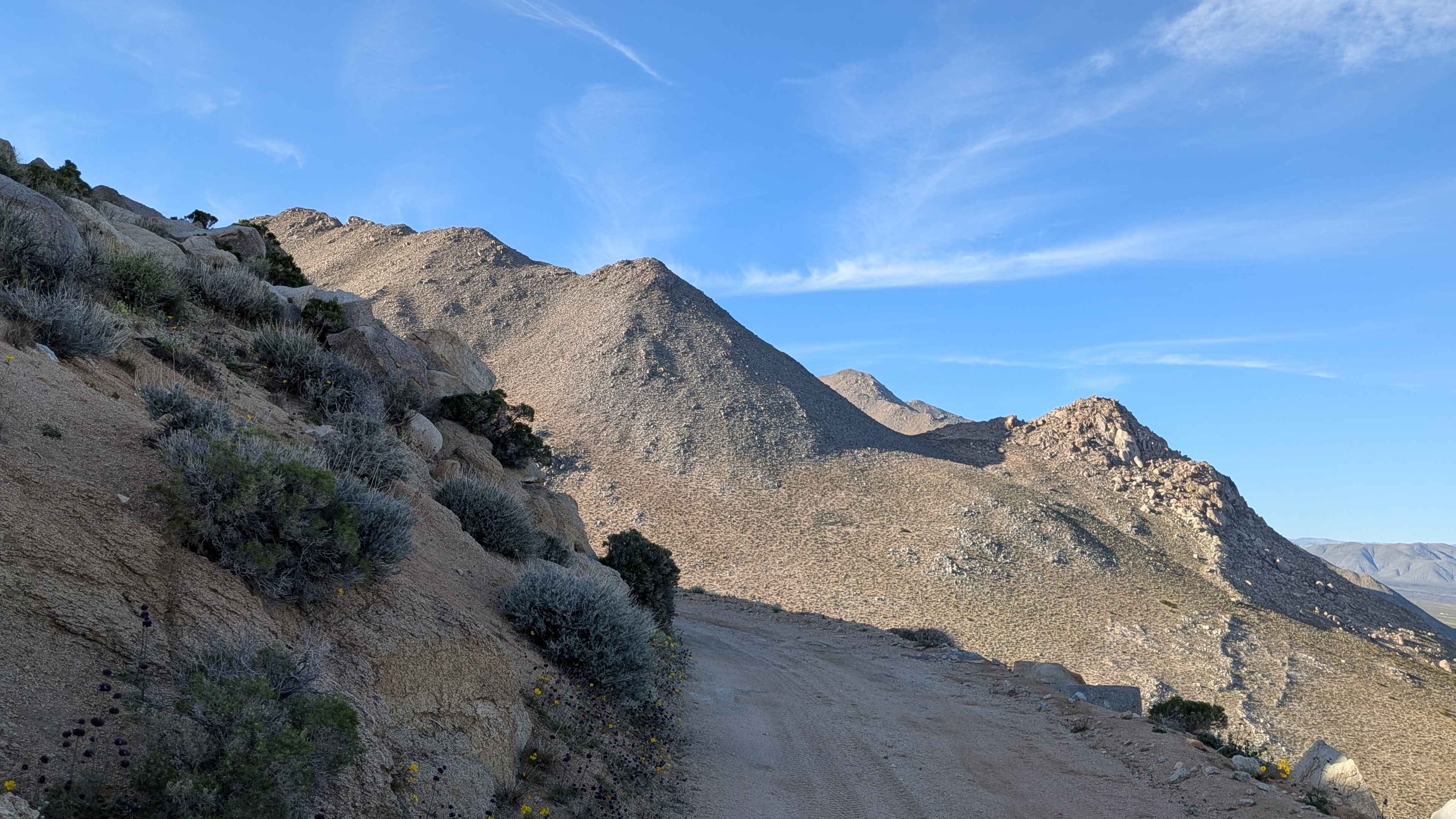
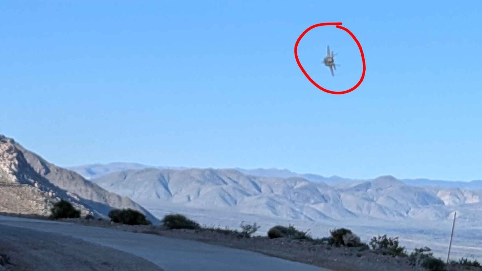
Starting off BLM SE120 near Grapevine Canyon Road, this sand and gravel road runs just over one vehicle wide while traveling mostly on a shelf road perched high above the valley below. Serving as access to the LADWP aqueduct system on BLM land, the route delivers stunning views of valleys below and mountains to the east, with glimpses of some Eastern Sierra valleys adding variety. Keep your eyes peeled as military jets routinely fly by the area in close proximity, adding dramatic aerial displays to the already spectacular scenery from this elevated vantage point.
Photos of Aquaduct Service Road Grapevine - BLM LA1
Difficulty
The shelf road high above the valley creates a psychological challenge with exposure, though the trail surface itself handles reasonably. Just over one vehicle wide means limited passing opportunities and demands precise navigation near the edges. A sand and gravel surface provides decent traction. The elevation and exposure require steady nerves more than technical driving skill. Any vehicle with adequate clearance and a driver comfortable with heights navigates this scenic aqueduct access route successfully.
Status Reports
Aquaduct Service Road Grapevine - BLM LA1 can be accessed by the following ride types:
- High-Clearance 4x4
- SUV
- SxS (60")
- ATV (50")
- Dirt Bike
Aquaduct Service Road Grapevine - BLM LA1 Map
Popular Trails

Peavine - FS 33
Obsidian Dome

Borrego Mountain Wash
The onX Offroad Difference
onX Offroad combines trail photos, descriptions, difficulty ratings, width restrictions, seasonality, and more in a user-friendly interface. Available on all devices, with offline access and full compatibility with CarPlay and Android Auto. Discover what you’re missing today!