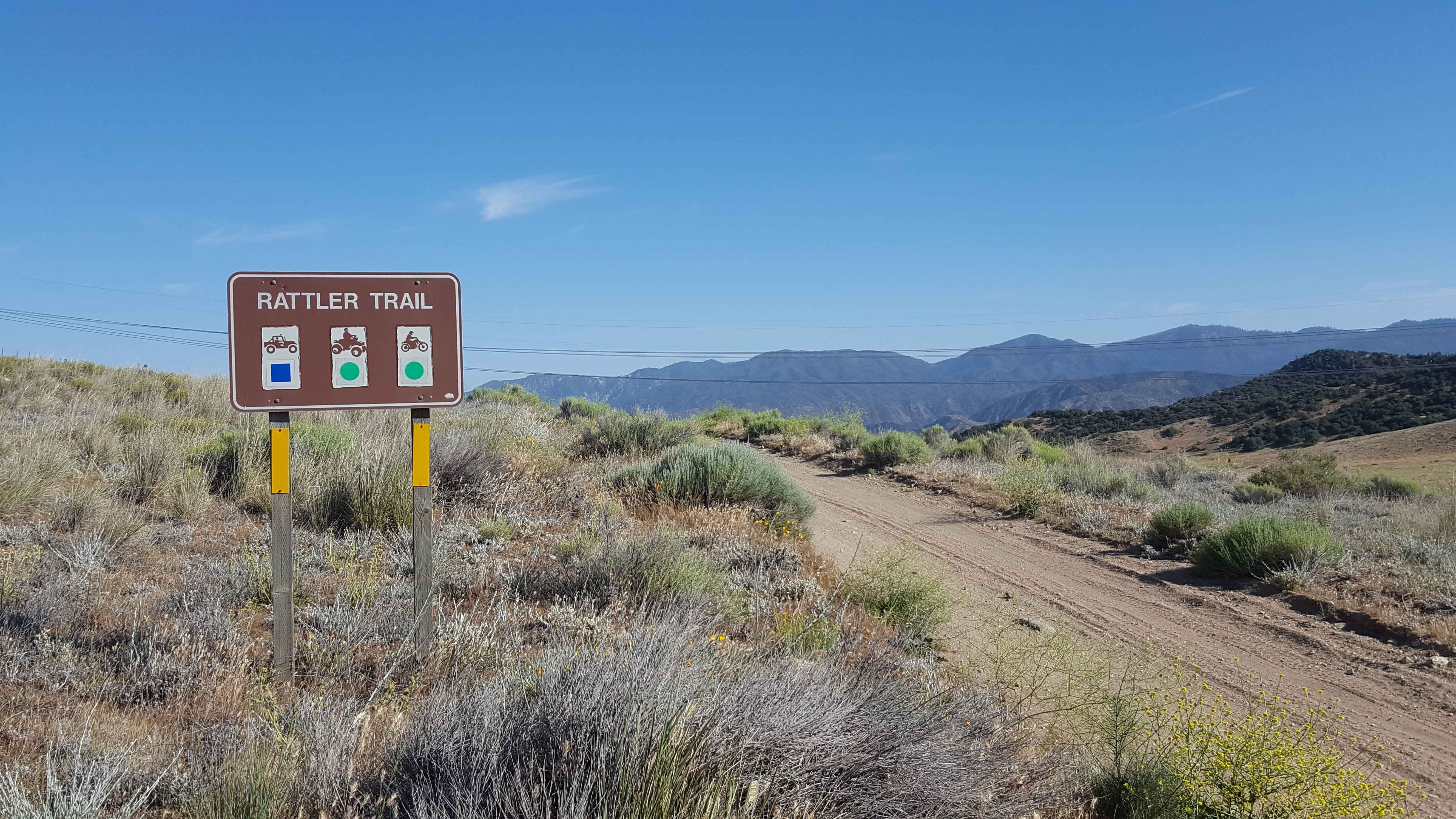
Rattler Trail
Total Miles
4.5
Technical Rating
Best Time
Spring, Summer, Fall, Winter
Trail Type
Full-Width Road
Accessible By
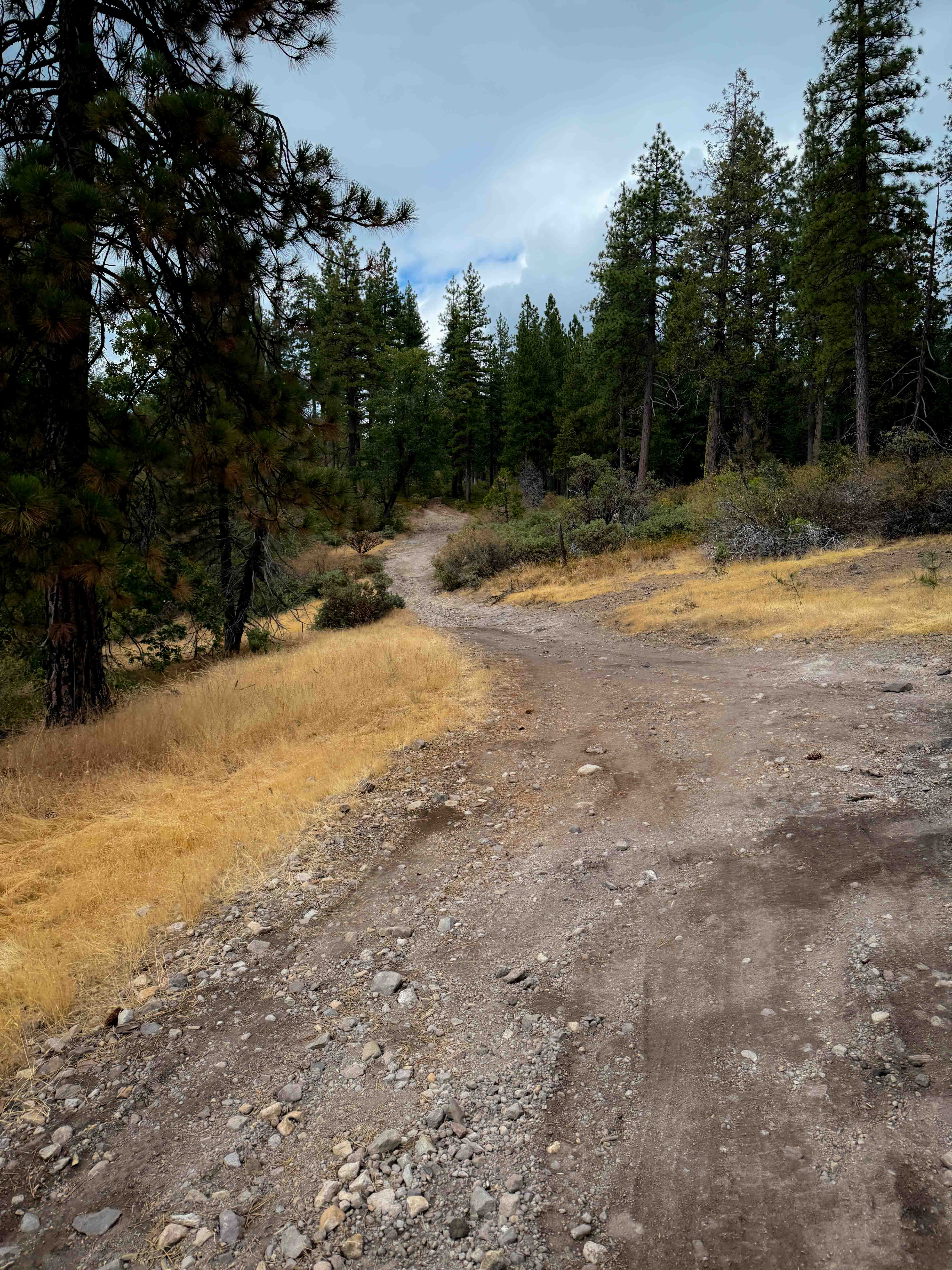
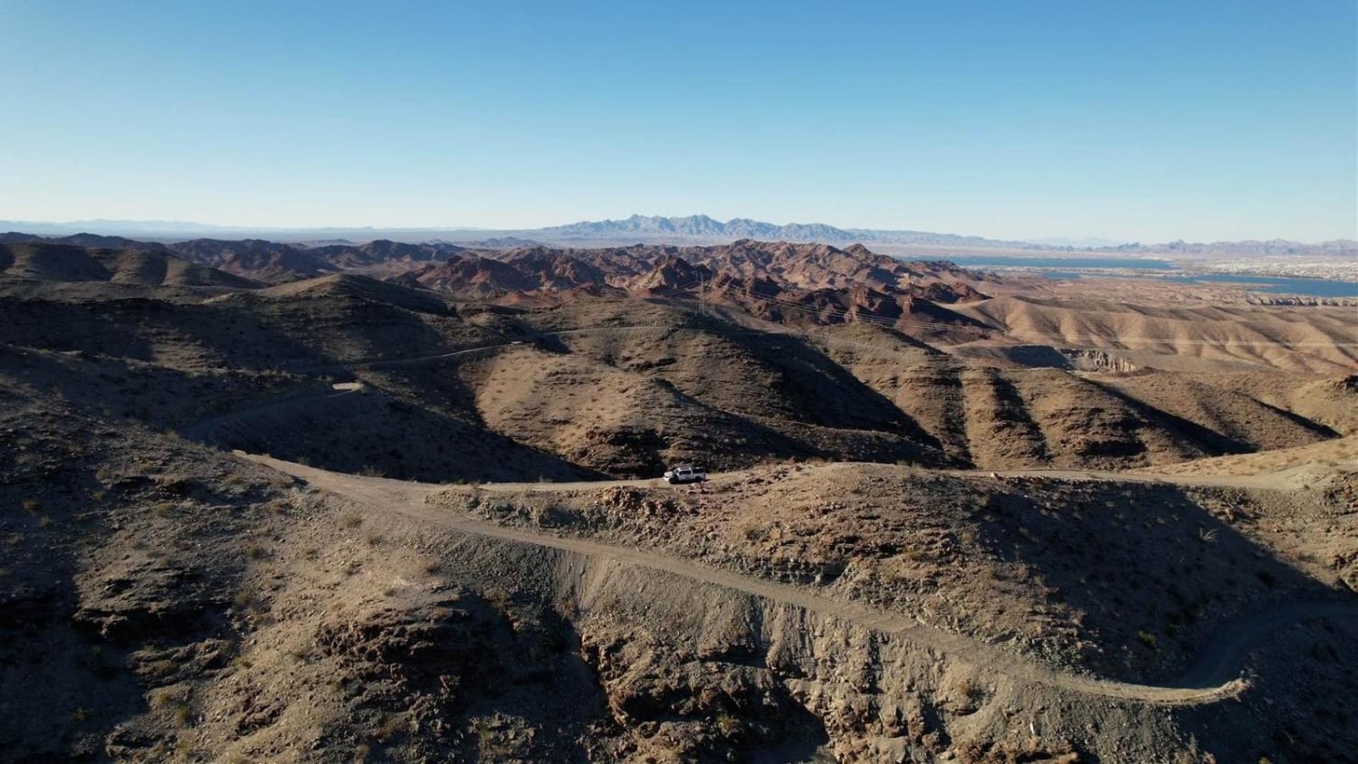
Trail Overview
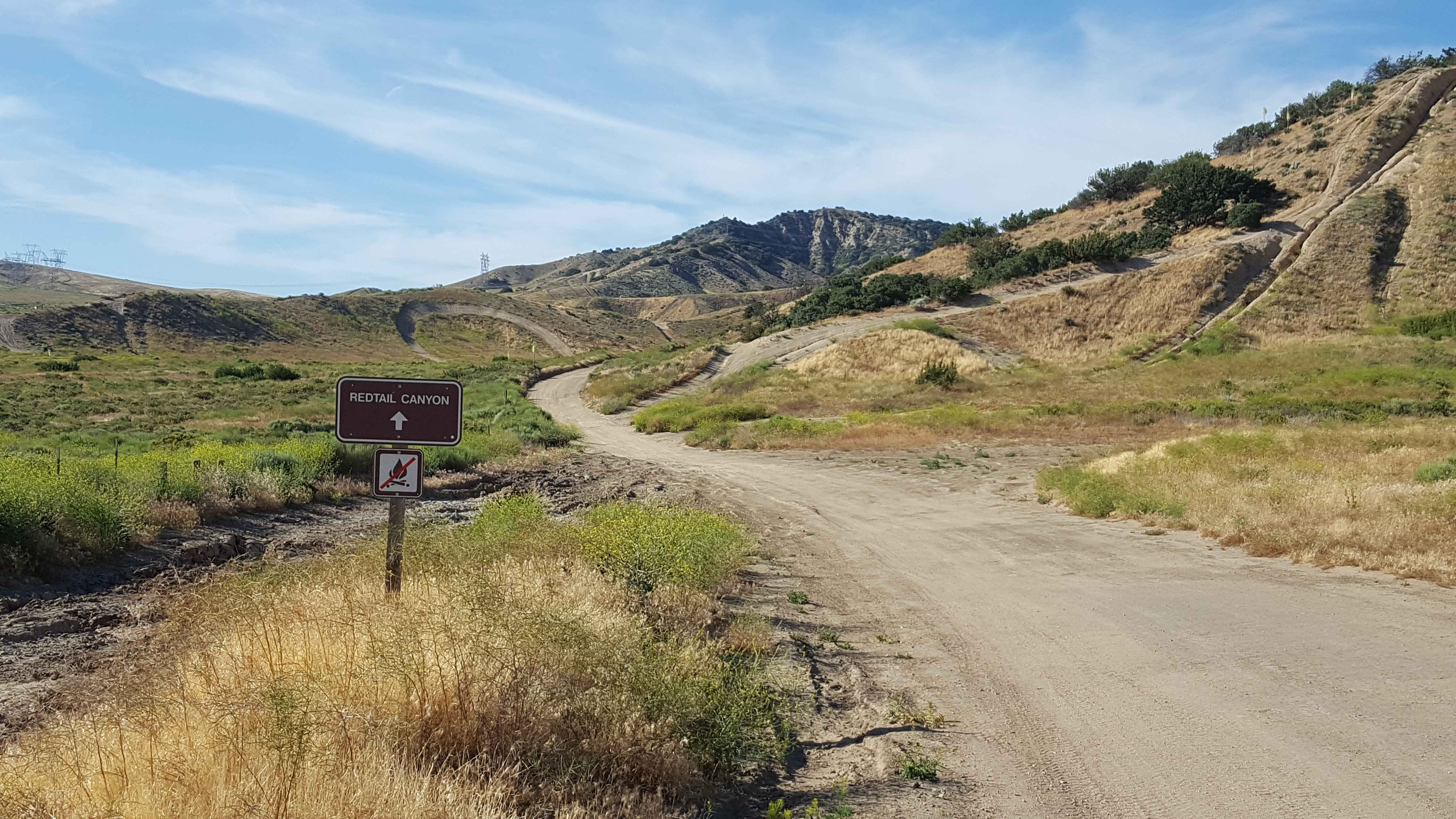
This is a point-to-point OHV trail running lengthwise through the Hungry Valley SVRA. The trail is accessible from either end and at multiple places along its route where it intersects with other trails in the area. From the north end, the trail begins as a one-lane, packed dirt road with frequent areas to move aside for vehicles to pass. Near the halfway point, the trail will climb and descend several short, steep dirt hills that may have foot-deep erosion ruts at the edges and small trail-embedded rocks. Be cautious cresting these hill climbs as there will be no line-of-sight to the other side. OHVs are required to have safety flags at Hungry Valley, and it is recommended that any vehicle traversing these "blind" hill crests have a front-mounted flag to prevent head-on accidents. After the hill section, the trail will drop down into a sandy wash for a short stretch. Sand can be soft and several inches deep in this area. The final section at the south end runs along the ridges of several small hills before intersecting with Hungry Valley Rd near the ATV park and Hungry Valley Activity center. Due to its intersection with multiple other trails, be cautious of other vehicles crossing this trail or running close by on adjacent routes. This trail is open year-round. Red sticker vehicles permitted from 10/1 to 4/30. Green sticker vehicles permitted year-round. A user fee for the OHV area is required and payable at the main entrance to Hungry Valley. Moderate to weak cellular phone service is present along the trail. Tread Lightly and Pack-It-Out.
Photos of Rattler Trail
Difficulty
The trail surface is primarily packed dirt and is only one vehicle wide. There are several short, steep hill climbs where the trail can be deeply rutted and eroded (up to foot deep) on the sides of the route. One stretch also passes through a wash where loose sand can be up to 6" or more deep. Even though the trail is only one lane wide, there are frequent places to pull off the route to allow other vehicles to pass. 2WD vehicles with moderate clearance should be able to handle the majority of this route, with the exception of the sandy wash stretch (may require 4WD).
Status Reports
Rattler Trail can be accessed by the following ride types:
- High-Clearance 4x4
- SUV
- SxS (60")
- ATV (50")
- Dirt Bike
Rattler Trail Map
Popular Trails
Pinecrest Peak
Roundabout Rim
Hightower Trail
The onX Offroad Difference
onX Offroad combines trail photos, descriptions, difficulty ratings, width restrictions, seasonality, and more in a user-friendly interface. Available on all devices, with offline access and full compatibility with CarPlay and Android Auto. Discover what you’re missing today!