
Dirt Bike Trails
Near Stansbury Park, Utah
Explore All Dirt Bike Trails Near Stansbury Park, Utah
Dirt Bike Trails Near Stansbury Park, Utah
Discover the best dirt bike trails near you. Browse trail maps, check difficulty ratings, and find your next adventure — whether you're looking for a quick ride or an all-day expedition.
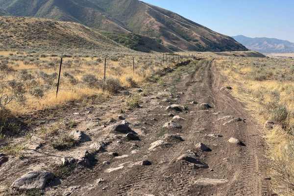
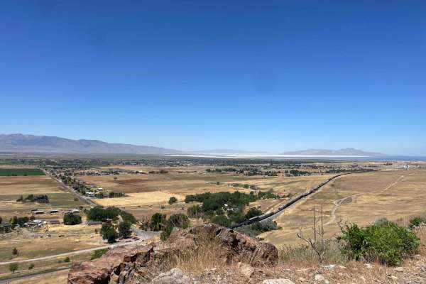
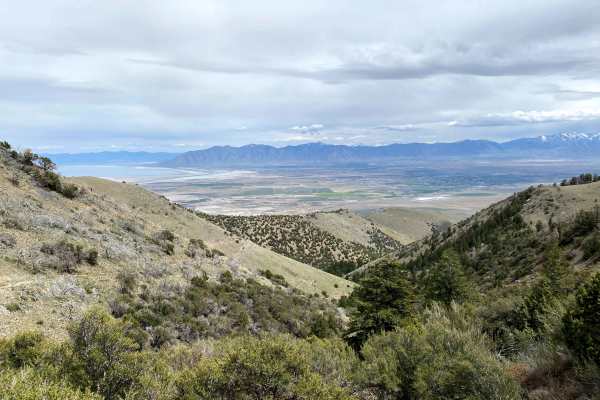
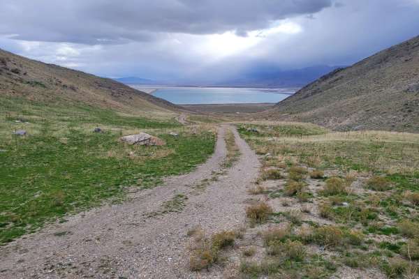
Springs Road Fence Line Trail
This trail starts off the dirt road called Foothill Drive. It starts heading east up the hill on the section line road and then connects to TC03617 back to the southeast all the way to the fence line. There is a gate that has been broken down in the past. There is NO Motorized access past this gate,...
Learn more about Springs Road Fence Line Trail
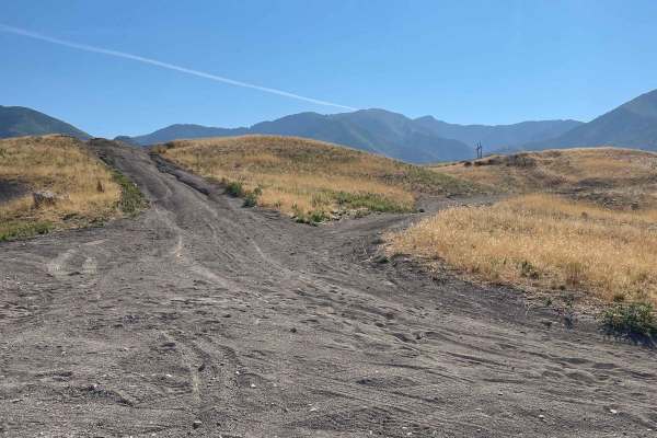
Pole Canyon Trail
This is one of the easiest ways to the top of the plateau. There are some large boulders and sand that could present a challenge depending on your vehicle type. There are mostly rocks on the lower half of the trail and then once climbing on the upper section, you will find a good hard pack and some ...
Learn more about Pole Canyon Trail
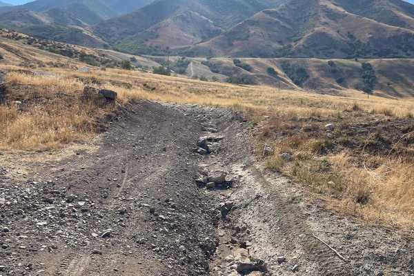
Bates Canyon Trail
This is a well-traveled two-track with all types of 4x4 and off-road machines. This trail is a great way to overlook the Tooele Valley above Stansbury Park and Erda. You will encounter some large rocks and rutted roads along the way to the top. There is a gate at the end where motorized travel is pr...
Learn more about Bates Canyon Trail
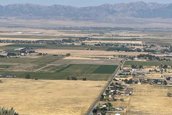
Bates Canyon Trail Access To Erda Lookout
This trail is a short 2-track hill. It starts off with a hardpack OHV trail and about a 1/3 of a mile in, you will get to a steep sand hill. This feature alone makes this a 4 or 5/10. You will need some speed and skill to make it up the deep sand slope. Other than this section, the trail is a 2 or 3...
Learn more about Bates Canyon Trail Access To Erda Lookout
The Bunker Trail
There are a few gates on this trail, make sure you leave the gates the way you found them. This trail rides along the ridgeline and has lots of loose rocks (baby heads mostly with some sharp rocks). This can be challenging on a bigger motorcycle due to the grades and loose material. 4x4s might find ...
Learn more about The Bunker Trail
Radio Tower - Tramway Slide Trail
This route starts at the Radio Towers on Droubay Road and rides along the Rail Road tracks heading north, and about 3 miles up, you veer off to the east up the mountain toward the landslide on the hill. Once you are next to the fence line, you will go through a bit of a rock garden and then see a sm...
Learn more about Radio Tower - Tramway Slide Trail
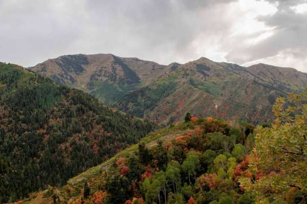
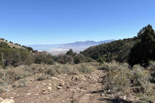
Butterfield Canyon
Closed from October to June. This is a great drive that takes you up and over the Oquirrh Mountains between Herriman and Tooele, Utah. This is a perfect place for an evening with great views. This area is particularly beautiful in the fall with many colors in the trees. You will also get a great bir...
Learn more about Butterfield Canyon
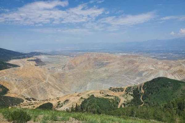
Kennecott Copper Mine Overlook
This trail is a quick 5-mile total out-and-back. It is well-maintained dirt leading to a large parking area that overlooks the main pit of the mine. One can also see the Salt Lake Valley to the east and Tooele Valley to the west and the views of the mountains, valleys, and mine are incredible. The r...
Learn more about Kennecott Copper Mine Overlook
Miner Canyon/Kimbell Mine
This trail has mystery and beautiful views. The trail goes up what is known locally as Miner's Canyon and climbs to just over 7000 feet to an old miner's shack. The trail is very rocky, which can make for a very bumpy ride. 12" of ground clearance is required. Longer wheelbase rigs might have to mak...
Learn more about Miner Canyon/Kimbell Mine
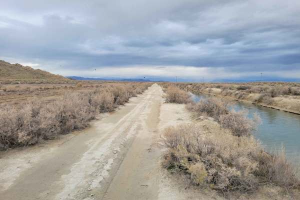
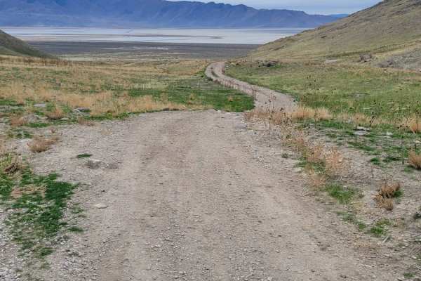
Canal Road
This straight-away trail leads to the furthest, Eastern part of the island's BLM land. It parallels one of the Great Salt Lake water canals and is in much better condition than many of the other trails in the area. A couple of ruts and mud holes are possible. There is no barrier to protect against f...
Learn more about Canal Road
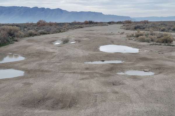
Direct Shot
This connecting route leads to several other trails in the area, as well as a handful of shooting ranges against the mountainside. The trail is hard-packed dirt with quite a few massive "potholes". Water or mud may be present in them. Always remember to "pack it in, pack it out" with the shooting ra...
Learn more about Direct Shot
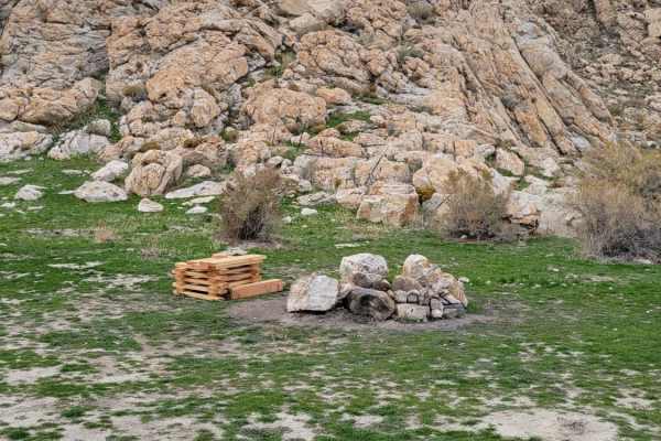
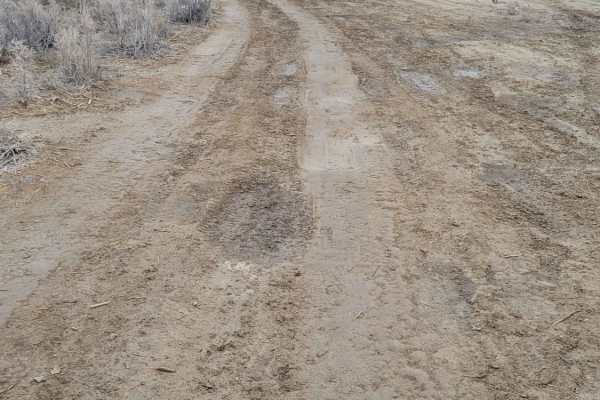
Dismal Finale
This little route leads to the furthest eastern end of publicly accessible BLM land. Beyond this point is private property. The trail itself is pretty beat up and in dismal shape, especially in wet conditions. Lots of mud holes and ruts to navigate. There was a lone fire ring at the end of the trail...
Learn more about Dismal Finale
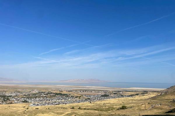
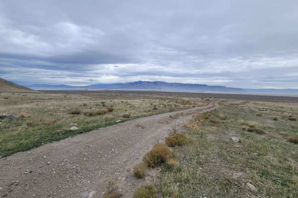
Dead End Pass
This short, narrow little trail leads up into the hillside but ultimately comes to a dead end. There are a couple of spots with fire rings that people may have camped at before. There is nothing difficult about this trail. Expansive views down the hill and over part of the Great Salt Lake.
Learn more about Dead End Pass
Southside
This connecting trail is less damaged than others in the area, although there are still a couple of ruts and mud holes to navigate. It leads from the main road up to one of the many shooting areas and connects to several other trails.
Learn more about Southside
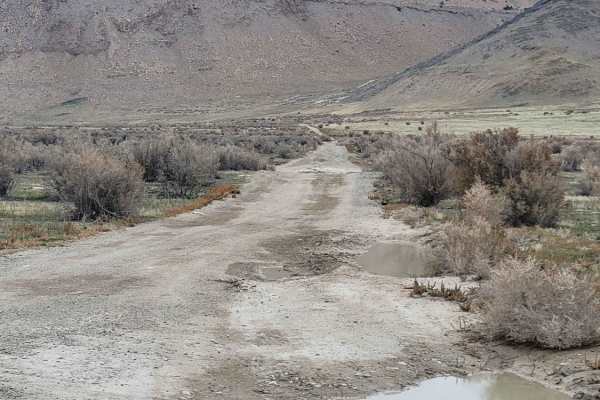
Straight Shooter
This short, straight trail takes you past a small shooting area on the South end and up to Tabby's Canyon area on the North end. There are various connecting trails off of this route. Tons of mud holes and trail damage (ruts) are present, but often there are secondary ways around some of the worst s...
Learn more about Straight Shooter
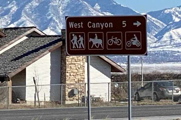
West Canyon Trailhead Road
For those who might want to get out for a nice day hike, this road leads to the West Canyon Trailhead and has some beautiful views. Most of the year, it's a really easy road to drive, but snow and snowdrifts can make the road very difficult to travel in the wintertime. It does climb almost 2000' in ...
Learn more about West Canyon Trailhead Road
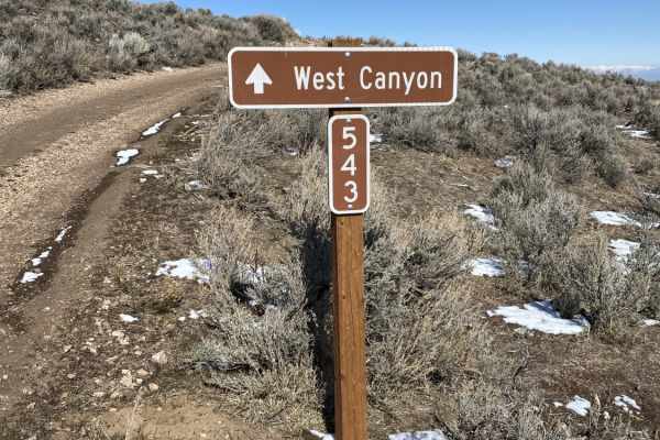
Magpie Road to West Canyon Trailhead
This is an older alternate route going up to West Canyon Trailhead. Much like the dirt road that now goes to the trailhead, which is in the Wasatch National Forest lands, it does go thru some private properties, which at different times of year are grazing cattle. There are only a couple of cattle g...
Learn more about Magpie Road to West Canyon Trailhead
Stansbury Front
Stansbury Front is a 22-mile-long trail that travels north-south along the Stansbury Mountain range. This trail is point-to-point and ends very far from where you begin. Most riders get to the end, turn around, and ride another 22 miles back to their vehicle. Allow 4+ hours for the full out-and-back...
Learn more about Stansbury Front
Round The Bend
This easy trail around the hillside connects Stansbury Gulch and Tabby's Canyon. There is nothing of major difficulty to note except where the trail dips down and up a ravine on the beginning of the Eastside. The west end of the trail is at a quarry/shooting area. Great views overlooking the Salt La...
Learn more about Round The Bend
Tabby's Canyon
A narrow trail that winds its way up and back into the mountain. This trail is probably best suited for smaller machines, although a Tacoma made it up no problem. A couple of sections have large rocks to maneuver around, which bump up the technicality rating. The trail does keep going beyond where m...
Learn more about Tabby's Canyon
ATV trails near Stansbury Park, Utah
Explore ATV-friendly trails near you. These trails are accessible for vehicles up to 50 inches wide, perfect for ATVs and smaller off-road machines.
Springs Road Fence Line Trail
This trail starts off the dirt road called Foothill Drive. It starts heading east up the hill on the section line road and then connects to TC03617 back to the southeast all the way to the fence line. There is a gate that has been broken down in the past. There is NO Motorized access past this gate,...
Learn more about Springs Road Fence Line Trail
Pole Canyon Trail
This is one of the easiest ways to the top of the plateau. There are some large boulders and sand that could present a challenge depending on your vehicle type. There are mostly rocks on the lower half of the trail and then once climbing on the upper section, you will find a good hard pack and some ...
Learn more about Pole Canyon Trail
Bates Canyon Trail
This is a well-traveled two-track with all types of 4x4 and off-road machines. This trail is a great way to overlook the Tooele Valley above Stansbury Park and Erda. You will encounter some large rocks and rutted roads along the way to the top. There is a gate at the end where motorized travel is pr...
Learn more about Bates Canyon Trail
Bates Canyon Trail Access To Erda Lookout
This trail is a short 2-track hill. It starts off with a hardpack OHV trail and about a 1/3 of a mile in, you will get to a steep sand hill. This feature alone makes this a 4 or 5/10. You will need some speed and skill to make it up the deep sand slope. Other than this section, the trail is a 2 or 3...
Learn more about Bates Canyon Trail Access To Erda Lookout
UTV/side-by-side trails near Stansbury Park, Utah
Find UTV and side-by-side trails near you. These trails accommodate vehicles up to 60 inches wide, ideal for UTVs, side-by-sides, and wider off-road rigs.
Springs Road Fence Line Trail
This trail starts off the dirt road called Foothill Drive. It starts heading east up the hill on the section line road and then connects to TC03617 back to the southeast all the way to the fence line. There is a gate that has been broken down in the past. There is NO Motorized access past this gate,...
Learn more about Springs Road Fence Line Trail
Pole Canyon Trail
This is one of the easiest ways to the top of the plateau. There are some large boulders and sand that could present a challenge depending on your vehicle type. There are mostly rocks on the lower half of the trail and then once climbing on the upper section, you will find a good hard pack and some ...
Learn more about Pole Canyon Trail
Bates Canyon Trail
This is a well-traveled two-track with all types of 4x4 and off-road machines. This trail is a great way to overlook the Tooele Valley above Stansbury Park and Erda. You will encounter some large rocks and rutted roads along the way to the top. There is a gate at the end where motorized travel is pr...
Learn more about Bates Canyon Trail
Bates Canyon Trail Access To Erda Lookout
This trail is a short 2-track hill. It starts off with a hardpack OHV trail and about a 1/3 of a mile in, you will get to a steep sand hill. This feature alone makes this a 4 or 5/10. You will need some speed and skill to make it up the deep sand slope. Other than this section, the trail is a 2 or 3...
Learn more about Bates Canyon Trail Access To Erda Lookout
The onX Offroad Difference
onX Offroad combines trail photos, descriptions, difficulty ratings, width restrictions, seasonality, and more in a user-friendly interface. Available on all devices, with offline access and full compatibility with CarPlay and Android Auto. Discover what you're missing today!
Open Trail Map