
Dirt Bike Trails
Near Tooele, Utah
Explore All Dirt Bike Trails Near Tooele, Utah
Dirt Bike Trails Near Tooele, Utah
Discover the best dirt bike trails near you. Browse trail maps, check difficulty ratings, and find your next adventure — whether you're looking for a quick ride or an all-day expedition.
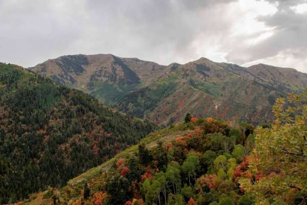
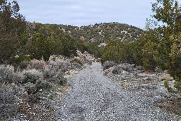
Butterfield Canyon
Closed from October to June. This is a great drive that takes you up and over the Oquirrh Mountains between Herriman and Tooele, Utah. This is a perfect place for an evening with great views. This area is particularly beautiful in the fall with many colors in the trees. You will also get a great bir...
Learn more about Butterfield Canyon
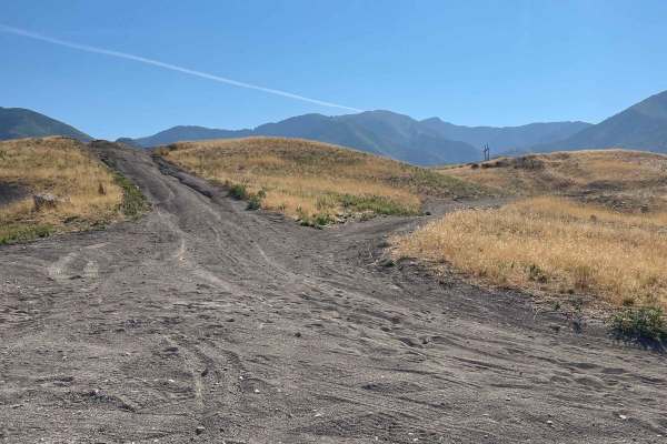
Pole Canyon Trail
This is one of the easiest ways to the top of the plateau. There are some large boulders and sand that could present a challenge depending on your vehicle type. There are mostly rocks on the lower half of the trail and then once climbing on the upper section, you will find a good hard pack and some ...
Learn more about Pole Canyon Trail
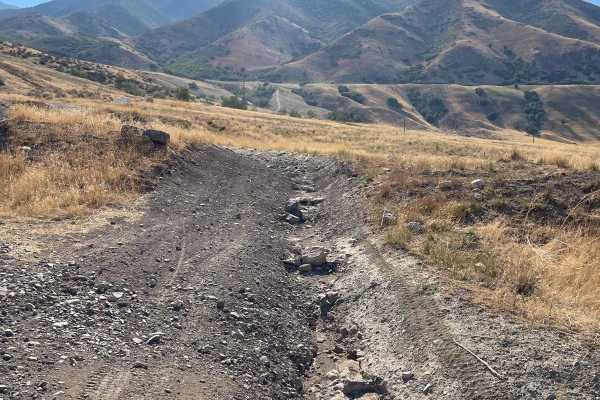
Bates Canyon Trail
This is a well-traveled two-track with all types of 4x4 and off-road machines. This trail is a great way to overlook the Tooele Valley above Stansbury Park and Erda. You will encounter some large rocks and rutted roads along the way to the top. There is a gate at the end where motorized travel is pr...
Learn more about Bates Canyon Trail
The Bunker Trail
There are a few gates on this trail, make sure you leave the gates the way you found them. This trail rides along the ridgeline and has lots of loose rocks (baby heads mostly with some sharp rocks). This can be challenging on a bigger motorcycle due to the grades and loose material. 4x4s might find ...
Learn more about The Bunker Trail
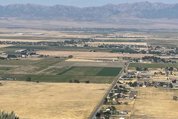
Bates Canyon Trail Access To Erda Lookout
This trail is a short 2-track hill. It starts off with a hardpack OHV trail and about a 1/3 of a mile in, you will get to a steep sand hill. This feature alone makes this a 4 or 5/10. You will need some speed and skill to make it up the deep sand slope. Other than this section, the trail is a 2 or 3...
Learn more about Bates Canyon Trail Access To Erda Lookout
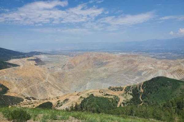
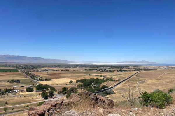
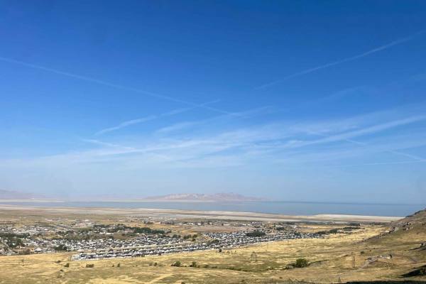
Kennecott Copper Mine Overlook
This trail is a quick 5-mile total out-and-back. It is well-maintained dirt leading to a large parking area that overlooks the main pit of the mine. One can also see the Salt Lake Valley to the east and Tooele Valley to the west and the views of the mountains, valleys, and mine are incredible. The r...
Learn more about Kennecott Copper Mine Overlook
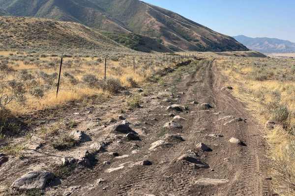
Springs Road Fence Line Trail
This trail starts off the dirt road called Foothill Drive. It starts heading east up the hill on the section line road and then connects to TC03617 back to the southeast all the way to the fence line. There is a gate that has been broken down in the past. There is NO Motorized access past this gate,...
Learn more about Springs Road Fence Line Trail
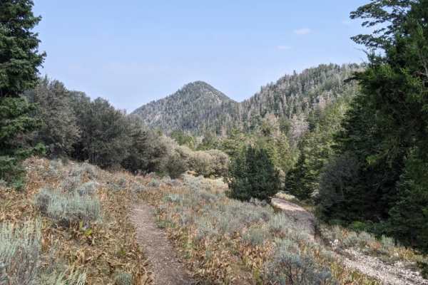
Jacob City Soldier Canyon Loop
Jacob City is a scenic loop with classic Great Basin scenery. The trail passes the historic Jacob City ghost town and then climbs to nearly 10,000 feet before climbing down to Soldier Canyon on a rough and narrow trail. Mine history is scattered throughout.
Learn more about Jacob City Soldier Canyon Loop
Radio Tower - Tramway Slide Trail
This route starts at the Radio Towers on Droubay Road and rides along the Rail Road tracks heading north, and about 3 miles up, you veer off to the east up the mountain toward the landslide on the hill. Once you are next to the fence line, you will go through a bit of a rock garden and then see a sm...
Learn more about Radio Tower - Tramway Slide Trail
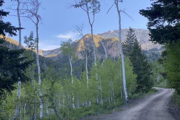
South Willow Canyon
This is a scenic drive that follows South Willow Creek, leaving the high desert of Tooele Valley and entering the aspen groves. There are 4 campgrounds along this road. The majority of the campgrounds are along the stream or within the scenic forest. This area is particularly gorgeous during the fal...
Learn more about South Willow Canyon
Box Elder Canyon South
This is a scenic drive that follows along a canyon in the high desert of Tooele Valley. Warning: The trail has a lot of tight areas through the brush. It is not recommended to take a full-size vehicle. Scratches are likely. It was tight in a Grand Cherokee. The trail as of this recording is washed o...
Learn more about Box Elder Canyon South
Martin Fork
This is a scenic drive that follows along the edge of a canyon in the high desert of Tooele Valley. Warning: The trail has a lot of tight areas through the brush. It is not recommended to take a full-size vehicle. Scratches are likely. It was tight in a Grand Cherokee. The trail as of this recording...
Learn more about Martin Fork
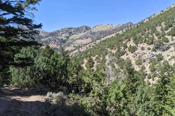
Miner Canyon/Kimbell Mine
This trail has mystery and beautiful views. The trail goes up what is known locally as Miner's Canyon and climbs to just over 7000 feet to an old miner's shack. The trail is very rocky, which can make for a very bumpy ride. 12" of ground clearance is required. Longer wheelbase rigs might have to mak...
Learn more about Miner Canyon/Kimbell Mine
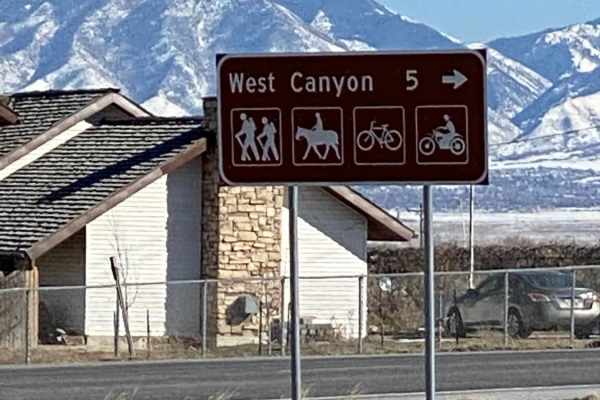
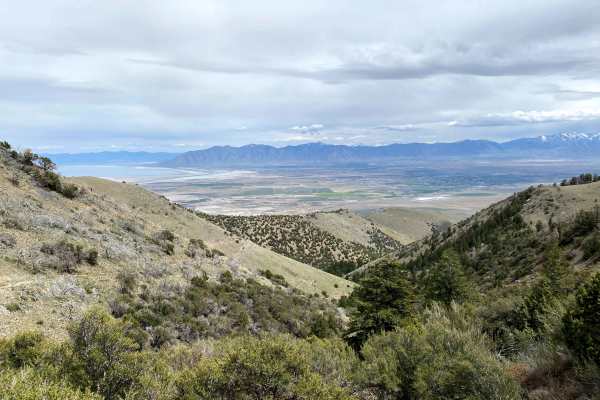
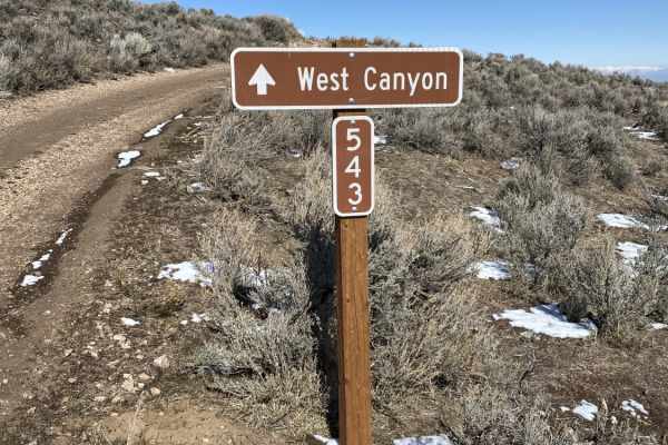
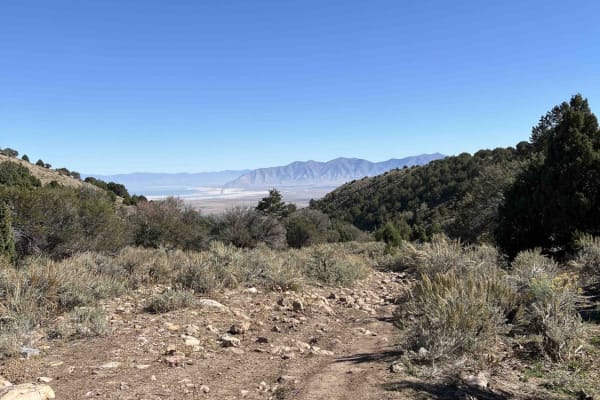
West Canyon Trailhead Road
For those who might want to get out for a nice day hike, this road leads to the West Canyon Trailhead and has some beautiful views. Most of the year, it's a really easy road to drive, but snow and snowdrifts can make the road very difficult to travel in the wintertime. It does climb almost 2000' in ...
Learn more about West Canyon Trailhead Road
Magpie Road to West Canyon Trailhead
This is an older alternate route going up to West Canyon Trailhead. Much like the dirt road that now goes to the trailhead, which is in the Wasatch National Forest lands, it does go thru some private properties, which at different times of year are grazing cattle. There are only a couple of cattle g...
Learn more about Magpie Road to West Canyon Trailhead
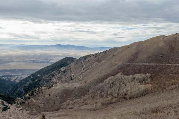
Stansbury Front
Stansbury Front is a 22-mile-long trail that travels north-south along the Stansbury Mountain range. This trail is point-to-point and ends very far from where you begin. Most riders get to the end, turn around, and ride another 22 miles back to their vehicle. Allow 4+ hours for the full out-and-back...
Learn more about Stansbury Front
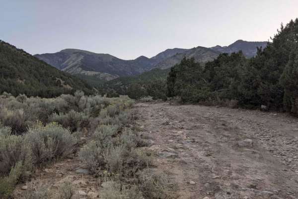
Dip Gulch Road
This trail starts out as easy and unassuming but quickly offers some challenges. Water erosion has created some deep gouges on the trail, making for off-camber sections. The further up trail you travel, the more narrow and less tracked it becomes. If you take a vehicle up there, expect to have veget...
Learn more about Dip Gulch Road
Mining Fork 4x4
This is a scenic drive that follows along a ridgeline in the high desert of Tooele Valley and drops down into a canyon entering the aspen groves. Warning: The trail has a lot of tight areas along cliff sides and through the brush. It is not recommended to take a full-size vehicle. Scratches are like...
Learn more about Mining Fork 4x4
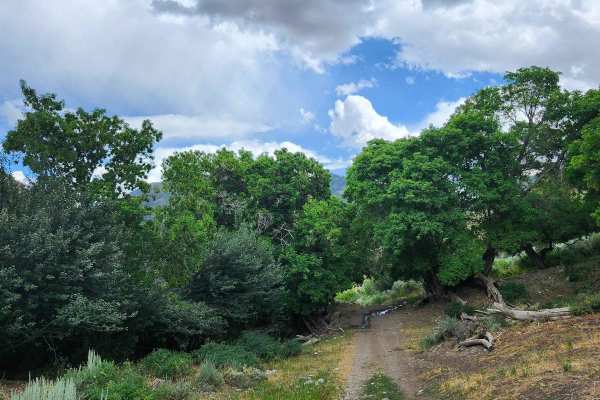
Bear Fork
This trail is a little tight with overgrowth and has washed out in the past, but it is still a fairly easy trail. There are some rocks and narrow areas, so a large vehicle is not advised, but you can take it at your own risk. This is a short trail, but it connects Hickman Canyon Road to the singletr...
Learn more about Bear Fork
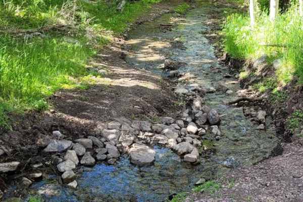
Hickman Canyon Road
This is a nice canyon road for a quick getaway into the mountains. There are a few small water crossings in the late spring and heavy water in the early spring due to runoff. This is a great road for most 4x4 vehicles but a low-clearance car is not recommended up here. The road ends where a dedicate...
Learn more about Hickman Canyon Road
ATV trails near Tooele, Utah
Explore ATV-friendly trails near you. These trails are accessible for vehicles up to 50 inches wide, perfect for ATVs and smaller off-road machines.
Butterfield Canyon
Closed from October to June. This is a great drive that takes you up and over the Oquirrh Mountains between Herriman and Tooele, Utah. This is a perfect place for an evening with great views. This area is particularly beautiful in the fall with many colors in the trees. You will also get a great bir...
Learn more about Butterfield Canyon
Pole Canyon Trail
This is one of the easiest ways to the top of the plateau. There are some large boulders and sand that could present a challenge depending on your vehicle type. There are mostly rocks on the lower half of the trail and then once climbing on the upper section, you will find a good hard pack and some ...
Learn more about Pole Canyon Trail
Bates Canyon Trail
This is a well-traveled two-track with all types of 4x4 and off-road machines. This trail is a great way to overlook the Tooele Valley above Stansbury Park and Erda. You will encounter some large rocks and rutted roads along the way to the top. There is a gate at the end where motorized travel is pr...
Learn more about Bates Canyon Trail
The Bunker Trail
There are a few gates on this trail, make sure you leave the gates the way you found them. This trail rides along the ridgeline and has lots of loose rocks (baby heads mostly with some sharp rocks). This can be challenging on a bigger motorcycle due to the grades and loose material. 4x4s might find ...
Learn more about The Bunker Trail
UTV/side-by-side trails near Tooele, Utah
Find UTV and side-by-side trails near you. These trails accommodate vehicles up to 60 inches wide, ideal for UTVs, side-by-sides, and wider off-road rigs.
Butterfield Canyon
Closed from October to June. This is a great drive that takes you up and over the Oquirrh Mountains between Herriman and Tooele, Utah. This is a perfect place for an evening with great views. This area is particularly beautiful in the fall with many colors in the trees. You will also get a great bir...
Learn more about Butterfield Canyon
Pole Canyon Trail
This is one of the easiest ways to the top of the plateau. There are some large boulders and sand that could present a challenge depending on your vehicle type. There are mostly rocks on the lower half of the trail and then once climbing on the upper section, you will find a good hard pack and some ...
Learn more about Pole Canyon Trail
Bates Canyon Trail
This is a well-traveled two-track with all types of 4x4 and off-road machines. This trail is a great way to overlook the Tooele Valley above Stansbury Park and Erda. You will encounter some large rocks and rutted roads along the way to the top. There is a gate at the end where motorized travel is pr...
Learn more about Bates Canyon Trail
The Bunker Trail
There are a few gates on this trail, make sure you leave the gates the way you found them. This trail rides along the ridgeline and has lots of loose rocks (baby heads mostly with some sharp rocks). This can be challenging on a bigger motorcycle due to the grades and loose material. 4x4s might find ...
Learn more about The Bunker Trail
The onX Offroad Difference
onX Offroad combines trail photos, descriptions, difficulty ratings, width restrictions, seasonality, and more in a user-friendly interface. Available on all devices, with offline access and full compatibility with CarPlay and Android Auto. Discover what you're missing today!
Open Trail Map