
Dirt Bike Trails
Near Mesa Vista, California
Explore All Dirt Bike Trails Near Mesa Vista, California
Dirt Bike Trails Near Mesa Vista, California
Discover the best dirt bike trails near you. Browse trail maps, check difficulty ratings, and find your next adventure — whether you're looking for a quick ride or an all-day expedition.
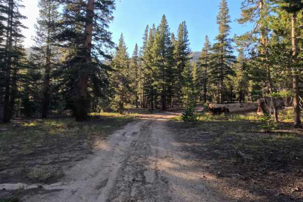
Unnamed Spur off Jobs Peak Trail Road - FS 31051
Winding through a serene, high-elevation alpine forest managed by Humboldt-Toiyabe National Forest, Unnamed Spur 1 branches directly off Jobs Peak Trail Road - FS 31051 as a versatile side route. While it lacks official junction signage at the start, the well-established dirt entrance is easy to spo...
Learn more about Unnamed Spur off Jobs Peak Trail Road - FS 31051
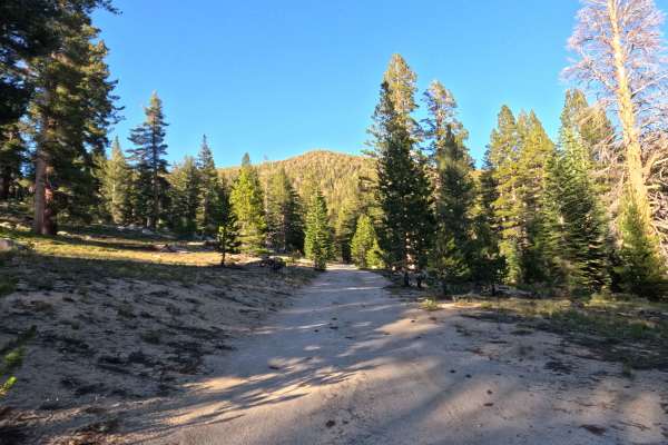
Jobs Peak Trail Spur - FS 31051A
Jobs Peak Trail Road - FS 31051A is a tranquil 0.5-mile out-and-back spur route through alpine forest managed by Humboldt-Toiyabe National Forest. Accessed directly from the main forest road network, this short single-track dirt road serves as a primary access corridor for hikers to reach the Jobs P...
Learn more about Jobs Peak Trail Spur - FS 31051A
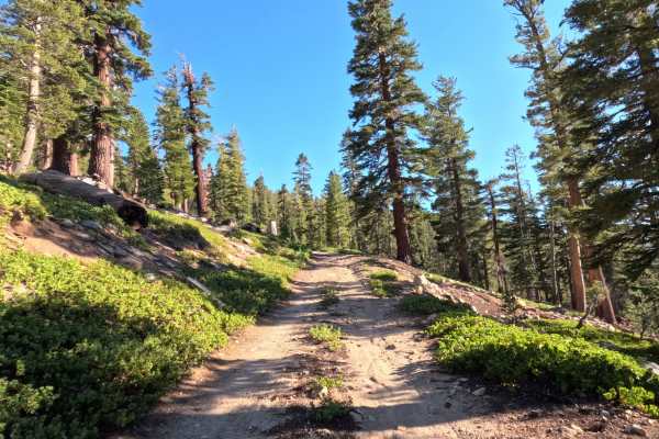
Horse Meadows Spur - FS 31051B
Located in a peaceful, high-altitude forest, Horse Meadows Spur B - FS 31051B is a 1-mile spur route managed by Sequoia National Forest. Accessed via the top of Horse Meadows Road, this trail is primarily used by visitors seeking remote primitive camping and access to nearby high-country hiking trai...
Learn more about Horse Meadows Spur - FS 31051B
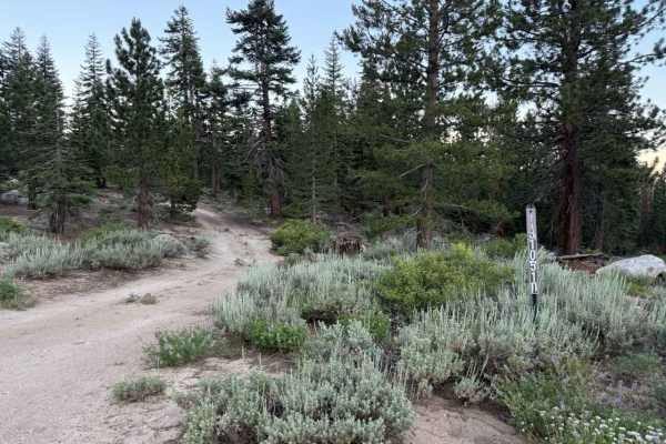
Willow Creek Road - FS 31051D
Winding through a dense, high-elevation pine forest managed by Humboldt-Toiyabe National Forest, Willow Creek Rd 31051D offers a scenic and tranquil loop off Horse Meadows Rd and nearby access points closest to Armstrong Pass Trailhead. Outdoor enthusiasts often utilize this short connector route to...
Learn more about Willow Creek Road - FS 31051D
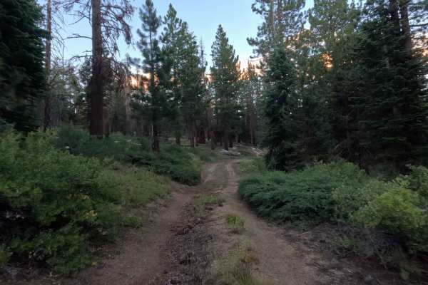
Willow Creek Spur E - FS 31051E
Traversing a high-elevation woodland within the Humboldt-Toiyabe National Forest, Willow Creek Spur E - FS 31051E branches off Willow Creek Road to offer a quiet, secluded out-and-back trek. This short side path leads through remote forest terrain to an established, off-grid campsite boasting sweepi...
Learn more about Willow Creek Spur E - FS 31051E
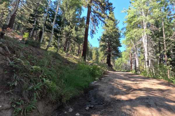
Horse Meadows Rd - FS 31051
Set within a lush high-alpine conifer forest filled with towering pines, quaking aspens, and mountain meadows managed by the Humboldt-Toiyabe National Forest, Horse Meadows Road - FS 31051 offers a scenic mountain ascent. Accessed directly off Luther Pass Road (Hwy 89), this 5.4-mile out-and-back fo...
Learn more about Horse Meadows Rd - FS 31051
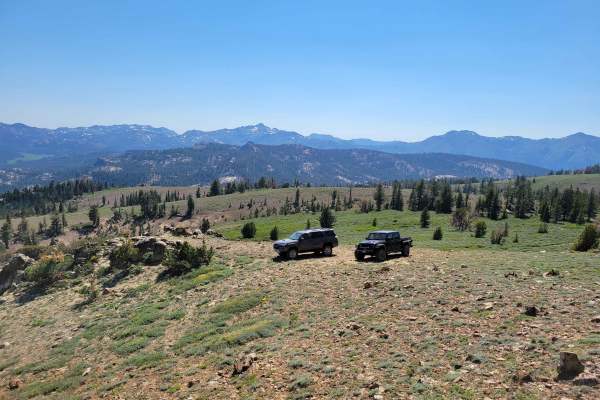
Pistol Point Trail
Pistol Point Trail is one vehicle wide with places to pass on this double track dirt trail. The trail ascends from an elevation of 8,820 feet to a maximum elevation of 9,286 feet. There is a seasonal, shallow, narrow water crossing on this trail. Snow can be found about a mile from the trail head, ...
Learn more about Pistol Point Trail
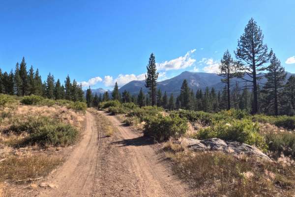
Hawkins Spur C - FS 31019C
Set within a high-elevation coniferous forest featuring dense pine stands, sagebrush slopes, and small aspen groves in the Humboldt-Toiyabe National Forest, Hawkins Spur C - FS 31019C offers an adventurous, off-the-beaten-path mountain excursion. Accessed directly off Hawkins Peak Road - FS 31019, t...
Learn more about Hawkins Spur C - FS 31019C
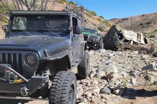
Secret Canyon
This trail offers a rugged adventure, tracing a dry riverbed through a rocky canyon. It's a demanding route, testing both driver skill and vehicle durability. The scenery may not be particularly picturesque, but the trail will thoroughly challenge every bolt, screw, and fastener on your 4x4. To tack...
Learn more about Secret Canyon
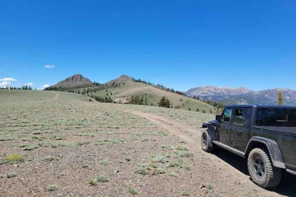
Pickett Peak Road 31053
Pickett Peak Road entrance is marked with USFS number 31053. The gradual ascent is typically one vehicle wide with places to pass on this double-track dirt trail. This first 2.5-mile portion of the trail ascends from an elevation of 7,800 feet to 8,500 feet. The trail descends and then climbs to the...
Learn more about Pickett Peak Road 31053
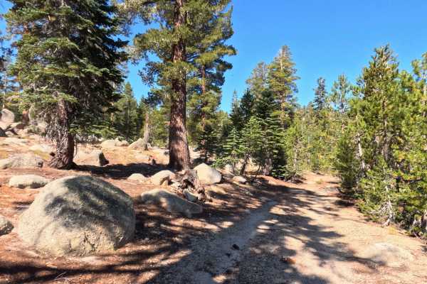
Burnside Lake - FS 31205
Set within an alpine pine forest featuring granite outcrops and grassy mountain clearings in the Humboldt-Toiyabe National Forest, Burnside Lake - FS 31205 offers a quiet, unmaintained backcountry detour. Accessed directly off of main Burnside Lake Road near Hope Valley, this single-lane dirt spur f...
Learn more about Burnside Lake - FS 31205
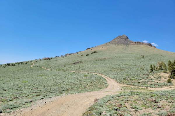
Hawkins Peak Road
Hawkins Peak Road begins as a gradual accent and is typically one vehicle wide with places to pass on this double track dirt trail. The trail gradually ascends from an elevation of 7,057 feet to 9,689 feet. There are no water crossings on this trail. Snow can be found on the East hill side of Hawkin...
Learn more about Hawkins Peak Road
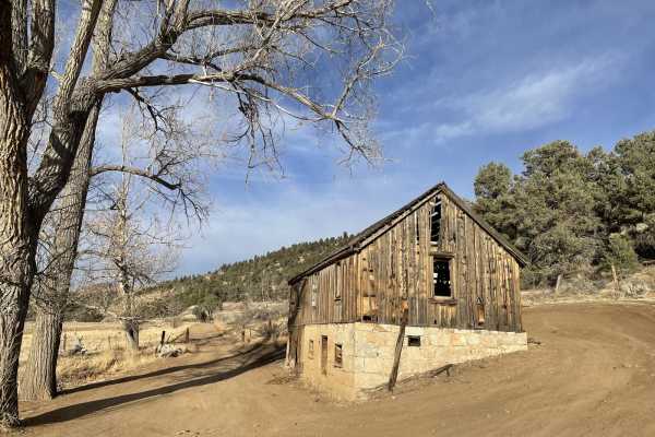
Carson River East Fork Hot Springs Trail
This trail along the East Fork of the Carson River with spectacular views of the River's canyon, the walls peaks of the High Sierra's to the west will not disappoint any mid-level experienced rider. Use caution and be courteous, this may be a high traffic area. The majority of this trail is only wid...
Learn more about Carson River East Fork Hot Springs Trail
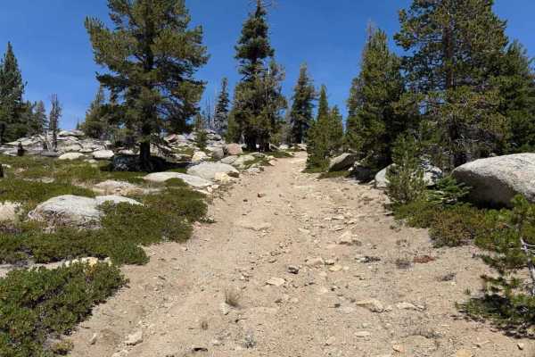
Burnside Spur - FS 31205A
Set within an alpine pine forest featuring granite boulders and sagebrush slopes in the Humboldt-Toiyabe National Forest, Burnside Spur - FS 31205A provides a rugged, quiet high-country excursion. Accessed directly off Burnside Lake Road - FS 31205 near Hope Valley, this single-lane out-and-back spu...
Learn more about Burnside Spur - FS 31205A
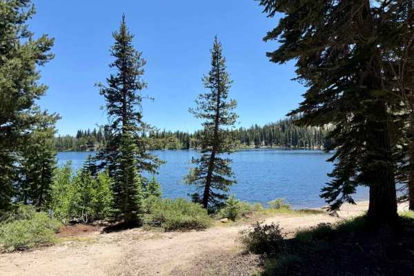
Scotts Lake Road - FS 31079
Set within a picturesque alpine conifer forest intermingled with aspen stands and mountain meadows managed by the Humboldt-Toiyabe National Forest and the Lake Tahoe Basin Management Unit (LTBMU), Scotts Lake Road (FS 31079) offers a scenic high-country mountain drive. Accessed directly off Californ...
Learn more about Scotts Lake Road - FS 31079
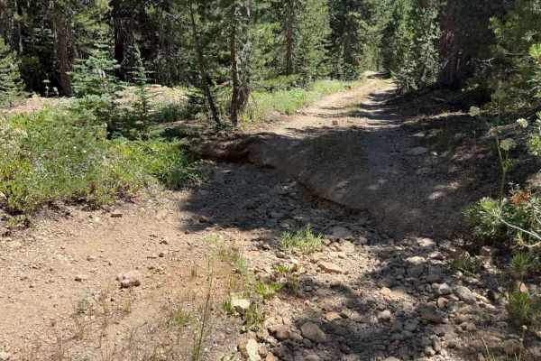
Hawkins Spur D - FS 31205D
Set within a high-elevation alpine forest of Jeffrey pines, firs, and granite outcrops in the Humboldt-Toiyabe National Forest, Hawkins Spur D (FS 31205D) serves as a rugged connector trail linking Burnside Spur A (FS 31205A) down to Burnside Connector Spur B beneath Hawkins Peak. Off-road enthusias...
Learn more about Hawkins Spur D - FS 31205D
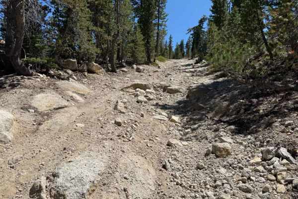
Burnside Connector Spur B - FS 31205B
Set within a serene high-alpine conifer forest of tall Jeffrey pines and granite boulder outcrops in the Humboldt-Toiyabe National Forest, Burnside Connector Spur B (FS 31205B) offers a picturesque mountain detour. Accessed either directly off Burnside Lake Road (FS 31019) or via Hawkins Spur D (FS ...
Learn more about Burnside Connector Spur B - FS 31205B
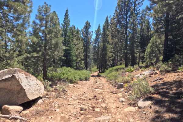
Horseshoe Road - FS 31079B
Set within a fragrant alpine pine forest with a dense evergreen canopy and leafy shrub understory in the Humboldt-Toiyabe National Forest, Horseshoe Road (FS 31079B) offers a short forest loop detour. Accessed twice directly off of Scotts Lake Road (FS 31079) near Scotts Lake, this 0.6-mile single-l...
Learn more about Horseshoe Road - FS 31079B
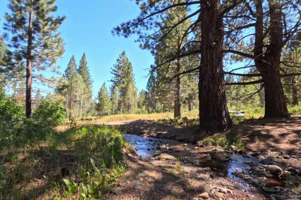
Scotts Trail - FS 21565
Set within a lush high-alpine environment of towering conifer timber, willow-lined creek corridors, and leafy aspen groves in the Humboldt-Toiyabe National Forest, Scotts Trail (FS 21565) offers an engaging mountain connection. Accessed off forest service routes near the Highway 88 corridor, this 2....
Learn more about Scotts Trail - FS 21565
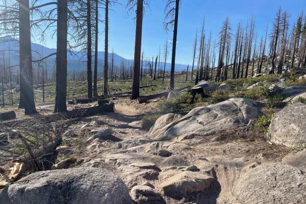
Upper Corral
Upper Corral is a fun and more technical trail in the area. It is quite fun in both directions, but it should be recommended as primarily downhill, to avoid head-to-heads with mountain bikers on one of the most popular and frequently ridden trails in the area. It is quite loose and full of sandier s...
Learn more about Upper Corral
ATV trails near Mesa Vista, California
Explore ATV-friendly trails near you. These trails are accessible for vehicles up to 50 inches wide, perfect for ATVs and smaller off-road machines.
Unnamed Spur off Jobs Peak Trail Road - FS 31051
Winding through a serene, high-elevation alpine forest managed by Humboldt-Toiyabe National Forest, Unnamed Spur 1 branches directly off Jobs Peak Trail Road - FS 31051 as a versatile side route. While it lacks official junction signage at the start, the well-established dirt entrance is easy to spo...
Learn more about Unnamed Spur off Jobs Peak Trail Road - FS 31051
Jobs Peak Trail Spur - FS 31051A
Jobs Peak Trail Road - FS 31051A is a tranquil 0.5-mile out-and-back spur route through alpine forest managed by Humboldt-Toiyabe National Forest. Accessed directly from the main forest road network, this short single-track dirt road serves as a primary access corridor for hikers to reach the Jobs P...
Learn more about Jobs Peak Trail Spur - FS 31051A
Horse Meadows Spur - FS 31051B
Located in a peaceful, high-altitude forest, Horse Meadows Spur B - FS 31051B is a 1-mile spur route managed by Sequoia National Forest. Accessed via the top of Horse Meadows Road, this trail is primarily used by visitors seeking remote primitive camping and access to nearby high-country hiking trai...
Learn more about Horse Meadows Spur - FS 31051B
Willow Creek Road - FS 31051D
Winding through a dense, high-elevation pine forest managed by Humboldt-Toiyabe National Forest, Willow Creek Rd 31051D offers a scenic and tranquil loop off Horse Meadows Rd and nearby access points closest to Armstrong Pass Trailhead. Outdoor enthusiasts often utilize this short connector route to...
Learn more about Willow Creek Road - FS 31051D
UTV/side-by-side trails near Mesa Vista, California
Find UTV and side-by-side trails near you. These trails accommodate vehicles up to 60 inches wide, ideal for UTVs, side-by-sides, and wider off-road rigs.
Unnamed Spur off Jobs Peak Trail Road - FS 31051
Winding through a serene, high-elevation alpine forest managed by Humboldt-Toiyabe National Forest, Unnamed Spur 1 branches directly off Jobs Peak Trail Road - FS 31051 as a versatile side route. While it lacks official junction signage at the start, the well-established dirt entrance is easy to spo...
Learn more about Unnamed Spur off Jobs Peak Trail Road - FS 31051
Jobs Peak Trail Spur - FS 31051A
Jobs Peak Trail Road - FS 31051A is a tranquil 0.5-mile out-and-back spur route through alpine forest managed by Humboldt-Toiyabe National Forest. Accessed directly from the main forest road network, this short single-track dirt road serves as a primary access corridor for hikers to reach the Jobs P...
Learn more about Jobs Peak Trail Spur - FS 31051A
Horse Meadows Spur - FS 31051B
Located in a peaceful, high-altitude forest, Horse Meadows Spur B - FS 31051B is a 1-mile spur route managed by Sequoia National Forest. Accessed via the top of Horse Meadows Road, this trail is primarily used by visitors seeking remote primitive camping and access to nearby high-country hiking trai...
Learn more about Horse Meadows Spur - FS 31051B
Willow Creek Road - FS 31051D
Winding through a dense, high-elevation pine forest managed by Humboldt-Toiyabe National Forest, Willow Creek Rd 31051D offers a scenic and tranquil loop off Horse Meadows Rd and nearby access points closest to Armstrong Pass Trailhead. Outdoor enthusiasts often utilize this short connector route to...
Learn more about Willow Creek Road - FS 31051D
The onX Offroad Difference
onX Offroad combines trail photos, descriptions, difficulty ratings, width restrictions, seasonality, and more in a user-friendly interface. Available on all devices, with offline access and full compatibility with CarPlay and Android Auto. Discover what you're missing today!
Open Trail Map