
Dirt Bike Trails
Near Cromberg, California
Explore All Dirt Bike Trails Near Cromberg, California
Dirt Bike Trails Near Cromberg, California
Discover the best dirt bike trails near you. Browse trail maps, check difficulty ratings, and find your next adventure — whether you're looking for a quick ride or an all-day expedition.
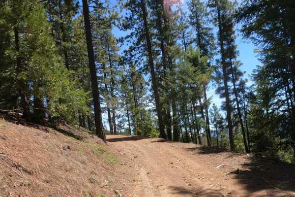
Bonta Ridge - NF23N05Y
Bonta Ridge (Forest Service Road 23N05Y) is an approachable, scenic climb ideal for beginners and scenic tourers looking to explore the rugged beauty of the Plumas National Forest. Starting from Bonta Creek Road just off CA-70, this 3.6-mile dirt and gravel route features a steady ascent with an ele...
Learn more about Bonta Ridge - NF23N05Y
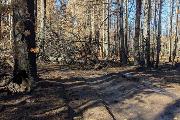
Happy Valley Ridgeline
Mix of fire roads and old logging roads. The area has been scorched by fire recently. There are a lot of downed trees that cross the trail, be prepared with a chain saw or chain/rope. Some trees are too big and require alternate routes. Trail is fairly easy for most of the way. There are a few secti...
Learn more about Happy Valley Ridgeline

Mohawk Creek - FS 22N42
Mohawk Creek - FS 22N42 begins off Mohawk Chapman Road and acts as a steady, twisting dirt climb up the mountain. Forest Service signage at the start indicates that this route was primarily used as a logging road, as supported by the wide, graded dirt surfaces and clearings with slash piles visible ...
Learn more about Mohawk Creek - FS 22N42
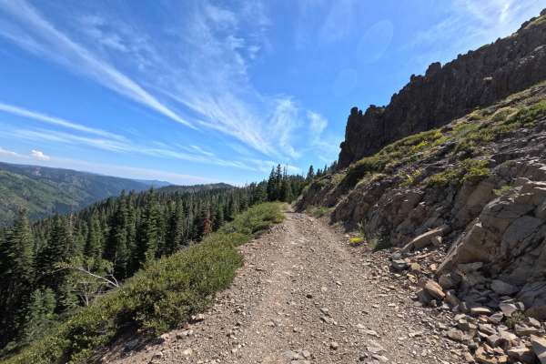
Cowell Mine Road - FS 2308
Cowell Mine Rd - FS 2308 has a bit of a barrier to entry with significant overgrown grass and greenery, along with puddles on each side of the track roughly 6 to 12 inches deep for about 50 yards. Once you pass these potholes, the trail opens up and becomes slightly wider. It is a very loose and une...
Learn more about Cowell Mine Road - FS 2308
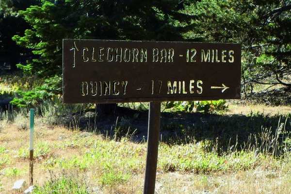
Cleghorn Bar
Cleghorn Bar offers an adventurous off-road trek through Plumas National Forest, making it perfect for intermediate drivers seeking a scenic descent into a remote river canyon. This 11.7-mile route starts along a relatively easy gravel forest road, winding through beautiful mountain valleys and over...
Learn more about Cleghorn Bar
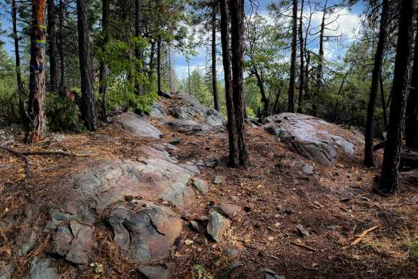
Chandler
Chandler is a fun intermediate option in the Mount Hough Trail System, located near the Four Corners Trailhead. This one has a couple intermediate rock features, plus a scenic view on the south end of the loop. It makes a 4.1-mile-long loop, that is mostly a gradual grade as it winds through the spa...
Learn more about Chandler

Spencer Lakes OHV - FS 11M01
Welcome to Spencer Lakes off-highway vehicle trail, a rewarding but rugged little adventure tucked into the alpine trees! The journey begins beautifully but quickly drops into a steep, loose rock descent that occasionally transitions into soft, sandy spots. As you make your way further down, the est...
Learn more about Spencer Lakes OHV - FS 11M01

Mohawk Chapman Road - FS 22N98
While the entire road stretches for roughly 12 miles, this specific adventure covers the upper 7.5-mile unpaved segment as it climbs gently toward Chapman Saddle. This is a classic, highly scenic Forest Service road, featuring a wide, well-maintained path framed by towering pine trees that offer won...
Learn more about Mohawk Chapman Road - FS 22N98
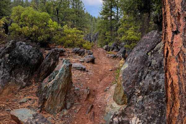
Taylor Creek
Taylor Creek is a fun single track that starts near the Four Corners Trailhead in the Mount Hough trail system. It winds for 5.6 miles through the low alpine hills, gradually ascending over 1,600 feet elevation from south to north. A majority of the trail is fast and flowy with tight curves through ...
Learn more about Taylor Creek
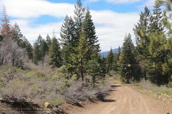
Sugarpine - NF22N55
Dirt Forest Service road accessing a network of roads climbing Beckwourth Mountain just outside of Portola, California. This looks to be the primary route accessing the summit from town. The road is wider and looks more maintained. These roads start at 5,000 feet and climb up to over 7,000 feet, so ...
Learn more about Sugarpine - NF22N55
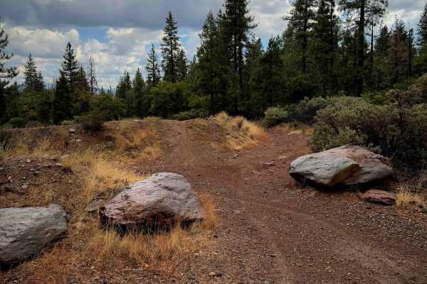
MX Track
The MX track is located at the Four Corners Trailhead, and it makes an easy loop that is less than half a mile long. It’s a more primitive track with a light layer of small loose rocks on it in spots, shallow ruts, and small embedded rocks. It’s lined with small pine trees and shrubs. There are a fe...
Learn more about MX Track
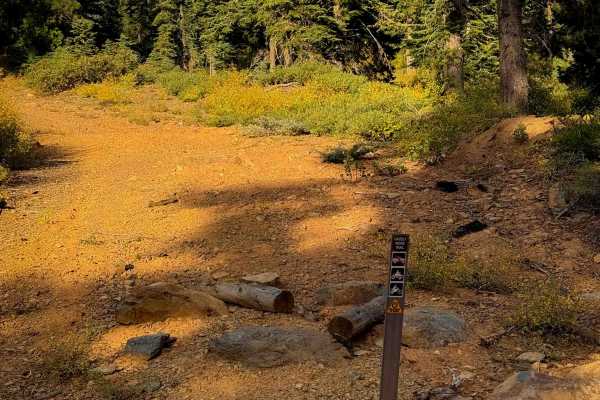
Grizzly Ridge
This is one of only a couple ATV options within the Mount Hough trail system. It is 1.9 miles long, and starts out on the west end by climbing straight up a hillside on a more primitive trail that looks like it used to be a road. It’s pretty smooth with a few ruts. It narrows up about half way throu...
Learn more about Grizzly Ridge
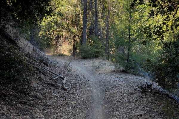
Berry Creek
Berry Creek is a 2.2-mile-long moderate dirt bike trail in the Mount Hough trail system. From the west end, it starts off flowy and flat along an old shelf, going through a shaded corridor. It crosses a small rocky dry ravine bottom, then goes up a couple of moderate switchbacks and gets pretty stee...
Learn more about Berry Creek
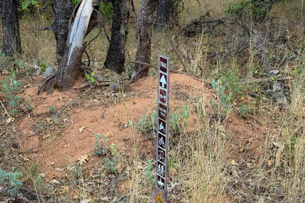
Fireline
The west end of Fireline starts across the road from the Berry Creek Tie, and it makes a .7 mile long loop to the main road (403) just south of the 4 Corners staging area. It’s a very easy and approachable trail, being a wide single track through a dry and sparse pine forest. The trail meanders alon...
Learn more about Fireline
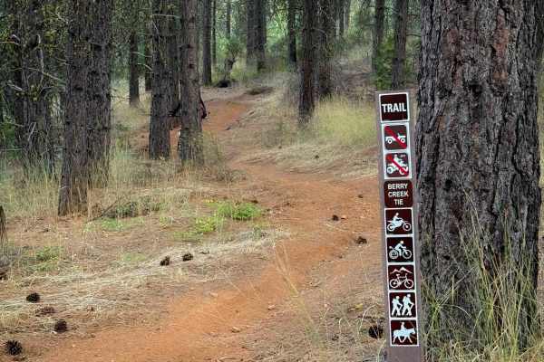
Berry Creek Tie
This is a short connector trail in the Mount Hough trail system. The south end starts across from the Fireline trail, and after .6 miles it joins the Berry Creek Trail. It’s overall very easy and gradual, with the steepest part being on the south end as it descends through a couple of gradual switc...
Learn more about Berry Creek Tie

Mohawk heights road - FS 21N21
Winding through the forest, Mohawk Heights Road - FS 21N21 is a largely unmaintained dirt trail that descends for the majority of its 1.2-mile length. The route is overgrown in several places, with branches hanging close to the roadway, and ultimately ends abruptly with several downed trees blocking...
Learn more about Mohawk heights road - FS 21N21

Haskell Cross - FS 21N91
Haskell Cross - FS 21N91 is accessed from Haskell Sheep Ranch Road and connects to Mohawk Chapman. This route is a nice, winding forest road that functions mostly as a tree-lined "forest tunnel." While it lacks sweeping scenic views or major points of interest, it serves as an excellent, time-saving...
Learn more about Haskell Cross - FS 21N91
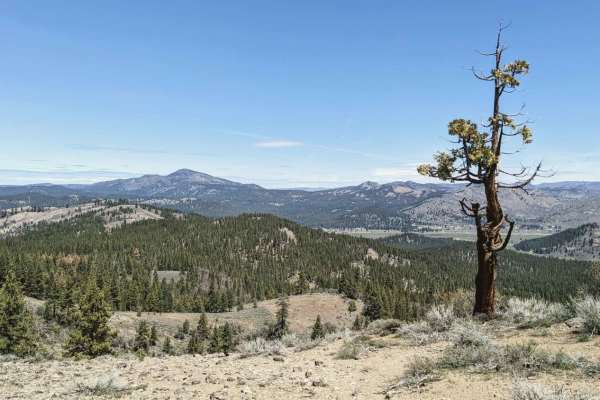
Beckwourth - NF23N03
Beckwourth - NF23N03 is an ideal introductory route for four-wheel-drive vehicles, SxSs, and high-clearance rigs looking to access the sprawling network of forest service roads on Beckwourth Mountain. Starting right outside of Portola, California, at an elevation of 4,875 feet, this 3.45-mile dirt a...
Learn more about Beckwourth - NF23N03
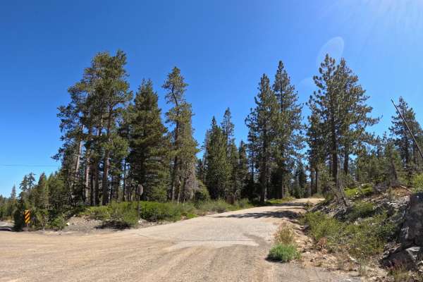
Church meadow road - FS 721
Starting near Gold Lake, Church Meadow Road is a pretty easy, manageable trail suitable for all vehicles. The route features a dirt and gravel surface with occasional loose granite rocks that are easy for all skill levels to navigate. The difficulty remains consistently low throughout the entire dri...
Learn more about Church meadow road - FS 721
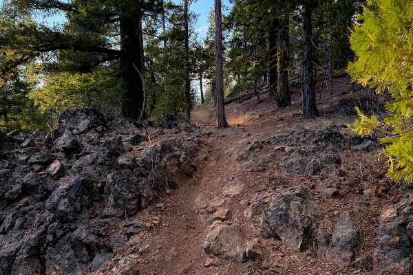
Kings Crossing
The east end of this easy connector trail starts at the road intersection of 10M25 and 25N10Y, and it goes west to 403. There’s a small additional piece of trail that connects to the Mount Hough Trail on the west side of 403. From the east end, it weaves around a rock outcropping, then passes the in...
Learn more about Kings Crossing
ATV trails near Cromberg, California
Explore ATV-friendly trails near you. These trails are accessible for vehicles up to 50 inches wide, perfect for ATVs and smaller off-road machines.
Bonta Ridge - NF23N05Y
Bonta Ridge (Forest Service Road 23N05Y) is an approachable, scenic climb ideal for beginners and scenic tourers looking to explore the rugged beauty of the Plumas National Forest. Starting from Bonta Creek Road just off CA-70, this 3.6-mile dirt and gravel route features a steady ascent with an ele...
Learn more about Bonta Ridge - NF23N05Y
Happy Valley Ridgeline
Mix of fire roads and old logging roads. The area has been scorched by fire recently. There are a lot of downed trees that cross the trail, be prepared with a chain saw or chain/rope. Some trees are too big and require alternate routes. Trail is fairly easy for most of the way. There are a few secti...
Learn more about Happy Valley Ridgeline
Mohawk Creek - FS 22N42
Mohawk Creek - FS 22N42 begins off Mohawk Chapman Road and acts as a steady, twisting dirt climb up the mountain. Forest Service signage at the start indicates that this route was primarily used as a logging road, as supported by the wide, graded dirt surfaces and clearings with slash piles visible ...
Learn more about Mohawk Creek - FS 22N42
Cowell Mine Road - FS 2308
Cowell Mine Rd - FS 2308 has a bit of a barrier to entry with significant overgrown grass and greenery, along with puddles on each side of the track roughly 6 to 12 inches deep for about 50 yards. Once you pass these potholes, the trail opens up and becomes slightly wider. It is a very loose and une...
Learn more about Cowell Mine Road - FS 2308
UTV/side-by-side trails near Cromberg, California
Find UTV and side-by-side trails near you. These trails accommodate vehicles up to 60 inches wide, ideal for UTVs, side-by-sides, and wider off-road rigs.
Bonta Ridge - NF23N05Y
Bonta Ridge (Forest Service Road 23N05Y) is an approachable, scenic climb ideal for beginners and scenic tourers looking to explore the rugged beauty of the Plumas National Forest. Starting from Bonta Creek Road just off CA-70, this 3.6-mile dirt and gravel route features a steady ascent with an ele...
Learn more about Bonta Ridge - NF23N05Y
Happy Valley Ridgeline
Mix of fire roads and old logging roads. The area has been scorched by fire recently. There are a lot of downed trees that cross the trail, be prepared with a chain saw or chain/rope. Some trees are too big and require alternate routes. Trail is fairly easy for most of the way. There are a few secti...
Learn more about Happy Valley Ridgeline
Mohawk Creek - FS 22N42
Mohawk Creek - FS 22N42 begins off Mohawk Chapman Road and acts as a steady, twisting dirt climb up the mountain. Forest Service signage at the start indicates that this route was primarily used as a logging road, as supported by the wide, graded dirt surfaces and clearings with slash piles visible ...
Learn more about Mohawk Creek - FS 22N42
Cowell Mine Road - FS 2308
Cowell Mine Rd - FS 2308 has a bit of a barrier to entry with significant overgrown grass and greenery, along with puddles on each side of the track roughly 6 to 12 inches deep for about 50 yards. Once you pass these potholes, the trail opens up and becomes slightly wider. It is a very loose and une...
Learn more about Cowell Mine Road - FS 2308
The onX Offroad Difference
onX Offroad combines trail photos, descriptions, difficulty ratings, width restrictions, seasonality, and more in a user-friendly interface. Available on all devices, with offline access and full compatibility with CarPlay and Android Auto. Discover what you're missing today!
Open Trail Map