
Dirt Bike Trails
Near Plumas Eureka, California
Explore All Dirt Bike Trails Near Plumas Eureka, California
Dirt Bike Trails Near Plumas Eureka, California
Discover the best dirt bike trails near you. Browse trail maps, check difficulty ratings, and find your next adventure — whether you're looking for a quick ride or an all-day expedition.
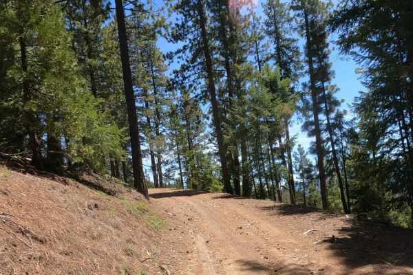
Bonta Ridge - NF23N05Y
Bonta Ridge (Forest Service Road 23N05Y) is an approachable, scenic climb ideal for beginners and scenic tourers looking to explore the rugged beauty of the Plumas National Forest. Starting from Bonta Creek Road just off CA-70, this 3.6-mile dirt and gravel route features a steady ascent with an ele...
Learn more about Bonta Ridge - NF23N05Y

Mohawk Creek - FS 22N42
Mohawk Creek - FS 22N42 begins off Mohawk Chapman Road and acts as a steady, twisting dirt climb up the mountain. Forest Service signage at the start indicates that this route was primarily used as a logging road, as supported by the wide, graded dirt surfaces and clearings with slash piles visible ...
Learn more about Mohawk Creek - FS 22N42
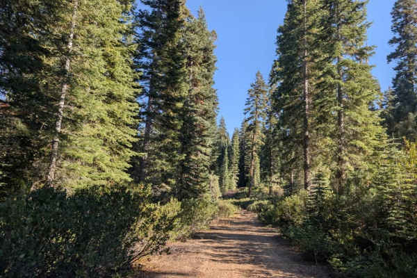
Willow Creek Road
This user-maintained trail offers a comfortable, easygoing drive through the valley and makes a great alternative to the main road if you want to avoid the steeper climb into the mountains. The route stays at a lower elevation, offering a more relaxed way to cross the area without the same ascent an...
Learn more about Willow Creek Road

Mohawk Chapman Road - FS 22N98
While the entire road stretches for roughly 12 miles, this specific adventure covers the upper 7.5-mile unpaved segment as it climbs gently toward Chapman Saddle. This is a classic, highly scenic Forest Service road, featuring a wide, well-maintained path framed by towering pine trees that offer won...
Learn more about Mohawk Chapman Road - FS 22N98
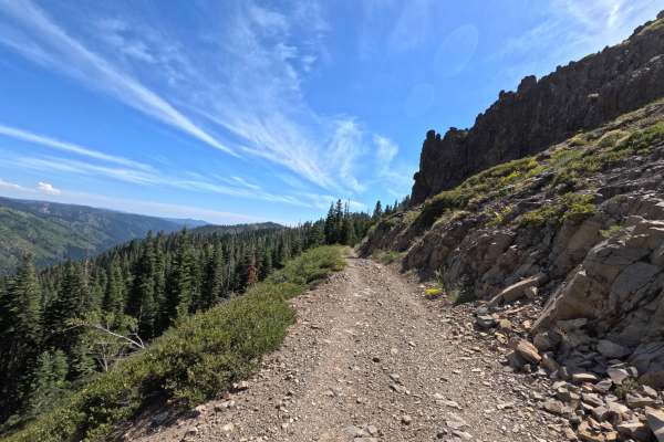
Cowell Mine Road - FS 2308
Cowell Mine Rd - FS 2308 has a bit of a barrier to entry with significant overgrown grass and greenery, along with puddles on each side of the track roughly 6 to 12 inches deep for about 50 yards. Once you pass these potholes, the trail opens up and becomes slightly wider. It is a very loose and une...
Learn more about Cowell Mine Road - FS 2308
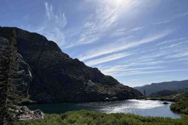
Spencer Lakes OHV - FS 11M01
Welcome to Spencer Lakes off-highway vehicle trail, a rewarding but rugged little adventure tucked into the alpine trees! The journey begins beautifully but quickly drops into a steep, loose rock descent that occasionally transitions into soft, sandy spots. As you make your way further down, the est...
Learn more about Spencer Lakes OHV - FS 11M01

Mohawk heights road - FS 21N21
Winding through the forest, Mohawk Heights Road - FS 21N21 is a largely unmaintained dirt trail that descends for the majority of its 1.2-mile length. The route is overgrown in several places, with branches hanging close to the roadway, and ultimately ends abruptly with several downed trees blocking...
Learn more about Mohawk heights road - FS 21N21

Haskell Cross - FS 21N91
Haskell Cross - FS 21N91 is accessed from Haskell Sheep Ranch Road and connects to Mohawk Chapman. This route is a nice, winding forest road that functions mostly as a tree-lined "forest tunnel." While it lacks sweeping scenic views or major points of interest, it serves as an excellent, time-saving...
Learn more about Haskell Cross - FS 21N91
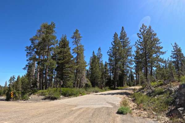
Church meadow road - FS 721
Starting near Gold Lake, Church Meadow Road is a pretty easy, manageable trail suitable for all vehicles. The route features a dirt and gravel surface with occasional loose granite rocks that are easy for all skill levels to navigate. The difficulty remains consistently low throughout the entire dri...
Learn more about Church meadow road - FS 721

FS 822
FS 822 starts from its north end, immediately descending gradually for the first 100 yards. The surface is primarily dominated by loose rock, though it transitions into more embedded, solid rock farther along the trail. While mostly straightforward, there is one section where additional ground clear...
Learn more about FS 822
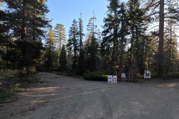
Gold Lake Shore Lower Segment - FS 12M01
Gold Lake Shore Lower Segment (FS 12M01) picks up where the upper descent ends, leveling out to follow the shoreline of Gold Lake. Once you reach the bottom of the descent, the trail transitions into a series of embedded, sharp rocky features and rock gardens that require a high-clearance vehicle to...
Learn more about Gold Lake Shore Lower Segment - FS 12M01

Mills Peak - FS 12E74
The trail kicks off at the intersection of 721 Church Meadow Road, starting with an easy, gradual climb. As you pass through the towering fir forest, the terrain becomes a bit more difficult, requiring slower travel for low-clearance vehicles. Along the way, you'll catch intermittent views of nearby...
Learn more about Mills Peak - FS 12E74

Church Creek - FS 28
Church Creek - FS 28 begins on the eastern end of Forest Road 721. The road is generally flat and passes through densely forested sections. The surface is mostly hard-packed sand with a few short sections of loose rock. You will see several downed trees alongside the trail, but it currently remains ...
Learn more about Church Creek - FS 28
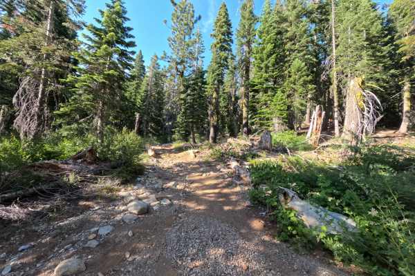
Snake Lake Trail - FS 12E67
Approaching from the Gold Valley OHV Trail, Snake Lake (FS 12E67) wastes no time letting you know exactly what kind of ride you are in for. The trail immediately greets you with a steep, incredibly loose, and rocky climb. Early on, you will navigate a densely wooded area heavily impacted by timber f...
Learn more about Snake Lake Trail - FS 12E67
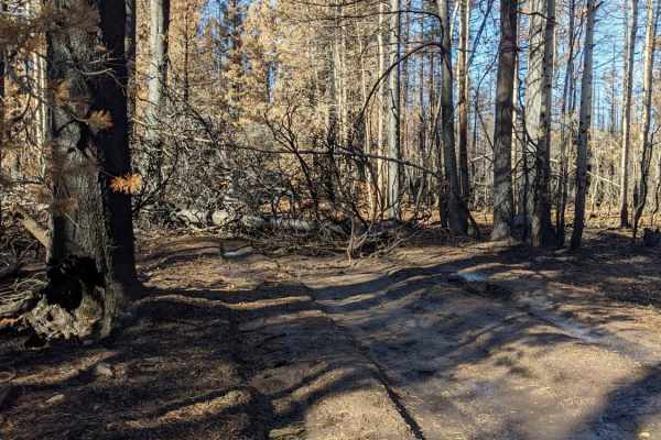
Happy Valley Ridgeline
Mix of fire roads and old logging roads. The area has been scorched by fire recently. There are a lot of downed trees that cross the trail, be prepared with a chain saw or chain/rope. Some trees are too big and require alternate routes. Trail is fairly easy for most of the way. There are a few secti...
Learn more about Happy Valley Ridgeline
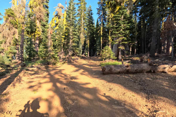
Gold Lake Shore Upper Segment - FS 12M01
Gold Lake Shore Upper Segment (FS 12M01) is accessed directly from the Snake Lake Trail. The upper section of the trail, prior to the main descent, features numerous prime camping opportunities with stunning overlooks of Gold Lake. As the trail descends, you will encounter a couple of deep, loose se...
Learn more about Gold Lake Shore Upper Segment - FS 12M01
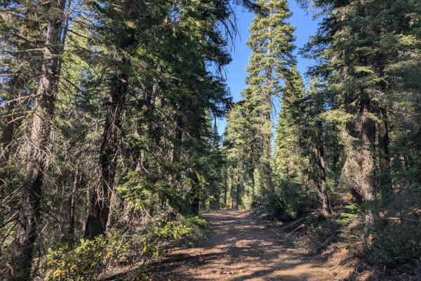
FS 24N55
This user-maintained trail branches off a nearby route and provides a scenic connection back to 24N10. The initial section is relatively straightforward, with one dip that adds a little interest before the trail continues through open forest. The surroundings are beautiful, and the route makes for a...
Learn more about FS 24N55
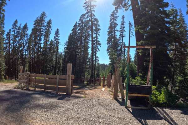
Pauley Creek - FS 93-003
Pauley Creek - FS 93-003, a wonderfully scenic and remarkably smooth journey that is perfect for a relaxing day out in the woods. This beautiful, wide gravel road winds its way comfortably through a lovely, medium-density pine forest, offering plenty of dappled shade along the route. As you cruise a...
Learn more about Pauley Creek - FS 93-003
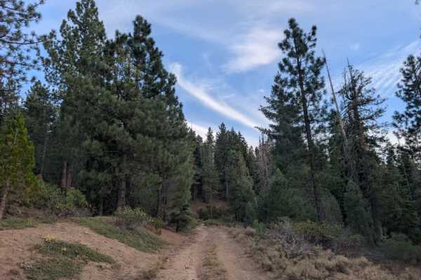
FS 24N74Y
This well-maintained trail sees regular use from adventurers and offers a varied drive through the mountains and surrounding valleys. The route climbs through rocky sections before descending into lower areas with marshland and more open scenery. Although the surface is generally manageable, watch f...
Learn more about FS 24N74Y

Church Creek Spur - Fs 28-004
Church Creek Spur - FS 28-004 is accessed directly from Church Creek Road. The trail begins with a manageable Level 2 difficulty, but the loose rocks become progressively larger as you continue. About halfway through, drivers will encounter several off-camber sections and a partially cleared cluster...
Learn more about Church Creek Spur - Fs 28-004
ATV trails near Plumas Eureka, California
Explore ATV-friendly trails near you. These trails are accessible for vehicles up to 50 inches wide, perfect for ATVs and smaller off-road machines.
Bonta Ridge - NF23N05Y
Bonta Ridge (Forest Service Road 23N05Y) is an approachable, scenic climb ideal for beginners and scenic tourers looking to explore the rugged beauty of the Plumas National Forest. Starting from Bonta Creek Road just off CA-70, this 3.6-mile dirt and gravel route features a steady ascent with an ele...
Learn more about Bonta Ridge - NF23N05Y
Mohawk Creek - FS 22N42
Mohawk Creek - FS 22N42 begins off Mohawk Chapman Road and acts as a steady, twisting dirt climb up the mountain. Forest Service signage at the start indicates that this route was primarily used as a logging road, as supported by the wide, graded dirt surfaces and clearings with slash piles visible ...
Learn more about Mohawk Creek - FS 22N42
Willow Creek Road
This user-maintained trail offers a comfortable, easygoing drive through the valley and makes a great alternative to the main road if you want to avoid the steeper climb into the mountains. The route stays at a lower elevation, offering a more relaxed way to cross the area without the same ascent an...
Learn more about Willow Creek Road
Mohawk Chapman Road - FS 22N98
While the entire road stretches for roughly 12 miles, this specific adventure covers the upper 7.5-mile unpaved segment as it climbs gently toward Chapman Saddle. This is a classic, highly scenic Forest Service road, featuring a wide, well-maintained path framed by towering pine trees that offer won...
Learn more about Mohawk Chapman Road - FS 22N98
UTV/side-by-side trails near Plumas Eureka, California
Find UTV and side-by-side trails near you. These trails accommodate vehicles up to 60 inches wide, ideal for UTVs, side-by-sides, and wider off-road rigs.
Bonta Ridge - NF23N05Y
Bonta Ridge (Forest Service Road 23N05Y) is an approachable, scenic climb ideal for beginners and scenic tourers looking to explore the rugged beauty of the Plumas National Forest. Starting from Bonta Creek Road just off CA-70, this 3.6-mile dirt and gravel route features a steady ascent with an ele...
Learn more about Bonta Ridge - NF23N05Y
Mohawk Creek - FS 22N42
Mohawk Creek - FS 22N42 begins off Mohawk Chapman Road and acts as a steady, twisting dirt climb up the mountain. Forest Service signage at the start indicates that this route was primarily used as a logging road, as supported by the wide, graded dirt surfaces and clearings with slash piles visible ...
Learn more about Mohawk Creek - FS 22N42
Willow Creek Road
This user-maintained trail offers a comfortable, easygoing drive through the valley and makes a great alternative to the main road if you want to avoid the steeper climb into the mountains. The route stays at a lower elevation, offering a more relaxed way to cross the area without the same ascent an...
Learn more about Willow Creek Road
Mohawk Chapman Road - FS 22N98
While the entire road stretches for roughly 12 miles, this specific adventure covers the upper 7.5-mile unpaved segment as it climbs gently toward Chapman Saddle. This is a classic, highly scenic Forest Service road, featuring a wide, well-maintained path framed by towering pine trees that offer won...
Learn more about Mohawk Chapman Road - FS 22N98
The onX Offroad Difference
onX Offroad combines trail photos, descriptions, difficulty ratings, width restrictions, seasonality, and more in a user-friendly interface. Available on all devices, with offline access and full compatibility with CarPlay and Android Auto. Discover what you're missing today!
Open Trail Map