Best Off-Road Trails in Arizona: 2020
If you’re planning an off-roading trip, make sure Arizona is on the list. From Flagstaff to Sedona to Lake Havasu to Tucson, you’ll find adventurous trails for every skill level year round. Cruise high mountain trails and roads in the summer, or drop into canyons and rip sandy washes in the winter.
We came up with a list of our favorite Arizona trails at onX Offroad, but this is just the beginning. Hop into your App, zoom to Arizona, and tap Discover in the bottom menu to discover even more off-road trails.
Looking for more trails? See more off-road trails in Sedona
Best Arizona Off-Road Trails of 2020
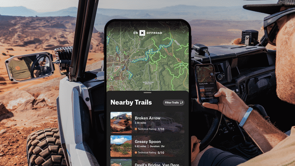
Broken Arrow
Difficulty: Difficult / Distance: 3 miles
Get ready for a rowdy day on this beautiful red rock trail outside of Sedona. High clearance vehicles are recommended for the ledges (especially The Steps obstacle). The trail gets narrow at times, and you can expect occasional traffic. It’s all worth it for the stunning views.
Smiley Rock
Difficulty: Difficult / Distance: 23 miles
Enjoy great views of Verde Valley along this relatively moderate road. But be warned: this is rated difficult because of a challenging, narrow and rocky section through Martin Canyon. Leave enough time to visit Jerome, a very cool town built on a cliff. Modified, high clearance vehicles recommended.
Backway to Crown King
Difficulty: Moderate-Difficult / Distance: 25 Miles
This is a popular trail for good reason. It has a little something for everyone, including great views, climbs, and a few obstacles. The trail changes every year with rain and erosion, so come prepared with a 4×4 vehicle and off-roading skills. Unlicensed vehicles are okay on roads in Prescott National Forest. Keep it street legal on Cow Creek Road. Pro tip: Make sure to leave time for a detour to the Cleator Yacht Club. This bar in the middle of nowhere has half-buried boats, surfboard tables, and hosts monthly 4×4 runs.
Bloody Basin Road to Sheep’s Bridge
Difficulty: Easy / Distance: 37 miles
Spend the day driving this relatively easy road to Agua Fria National Monument. Take some extra time to explore archaeological sites and petroglyphs along the way. You can also enjoy a warm soak in the natural hot springs north of the bridge on the west side. Unlicensed vehicles are allowed in this area. The road gets a little rockier as you descend to the bridge. Use caution in wet conditions. Bloody Basin road can be connected to the Backway to Crown King trail by crossing I-17 South of Cordes Junction, or take the cave creek rd 24 towards Cave Creek and the Phoenix Valley.
El Camino del Diablo
Difficulty: Easy / Distance: 91 miles
Enter at your own risk! El Camino del Diablo is a relatively easy road through the desert that passes through historic old towns, Organ Pipe Cactus National Monument, Cabeza Prieta National Wildlife Refuge, and Goldwater Range. However, risks can be extremely severe and even life-threatening. This route passes through a military zone and an active smuggling region. You will need to obtain a permit through the BLM and sign waivers against vehicle damage, dismemberment, and death. Plan ahead by downloading your maps on multiple devices, carrying plenty of food and water, and packing emergency gear, especially for cold nights.