How to Use onX Offroad
onX Offroad is like having 5,000 paper maps in the palm of your hand. It’s accessing the best trail and road data with the tap of a finger. It’s customizing your maps your way with tracked trips, photo Waypoints and downloaded maps. onX Offroad is the ultimate tool for adventure off the pavement.
Below are a few ways to help you make the most of your onX Offroad App.

Trail Legend
Get familiar with your Offroad map with a few of these fast tips:
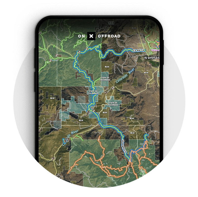
- Blue trails = “Featured” with photos, difficulty ratings, descriptions and more.
- Green trails = Open and ready to go. Tap for more details.
- Red trails = Temporarily closed.
- Black and white dashed trails = Hiking, biking and/or equestrian trails
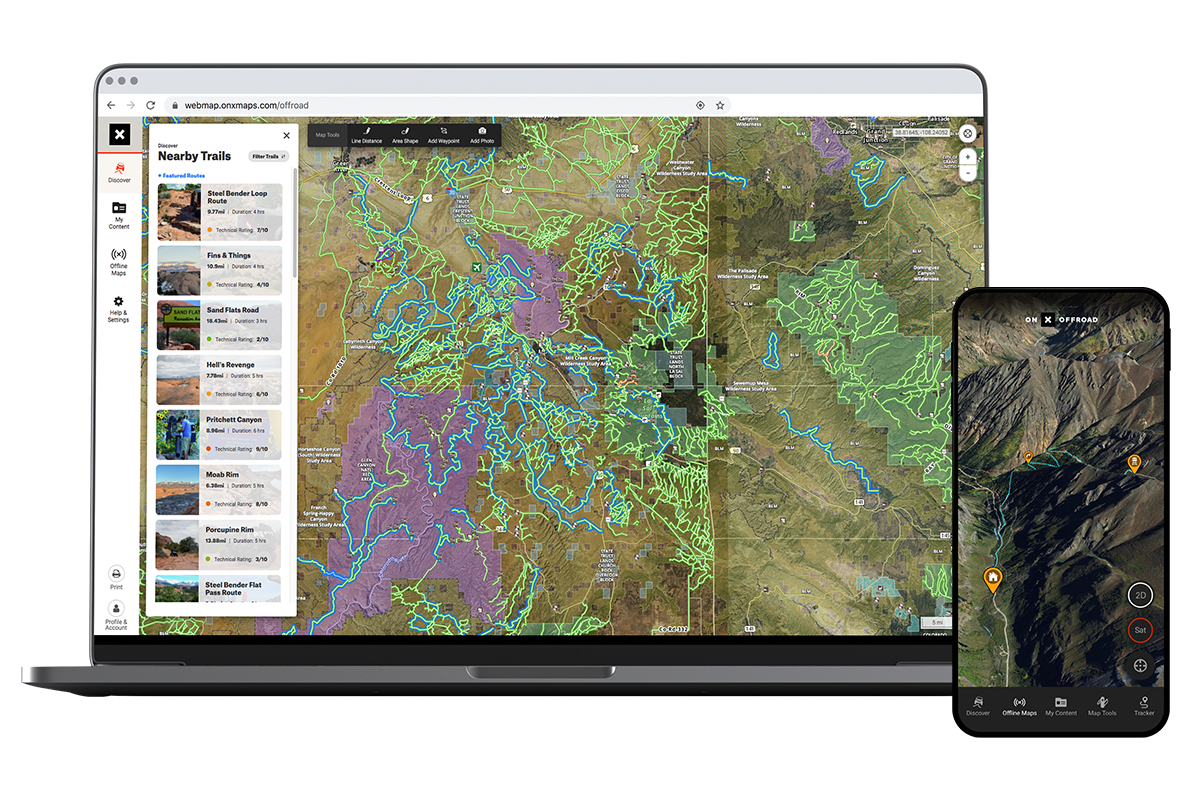
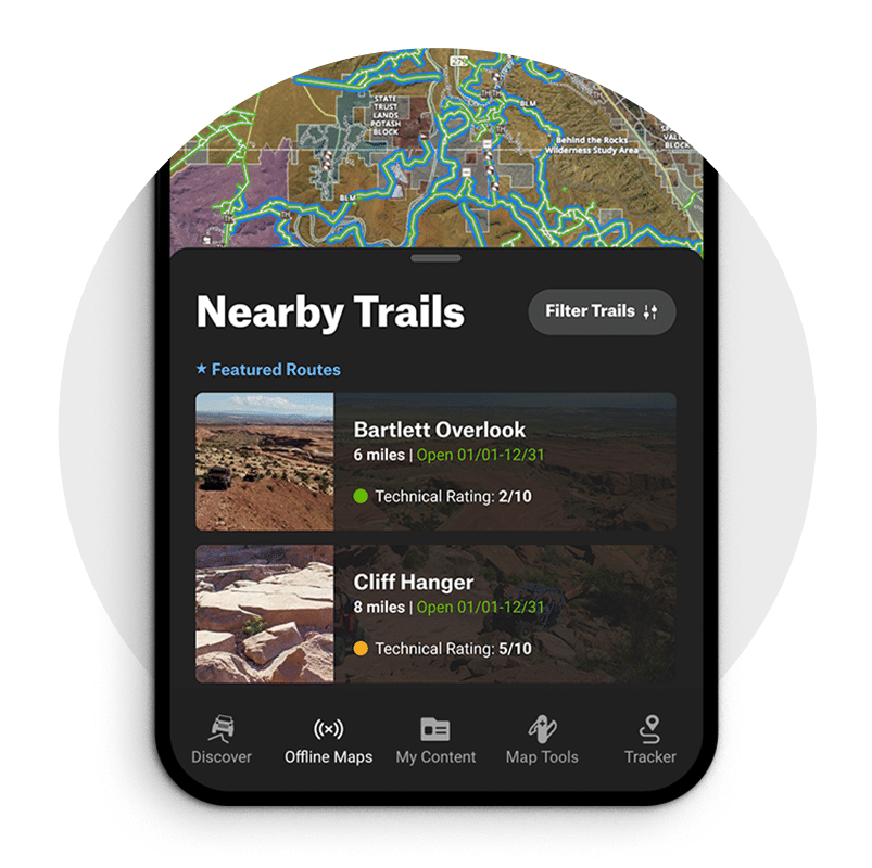
Discover Trails Near You
Whether you’re looking for trails close to home or across the country, we have you covered. Tap “Discover” in the bottom menu to find trails within 100 miles of you. Tap a trail to see difficulty ratings, mileage, photos and vehicle restrictions.
What’s Up With the Blue Trails?
Look for blue, or “Featured,” trails in your App around the country. Tap a blue trail for detailed trail descriptions, difficulty ratings, distance, photos and more. You can also tap “Share Trail” to send it to other Offroad users.
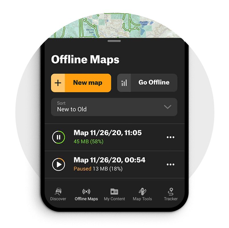
Download Your Maps Before You Go
No service? No problem. We have you covered. Before you head out, take just a minute to download the maps you need. Tap “Offline Maps” in the lower menu and then “New Offline Map.” One question we see a lot is, “can your phone’s GPS work offline?” and the answer is absolutely. It can track your location even without cell service, meaning you can still use the location finder, Tracker, and have full access to all trail details and the ability to add Waypoints.

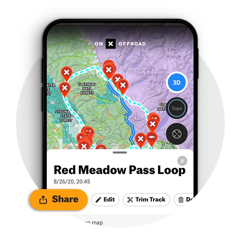
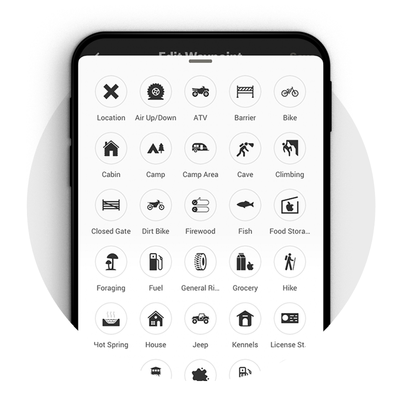
Add Waypoints to the Map
Customize your map by adding Waypoints for spots such as camp, a closed gate, non-ethanol fuel stations, obstacles and more. Tap anywhere on the map to add a Waypoint, or go to “Map Tools” in the lower menu to add map markups. Waypoints can be easily saved and shared with other Offroad users.
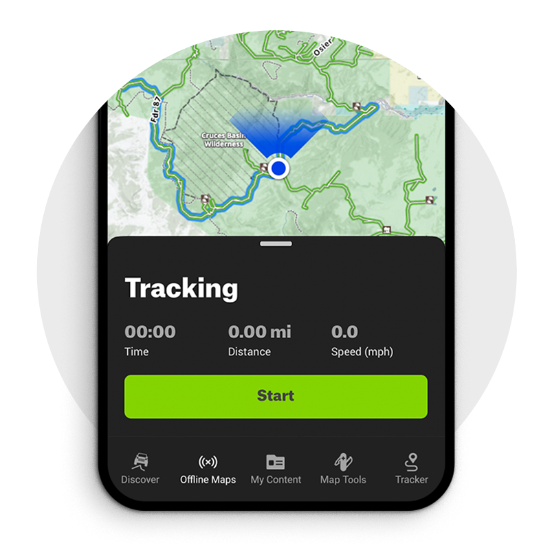
Track Your Trips
We all know how important bread crumbs can be in the backcountry. Use the Tracker feature to track your trips, even without cell service. The Tracker also records your time, distance and speed, and can be shared with other Offroad users.
Trail Difficulty Ratings
Tap a blue trail and scroll down to view the difficulty rating from 1-10. These technical ratings provide an idea of what you might encounter on a trail or road. Remember though, trail conditions change frequently and can impact the difficulty rating. Use your best judgment and know what your vehicle can handle.