
Beginner Off-Road Trails
Near Amherst Junction, Wisconsin
Explore All Beginner Trails Near Amherst Junction, Wisconsin
Beginner Off-Road Trails Near Amherst Junction, Wisconsin
Discover the best beginner-friendly off-road trails near you. These easier, lower-rated trails are a great place to start — browse trail maps, check difficulty ratings, and find your next adventure.

Pine Bluff
This is a short route through the rolling hills, forests, and fields of central Wisconsin. This route will take you on gravel roads through a scenic rural area of central Wisconsin. The route is generally well-maintained and accessible to all road vehicles during the 3 non-winter seasons. The east e...
Learn more about Pine Bluff

White River Road
The road is a narrow gravel road through the White River Wildlife Area. The road is gravel/dirt and flat with several parking areas for hiking, hunting, and photography. Sections of the road are only 1 vehicle wide and you can not pass another vehicle. Central Wisconsin is not known for its offroad ...
Learn more about White River Road
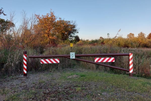
Dead End Road
This is mostly 2 track dirt/gravel road. The road is flat with no large obstacles. As the name implies it is a dead end out and back. Being a single lane out and back, encountering another person will make passing an adventure so drive slowly and watch for others. There are large parking areas at th...
Learn more about Dead End Road
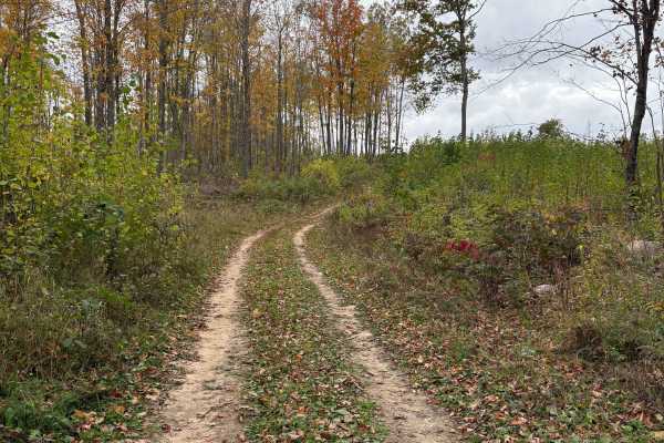
Hemlock North/South
Part of the Langlade OHMV trail system, this permit-only trail is an easy loop that leads to Hemlock Ridge. Hard park dirt and gravel with minimal trail features. It is divided up into North Hemlock and South Hemlock, but they tie together at the trail head of Hemlock Ridge, and both lead to the acc...
Learn more about Hemlock North/South
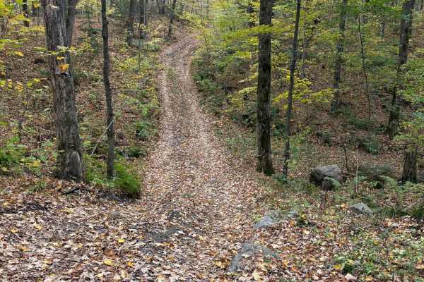
Porkey Lake Loop
The Porkey Lake Loop is part of the Langlade OHMV trail system and is rated as an "Access Trail". It is a mellow, easy trail that brings you to the trail head for "No-Eye-Deer (Rock Crawl)" and "John's Rock Crawl". It features small hills, few rocks, and a few horseback trails.
Learn more about Porkey Lake Loop
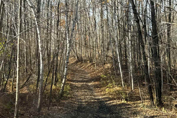
Norway Lake Loop
The Norway Lake Loop is a point-to-point trail that picks up on the eastern end from Porkey Lake Loop. It is primarily a dirt two-track with several sections of rocks and mud sections to cross. Expect a few mud holes, loose rock, and a few moderately steep sections.
Learn more about Norway Lake Loop
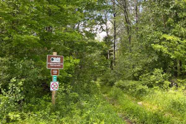
Luana Land
Nice, meandering, scenic, hard-pack two-track with slight elevation changes. Can be slick when wet and seasonally brushy. Combine this easier trail with other trails in the trail network to make a trail ride of your chosen challenge level.
PERMIT REQUIRED. Part of the West Evergreen OHMV trail netwo...
Learn more about Luana Land
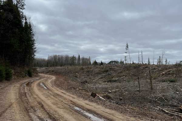
Wolf River to Junction 22A
This is a well-maintained trail courtesy of Polar Blazers. Primarily open dirt roads, this trail goes through active logging operations. The logging company graciously continues to allow access to this trail. Please stay on the trail. Maintain safe speeds especially when crossing through logging are...
Learn more about Wolf River to Junction 22A
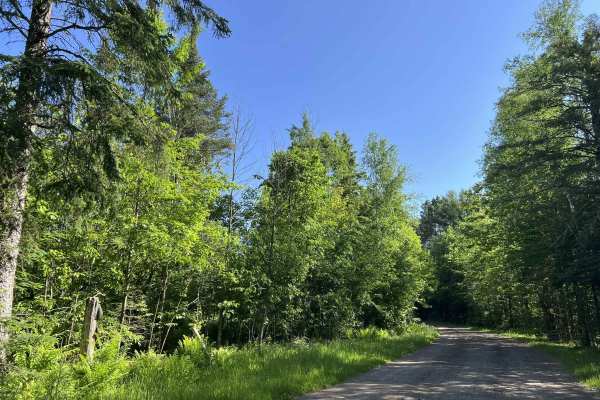
FS 2988A
Forest Service Road 2988A is a moderate, there-and-back style trail. This trail begins at its intersection with Forest Service Road 2260, Fish Hatchery Road. This trail is excellent for dispersed camping, as there are several clearings along the trail as it navigates to its endpoint, as well as a la...
Learn more about FS 2988A
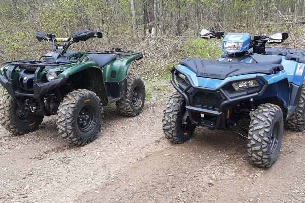
Great Bear Trail
There are a variety of dirt, sand, and gravel routes through forest roads that span from this route. It winds along a few small lakes through Oconto County. The trail runs from Lakewood south through the mountain area and wraps up close to Boulder Lake with a few route alternatives if you want to ex...
Learn more about Great Bear Trail

Perch Lake Lane
This trail offers a great mix of terrain for the area, including steep hills, dirt, sand, mud, and loose softball-sized rocks. Along the route is beautiful Perch Lake, a 12-acre lake with a maximum depth of about 10 feet. The only practical way to access the water is by kayak or another small hand-l...
Learn more about Perch Lake Lane
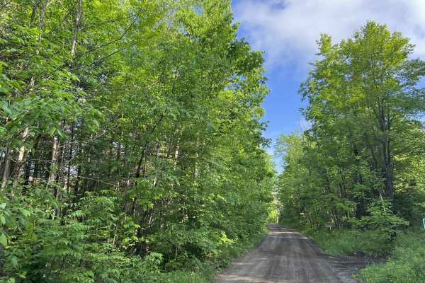
Bonita Road - FS 2112
Bonita Road (FS 2112) begins at its intersection with Weso Creek Road and the paved portion of Forest Service Road 2112, and navigates northwest to its intersection with County Highway W. This is a moderately maintained gravel trail that is wide enough for two vehicles for most of its length. This t...
Learn more about Bonita Road - FS 2112

Saul Springs Road
This portion of Saul Springs Road navigates from its intersection with Rose Lake Road FS 2336 to its intersection with FS 2118. This section of the trail, like the majority of Saul Springs Road, is a moderately maintained gravel road and provides access to many more remote and rugged trails within t...
Learn more about Saul Springs Road
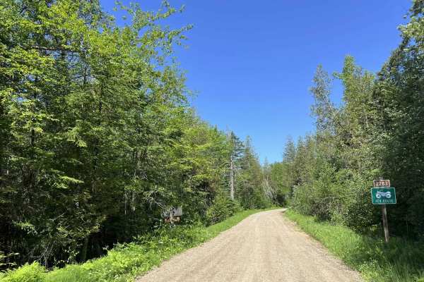
FS 2283
Forest Service Road 2283 is a moderately maintained gravel road that navigates from its intersection with FS 2336 and Saul Springs Road to its intersection with FS 2122. This trail is wide enough for two vehicles to safely navigate past each other in most areas. However, the dense trailside and unde...
Learn more about FS 2283
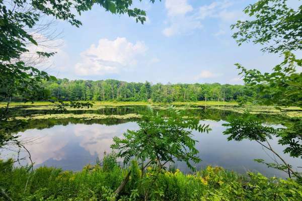
FR 2289
This is a short two-track trail that winds through a scenic mix of conifers and hardwoods. The terrain varies between gravel, mud, and occasional washouts—one of which is deep enough to bottom out if approached carelessly. A few muddy, less-maintained spurs branch off the main fire road, leading to ...
Learn more about FR 2289
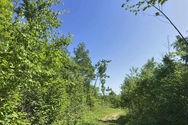
FS 2336BA/AAA
Forest Road 2336BA/AAA is an alternative route for 2336AA and 2956A. Adding some extra distance, as well as mild difficulty in comparison to the section of trail that is bypassed. This trail begins at its intersection with 2336B, and navigates to its intersection with 2336AA. The trail has several m...
Learn more about FS 2336BA/AAA
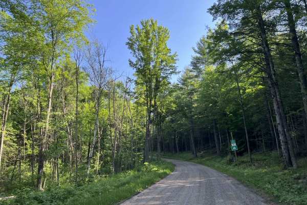
FS 2316
Forest Service Road 2316 begins at its intersection with County Highway W and travels north to its intersection with State Highway 64. This trail is a moderately maintained forest road that has a loose gravel base and is wide enough for two vehicles to comfortably pass each other at speed in most ar...
Learn more about FS 2316
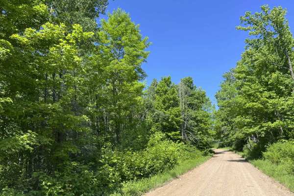
Diamond Roof Road - FS 2123
Diamond Roof Road - FS 2123 is a roughly 12-mile-long gravel route that navigates from its intersection with Sawyer Lake Road to its intersection with State Highway 32. This is a moderately maintained gravel forest road. The trail is wide enough for two vehicles in most areas, but like most forest r...
Learn more about Diamond Roof Road - FS 2123

Nauke Road Trail
This trail is part of the Oconto County ATV trail system and runs east off of Nauke Road, just south of Highway 64. The trail is sandy and features washboard sections that are periodically smoothed by the dusty trails ATV club. There are ample areas to pass oncoming traffic on this trail.
Learn more about Nauke Road Trail
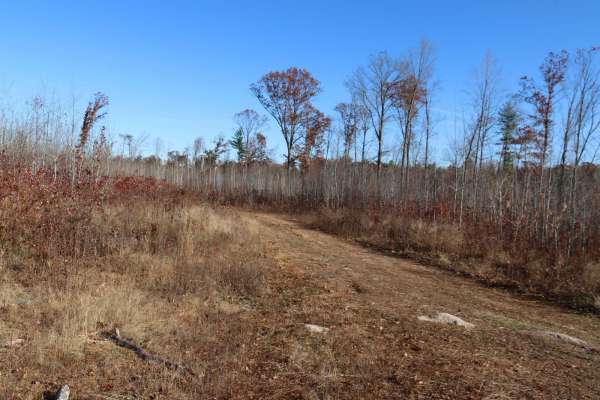
FR 3009
This is a relatively flat two track with a couple small water holes and washouts. The surface is a combination of gravel and dirt/mud. During the Winter this trail overlaps with the snowmobile trail so it would be in your best interest to avoid it altogether during snowmobile season.
Learn more about FR 3009
Beginner ATV trails near Amherst Junction, Wisconsin
Explore ATV-friendly trails near you. These trails are accessible for vehicles up to 50 inches wide, perfect for ATVs and smaller off-road machines.
Hemlock North/South
Part of the Langlade OHMV trail system, this permit-only trail is an easy loop that leads to Hemlock Ridge. Hard park dirt and gravel with minimal trail features. It is divided up into North Hemlock and South Hemlock, but they tie together at the trail head of Hemlock Ridge, and both lead to the acc...
Learn more about Hemlock North/South
Porkey Lake Loop
The Porkey Lake Loop is part of the Langlade OHMV trail system and is rated as an "Access Trail". It is a mellow, easy trail that brings you to the trail head for "No-Eye-Deer (Rock Crawl)" and "John's Rock Crawl". It features small hills, few rocks, and a few horseback trails.
Learn more about Porkey Lake Loop
Norway Lake Loop
The Norway Lake Loop is a point-to-point trail that picks up on the eastern end from Porkey Lake Loop. It is primarily a dirt two-track with several sections of rocks and mud sections to cross. Expect a few mud holes, loose rock, and a few moderately steep sections.
Learn more about Norway Lake Loop
Wolf River to Junction 22A
This is a well-maintained trail courtesy of Polar Blazers. Primarily open dirt roads, this trail goes through active logging operations. The logging company graciously continues to allow access to this trail. Please stay on the trail. Maintain safe speeds especially when crossing through logging are...
Learn more about Wolf River to Junction 22A
Beginner UTV/side-by-side trails near Amherst Junction, Wisconsin
Find UTV and side-by-side trails near you. These trails accommodate vehicles up to 60 inches wide, ideal for UTVs, side-by-sides, and wider off-road rigs.
Hemlock North/South
Part of the Langlade OHMV trail system, this permit-only trail is an easy loop that leads to Hemlock Ridge. Hard park dirt and gravel with minimal trail features. It is divided up into North Hemlock and South Hemlock, but they tie together at the trail head of Hemlock Ridge, and both lead to the acc...
Learn more about Hemlock North/South
Porkey Lake Loop
The Porkey Lake Loop is part of the Langlade OHMV trail system and is rated as an "Access Trail". It is a mellow, easy trail that brings you to the trail head for "No-Eye-Deer (Rock Crawl)" and "John's Rock Crawl". It features small hills, few rocks, and a few horseback trails.
Learn more about Porkey Lake Loop
Norway Lake Loop
The Norway Lake Loop is a point-to-point trail that picks up on the eastern end from Porkey Lake Loop. It is primarily a dirt two-track with several sections of rocks and mud sections to cross. Expect a few mud holes, loose rock, and a few moderately steep sections.
Learn more about Norway Lake Loop
Wolf River to Junction 22A
This is a well-maintained trail courtesy of Polar Blazers. Primarily open dirt roads, this trail goes through active logging operations. The logging company graciously continues to allow access to this trail. Please stay on the trail. Maintain safe speeds especially when crossing through logging are...
Learn more about Wolf River to Junction 22A
The onX Offroad Difference
onX Offroad combines trail photos, descriptions, difficulty ratings, width restrictions, seasonality, and more in a user-friendly interface. Available on all devices, with offline access and full compatibility with CarPlay and Android Auto. Discover what you're missing today!
Open Trail Map