You can always use GPS on your mobile device regardless of an internet or cellular connection. As long as you have a charged smartphone with you, you can find your way around remote areas and foreign landscapes. GPS tracking on your phone works just as well without internet connectivity or cellular service.
We are constantly surrounded by Global Positioning System signals from satellites orbiting the planet. Your phone is continuously tracking these signals to get an estimate of your location even when you are offline. Phones can connect to GPS signals without depending on cellular companies or data plans. Even older, retired models perform very well as GPS navigators.
TL;DR: Yes, you can use GPS without service or data. Your phone connects to satellites for accurate location tracking, and with Offline Maps downloaded in advance, you can navigate anywhere. Offline GPS apps like onX Hunt, onX Offroad, onX Backcountry, and Google Maps make it easy to explore remote areas, hunt, hike, or travel without cell coverage.
GPS navigation usually works independently from needing a data connection. Although some apps require a data connection to allow their GPS functionality to work, there are GPS tracking apps that offer a robust offline navigation experience without that connection. Read on to learn more about how you can orient yourself in the great outdoors using only phone GPS without service.
How Does Your Phone GPS Work Without Data or Internet?
GPS is a Global Positioning System that uses satellites, processors, and algorithms to generate accurate information about a device’s location. The three major components of the navigation system are a GPS receiver, maps, and the navigation platform. Your phone contains a built-in GPS receiver that allows it to track your location without cellular service. Maps stored on your mobile device do not need internet connectivity as the routes don’t change often. This information comes together to give you the location of your device and the routes around you. When your phone is not connected to signals from local cell towers, it might take a little longer than usual to identify your location. GPS accuracy could also vary according to terrain conditions, depending on your app, platform, and device.
Since you will not be able to stream maps onto your device without data, you need to save maps for offline use ahead of time. Offline Maps allow you to search for specific locations and can give you walking, biking, or driving directions at any time. By default, maps are saved directly to your phone’s internal storage. Combining navigation information from saved maps and GPS location on your smartphone, you can navigate unfamiliar terrain with confidence.
A common misconception about GPS is that you need a data connection to use it. Not so! The GPS on your phone acts entirely independent from data and harnesses signals from satellites. Another common confusion related to the first is that you need to pay for extra data in order to use GPS on your phone. Again, this is inaccurate. Using GPS on your phone has nothing to do with your bill for data. There are also no data plans specific to GPS that you need in order to use GPS features on your phone. GPS works off satellites and that positioning technology is applied to the offline maps that you’ll download within an app ahead of time.
GPS Signals vs. Data
The difference between GPS signals and data for cellular networks is simple: Data is information your phone transmits and receives to access things like email, web browsing, social media apps, etc. Basically, it gives you access to the internet without a WiFi connection. We pay for data in the form of data plans. GPS works independently of cellular networks using GPS satellites. Your device receives a signal from the satellites to determine your exact location.
GPS accomplishes the same task across phones or dedicated GPS devices, but the functionality between the two is somewhat different. For instance, on GPS devices, you’re generally going to get better battery life. This is because the GPS device has one job and one job only: navigation. Your phone, on the other hand, has many other things it’s doing along with being a GPS. The other difference is the features each device offers. A GPS device’s features are going to be solely dedicated to the outdoor navigation experience. Marking waypoints, tracking, etc. By contrast, a phone offers a much broader feature set, such as 3D mapping, sharing to social media, exaggerated terrain, etc.
For the absolute best experience off-grid, it’s essential to download offline maps. This is going to keep your GPS working smoothly instead of trying to display where you are as well as trying to load maps. When this is the case, your maps might not load perfectly, you could lose resolution, functionality, and just have an overall worse experience.
Apps That Use GPS Without Data
GPS apps truly are the way of the future. They’re a more efficient system that not only works well, but also requires the hunter to carry fewer devices in the field. There’s no need for a dedicated GPS unit if you’re using a GPS app on your phone.
onX Hunt
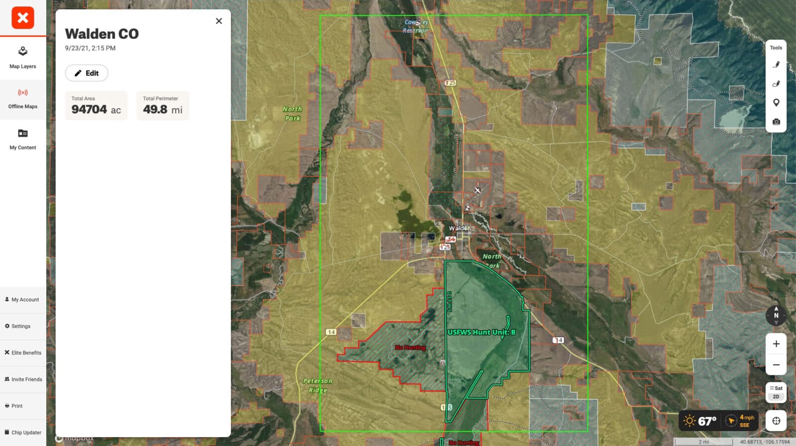
By downloading Offline Maps ahead of time within the onX Hunt App, you’re setting yourself up for a better navigation experience on your hunt. You’ll have detailed maps with private/public land boundaries at the ready without the need for any service whatsoever. This offers peace of mind, yes, but it also is just smart. Not just for knowing where you stand, but for aiding in hunt strategy once in the field, too.
Google Maps
Google Maps is another app that can provide GPS functionality without the need for data. Similar to onX Hunt, you need to download maps ahead of time to have the best navigation experience. But this can be rather limiting. Yes, you have GPS functionality in the area you downloaded, but that’s it—there are no specialized features catering to hunters or outdoor enthusiasts.
onX Offroad and onX Backcountry
Two other GPS apps you might want to check out are onX Offroad and onX Backcountry. Both offer specialized features that cater to outdoor recreationists. For instance, onX Offroad allows the user to sort trail maps based on vehicle type and it will also show you areas that are open to free riding. onX Backcountry is more geared toward the hiker and has 650,000 miles of hiking trails within it along with color-coded trail slopes, avalanche forecasts, and more. Both apps show government land boundaries and both work without data.
How To Use GPS Offline While Hunting
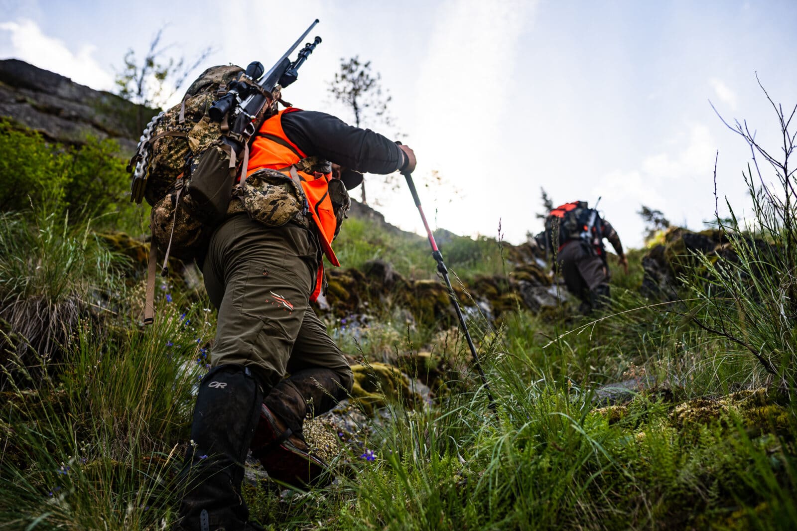
Over the past decade, cell phones have become almost an essential piece of gear for most hunters. As phones increasingly offer better battery life and map detail, they have emerged as the better alternative to dedicated GPS units.
Cell reception in the backcountry is spotty at best and non-existent at worst. To help you find your way in the woods, there is a broad selection of apps for Android and iOS that allow you to download maps in advance. With the maps already loaded on your device, you only need a clear view of the sky to use the GPS signals from satellites. The onX Hunt App offers excellent offline GPS functionality to help you keep track of your location at all times. All Offline Maps include aerial, topo, and hybrid imagery along with onX Layers automatically. With its new and improved Offline Map experience, sorting and renaming saved maps is a breeze. It’s also easier to download multiple maps at once. Through its advanced tile-saving technology, all individual Layers and Basemaps display on Offline Maps for clear, efficient offline navigation.
In addition to Basemaps and Layers, custom Markups like Waypoints and Tracks can take advantage of GPS functionality far beyond cell service. Tracks recorded with GPS location while offline are saved locally and then synced back to your onX account when you return to service. Likewise, Waypoints placed while e-scouting are included when an Offline Map is saved, which you can then navigate to far from coverage thanks to GPS.
Waypoints and Tracker can especially come in handy when you are trailing an animal after it’s been hit. Mark a Waypoint at first blood and then turn your Tracker on from there, marking potential notable points along the trail like beds. In a tricky tracking situation, having this bird’s-eye view of the general path of travel can help find the pot of gold at the end of the rainbow.
FAQs
Yes. Your phone’s built-in GPS connects directly to satellites, so it works without data or cell service. To navigate offline, download maps ahead of time.
Google Maps allows you to download areas in advance for offline use. GPS will still show your location, but you’re limited to the regions you saved.
Yes. iPhones have a GPS receiver that works even without data. However, Apple Maps offers limited offline support, so specialized GPS apps are more reliable.
Yes, GPS works all over the world. However, your phone may not work with data networks in other countries and country-specific apps may not offer complete offline maps in other places. For instance, onX Hunt Map Tools and Basemaps will generally work no matter what country you’re in, but Map Layers are currently only available in the United States and Canada.
Apps like onX Hunt, onX Offroad, onX Backcountry, and Google Maps all support offline GPS. They let you track your location and navigate without service.