
Public Hunting Land Maps
Find public hunting land near you.
Discover Public Hunting Land
The onX Hunt App gives you the most comprehensive maps and information to locate public lands, even the smallest tracts near local farmlands. Whether you’re hunting elk, deer, or small game, on either state or federal land, onX Hunt helps you know where you stand. With 998 million acres of public land mapped in the U.S., 836 million acres mapped in Canada, and an ever-growing 421 map overlays, your next trophy is in sight with onX Hunt.
Public Land Hunting Breakdown
See State Land Hunting Opportunities
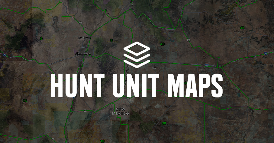
onX Hunt’s unique and extensive layers make finding public hunting grounds near you easy. Find huntable public lands, including state land in your home state or the state in which you drew a tag. Color-coded land designation within the Hunt App makes it easy to see state land boundaries and designations at a glance. Remember, as a hunter, it’s your responsibility to do your due diligence in confirming hunting access and regulations.
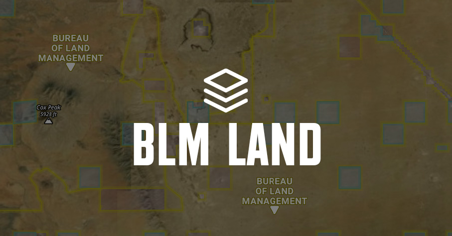
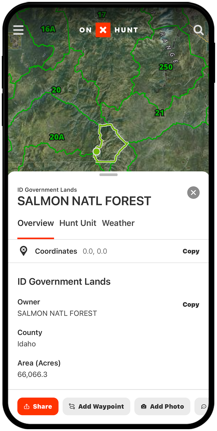
Find Federal Hunting Land
Whether Bureau of Land Management land, national forest, wilderness areas, or even national parks, the Hunt App’s numerous federal land Map Layers allow you to visually understand public land. Find public hunting land near you on the onX Hunt App or by using onX on your computer, viewing maps that show public and private property lines overlaid on satellite or topographic base maps. As always, verify access and regulations before you hunt.

Explore Voluntary Public Access Programs
Commonly called “walk-in” programs, voluntary public access programs are known by a range of names and acronyms that can confuse their common effort: to incentivize private landowners to open their properties to the public for hunting, provide critical wildlife habitat, and bolster ecosystem conservation efforts. Easily view these lands and the associated rules within the onX Hunt App.
View Possible Access
The onX Hunt App comes with a Possible Access Layer, in addition to state-specific layers showing private land available to the public during certain hunting seasons. Possible Access properties are private lands owned by timber companies, non-governmental organizations, and other private entities that may allow public access for hunting. (Make sure to contact the landowner for permission before you visit.)
Every time I go to a new area of the country to hunt, the first thing I do is look at a high level view with the Public Land Layer on. It gives me an idea of what part of the state I want to go to and then, as I go into a more detailed view, I’m able to look at boundaries so that I know what access option I have.
– Tyler Jones, The Element
Find Public Land Near or Far
Expand your horizons and find new land to hunt.
Frequently Asked Questions
onX Hunt provides color-coded land designations that make finding public hunting land as easy as turning on the “Gov Lands” Map Layers and looking at your area of interest. Always verify access and regulations before you hunt.
Yes, onX Hunt includes layers for most types of state land including state forests, state parks, walk-in areas, and more.
Yes, the onX Hunt App includes federal land Map Layers covering Bureau of Land Management land, national forests, wilderness areas, and national parks, all overlaid on satellite or topographic base maps.
These programs incentivize private landowners to open their properties to the public for hunting and wildlife habitat conservation. You can view these lands and their associated rules directly within the onX Hunt App.
The Possible Access Layer shows private lands owned by timber companies, non-governmental organizations, and other private entities that may allow public access for hunting. You should contact the landowner for permission before visiting any Possible Access property.
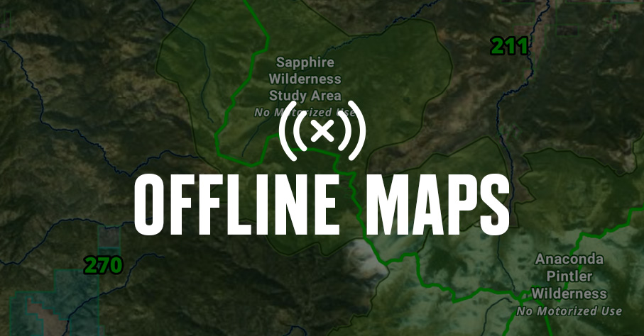
Yes, Offline Maps allow you to view the map and use many of your favorite map tools even when you are beyond cell service.
onX Hunt has mapped 998 million acres of public land in the U.S. and 836 million acres in Canada, along with over 421 map overlays.
Understanding whether you are on public or private land and knowing the hunting district you plan to hunt are both essential. onX Hunt shows public and private land boundary layers to help you know where you stand.