How Joe Grant Prepares for the Rim to Rim to Rim
The Grand Canyon is considered one of the seven natural wonders of the world. Standing on the rim—peering down into its depths—no amount of superlatives can do the sight justice. While many might think of the canyon as primarily a visual experience, it conjures up emotions well beyond what the eye can see.
Only a small percentage of the six million annual visitors venture below the rim. However, if you do find yourself lucky enough, prepare for a fully immersive undertaking that will captivate and engage all of your senses.
The following is an outline for planning an adventure in the Grand Canyon traversing the popular Rim to Rim to Rim (R2R2R) route via the South and North Kaibab trails.
R2R2R Masterclass with Joe Grant
Listen in on onX Backcountry’s first-ever Masterclass covering the topic of a Rim to Rim to Rim hike through the Grand Canyon. Learn how the onX Backcountry platform can help you navigate this harrowing landscape or any other objective your trail season holds.
A Brief History
The Grand Canyon formed 5-6 million years ago by erosion from the Colorado River. The carved channel is 277 miles long, 18 miles wide, and plummets well over a vertical mile to the canyon floor sitting at around 2,400 feet. The walls of the canyon reveal a cross section of earth’s crust going back nearly 2 billion years. The oldest rock is found in the Vishnu Group and is around 1.7 billion years old; the youngest rock is Kaibab limestone which is around 250-million-years-old.
The cultural history of the Grand Canyon began 3,000-4,000 years ago with the Puebloan peoples. They were primarily hunter-gatherers, created baskets out of yucca, and later made pottery.
The Hualapai (people of the pine trees), Havasupai (people of the blue-green water), Southern Paiute, Hopi, and Navajo (Diné – The People) are the five tribes that live in and around the Grand Canyon today. They practice agriculture, herding, art, and tourism.
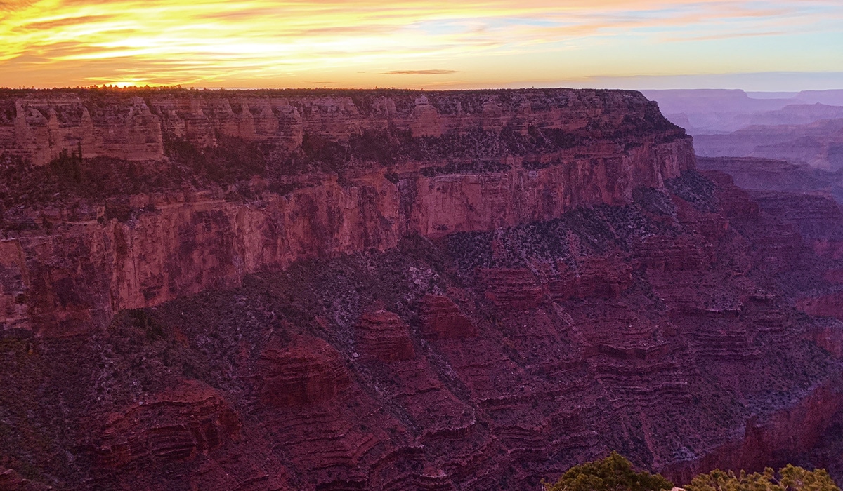
Photo Credit: Joe Grant
Preparation for the R2R2R
There are three key areas of focus when preparing for your traverse: Mind, Body, and Gear.
Mind
Visualization
It is helpful to think of the Grand Canyon as an upside down mountain with all the challenges of scaling a mountain presented in reverse. Seeing oneself in the canyon—running or hiking—is a way to manifest that reality before even setting foot on the rim.
Kaibab: Ute for mountain lying down.
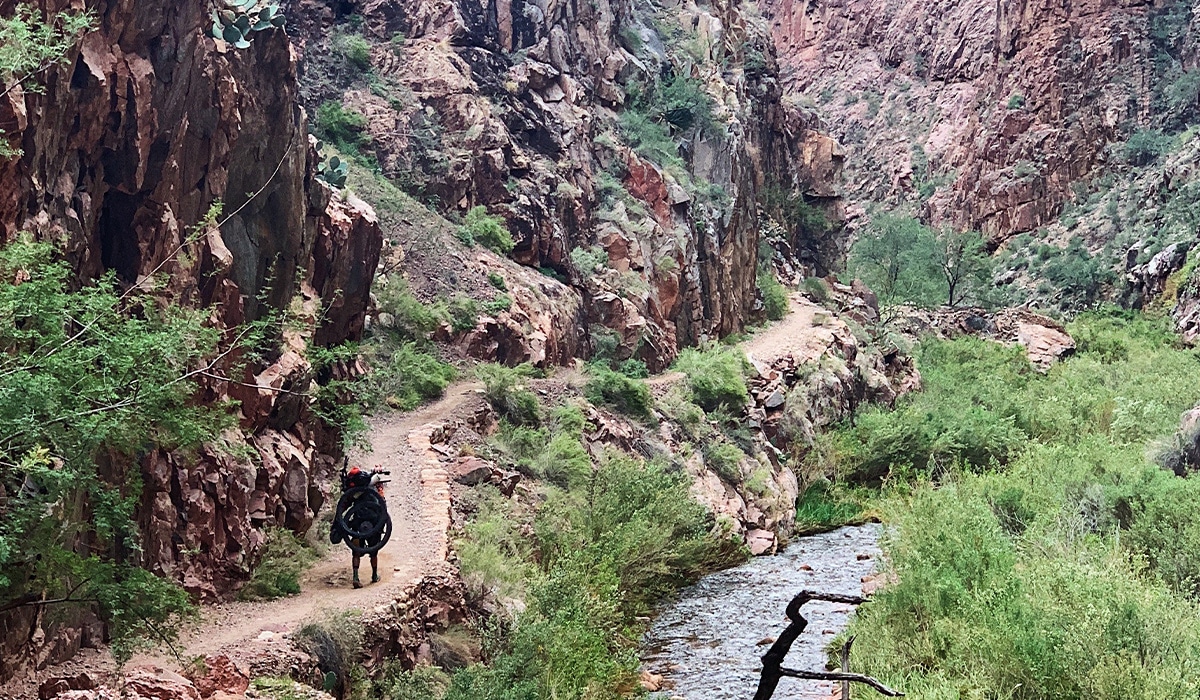
Photo Credit: Joe Grant
Scale
The canyon is so vast and rugged, mileage can feel distorted. Plan conservatively based on your abilities and fitness because stretches of the canyon will feel longer and more strenuous than they seem on paper. A good way to address this is to break up the run into different segments and tackle one segment at time without projecting too far ahead.
Exposure
Temperatures and weather vary greatly. You might find snow on the rim, but be overheating by the time you reach the canyon floor. Be prepared for a variety of conditions and gaining altitude as you near the rim. Some of the trail sections are also quite exposed, so use caution when navigating these zones.
Pace yourself. A great analogy my friend once gave me when preparing to run longer distances is to think of effort like peanut butter and to spread it evenly on the slice of bread. It’s easy to get carried away with the downhill miles, but always remember to keep a little in the tank for the final climb out!
Body
Even as a runner, having strong hiking legs will be very beneficial in the canyon. Work on your powerhiking on any steep hills you can find. Practice gradual grade uphill and downhill running as this will serve you for the more moderate trail sections in the middle of the double crossing.
Conditioning for the downhills is imperative for a successful trip across the canyon. Ideally, you’ll want to train on steep trails that mimic the terrain you’ll find in the canyon. If you do not have access to steep hilly trails, good alternatives include stairs, pavement hills, burpees, squats, and other leg conditioning exercises in the gym. Also, having a strong core and general base of athleticism will help the body endure the harsh terrain.
Taking breaks to enjoy the view, staying light on your feet, and relaxing will contribute to helping preserve your body as the miles accumulate. Finally, working back from your planned start date, make sure you have a realistic timeframe to build gradually for your objective.
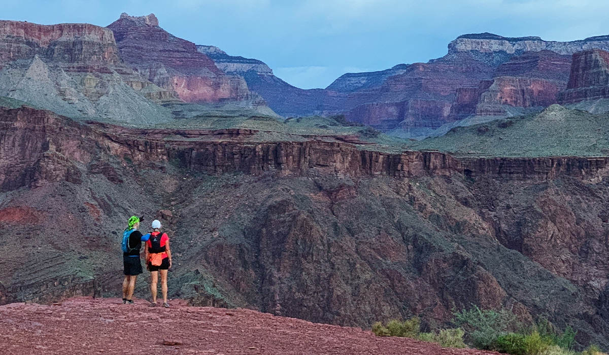
Photo Credit: Joe Grant
Gear
Here’s a non-exhaustive list of gear to consider bringing on your adventure:
- A pack or running vest with a minimum of 1.5 liters water.
- Food supply.
- As a starting point for planning, I bring one food item per hour that I estimate being in the canyon. Some examples are a bar or sports drink of around 200-300 calories a piece. For 12 hours, I would bring 12 food items and around 3,000 calories of food.
- For safety equipment—I bring a medical kit, space blanket, light puffy jacket, foot repair kit, and a water filter.
- Regular running gear, windbreaker, neck gaiter, hat, sunscreen, sunglasses, light long sleeve, and spare socks.
- Extra layers for winter conditions and potential rainwear based on the weather.
- Winter gear considerations include traction spikes, poles, extra layers, gloves.
- Headlamp with back up batteries, Offline Maps downloaded, Waypoints with notes, and a power bank.
- Footwear with good grip, cushioning, and comfort.
R2R2R Overview
Getting There
Yaki Point & South Kaibab trailheads are for shuttle buses only. There are a few parking spots off Desert View Road, which is about a half mile hike to the rim. Plan accordingly and remember you’ll need to retrieve your vehicle at the end of a very long day.
An alternative plan is to park at Grand Canyon Village, use the South Kaibab shuttle in the morning, and return via the Bright Angel Trail (+2 miles, but with a water source at Indian Gardens). You can find more information via the National Park Service.
South Kaibab Trail – Quick Facts
| Point of Interest | Feet Above Sea Level | Miles From Trailhead | Notes |
| South Rim Trailhead | 7,260 | 0 | |
| Ooh Aah Point | 6,660 | 1.8 | |
| Skeleton Point | 5,200 | 3 | It gets its name from the number of mules that have died here, not people. |
| The Tip-Off | 4,200 | 4.4 | South Kaibab trail intersects with the Tonto Plateau which spans roughly 100 miles from Elves Chasm in the west to New Hance rapids in the east. |
| Kaibab Suspension Bridge | 2,500 | 6.3 |
Unlike many of the other rim-to-river trails in the canyon, which were Native peoples’ paths further improved by prospectors, the South Kaibab trail was built in 1924 by the National Park Service as an alternative to the Bright Angel Trail as hosteler Ralph Cameron charged a $1 service fee to hike or ride down the trail. The Kaibab Suspension Bridge was constructed with the help of the Havasupai who carried eight steel cables down the trail to the river.
North Kaibab Trail – Quick Hits
This portion of trail runs through Bright Angel Canyon along Bright Angel Creek to Roaring Springs Canyon and heads north up to the rim around Manzanita Point.
| Point of Interest | Feet Above Sea Level | Distance From River | Notes |
| Kaibab Suspension Bridge | 2,500 | 0 | |
| Phantom Ranch | 2546 | 0.7 miles | First Potable Water |
| Cottonwood Campground | 4080 | 8 miles | You’ll pass Ribbon Falls on the way, but bridge is out. |
| Manzanita Ranger Station | 4,800 | 9.5 miles | The trail gets steeper from here ascending Roaring Springs Canyon to the North Rim. |
| North Rim Trailhead | 8,241 | 14.2 miles |

Photo Credit: Joe Grant
Seasonal water closures begin around late October and reopen early May.
Remember, this is a busy corridor. Please try to minimize your impact and practice Leave No Trace principles.
- Plan ahead and prepare.
- Travel and camp on durable surfaces.
- Dispose of waste properly.
- Leave what you find.
- Minimize campfire impacts and be careful with fire.
- Respect wildlife.
- Be considerate of other visitors.
For more information on hiking the Grand Canyon, please visit NPS.gov.