Avalanche Terrain Exposure Scale (ATES) Maps
Avalanche Terrain Exposure Scale (ATES) is a system used by backcountry travelers to assess the potential risk of avalanches in a given area. It helps individuals make informed decisions about the level of risk when navigating through avalanche-prone terrain. onX Backcountry has constructed an ATES layer by utilizing a variety of inputs as well as working closely with avalanche centers to localize our data. Learn more about the history and future of ATES below.
Why Was ATES Created?
In the wake of the tragic avalanche incident in Glacier National Park on February 1, 2003, where 17 students from a Calgary private school were caught in an avalanche resulting in seven fatalities, Parks Canada’s Backcountry Avalanche Risk Review diligently sought solutions to prevent similar incidents. Subsequently, Parks Canada created and instituted the Avalanche Terrain Exposure Scale (ATES), a framework designed to thoroughly assess, describe, and communicate the intricate aspects of avalanche terrain exposure, aiming to enhance safety and prevent future tragedies.
How Has ATES Been Implemented
Parks Canada introduced the Avalanche Terrain Exposure Scale (ATES) as a structured system to comprehensively assess and communicate the complexities of avalanche-prone terrain. The resulting categorized trips were released in November 2004, later updated in 2005, using color-coded text (Simple = green; Challenging = blue; Complex = black). Alongside the Public Communication Model, Park Canada emphasized combining this information with other resources like maps and guidebooks. Extending this process, Parks Canada also classified avalanche terrain for 75 popular waterfall ice climbs in the Canadian Rockies, providing a similar brochure in both English and French, accessible at www.pc.gc.ca/avalanche.
What is onX Doing With ATES?
onX aims to introduce the ATES rating system to the United States through its navigation app. Collaborating with John Sykes, a doctoral researcher specializing in this field, the onX is developing an automated version of ATES, termed autoATES. This initiative involves compiling existing information and firsthand observations used by avalanche and snow safety experts to assess local terrain avalanche risks, constructing geospatial models that predict avalanche release areas and potential runout zones based on factors like slope angles, wind patterns, and forest density. This resulting ATES terrain classification offers crucial insights for backcountry users.
onX is partnering with local avalanche forecasters and guide professionals to localize our models and refine these ratings through direct on-site verification.
Why is This Important for Backcountry Travelers?
Currently, the avalanche community endeavors to establish a standardized means of communicating avalanche hazards, usually achieved through the avalanche forecast. The singular available tool for comprehending avalanche terrain within this forecast primarily revolves around slope angle and urging backcountry travelers to avoid slopes exceeding 30 degrees when the avalanche danger is high. ATES aims to elevate this communication by creating a more comprehensive toolkit because understanding avalanche terrain encompasses more than just slope angle. The objective of ATES is to forge a refined language and visual representation of avalanche terrain that surpasses the simplicity of slope angles.
ATES integrates multiple variables to effectively map and visualize avalanche terrain, providing a unified language for discussing terrain in relation to avalanche risk. These incorporated variables offer insights into the terrain’s propensity to trigger avalanches.
What ATES Ratings Can Be Found in onX Backcountry?
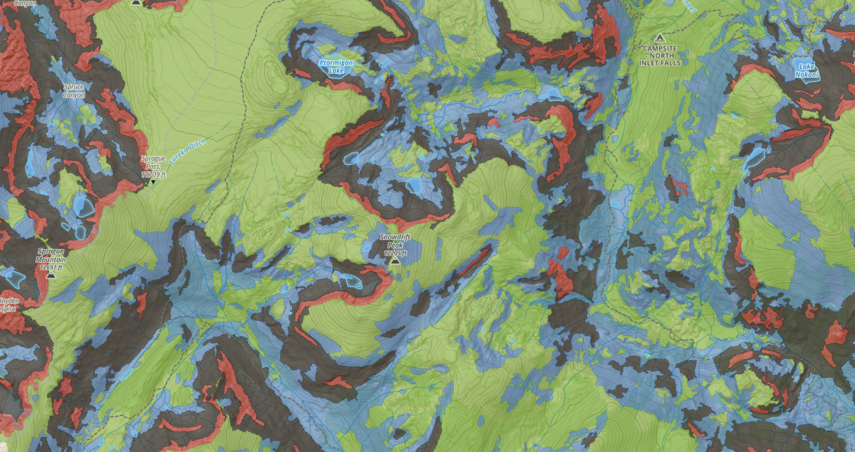
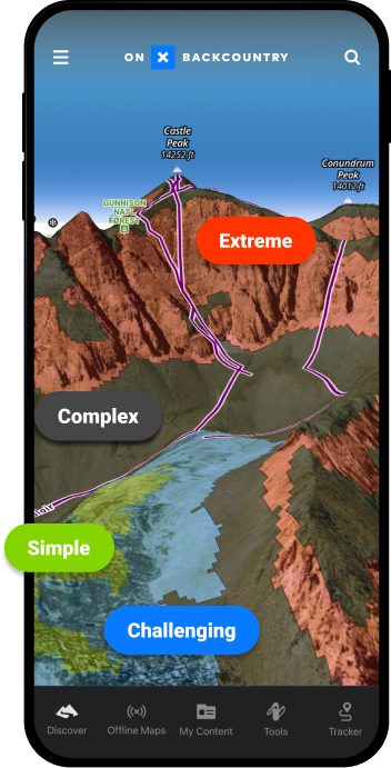
The Avalanche Terrain Exposure Scale (ATES) categorizes terrain into four main ratings or zones based on their potential avalanche risk. These ratings are Simple, Challenging, Complex, and Extreme. Learn more about what each of the ratings means, as well as some terrain examples in the interactive map below.
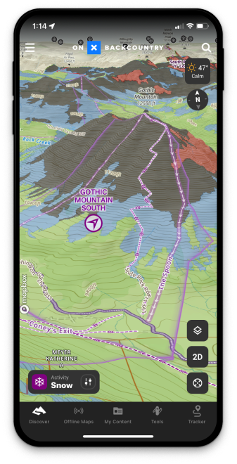
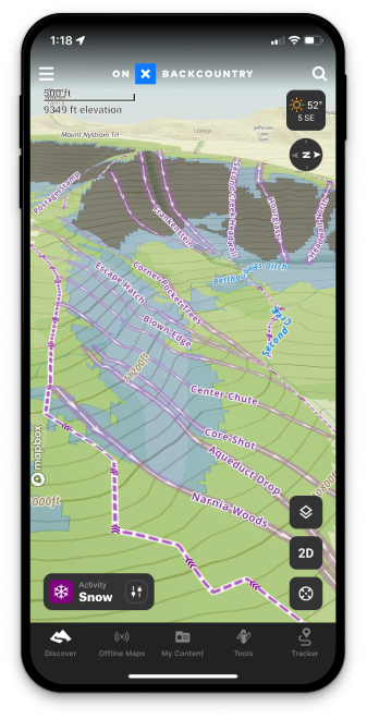
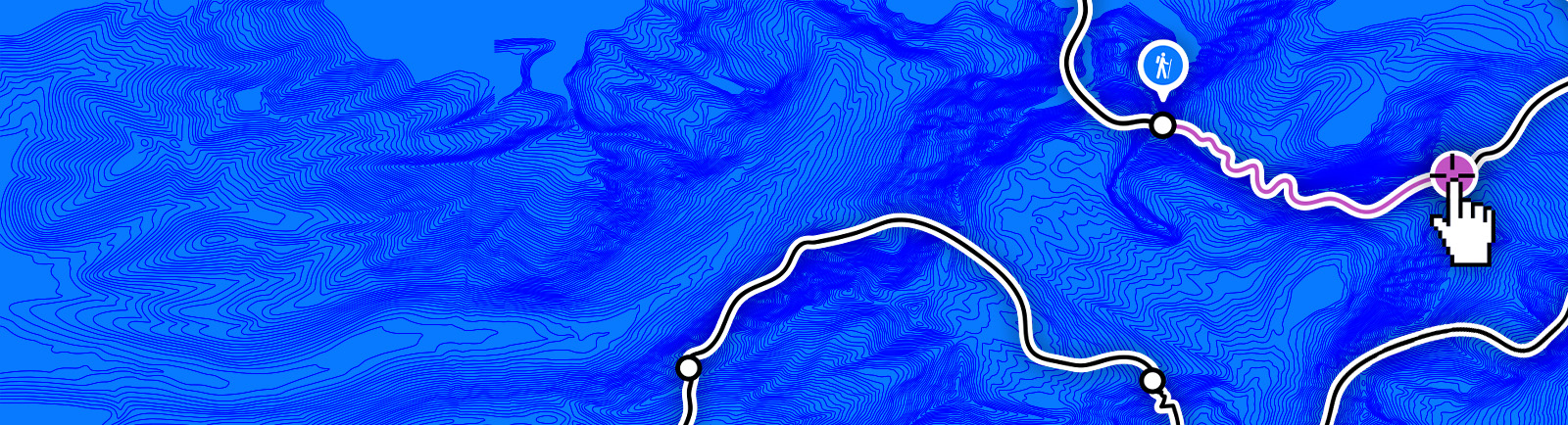
How to use ATES in onX Backcountry
Follow along with Jason Antin as he takes you step-by-step through accessing the ATES (Avalanche Terrain Exposure Scale) layer in onX Backcountry.
“ATES is an important tool for all winter enthusiasts
Taken together with the daily avalanche forecast, ATES can help the public–whether they’re a beginner or a professional–better understand how to reduce their overall risk, have an incredible time in the mountains, and get home to their friends and family at the end of the day.”
Mark Staples
Utah Avalanche Center
Frequently Asked Questions
The ATES Layer will be in onX Backcountry in December of 2023. ATES is live in the onX Backcountry application as of December 2023
- Colorado: Crested Butte, Marble, Aspen, Berthoud Pass, Loveland Pass, Montezuma, Silverton, Eastern RMNP, Mosquito Range, East Vail Pass
- Montana: Bridgers, Northern Gallatins, Northern Madisons, Southern Madisons, Cooke City
- Utah: Salt Lake, Logan, Ogden, Provo
- Washington: Snowqualmie Pass, Baker Area Backcountry
- Wyoming & Idaho: Tetons
- California: Lake Tahoe, Carson Pass
- Alaska: Chugach State Park / Girdwood
We’re collaborating extensively with avalanche centers to localize and approve the output of our autoATES model before integrating this layer into a specific zone. Our aim is to guarantee that our layer accurately represents the area and is authenticated by avalanche experts. We will continue to roll out ATES coverage as the year progresses.
The Avalanche Terrain Exposure Scale (ATES) primarily focuses on evaluating and categorizing the inherent characteristics of avalanche terrain based on its complexity, steepness, and exposure to potential avalanche risk. ATES itself doesn’t directly incorporate real-time or current avalanche conditions, such as recent snowfall, weather patterns, or snowpack stability. However, ATES provides a framework that helps individuals understand the inherent risk of a particular terrain based on its features.
Users typically utilize ATES in conjunction with other sources of information, such as avalanche forecasts, recent weather and snowpack conditions, to make informed decisions about the current risk of avalanches in specific areas. While ATES doesn’t inherently include current avalanche conditions, it serves as a valuable tool in assessing the potential risk levels of avalanche-prone terrain.
Try onX Backcountry Today
Start your free 7-day onX Backcountry trial today to start mapping your next adventure.