
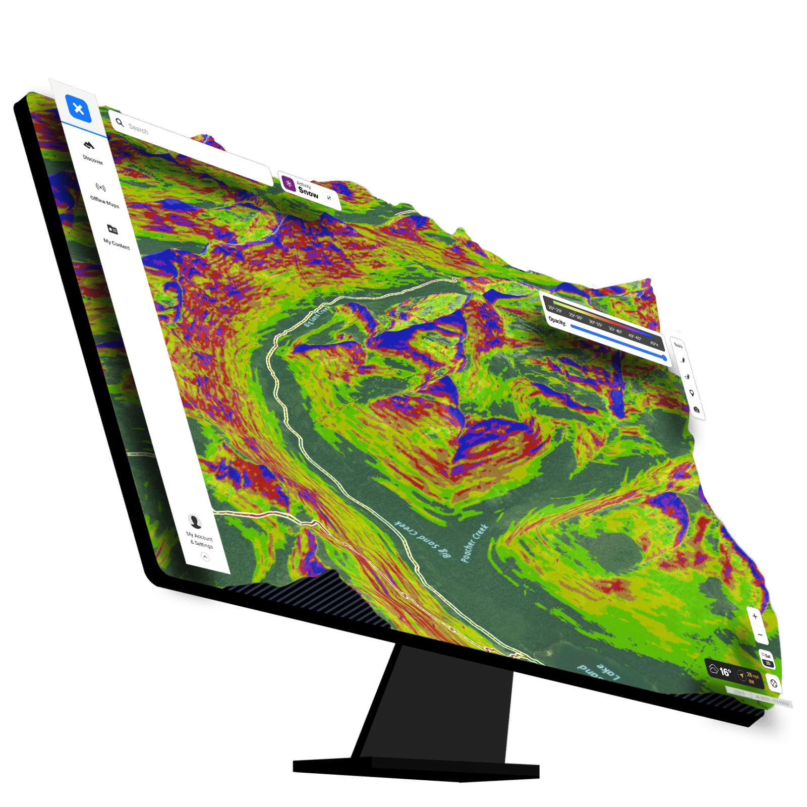
Avalanche Slope Angle Layer
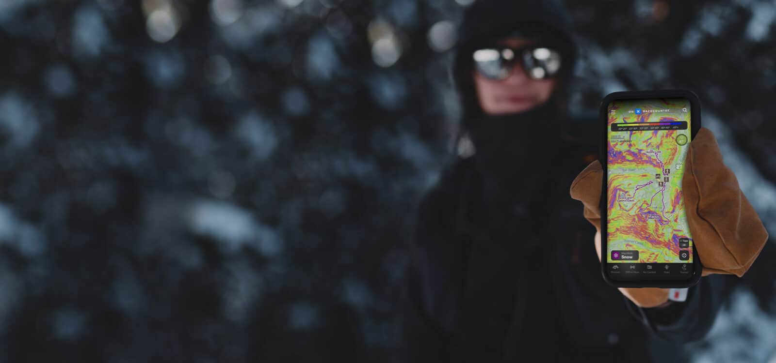
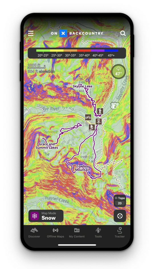
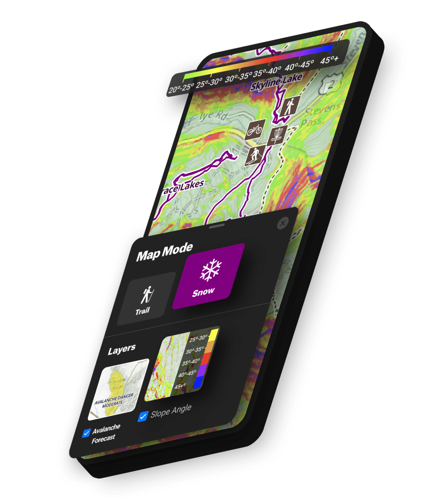
Using the Slope Angle Layer, you can evaluate the incline of any given slope in the backcountry. We overlaid a color spectrum to show the gradient of incline on mountains across the country. Use our app to evaluate how steep or mellow you want your day to be in avalanche terrain.
Using the Slope Angle Layer, you can evaluate the incline of any given slope in the backcountry. We overlaid a color spectrum to show the gradient of incline on mountains across the country. Use our app to evaluate how steep or mellow you want your day to be in avalanche terrain.
View Slope Angle Shading in 3D
Below is an interactive map sample. Login or create an account to gain full functionality.
What Is Slope Angle?
An integral part of avalanche safety, slope angle is the measurement of an incline a mountain makes against the horizon. This calculation is integral to knowing which slopes are prone to slide. Traditional methods included something called an inclinometer, while experienced mountain professionals can eyeball it. For ease of use and convenience, our Slope Angle Layer does all the math for you and can be taken anywhere. Always know how steep the terrain is around you.

Our color gradient is designed for skiers because it includes the spectrum of angles most sought after by backcountry enthusiasts.

“
Slope Angle is critical for the backcountry.
It helps you manage your terrain, allows you to ski on days where avalanche hazard may be considerable, and keeps you in safer terrain in the 20-25 degree range where you can still have a good time.”
Cody Townsend
Professional Backcountry Skier, The Fifty
Slope Angle:
Are You in the Danger Zone?
Talk nerdy to me. Our VP of Research talks through how we developed our Slope Angle Layer using satellite imagery, some geometry, and a healthy dose of “field-testing.”
On the Go or Your At-Home Planning Tool
Whether you need Slope Angle in the field or for your at-home planning, we’ve got you covered with a mix of benefits for any device.

In The Backcountry
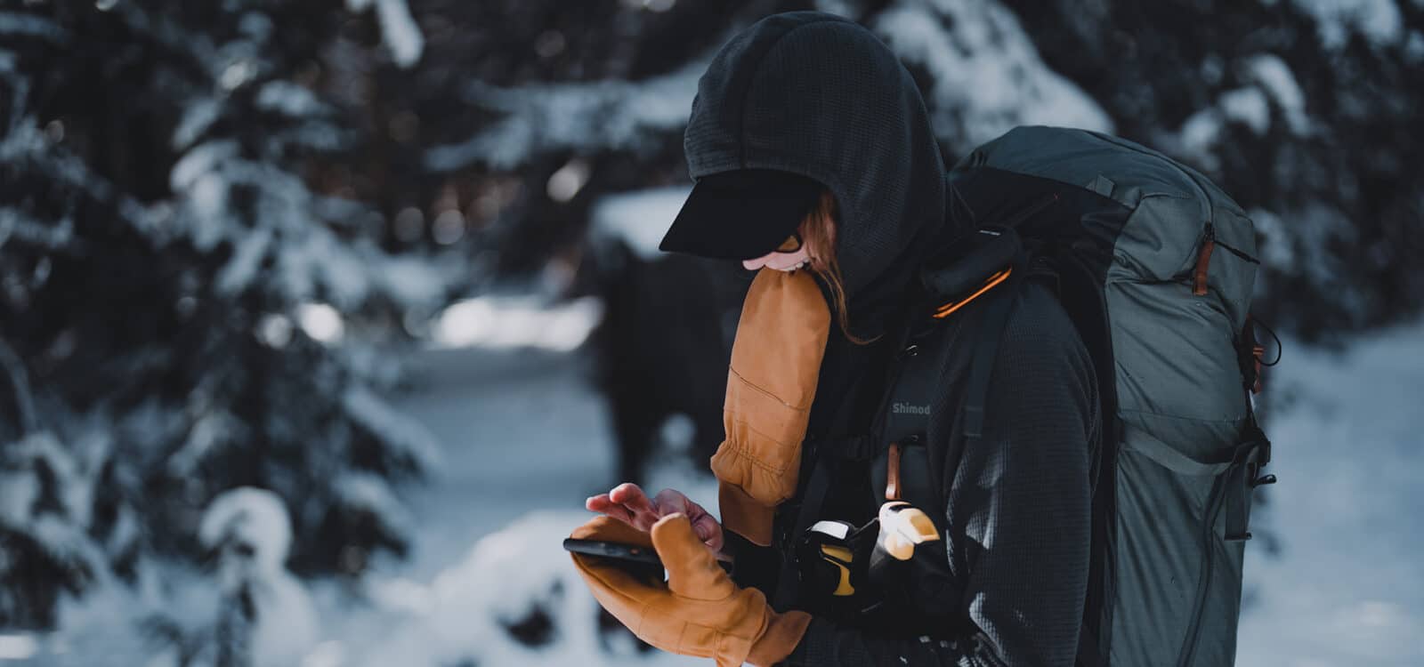
There’s no substitute for first-hand knowledge, but with Slope Angle in your hands, in cell range or not, you can evaluate how steep of a slope you’re on and what around you might be prone to slide.
Choose safer routes, stay mellow on high avalanche probability days, and mark scary terrain traps—all on the go.
Your Ultimate At-Home 3D Planning Tool
Before you even slip the boots on, use Slope Angle to evaluate your route choices, come up with multiple options, and see slopes prone to slide.
For a more detailed look, toggle 3D on to tilt, pan, and zoom your way throughout the virtual landscape. Next to boots on the ground, this is the closest you’ll get to being there.
How to Access Slope Angle Layer

On Desktop
- Login to your account on webmap.onxmaps.com/backcountry/login.
- Select Snow Mode at the top of your screen.
- Toggle Snow Mode on.
- Zoom in on a peak to display color gradient.
- In lower right corner, click 3D to activate 3D mode.
- Click CTRL+Left Mouse Click+Drag Mouse to tilt, pan, and zoom.
- Using the slider, change the Opacity layer to bring satellite imagery to the forefront.

In App
- Open onX Backcountry on your mobile device or tablet.
- Select Snow Mode on the bottom left of the home screen.
- Check the Slope Angle box.
- Zoom in on your favorite peak to see the elevation profile.
Frequently Asked Questions
The angle of a ski slope is a measurement taken by comparing the angle of a mountain compared to the horizon at 0 degrees.
Slope angles, and most terrain analyses, rely on Digital Elevation Models (DEMs) which are digital representations of the height of the earth’s surface at any given location. At onX, we’ve sourced high resolution terrain data, giving us a resolution for the U.S. in the range of 3 to 10 meters (and 25 meters for most of Canada).
According to our partner, American Institute for Avalanche Research and Education (AIARE), “Slab avalanches generally occur at slope angles between 25 and 60 degrees. On steeper slopes, snow doesn’t typically accumulate enough to form a slab, while shallower slopes are not steep enough for the snow to slide downhill.”
Try onX Backcountry’s Slope Angle Layer Today
Slope Angle color grading that’s available on and offline for backwoods adventures or evaluating your hometown hill. Make smarter decisions in crux scenarios.