Overland Stage Route to Fort La Clede
Total Miles
7.7
Technical Rating
Best Time
Summer, Spring, Fall
Trail Type
Full-Width Road
Accessible By
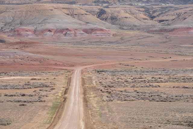
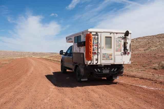
Trail Overview
This is a scenic desert drive between County Road 19 and Fort La Clede. The remains of the La Clede Stage Station are about a mile before the Fort. The Station and Fort were located along the Overland Trail; a stagecoach route operated in the mid-1800s. Ruins include a few remaining stone walls and rubble. Concrete posts marked with "Overland Stage" are periodically located near the vehicle trail marking the path of the historic Overland Trail route.
Photos of Overland Stage Route to Fort La Clede
Difficulty
This is a flat, well-graded gravel and dirt track road with room for two-way traffic.
Status Reports
Overland Stage Route to Fort La Clede can be accessed by the following ride types:
- High-Clearance 4x4
- SUV
- SxS (60")
- ATV (50")
- Dirt Bike
Overland Stage Route to Fort La Clede Map
Popular Trails

Bisbee Hill Road
Hole In the Wall Overlook

Torchlight Road
SR 271 Shell Reservoir
The onX Offroad Difference
onX Offroad combines trail photos, descriptions, difficulty ratings, width restrictions, seasonality, and more in a user-friendly interface. Available on all devices, with offline access and full compatibility with CarPlay and Android Auto. Discover what you’re missing today!