Ritchie Mines OHV CR/30 MacFarlan Road
Total Miles
5.4
Technical Rating
Best Time
Fall, Summer
Trail Type
High-Clearance 4x4 Trail
Accessible By
Trail Overview
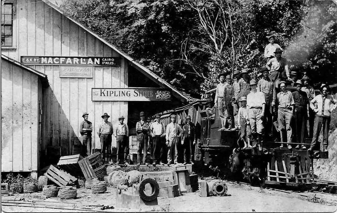
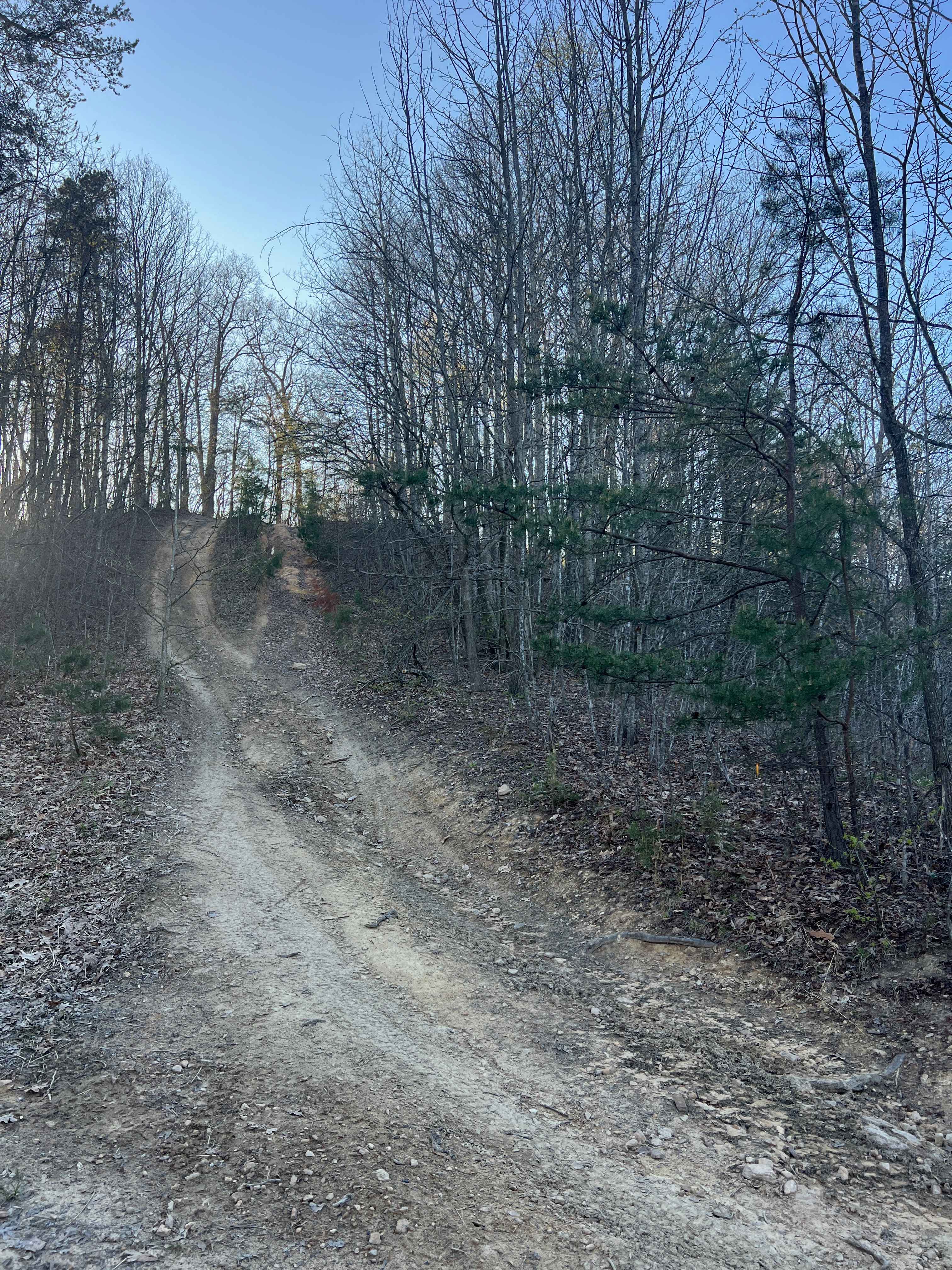
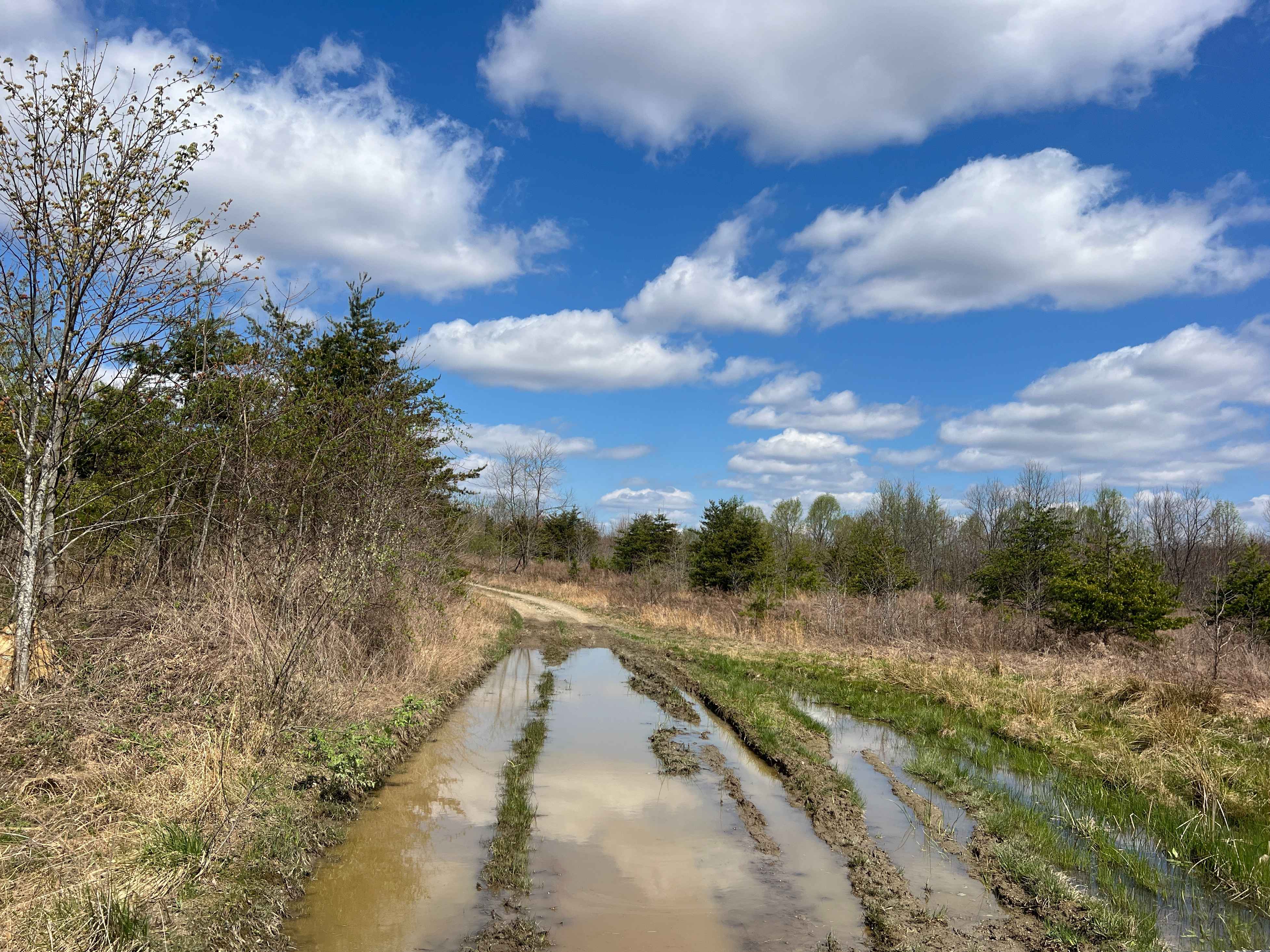
Located in the central area of Ritchie County in West Virginia is an OHV trail you will never forget. This trail is the main one going through the Ritchie Mine area where it begins on State Highway 47 in MacFarlan, WV, and ends on Gillispie Road or CR 1/7 about 5 miles north from the starting point. This is a one-way trail and would not be recommended to ever enter the trail from the North even though it is technically possible but not recommended because of the off-camber steep slippery terrain you would always want to go uphill on this trail. When you first start down the trail you will notice buildings on both sides of the entrance. These are former railroad buildings for the mine that maintained the "Ritchie" which was the small locomotive than ran the tracks. Please stay on the trail until you get passed the abandoned house on your left at the 1.8-mile marker. This is private land and as a traverser of this land, you are only allowed to be on CR/30. Once passed the abandoned house 39.090153-81.175164 the land becomes Ritchie Mines Wildlife Management Area and is owned by the state of WV where you may freely explore the trails. Please do not create any new trails and tread lightly in this area so that it is never closed to the public. This is a hidden gem of the mid-Ohio valley that we want to always be accessible by the public, your help is requested with picking up any trash you see while on the trail and doing your share to leave it nicer than when you visited. Along this trail, you will drive through streams that could be anywhere from 3 inches deep to 36 inches deep depending on current rainfall. Under no circumstances should you drive into any water if you are not sure of the depth and capability of your OHV. At mile marker 2.5 or 39.095336-81.166632 if you are going from the South to the North on this trail look to your left. You will see the beginning of the asphalt mine. That crack runs northwest about 1700 feet and is the location of the asphalt mine. Feel free to get out and take photos at this location, this is a small piece of history unknown to many. Continuing on the trail will lead you to 39.103693-81.164196 where you have to drive in the stream to get around a tree that has fallen across the main road area. The new path is well established to get around the tree, please do not make new paths and follow the one that currently exists. Everything is uphill from this point. Continue North following the trail until you get to 39.108603-81.168623 where most vehicles longer than a 2-door wrangler will have to do a 3-point turn to follow the trail up the hill in this switchback. It is possible to make this turn in a 2 door wrangler. Once you get to 39.114685-81.175635 you can shift back to 2wd as the rest of the trail is easily passable by almost any OHV. Continue on until you reach the pavement where this trail ends. Congratulations, you just made it through Ritchie Mines OHV Trail. Believe it or not, this is an existing county road in West Virginia. All motorized vehicles must be equipped with: A muffler to suppress noise and A spark arrestor to prevent fires. Motorized vehicles may not be operated: On any road that is posted as closed or Off the roads into woods or fields or On utility right-of-ways. Off-road vehicles (ORVs) may be operated: Only on designated trails or on roads open to other motorized vehicles unless otherwise prohibited by state or federal statute during daylight hours and when participating in an authorized activity.https://www.youtube.com/watch?v=DU-OAOVaVYk Link above to full trail video
Photos of Ritchie Mines OHV CR/30 MacFarlan Road
Difficulty
This trail was navigated during low rainfall in a 2004 Jeep Wrangler with 33" tires and a 2" body lift. No other modifications. 4x4 will be used by almost all who attempt the trails. There are several water crossings, hill climbs, mud holes, and general play areas for OHV in this area. Water levels can be high at times in the stream crossings. Under no circumstances should you try to cross any stream or body of water that you do not know the depth of, or capability of your OHV. If you are unsure turn around, do not drown. Always take a buddy with a second OHV to be able to recover your vehicle. Never try this trail alone, while you may make it through this trail today, the next time you visit the trail can be different depending on erosion and stream depths where you may become stuck and unable to get cell service or contact anyone through alternative methods. Use the buddy system.
History
RITCHIE MINES; A BEGINNING IN HISTORYArticle from RITCHIE GAZETTE 1992 HARRISVILLE WV Copyright by author, all rights reserved by, Janet Hodge. In a remote section of southern Ritchie County lies a place where time stands still. It is a place where fortunes were won and lost and the lives of over 1,000 of its hardiest inhabitants were changed forever. The place is called Ritchie Mines, and although few know of its actual location, there remains hardly a person who hasn't heard of its legendary tales. Although few agree on the "correct story" about Ritchie Mines, one name is always heard in the history circles--that of Fredrick Lemon. To read the entire article go to http://files.usgwarchives.net/wv/ritchie/history/ritchmin.txt
Status Reports
Ritchie Mines OHV CR/30 MacFarlan Road can be accessed by the following ride types:
- High-Clearance 4x4
- SxS (60")
- ATV (50")
- Dirt Bike
Ritchie Mines OHV CR/30 MacFarlan Road Map
Popular Trails

Halstead Hill Road

The onX Offroad Difference
onX Offroad combines trail photos, descriptions, difficulty ratings, width restrictions, seasonality, and more in a user-friendly interface. Available on all devices, with offline access and full compatibility with CarPlay and Android Auto. Discover what you’re missing today!