3 trails found in Utah
Which "monroe mountain road" are you looking for?
We found 3 off-road trails in Utah matching your search. Pick the one you're looking for below.
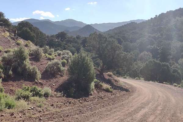
Monroe Mountain Road
This two-track trail runs through BLM lands north of Marysvale, UT, and the BLM gave it the name on their map "Monroe Mtn Rd." It doesn't lead up to Monroe Peak directly, but we used their name to be consistent. This full-width trail climbs the foothills below the Sevier Plateau, moving generally NW...
Learn more about Monroe Mountain Road
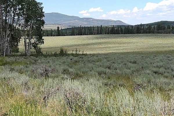
Monroe Mountain Road Spur (FS 42459, 41192)
This spur trail crosses Monroe Mountain Rd, and you can go either to the northeast or to the southwest. Either you're in the aspens, with the blooming flowers all around, or you break out into a clearing with a fantastic view. It's a full-width trail that just gets one off of the beaten path. Cattle...
Learn more about Monroe Mountain Road Spur (FS 42459, 41192)
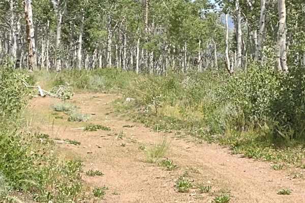
Monroe Mountain Road Spur Loop (FS 41178)
This is another full-width trail that's a road less traveled. You loop around east of Monroe Mountain Road just south of Upper Box Creek Reservoir. The trail is rocky in places, requiring a good amount of ground clearance, but it's not difficult. The rocks are no greater than 12 inches. The wildflow...
Learn more about Monroe Mountain Road Spur Loop (FS 41178)