Barrow Cemetery FSR 376
Total Miles
1.9
Technical Rating
Best Time
Summer, Winter, Fall, Spring
Trail Type
High-Clearance 4x4 Trail
Accessible By
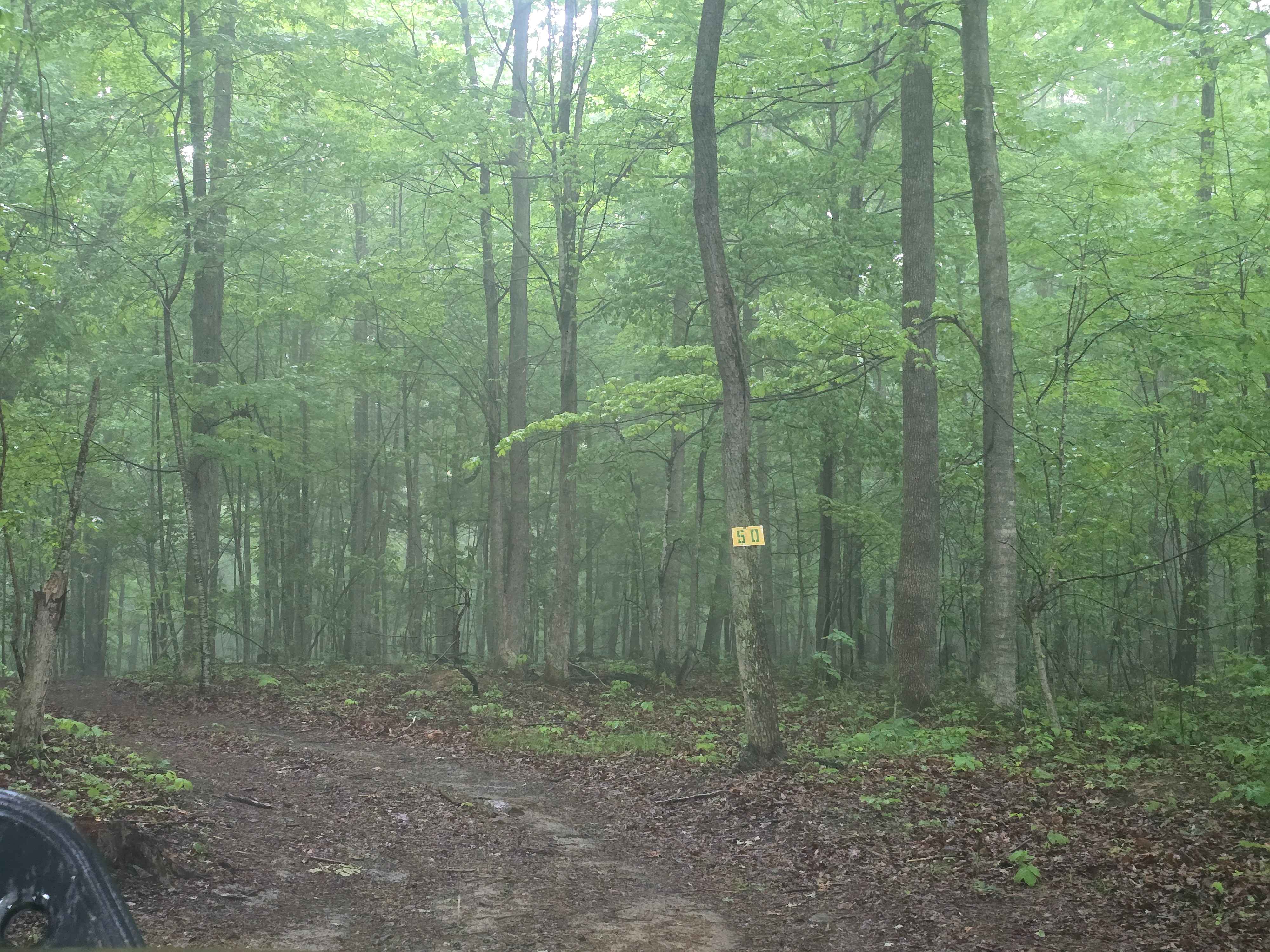
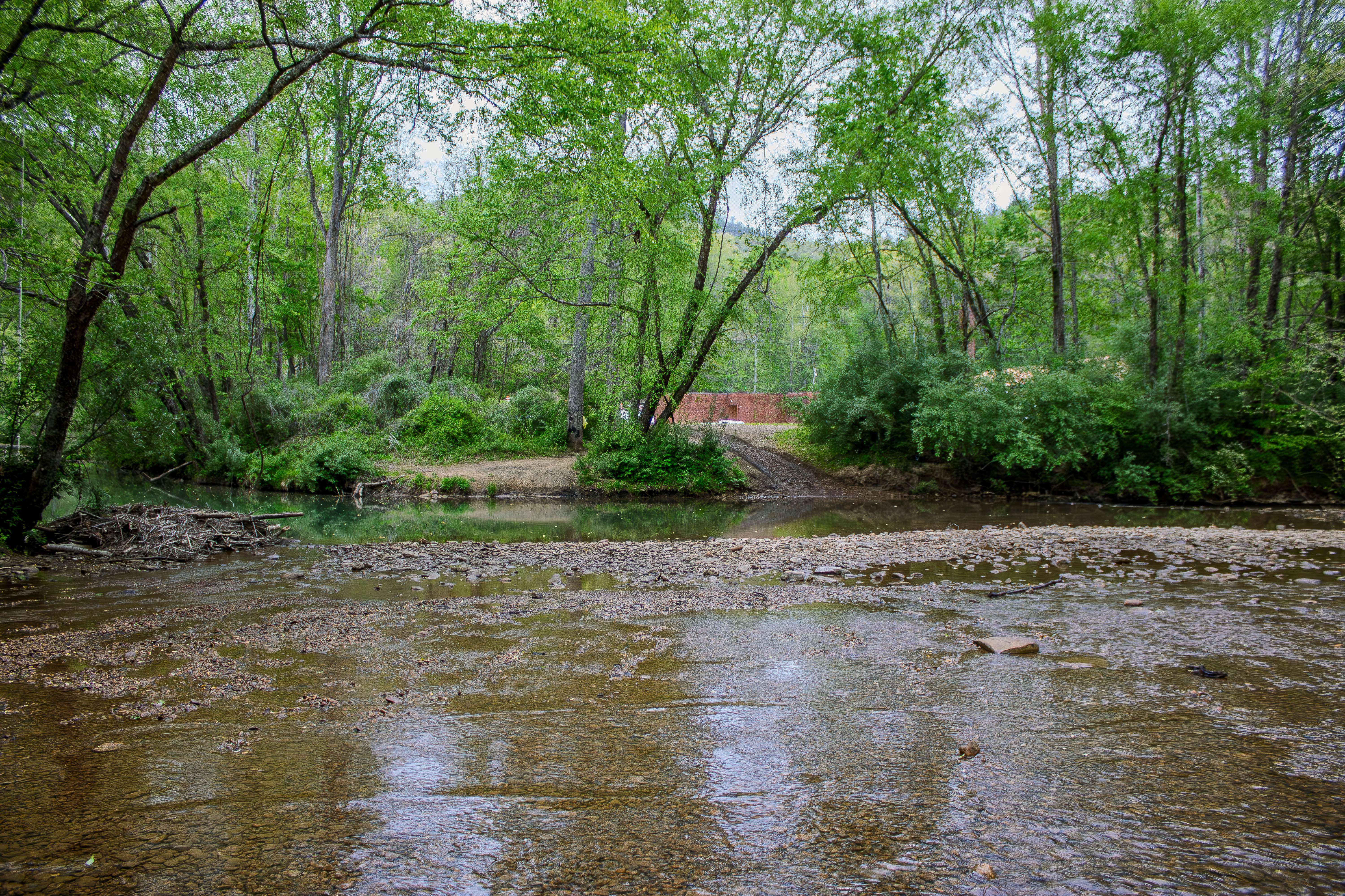
Trail Overview
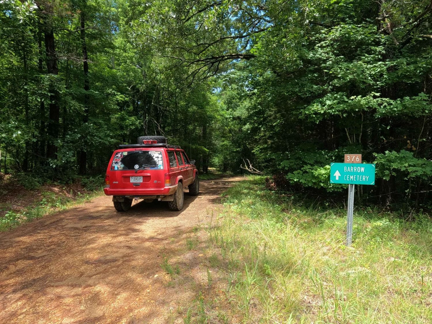
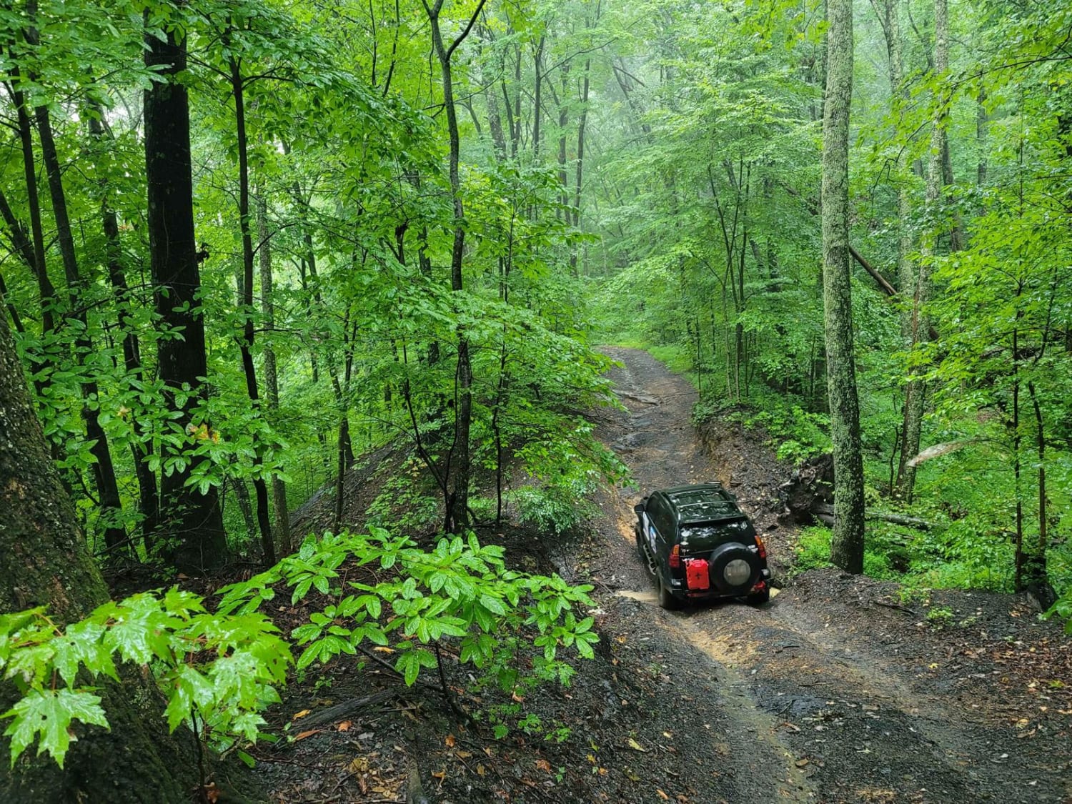
The Barrow Cemetery FSR 376, is a mostly natural forestry road through the southern Tennessee section, center of the peninsula, of Land Between the Lakes National Recreation Area. It features a mostly dirt road, with occasional gravel and natural rock, navigating large erosion ruts, and large mud holes that can mostly be bypassed, you have to pick which mud hole you want to hit, all while avoiding semi-tight trees, with off-camber banked turns where the water channelizes on the inside of the rut, all tied together with sections of open fields where it jots along to the next forest section. If you are looking for a challenging little road on the Tennessee side of the LBL peninsula, this one is worth looking into. From the southern entry point of the trail, the Barrow Cemetery is within the first quarter mile on the left, at 36.61448, -87.99604, after you pass this the trail degrades quickly.
Photos of Barrow Cemetery FSR 376
Difficulty
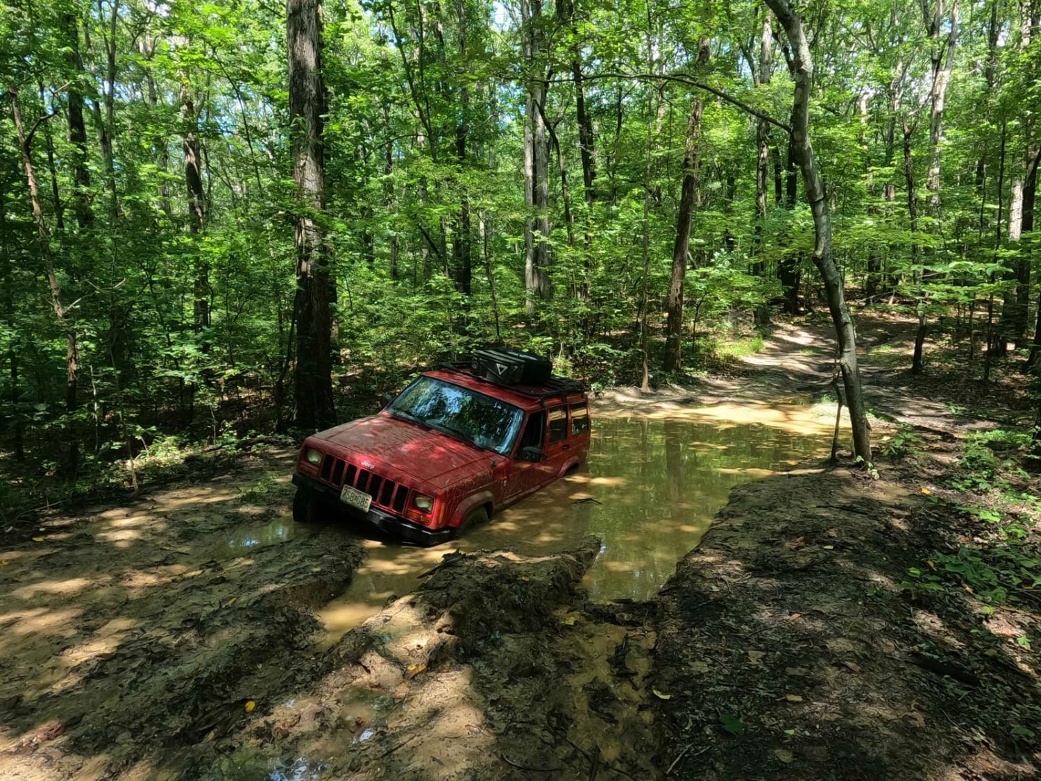
The main difficulty of this trail is the depth of the water and mud holes, being anywhere from 6" up to 30" deep, with sudden hard drop-offs and steep exits, limiting the speed and momentum you can carry into them, but momentum is critical to making it through, you need just the right amount. Some are hard-bottomed holes, some are not, and most can be bypassed, but a few can not be, especially for the bigger vehicles, where the tight tree bypasses don't allow wider and/or taller through. It is suggested to use the stick test throughout the portion that is to be crossed, very deceptively a 2-foot-deep rut will be right next to a 6-inch deep mound. Lite mud and dirt bottom roads should be expected throughout and sections of hay fields give a place to get tire speed moving to the point they will clear some of the mud away, to give fresh tread for the next section. There are also decent erosion ruts in the uphill and downhill sections where water channelizes and in spots, 2 foot 2-foot-deep ruts with soft bottoms have formed. Pinstriping is likely, but not overwhelmingly prevalent. All this said, a 5/10 rating is given due to the depth of the mud holes, but if the area was in a wet season or fall leaves were present on the ground, the difficulty and challenge would go up.
Status Reports
Barrow Cemetery FSR 376 can be accessed by the following ride types:
- High-Clearance 4x4
Barrow Cemetery FSR 376 Map
Popular Trails
87-Poplar Creek
Buzz Kill Hill
Phillips Cemetery Lane
The onX Offroad Difference
onX Offroad combines trail photos, descriptions, difficulty ratings, width restrictions, seasonality, and more in a user-friendly interface. Available on all devices, with offline access and full compatibility with CarPlay and Android Auto. Discover what you’re missing today!