73 - Harness Creek
Total Miles
0.6
Technical Rating
Best Time
Spring, Summer, Fall, Winter
Trail Type
Full-Width Road
Accessible By
Trail Overview
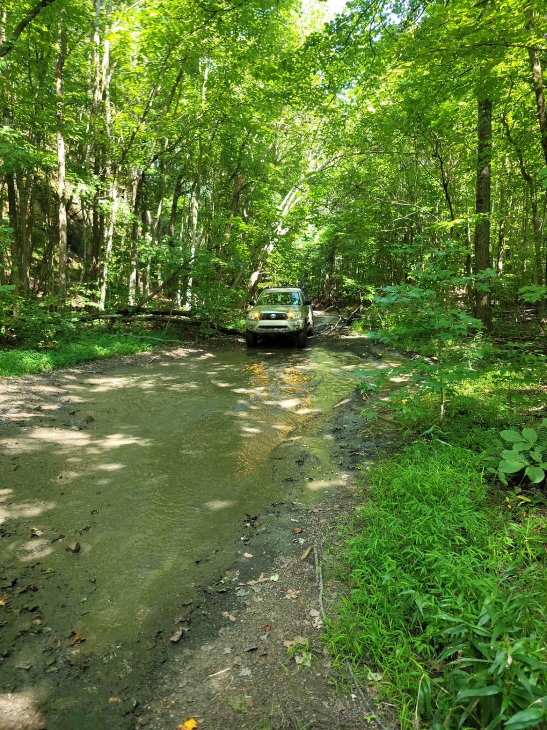
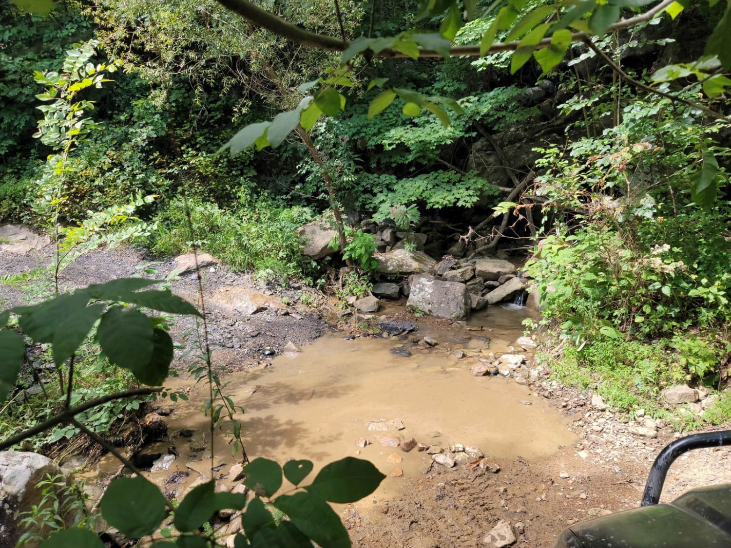
Trail 73 - Harness Creek begins at the end of Trail G31. This easy blue trail according to the Windrock Park map is a short, shady section that will cool you off on a hot summer day. Much of the creek can overflow and make this trail resemble riding a creek bed. One small section will have a short steep grade, but other than that, the mud will be your biggest obstacle.
Photos of 73 - Harness Creek
Difficulty
Hard rocky bottoms make this trail easy to pass but can overflow quickly.
Status Reports
73 - Harness Creek can be accessed by the following ride types:
- High-Clearance 4x4
- SUV
- SxS (60")
- ATV (50")
- Dirt Bike
73 - Harness Creek Map
Popular Trails
Ditney Mountain (66)

Web Hollow Road
The onX Offroad Difference
onX Offroad combines trail photos, descriptions, difficulty ratings, width restrictions, seasonality, and more in a user-friendly interface. Available on all devices, with offline access and full compatibility with CarPlay and Android Auto. Discover what you’re missing today!