2 trails found in Oregon
Which "lolo pass" are you looking for?
We found 2 off-road trails in Oregon matching your search. Pick the one you're looking for below.
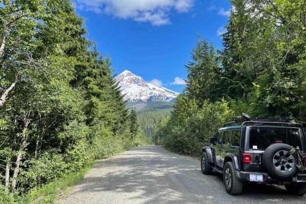
Lolo Pass
Historic Lolo Pass is a scenic drive that connects the Sandy River area to Lost Lake and Hood River. Spectacular valley views open up to reveal the western side of Mt. Hood. The driving surface is relatively smooth for the majority of the route, with the occasional pothole. The road will sometimes g...
Learn more about Lolo Pass
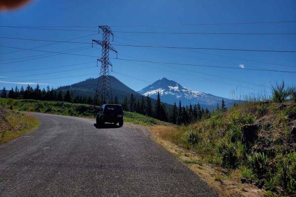
Forgotten Waterfall Cliffside Lolo Pass
Watch the city fall away and mount hood come closer and closer into view as each corner you turn takes you deeper into Mount Hood National Forest. Don't blink or you might miss a hidden waterfall on your left as you approach this path from the south. Tall power lines make for excellent cut outs in t...
Learn more about Forgotten Waterfall Cliffside Lolo Pass