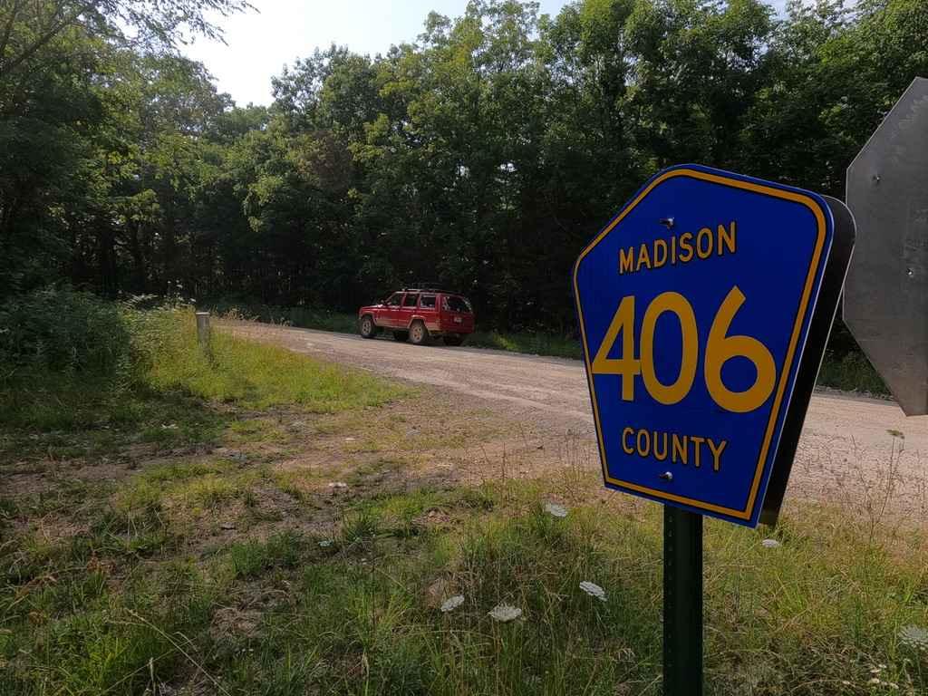
Mad-Co Road 406
Total Miles
3.5
Technical Rating
Best Time
Spring, Summer, Fall, Winter
Trail Type
Full-Width Road
Accessible By
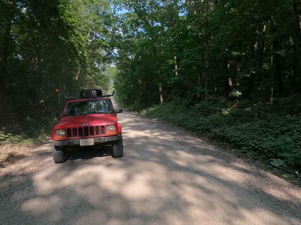
Trail Overview
The Madison County Road 406 is a gravel county road within the Fredericktown sector of Mark Twain National Forest. The road is useful to know within the network of hitting all the trails or shortcutting between the Matthews Mountain FSR 2127 and Central School FSR 2100 area to Bill Smith Hollow FSR 2064 and Arnett Mountain FSR 2191 area, it is significantly shorter than going the long way on state routes, plus you are off the pavement. The road is easy only encountering a few small hills, the steepest being on the western end of the road, and the typical gravel road complications (potholes, dust), yet full of the Mark Twain National Forest scenery and beauty. In the spring and early summer it is full of wildflowers, in the fall and winter is it cool to see the leaves change and all the rocks in the forest become so much more apparent.
Photos of Mad-Co Road 406
Difficulty
The Madison 406 is easy going, the most complications you would have on this road is finding it in a late maintenance cycle or heavy rain, it may feel like a rough gravel road in these scenarios, but this road is typically well graded and hit often, the most you will encounter on a normal day is dust (if it is dry, lots of dust) and the typical potholes, washboards, and mounding.
Status Reports
Mad-Co Road 406 can be accessed by the following ride types:
- High-Clearance 4x4
- SUV
- SxS (60")
Mad-Co Road 406 Map
Popular Trails

Outer Loop Bypass Trail

Middle Ridge - FS 424
Yee Haw Ledges 112
Lookout Road
The onX Offroad Difference
onX Offroad combines trail photos, descriptions, difficulty ratings, width restrictions, seasonality, and more in a user-friendly interface. Available on all devices, with offline access and full compatibility with CarPlay and Android Auto. Discover what you’re missing today!