Rubicon, West Side
Total Miles
5.4
Technical Rating
Best Time
Summer
Trail Type
High-Clearance 4x4 Trail
Accessible By
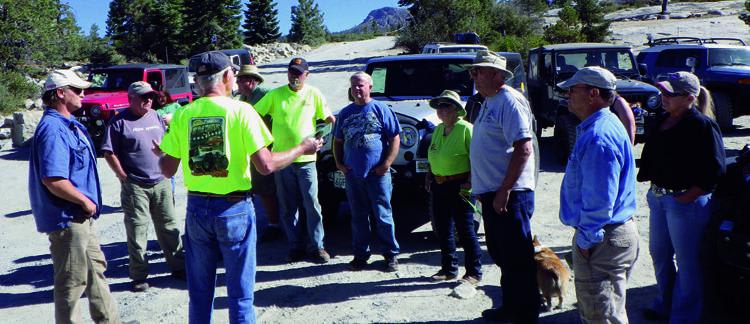
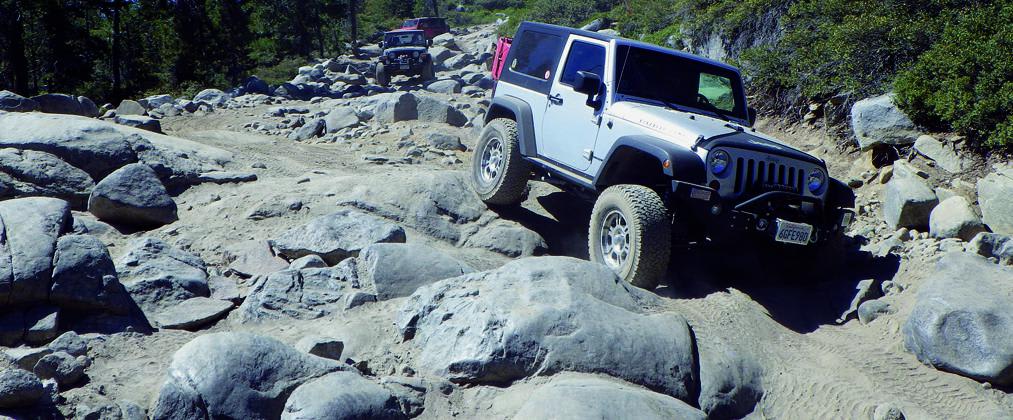
Trail Overview
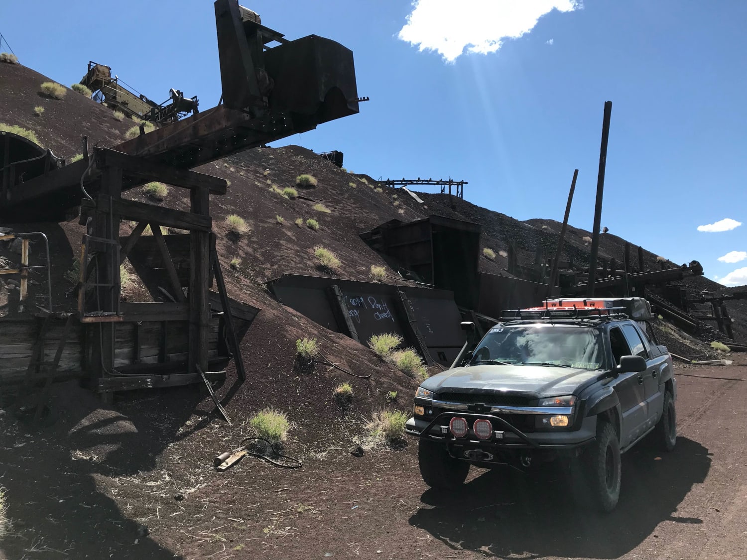
The Rubicon is our all-time favorite. It's a mix of gorgeous scenery and very challenging terrain. Our group camped overnight at the halfway point below Buck Island Dam. The trail is under constant scrutiny by environmental groups; stay on the designated route at all times. ATVs, UTVs, and dirt bikes are allowed. U.S.F.S. fire permit and portable toilet required. Official maps and accurate trail information are available for free at www.rubicontrailfoundation.org.
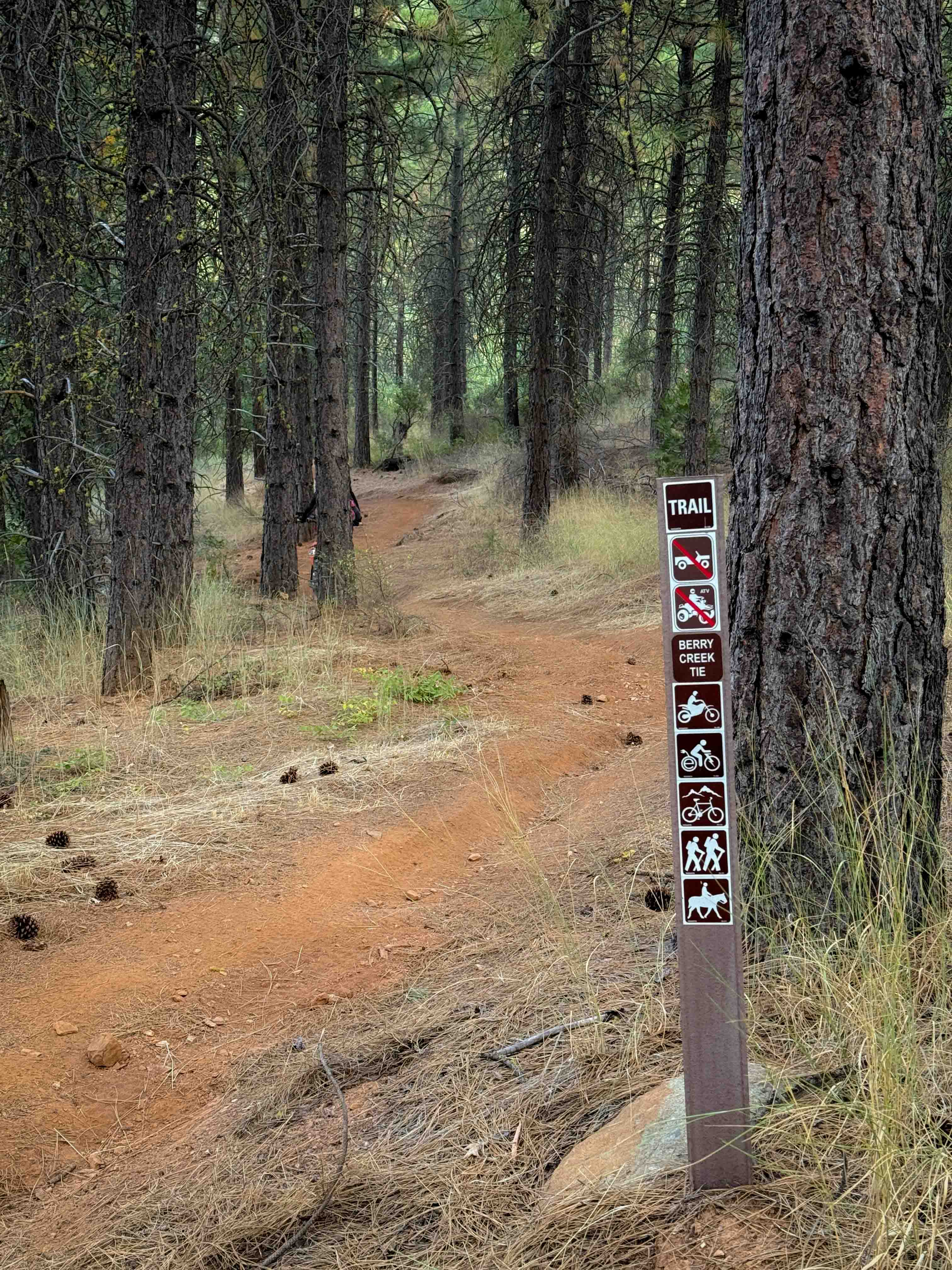
Photos of Rubicon, West Side
Difficulty
Difficult: West Side is dominated by open granite tracts interspersed with tight boulder fields and tall ledges. Lockers, lifts, 33" minimum tire size and skilled driver recommended. Optional Little Sluice and Old Big Sluice significantly increase difficulty.
History
The Rubicon Trail has a long history dating back to 1844. Rubicon Springs once had a hotel, but in 1908 it was destroyed by 8-ft.- deep flood waters. Even today, Rubicon Springs is closed much of the winter due to flooding. The first Georgetown Jeepers Jamboree occurred in 1952 and still continues today, the last weekend of July. More history at www.rubicontrailfoundation.org.
Status Reports
Rubicon, West Side can be accessed by the following ride types:
- High-Clearance 4x4
- SxS (60")
- ATV (50")
- Dirt Bike
Rubicon, West Side Map
Popular Trails
Dos Cabeza East - BLM 150
Lake Crowley Beach NE Cutoff
Aiken Mine Rd
The onX Offroad Difference
onX Offroad combines trail photos, descriptions, difficulty ratings, width restrictions, seasonality, and more in a user-friendly interface. Available on all devices, with offline access and full compatibility with CarPlay and Android Auto. Discover what you’re missing today!