Upper Red Raven Road
Total Miles
4.0
Technical Rating
Best Time
Spring, Fall, Winter
Trail Type
High-Clearance 4x4 Trail
Accessible By
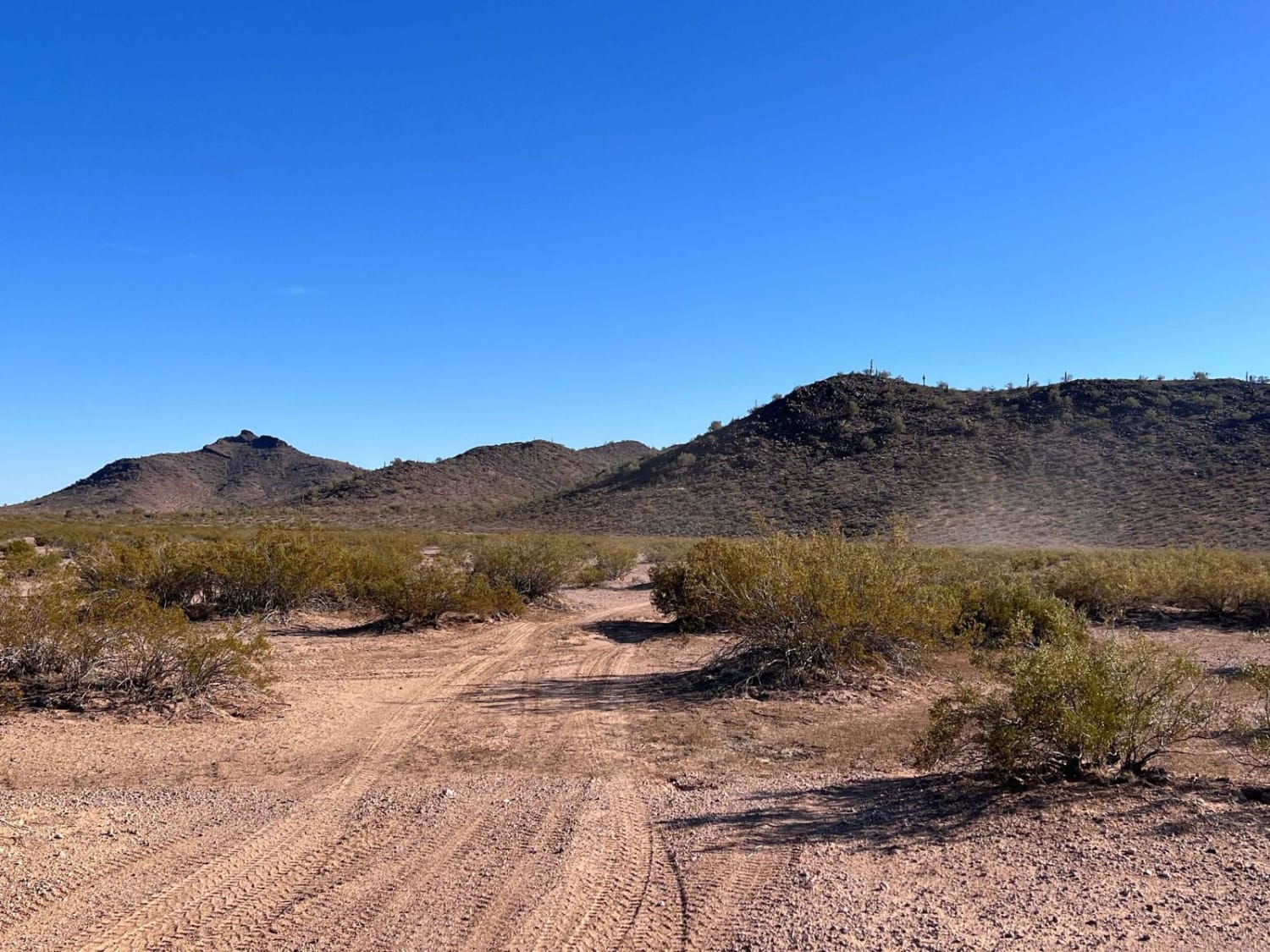
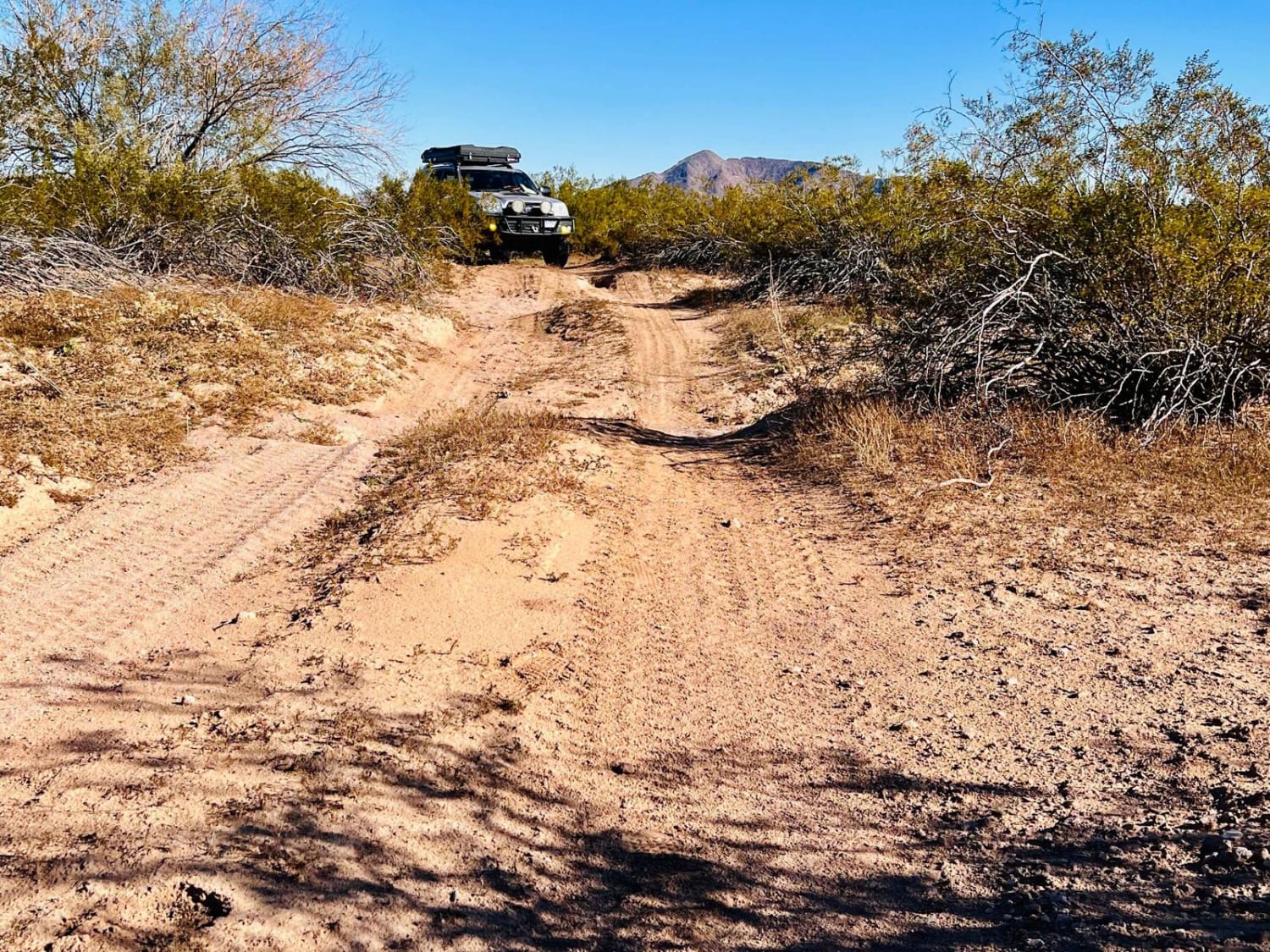
Trail Overview
This upper section of the road begins easily enough, then turns more difficult the further one proceeds. It is incredibly remote and has unbelievable views of the valleys and mountains as the terrain changes. It goes from the dense forests of Saguaro to Ocotillo and Cholla and back to Saguaro again as it dives and climbs through the hills and valleys. The further south one gets, the more varied the terrain becomes. There are steep drop-offs and rises out of washes with tight corners, as well as boulder fields of sharp lava rock just waiting to claim a tire. Some sections are so faint that you'll want to get out and walk to be sure you're not headed off course. The recording ends at a very steep drop-off shelf into a wash about 3 feet high--a high-clearance 4x4 could not surmount this. The route continues to the south for a more heavily modified vehicle, SXS, moto, or ATV. There is no cell service out here.
Photos of Upper Red Raven Road
Difficulty
This trail is mostly easy, but some sandy sections run in the wash and then there are deeper transitions across washes. There is one steep shelf where this trail recording ends.
Status Reports
Upper Red Raven Road can be accessed by the following ride types:
- High-Clearance 4x4
- SxS (60")
- ATV (50")
- Dirt Bike
Upper Red Raven Road Map
Popular Trails
Northview Cutoff


Grass Mine Trail
Tacna to Betty Lee Mine Spur
The onX Offroad Difference
onX Offroad combines trail photos, descriptions, difficulty ratings, width restrictions, seasonality, and more in a user-friendly interface. Available on all devices, with offline access and full compatibility with CarPlay and Android Auto. Discover what you’re missing today!